Heddon-on-the-Wall Local History Society
  • Home
  • Calendar
  • Introduction
  • Where are we?
  • History Map
  • Timeline
    • Prehistoric
    • AD43 to 1599
    • 1600 to 1799
    • 1800 to 1899
    • 1900 to 1999
    • 2000 to 2099
  • Heddon's History
    • Prehistory
    • Hadrian's Wall >
      • Vallum excavation (1893)
      • Hadrian's Wall excavation 1926
      • Wall ditch, Bays Leap (1958)
      • Hadrian’s Wall: Archaeological research by English Heritage 1976-2000
      • Throckley & Heddon entanglements
      • WallWatch
      • English Heritage (2020)
      • Wardell-Armstrong Archaeolgy Reports
      • Historic England Archives
    • Six townships >
      • 1 Heddon township >
        • Heddon in the Middle Ages
        • Common Land
        • Middle Marches
        • Tithe Award
        • St Andrew's Church >
          • Stained Glass Windows
          • Churchyard
          • Monuments of church & churchyard (1991)
          • Monuments Page 2
          • Vicars of Heddon
        • Village property
        • Heddon Hall >
          • Sale of Heddon Hall 2012
        • Heddon Banks Farm
        • Frenchman's Row
        • Methodist Church >
          • Heddon Methodist Church Centenary 1877-1977
        • Men's Institute
        • Women's Institute
        • Welfare Field
        • Knott Memorial Hall
        • Memorial Park
        • Schools
        • River Tyne
        • Coal Mining
        • Quarrying
        • Water Supplies
        • Transport
        • Waggonway & Railway
        • Occupations from 1800
        • Miscellaneous
      • 2 West Heddon township
      • 3 East Heddon township
      • 4 Houghton & Close House township >
        • Close House
      • 5 Eachwick township
      • 6 Whitchester township
    • Rudchester
  • People
    • Sir James Knott
    • Cadwallader J. Bates
    • Richard Burdon
    • Hugh Sinclair (Tim) Swann
    • George Clark
  • Old Photos
    • Postcards
    • Old photos 1
    • Old photos 2
    • Old photos 3
    • Old photos 4
    • Old photos 5
    • Old photos 6
    • Old Photos 7
  • Old News
    • Community News
    • Letter from the Emigrant Clergy of Frenchman's Row (1802)
    • Alleged Brutal Murder at Heddon-on-the-Wall (1876)
    • Sad boat accident at Ryton (1877)
    • Coronation tree (1902)
    • 65 Years on a Ferry Boat (1929)
    • Come claim your kiss at Heddon (1953)
    • The Swan (1972)
    • Heddon WI (1987)
    • Church House (1966)
    • Happy return (1993)
    • Hexham Courant (1997)
    • Butterfly Garden (1999)
    • Foot & Mouth (2001)
    • Remembrance Day (1996)
    • Remembrance Day (2016)
    • RAF at Ouston (2007)
    • Close House Golf Course (2009)
    • Heddon pupils celebrate British heritage (2011)
    • Roman Wall Forge (2011)
    • Diamond Jubilee (2012)
    • Auction of Bronze Statue, Close House (2012)
    • Heddon WI (2012)
    • Puffing Billy Festival (2013)
    • Heddon Village Show (2014)
    • View of the North (2014)
    • The Wall at Heddon (2014)
    • Heddon Village Show (2015)
    • War veterans singing send-off (September 2015)
    • Anglo-Saxon history (2014)
    • Heddon WI at 100 (2017)
    • Hadrian's Wall discovery (2019)
    • Tulip Mews (2020)
    • Mike Furlonger
    • Hadrian's Wall 1900 Festival
  • Memories
    • Olive White
    • Betty Cockburn
    • Betty Cockburn - miscellaneous information
    • Isabel Snowdon
    • William & Winnie Watson
    • Edith Ward
    • Mark Parker
    • Jack Lawson
    • Winnie Spoor
    • P Reay
    • Mr and Mrs Hall
    • Peter Chapman
    • Elizabeth Elenora Eames
    • Harry Murray
  • Other documents
    • Mackenzie (1825)
    • Bates (1886) >
      • Early & Roman
      • Townships
      • Heddon Church
      • Heddon & Houghton
      • Whitchester
      • Eachwick
      • West & East Heddon
      • Records
      • Addenda
      • Appendix A
    • History, Topography & Directory of Northumberland (Bulmer's) - 1886
    • History of Northumberland (1930)
    • Collingwood Bruce (1853)
    • Whellan (1855)
    • Post Office Directory (1879)
    • Prominent people in Heddon
    • Place names
    • Ad Murum
    • Archived documents
    • Thomas Bewick's History of British Birds (1826)
    • Census data 1801-1991
    • Historical Records 1888-1890
    • Knott Sale of Village Property (1924)
    • Extracts from Parish Council Records
    • Local colliery records
    • Blackburn (1938)
    • Clark (c.1963)
    • History of Church (1968)
    • Boundary Commission Report 1984
    • Village Atlas 2022
  • Walks
    • Walks 2
  • Blog
  • Contact us
  • Links
  • What's new
  • Site search
  • Past & Present
  • Photo of the Month
  • Place Name Studies
    • Meas & Meres
    • OS Name Books: Elsdon
    • OS Name Books: Allendale
    • OS Name Books: Cheviot Hills
    • OS Name Books: Other Parishes
  • Heddon 3D landscape

Coal mining in Throckley

29/5/2024

0 Comments

 
A preliminary attempt at drafting a summary of the history of coal mining in Throckley. The problem as always, what to leave out?

Throckley – coal mining
 
Primary source for this summary is:
Morrison, Jennifer (2007) Newburn Manor: an analysis of a changing medieval, post-medieval and early modern landscape in Newcastle Upon Tyne. Masters Thesis, Durham University.

  • Documentary references to coal mining in the Throckley area date back to the C14th (medieval period). Seams close to the surface could be exploited by drifts dug into the valley sides or by digging of 'bell pits' or 'day holes' (shallow vertical shafts).
  • In  1536, coal workings passed to the King, who then leased them to individuals. The Newburn mines passed to the Lord of the Manor, the Earl of Northumberland, and the mines at Throckley passed from the Crown to the Radcliffe family in the early C15th.
  • Radcliffe estates (Earl of Derwentwater) confiscated by the Crown and passed to Greenwich Hospital in 1735.
  • The tiny village of Lemington had been established at the staiths some time before 1620 when a few coal pits were being worked. ‘Sea-coal’ was transported from the staiths to colliers via the River Tyne.
  • George Stephenson’s father left Wylam to become fireman at Dewley Colliery. George’ first job  (age of 8), was for Grace Ainslie, farmer at Dewley Farm, guarding the cows which grazed the wagonways. He went on to become assistant fireman at the colliery before moving to Newburn.
  • The boundary between Newburn and Throckley was not fixed until the C17th. Remaining woodland in the area was felled for use in wagonways, pit props, staiths, wagons, keels etc.
  • Wagonways brought coal from Wylam & Throckley to Lemington Staiths from 1748. In the early 1800s, wooden horse-drawn wagonways were being replaced by new technology: metal rails, stream locomotives replacing horses (e.g. Puffing Billy & Wylam Dilly on the Wylam Wagonway).
  • By 1781 the main coal pits in Throckley had gone out of use and several former wagonways became  paths.
  • William Brown, colliery viewer, was brought up in Throckley. He had been appointed manager of Throckley Colliery by the lessee, Mr Bell, in 1756. Having erected a steam engine at Throckley, Brown went on to build engines at over twenty-one other collieries. In 1765 a new winning at Throckley was completed, and because steam-driven pumps helped solve the problem of pit drainage, shafts could be sunk to a greater depth.
  • In 1785, there was a list of 52 pits at Throckley, connected by wagonways to Lemington staiths, all worked by Bell and Brown. This colliery was worked out by 1794.
  • Messrs. Bell and Brown built the row of houses on the Hexham Road in 1796 that were to become known as Frenchmen's Row.
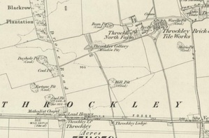
  • By 1858, the OS map shows several coal pits, most at the edges or corners of fields surrounded by small copses of trees. Some are out of use. The most extensive colliery workings were located at Throckley Colliery (Meadow Pit), which was served by a wagonway. To the east of this lay Throckley Brick and Tile Works.
  • At Throckley C19th mining involved the continuation of working of some of the pits which had been sunk in the C18th (such as Meadow, Maria, Rye, Nymph and Thristle) but most of these were out of use by 1895.
  • The Throckley Coal Company was formed in 1862 and Throckley Colliery opened in 1867. Maria Pit, which had been in existence in 1767 was expanded during the 1800s and was in operation until 1954. Isabella Colliery was in operation from 1869 to 1954.
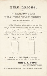
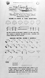
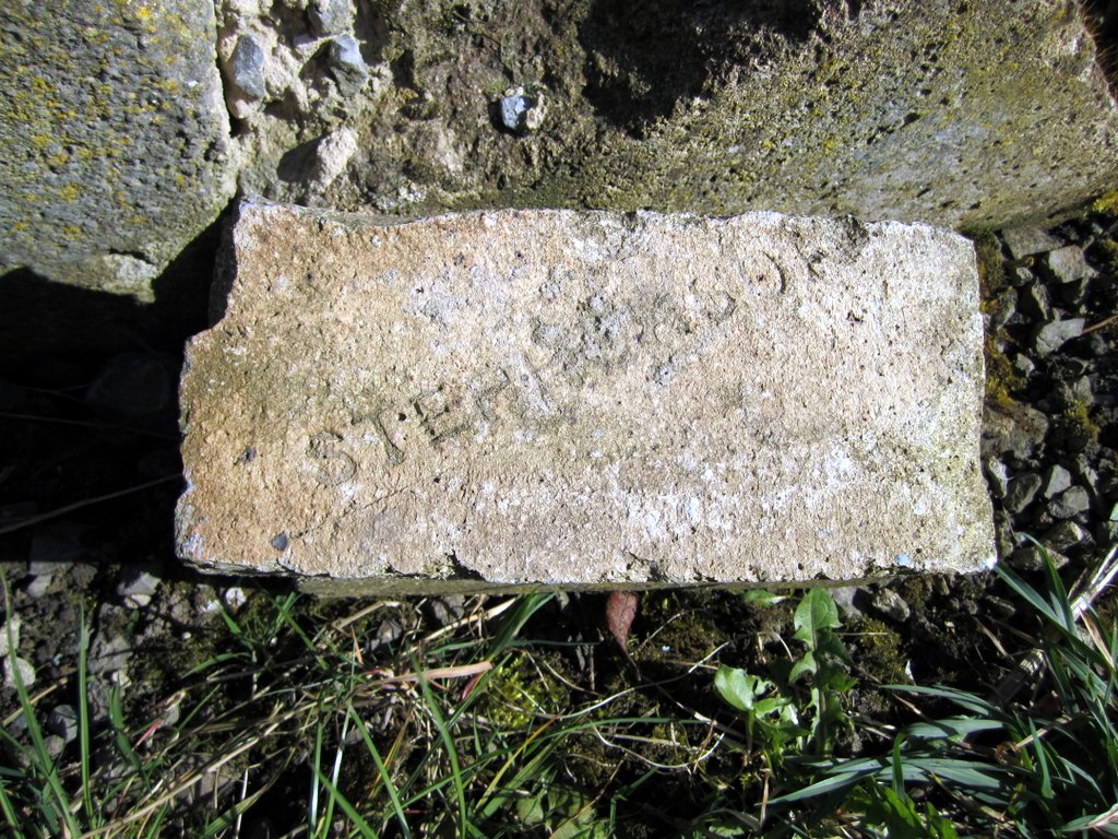
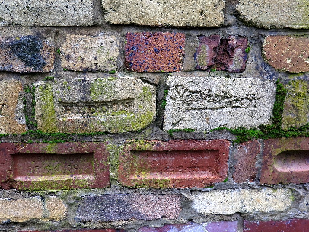
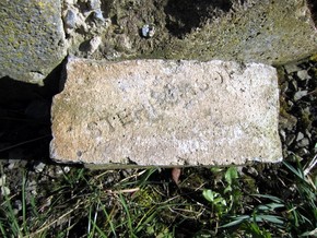
  • In 1867, Throckley Coal Co. brought the extensive Isabella Coke Ovens complex into production, mainly for use at Spencer's steelworks. Twenty-two coke ovens was built using Stephenson's bricks, close to the Isabella Pit. Other coal-dependant industries of the period included brick and tile making.
  • Throughout the nineteenth century industrialisation continued. In 1875, the route of the Wylam Wagonway became a branch of the North Eastern Railway. The old Throckley Wagonway was re-used for a mineral railway which served the colliery and brick-works.
  • Margaret Pit, in Heddon, was sold  to the Throckley Coal Co. in 1902. This allowed them improved control over water ingress in the Throckley pits. In 1906, Throckley merged with the brickmakers, Wm Stephenson & Sons and sank a third mine, the Maria. They continued to work Heddon Colliery until the early 1930's, when it was closed, and the remaining coal reserves accessed from Throckley Isabella.
  • The Stephensons and Throckley Coal Company provided their employees with many facilities including chapels, school, houses & institute.
  • Coal production ceased at Throckley Colliery in January 1954 and land was reclaimed. Opencast mining in 1991 destroyed the remains of the water mill, a section of the C18th wagonway, and several old pits. A69 (by-pass) built.
0 Comments

Some maps of Throckley

23/5/2024

0 Comments

 
Picture
Picture

Heddon & Throckley - 3D lidar landscape by NOWTAG on Sketchfab

0 Comments

Dewley Hill (or Law)

23/5/2024

0 Comments

 
Picture
Dewley Hill. Photo A Curtis (2013)
An alleged round barrow, Dewley Hill (also known as Dewley Law, Dewley Mound) is generally regarded as a natural feature - a kaim (or kame) of glacial origin. However, a number of finds suggest that it was utilised in prehistory.

Although doubts have been cast on the existence of some flints claimed to have been recovered from its surface, a fragment of a Neolithic polished stone axe plus Mesolithic cores, blades, flakes and a graver are known to have been found on or in the hill. The axe is in private possession, while the Mesolithic flints are in the Hancock Museum (Preston Collection), the Museum of the Society of Antiquaries, Newcastle Upon Tyne, and Sunderland Museum.

The hill, which has been shceduled as a monument, has been reduced in size by ploughing but measured a maximum 43 metres wide and 4.2 metres high when visited by the Ordnance Survey in 1978. It has been dug into on several occasions, some by the farmer while pursuing foxes. Nothing has ever been noted to suggest anything other than a natural sand and gravel feature.


Historic England - Research Record 22704
Picture
The Glacial Phenomena of the Country between the Tyne and the Wansbeck. By J. A. Smythe. Transactions of the Natural History Society of Northumberland, Durham & Newcastle upon Tyne, vol. 3 (1908-1911).
The finding of small flints on the surface, many of which exhibit human workmanship, might be thought to confirm the common view that the pile is of human origin, but its size and position, the nature of its pebbles and the general resemblance to the other kaims, make this extremely improbable. It is quite likely that such a prominent feature might be used by primitive man for burial or other purposes, which would sufficiently account for the presence on it of relics of his handiwork.

Picture
Picture
Sockett, E. W. (1971). Stone axe from Dewley Law. Archaeologia Aeliana Series 4. Vol 49, p. 246.

Aerial photographs of the monument indicate that the barrow is surrounded by a number of cropmarks. These include a circular cropmark, interpreted as a bank and ditch immediately surrounding the barrow, a hut circle and a further enclosing feature, believed to be a boundary bank and ditch enclosing the raised ground around the barrow. Further circular cropmarks, interpreted as hut circles, are evident in the north west corner of the field. These surrounding features are also included in the scheduling.

Whether Bronze Age burial mound or natural glacial feature (a kaim), Dewley Hill is a Scheduled Monument (List Entry Number: 1018678) and protected by law.
Picture
Dewley Hill. Photo A Curtis (2013)
Picture
Dewley Hill in centre of extract from LIDAR (NZ16ne_FZ_DSM_1m) © Environment Agency copyright and/or database right 2022. All rights reserved.
Although now safe from the prospects of nearby open-cast coal mining (mainly the result of a local campaign), the Dewley Hill Scheduled Monument was added to Historic England's Heritage at Risk Register (list entry: 27470) with the following assessment:

Assessment InformationAssessment
Type: Archaeology
Condition: Extensive significant problems
Principal Vunerability: Animal burrowing - extensive
Trend: Declining
Ownership: Private


Picture
Heritage at Risk: animal burrows in the Dewley Hill mound. Photo A Curtis (2013).
0 Comments

Throckley History Map

19/5/2024

0 Comments

 
An interactive map of Throckley as an aid to exploring records from the Tyne & Wear Historic Environment Record online as Sitelines.

There is also a summary of the history of Throckley here
https://sitelines.newcastle.gov.uk/sites/default/files/Throckley.pdf
Picture
Screenshot of interactive Throckley Sitelines map.
To get a copy of the interactive map, download the zip file (below) and extract the single html file within the compressed folder.
  1. Locate the zipped folder that you want to unzip (extract files or folders) from.
  2. Do one of the following:
    • To unzip a single file or folder, open the zipped folder, then drag the file or folder from the zipped folder to a new location.
    • To unzip all the contents of the zipped folder, press and hold (or right-click) the folder, select Extract All..., and then follow the instructions.

The extracted html file should open in your default internet browser.

Using the map you can change the background mapping (menu top right), search for markers by colour or text (menu top-left). Click on markers for pop-up information and links.

Triangle symbols (in black) refer to coal mining sites (pit shafts, collieries) and waggonways. Circle symbols are colour-coded depending on their historical period:
prehistoric - red
Roman - pink
Medieval - green
Post-medieval C17/C18 - yellow
Post-medieval C19/C20 - blue
throckley_sitelines-map.zip
File Size: 42 kb
File Type: zip
Download File

0 Comments

Tyne Riverside Park, Newburn

6/5/2024

0 Comments

 
Picture
Engine Plantation, Throckley. Formerly the site of Throckley Isabella Colliery. Photo A Curtis (2021).
Information on the reclamation of former industrial land between Throckley & Newburn in the creation of Tyne Riverside Country Park.
Hesselberth A & Hobson D (2003). Land reclamation in the North East: the last 30 years.
Chapter 4 (p. 81-89) in: H.M. Moore, H.R. Fox, S. Elliott, Land Reclamation - Extending Boundaries: Proceedings of the 7th International Conference, Runcorn, UK, 13-16 May 2003.


ABSTRACT: The North East of England has a long and glorious industrial heritage. This has led to a legacy of derelict land, but also to opportunities for reuse and regeneration. Government priorities and means of funding have changed over the last 30 years. The paper examines how land reclamation has progressed from the 1960s to the present time. It also looks at what has happened to land reclaimed during the earlier times and draws conclusions about the lessons that can be learned.

Picture
Slipway, Tyne Riverside Country Park. Photo A Curtis (2016).
4 Case Studies

4.1
Isabella colliery
An area of approximately 50 ha of land on the North bank of the River Tyne between Newburn and Throckley lay derelict for many years following the cessation of mining and the closure of a railway line. The site contained a number of interesting features including a scrap yard, railway track bed, waste heaps, lagoons, shafts from which mine water continuously discharged, and an area used by the water company for the disposal of liquid sludge from its settlement beds at a nearby treatment works, Natural drainage of the area had been disrupted by mining subsidence and flooding of the surrounding fields occurred during winter periods. The mine water was badly discoloured with yellow ochre and this was discharged via approximately 1.5km of open water course into the River Tyne. The site was not considered to be contaminated and therefore was not subject to chemical testing.

The site was reclaimed to create what is now known as the Tyne Riverside Park at Newburn. It was financed through l00% Derelict Land Grant. additional funding from the County Council and a small contribution from the Sports Council.

For a period of about three years prior to reclamation, surplus soils were brought onto the site from various sources. These were mainly from private developments being undertaken in the region and soils primarily comprised subsoils and clays. In most cases a small charge was made for accepting the materials and this provided additional funds for the project. These operations were not considered as waste disposal and therefore were not licensed under the Control of Pollution Act 1974.

The scheme involved the creation of a new land-form by regrading and covering over with the imported soils to form a growing medium. The scrapyard was cleared and visually dirty materials were removed off site for disposal in landfill. Mine shafts were capped but not filled and the drainage of the area improved as tar as possible by cleaning out channels and the installation of a flap valve upstream of the mine water discharge in order to prevent back flow into the areas worst affected by flooding.

The most challenging part of the scheme was the treatment of the area used for disposal of water company sludge. This had collected in a depression to a depth of about 3m and was of a consistency similar to jelly paint. Dewatering of this material was achieved by spreading it in thin layers and allowing it to freeze during the winter. The material was also found to. be useful as a soil enhancer although. because of the high moisture content it was extremely difficult to handle. Provision for future disposals of sludge was provided in cooperation with the Newcastle and Gateshead Water Company. The water company agreed to spray future discharges of sludge in order to spread it in a very thin layer that would be capable of drying over the winter. A large grassed area was therefore created under which a layer of gravel and system of pipes were installed. This would not have been feasible without a ready source of a large quantity of gravel. This was obtained by the excavation of a large slope into the bank of the River Tyne which comprised excellent quality river gravel. This operation was considered eligible for Derelict Land Grant because it was essential to the restoration of the site. The excavated area conveniently produced a slipway which was concreted over and this is still the largest access into the river for recreational purposes today.

The whole site was landscaped creating areas of grass and woodland with about 30% being returned to grazing land and the remainder being made available as a country park. The scheme was awarded first prize in the RICS/Times Conservation Awards RICS (1982). It is now a well used and mature country park.

Picture
Remains of Throckley Isabella Colliery Coke Oven. Photo A Curtis (2016).
Picture
Locally made bricks, Isabella Coke Ovens. Photo A Curtis (2016).
Picture
Polluted land from water filter beds at Tyne Riverside Park. Photo A Curtis (2013).
Picture
Great burnet (Sanguisorba officinalis), Tyne Riverside Country Park. Photo A Curtis (2015).
Picture
Flower-rich grassland, Tyne Riverside Country Park. Photo A Curtis (2015).
0 Comments

Lead House (Throckley)

4/5/2024

0 Comments

 
Buildings at the junction of Drove Road and the Military Road were known as 'Lead House' by 1858, when they appear on the first edition Ordnance Survey plan, and were apparently store houses for the Langley Lead Company. The crossroads is captioned 'Lead gate' on the county maps of Greenwood and Fryer in the 1820s.
Tyne and Wear HER(1966): Throckley, Hexham Road, Lead Houses
Link

Picture
John Fryer & Sons' Map of the County of Northumberland, 1820.
This name is applied to a small house in former times it was used as a store for lead it is now Inhabited and in good repair.
Northumberland Ordnance Survey Name Book(c.1860): Newburn 403 p.42
Picture
Ordnance Survey 25" Northumberland (Old Series) LXXXVII.15, Revised: 1895, Published: 1897. National Library of Scotland.
Mr. Walton having been at Throckley the other Day observed a great Quantity of Lead lying at the End of the Lane leading from the Turnpike Road to Newburn.  We desire you will acquaint the Carriers that unless they remove it and deliver it either at Newcastle or Newburn immediately, we will take care to give Directions to have it taken away, and certainly will not pay one farthing carriage for it from the Mill to the place where it now lyes.

The Carrier who delivered his Lead at Newburn contrary to Direction must not have any more Lead unless he can give a sufficient reason shewing that he could not deliver it at Newcastle without being put to very great Inconvenience.

Letter – Nicholas Walton to Peter Mulcaster – 22 Mar 1782.
Archives
of Greenwich Hospital (TNA ADM 66 97) Transcribed by Dukesfield Smelters & Carriers Project
Link

There is no lead in the Newburn area, but the industry has nevertheless affected the region. According to Linsley (n.d.) a bridle path which once ran past Cutty Coats Farm (see chapter eight), would have once been used by lead-carrying packhorses and Cutty Coats may actually have been the home base for a smallholder involved in the lead-carrying trade (Linsley, n.d.). The crossroads on the toll road at Throckley is captioned 'Lead Gate' on Fryer's map of 1820 (fig. 113) and adjacent buildings were known as 'Lead House' by 1858 (first edition Ordnance Survey map) and were apparently lead store houses for the Langley Lead Company (Walton 1994, 17; Northern Counties Archaeological Services 2001, 11).

An 'old lead wharf' is shown on the Newburn Tithe Map of 1849 (NRO DT 341 M). The Primitive Methodists who built a chapel at Throckley in 1891 were mainly miners who moved from the lead mines of Allendale to work in the coal mines (Rippeth 1993, 51). The link between the lead industry and Throckley appears to be the landowner: the lead mines on Alston Moor were owned by the lords of Throckley, the Radcliffe family then Greenwich Hospital from 1734 (Poole and Raistrick 1949, 90). The eighteenth century 'Lead Road', which survives in part as a modern carriageway at Greenside near Ryton, linked the mines and smelt mills at Alston Moor and Allendale to Ryton (Raistrick 1972, 132) which lies opposite Newburn on the south bank of the Tyne.
Presumably the ford was used to bring the lead across the river and for whatever reason the mine owners built lead storage buildings within their holdings on the main road into Newcastle.

Morrison, Jennifer (2007) Newburn Manor: an analysis of a changing medieval, post-medieval and early modern landscape in Newcastle Upon Tyne. Masters thesis, Durham University.

0 Comments

The Walbottle Hoard

4/5/2024

0 Comments

 
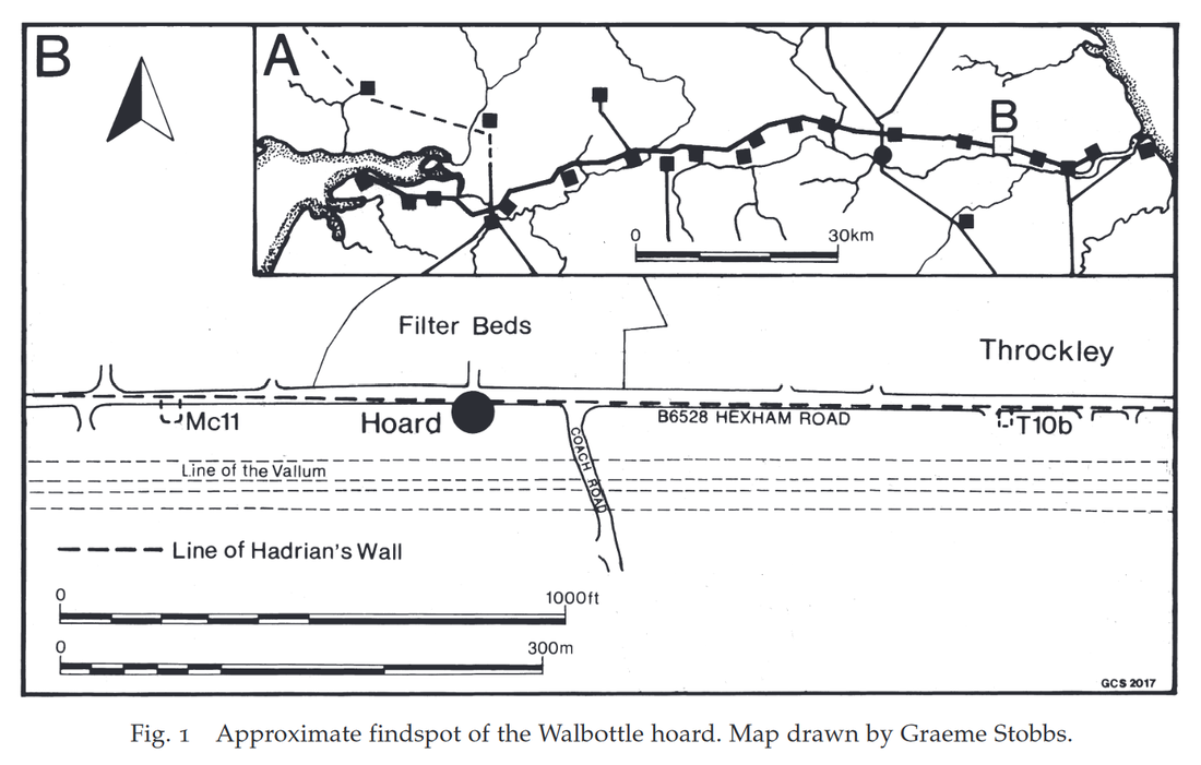
Although known as the Walbottle Hoard, this cache of over 5000 Roman coins of the third century was found by Hadrian's Wall in Throckley, close to the now-disused water filter beds.
A cache of over 5000 Roman coins, known as the Walbottle hoard, was found in 1879 during the construction of the Newcastle and Gateshead Water Company's filter beds (HER ref. 4236). It seems likely that the hoard may have been concealed in the Wall ditch near the site of Milecastle No. 11, at Throckley Bank Top. The coins were mostly of the decade AD 260-70. The hoard was dispersed in small lots by the finder, an Irish labourer, but subsequently some eight hundred or more were acquired by the Society of Antiquaries of Newcastle
Tyne and Wear HER(1241): Throckley, The Walbottle Hoard

An aqueduct was built from Whelton reservoir in Whittle Dean to Throckley Filter Beds in 1869. The water treatment works with extensive filter beds were completed in 1875 for the Newcastle and Gateshead Water Company. This involved extensive terracing and excavation of the area of the treatment plant, during the course of which the 'Walbottle Hoard' (SMR 1421) was found.
Tyne and Wear HER(4236): Throckley, The Walbottle Hoard
Picture
Clayton, J. (1880). Discovery of a Hoard of Roman Coins on the Wall of Hadrian. Archaeologia Aeliana Series 2. Vol 8, Society of Antiquaries of Newcastle. pp. 256-280.
Link


Picture
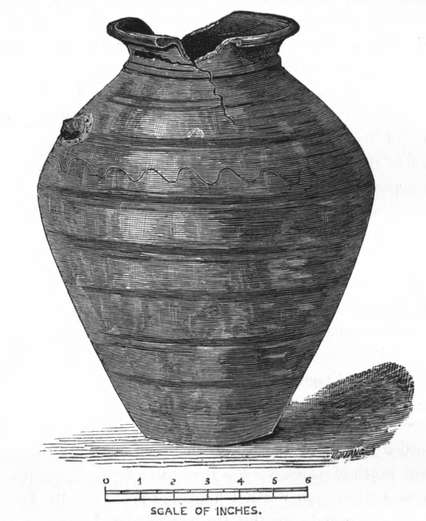
The discovery was made by an Irish labourer employed in digging for the purpose of laying water-pipes in the bed of the road. He met with the vase at a depth of four feet beneath the surface of the road, and in close proximity to the southern face of the Wall of Hadrian, and at a spot where three or four courses of stones of that wall remain in situ buried in the road.

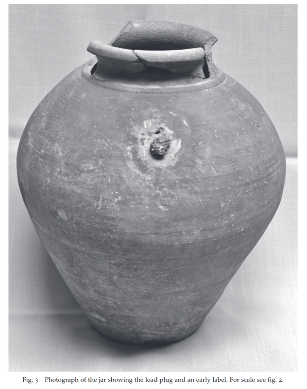
The vessel in which the.coins were contained is represented in the engraving on the previous page; it is of dark-coloured earthenware, and measures in height one foot two inches, and in girth or circumference at the widest part thirty-six inches.

5,028 coins were catalogued by Robert Blair and many were illustrated. They appear to be mainly small bronze coins  of low denomination (antoniniani), with a few silvered-bronze (known as 'billon').

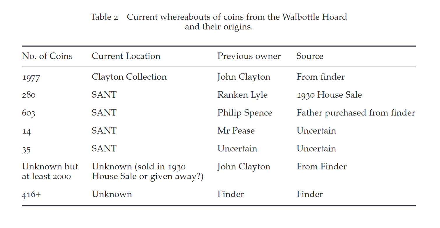
The workman sold a small number of coins privately but John Clayton managed to purchase the pot and most of those remaining. A few are now displayed in the Clayton Collection in Chesters museum. A small number of coins from the hoard were later acquired by the Society of Antiquaries of Newcastle Upon Tyne (SANT) (see table below).

Another paper was published about the hoard in 1931 justified by increased understanding of Roman coinage being able to add considerable information about the dates and places of minting of the coins: Hedley, W. Percy (1931). The Walbottle (Throckley) hoard of Roman Coins. Archaeologia Aeliana Series 4. Vol 8, pp. 12-48.

The paper estimated the value of the hoard at the time of its being buried or lost to be only about £13. This would represent the pay of a common soldier for about two and a half years, or one and a half years if it had belonged to a centurion.

The paper explains that in AD 270-272 there were disturbances on the frontier that could account for the concealment of the hoard.

Hedley, W. Percy. (1931). The Walbottle (Throckley) hoard of Roman Coins. Archaeologia Aeliana Series 4. Vol 8, pp. 12-48.
Link


McIntosh, Guest & Ponting (2018). ‘The Walbottle Hoard of 1879: re-examination and reassessment’, Archaeologia Aeliana 5th series, vol. 46, 41-75.

SUMMARY
This article reappraises the Walbottle (Throckley) hoard of late-third century Roman coins. The hoard’s complicated biography since its discovery in 1879 is described, followed by a summary of the re-identified coins and a discussion of the hoard’s dating. The results of a ground-breaking metallurgical study of a sample of the Walbottle coins are also presented, emphasising the on-going value of antiquarian finds when subjected to careful re-evaluation and analysis.

Picture

Peter Guest has recently published papers reexamining the basis for Roman coin hoards:

Guest, P (2015) 'The Burial, Loss and Recovery of Roman Coin Hoards in Britain and Beyond: past, present and future' pages 101-116 in J. Naylor and R. Bland (eds) 'Hoarding and the Deposition of Metalwork from the Bronze Age to the 20th Century: a British Perspective.' Oxford: Archaeopress.

Guest P. (2018) ‘The Walbottle Hoard of 1879: re-examination and reassessment’, Archaeologia Aeliana 5th series, vol. 46, 41-75 (with F. McIntosh and M. Ponting).

He concludes that the two previous papers about the Walbottle hoard reflect modern attitudes towards the Roman past rather than proven archaeological reality, and the continued failure to accurately date when hoards were buried and lost remains a significant problem:

"
imagined ‘events’ that led to its owner hiding the jar and coins in the ground, both authors believed, firstly that the 5,000 coins had been buried because of an imminent threat to the owner and presumably his property, secondly that it was the intention of the owner to return at some point in the future to recover his buried wealth, and finally that he had been unable to do so because of some unforeseen incident."
Why the hoard was buried and not recovered is likely to remain a mystery for the foreseeable future.
Picture
Historic England Picture Collection Reference: DP058664
Date: 17 Apr 2008
Location: Chesters Roman Fort, Museum, Humshaugh, Chesters, Northumberland

Picture
Picture
0 Comments

Cinemas in Throckley

9/4/2024

0 Comments

 
Tyne & Wear Historic Environment Record (HER) - Sitelines - lists two cinemas in Throckley, both buildings now demolished.

Tyne and Wear HER (7963): The Picture and Variety Palace, Bank Field Terrace.
Shown on third edition Ordnance Survey 25 inch to 1 mile of 1920. The planning application for the picture theatre was made in 1912. The building was to be single storey, 70 feet long by 45 feet wide, and constucted of timber with a corrugated iron roof. The picture theatre was demolished by 1952 and the site was turned into a car park in the 1970s.
Cinema Treasures website provides further information.

The Picture & Variety Palace:
1 screen, 600 seats.
Located on Bank Field Terrace, off the main Newcastle to Hexham Road, in the village of Throckley to the west of Newcastle upon Tyne. The building was constructed out of corrugated iron on its side walls and roof. It was the former Picturedrome of Newburn (October 1910-1911) which was designed by architect E. Tweddle of West Hartlepool. It was dismantled and and transported to Throckley by operator Towyn Thomas in October 1912. An additional 12ft was added to its length. It was granted a Cinematograph Licence on 12th November 1912.
In July 1922 it was taken over by Charles Nichol and was re-named Imperial Cinema. On 12th December 1922 it was destroyed by fire. A car park now occupies the site
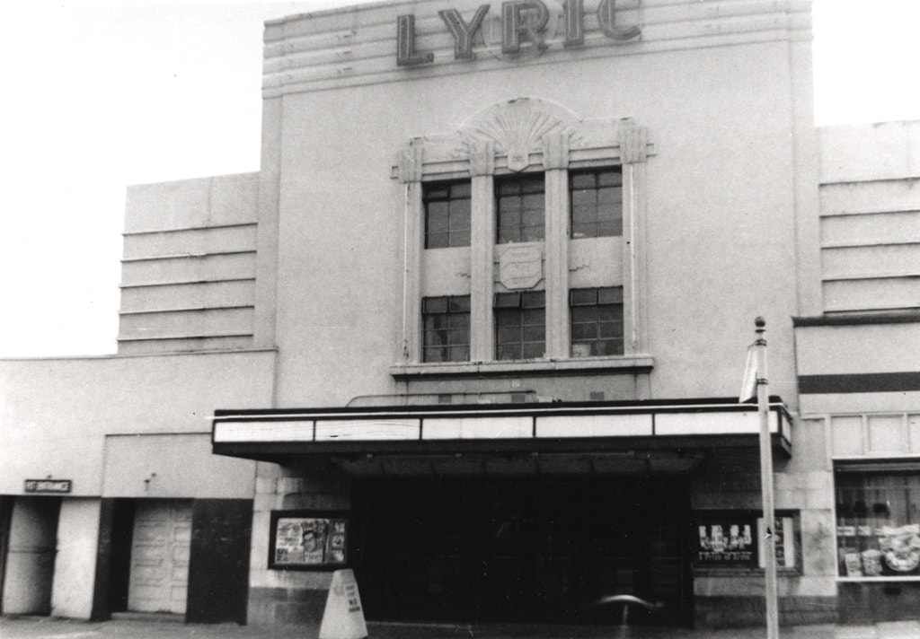
The village of Throckley was without a cinema until the Lyric Cinema was opened in 1935 (it has its own page on Cinema Treasures).

Tyne and Wear HER (12844): Lyric Cinema, Newburn Road.
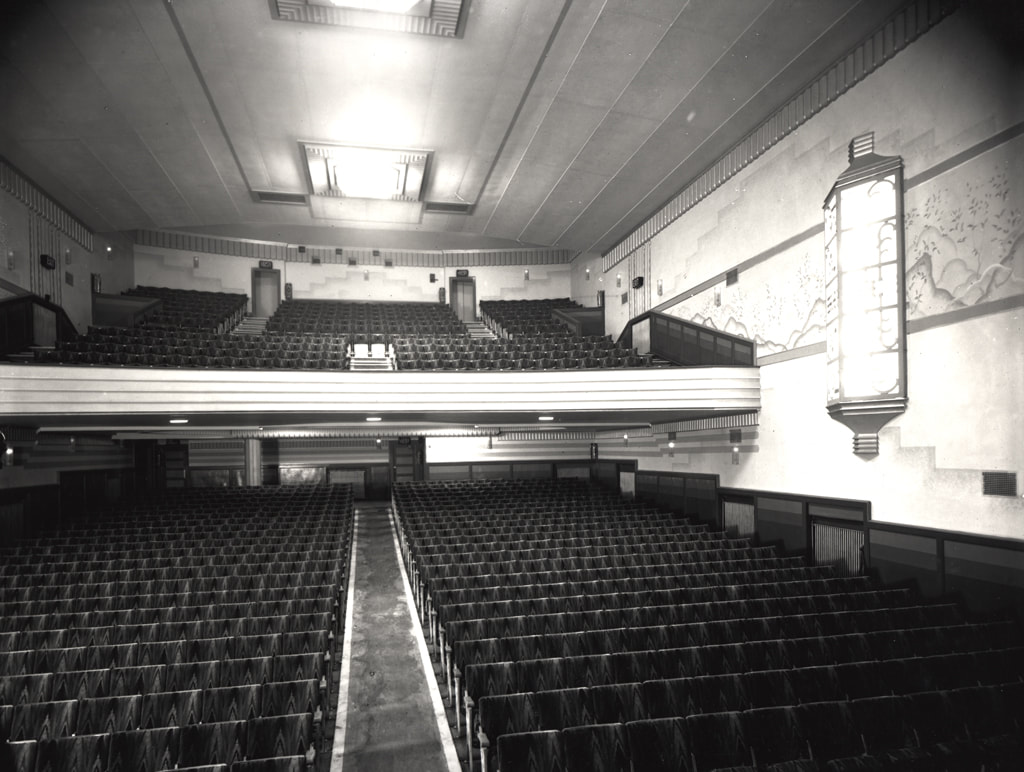
The Hinge circuit built the Lyric to designs by Percy L. Browne. It had a 850 seat auditorium with a dance hall and 7 shops. The Lyric opened on 15 May 1935 and the proceeds were donated to the Newburn and District Nursing Association, Newburn Cottage Homes and other local charities. The cinema had ruched curtains which changed colour from orange to green to red before the show started. The Lyric closed in October 1966 and became a bingo hall. It closed in the mid 1970s when permission was refused to convert it into an amusement arcade.
Cinema Treasures website provides further information.

Lyric Cinema, Throckley
1 screen, 858 seats.

Located in the village of Throckley, which today is a district to the outer west of Newcastle upon Tyne. The Lyric Cinema was built by the E.J. Hinge Circuit and opened on 15th May 1935 with William Powell in “The Thin Man”. Designed by architect Percy Lindsay Browne in an Art Deco style, seating was provided in stalls and circle levels. There was also a cafe & darts club in the building, which also had a row of shops attached. It was equipped with a British Talking Pictures (BTP) sound system.
The Lyric Cinema was closed in October 1966 and became a bingo club. It was closed in 1976 and the building became derelict and vandalised. It has since been demolished and the site is now a car park for Sainsbury’s Supermarket. The end shop unit still stands and is in use as Lyric Wines.
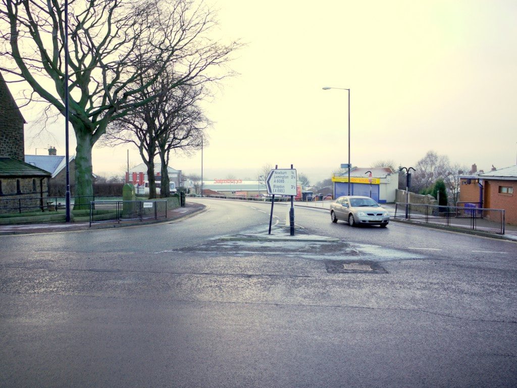
Picture
Lyric Cinema, Throckley (1963). Newcastle Libraries ref. 068682
Picture
Lyric Cinema, Throckley (1938). Newcastle Libraries ref. 068806. Photograph of the auditorium of the Lyric cinema Newburn Road, Throckley. The photograph has been taken from the proscenium looking towards the back of the cinema and up to the circle.
Picture
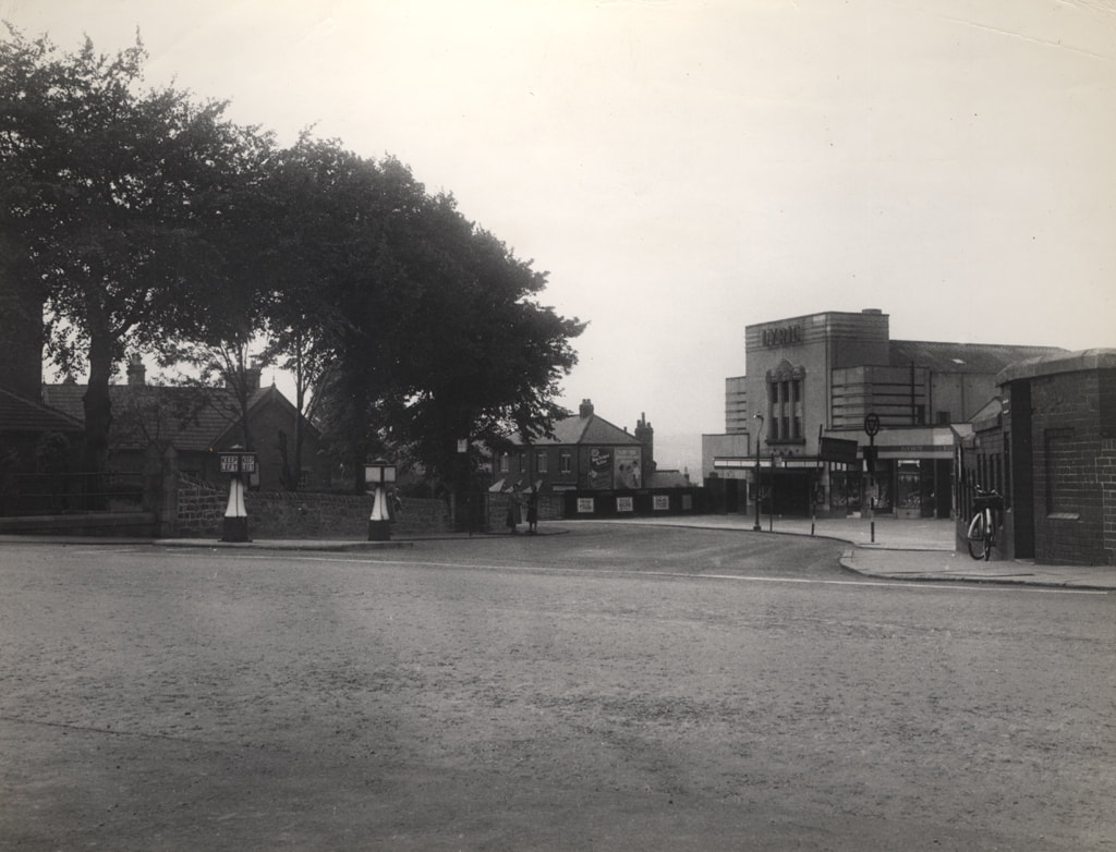
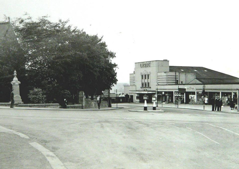
Newcastle Libraries (ref. 056515): decribed as Hexham Road/Coach Road, Throckley (but actually top of Newburn Road), Francis Frith c.1956.
Picture
"Blast from the past, Lyric Cinema at Throckley, Tyne & Wear. We demolished this building in the early 1990s (Synergy Demolition Group).
Picture
Junction of Newburn Road & Hexham Road, Throckley. Photo A Curtis (2011). Taken from the roundabout at the junction with Hexham Road. St Mary's Church is on the left NZ1566 : St Mary the Virgin Church, Throckley. The small building behind the car is the only reminder of the Lyric Cinema which used to be at this junction. The store is called, 'Lyric Wines'. The Lyric Cinema opened in 1935 and closed in 1966.
0 Comments

Banks in Throckley

9/4/2024

0 Comments

 
Screenshots and information below taken from Martins Bank Archive.
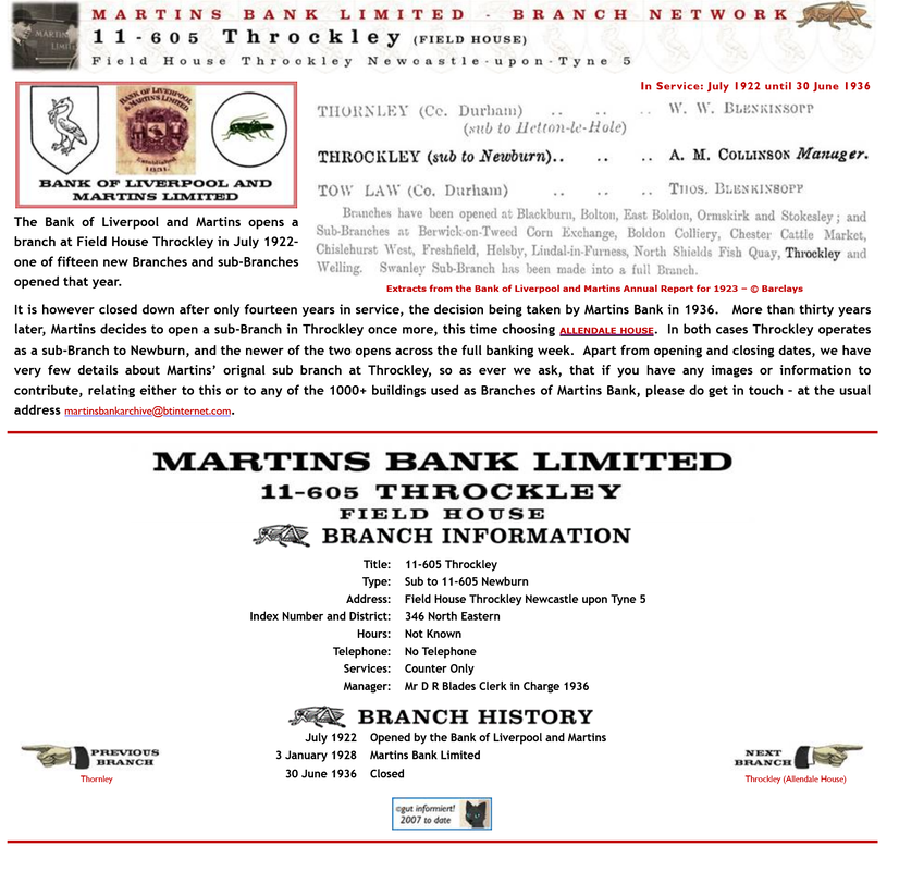
The Bank of Liverpool and Martins opened a branch at FIELD HOUSE, Throckley in July 1922 – one of fifteen new branches and sub-branches opened that year.

It was in service for fourteen years until 30 June 1936.
 
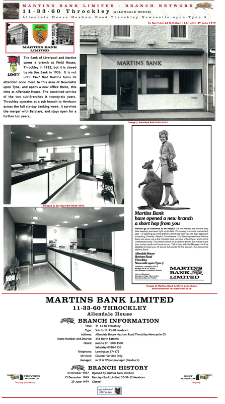
More than thirty years later, Martins decided to open a sub-Branch in Throckley once more, this time choosing ALLENDALE HOUSE.

This opened on 23rd October 1967. Martins merged with Barclays in 1969 and the Throckley branch finally closed ten years later on 29th June 1979.

In both cases Throckley operated as a sub-Branch to Newburn, and the more recent bank opened across the full banking week.
Picture
Picture
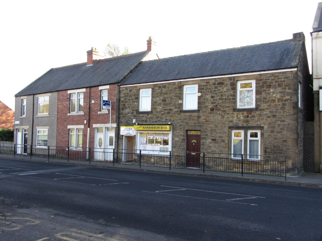
Field Terrace, Hexham Road, Throckley. Photo A Curtis (2013). Field House is on the right, next to the Sandwich Bar.
Picture
Picture
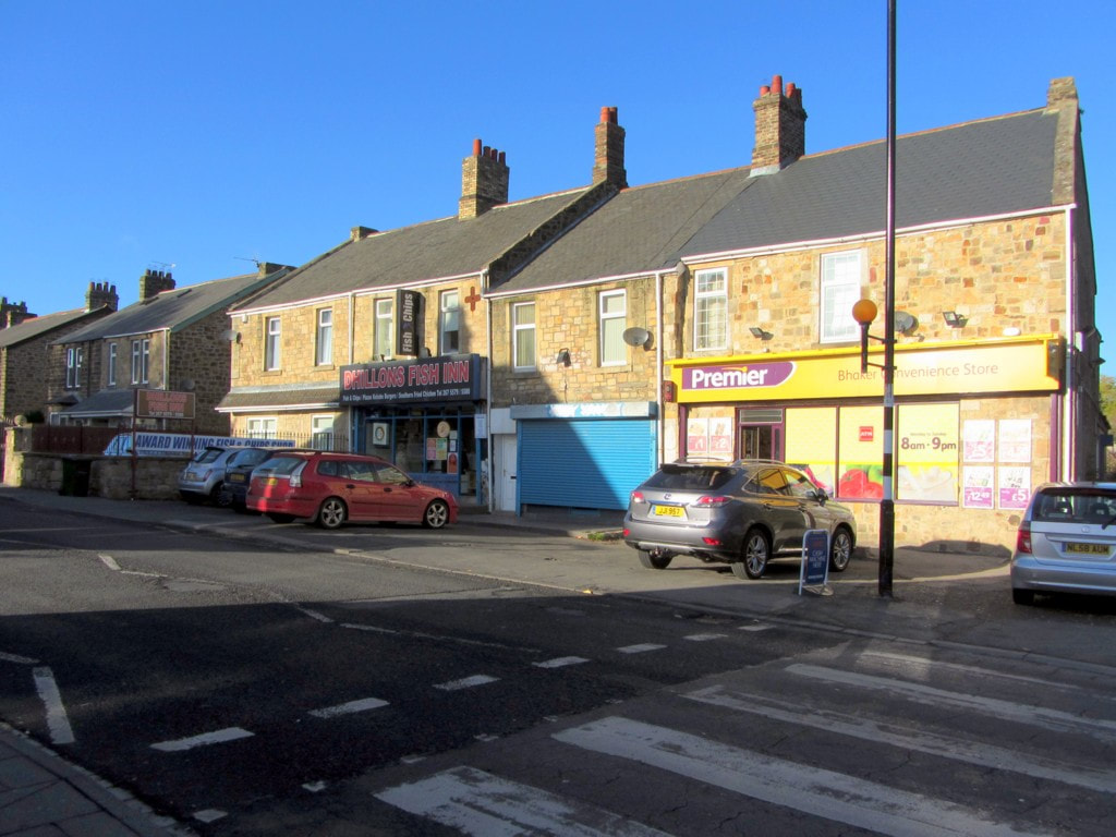
Shops on Hexham Road, Throckley. Photo A Curtis (2013). Allendale House is the middle property with the blue shutter.
0 Comments

Throckley temperance

7/4/2024

0 Comments

 
Picture
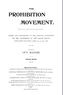
The Prohibition Movement
Papers and Proceedings of the National Convention for the Prohibition of the Liquor Traffic, Newcastle-upon-Tyne, April 3rd to 9th, 1897. Edited by Guy Hayler (1897).

The following is reported on pages 25-26.
The Newcastle Daily Chronicle gives the following testimony in favour of Prohibition. “As at Ford, at and Scot's Gap, as at Belsay, so at Throckley. But there is a difference. The former places are rural villages devoted to agriculture and the peaceful pursuits of the country. But at Throckley, only six miles west of Newcastle, the hum of modern life is distinctly heard, and the quiet seclusion Of the other Prohibition estates mentioned is wanting. It is a place no less ancient, however, than the rest, for it dates back further than the ancient city of Newcastle. When William the Conqueror's eldest son Robert led, as far north as Falkirk, the expedition which was principally memorable from the fact of his founding the New Castle upon the Tyne during his homeward march, and the real conquest of Northumberland began, the county was parcelled out among the warriors who helped to win the victory at Hastings. Throckley, however, with other sundry small places, remained in the hands of its Saxon proprietor. There had been people at Throckley long before this, and a very fine ancient British barrow at Dewley, which is now considered part of Throckley, is not yet obliterated by the plough. Dewley, it may be recalled, was one of the places where George Stephenson, the great locomotive engineer, lived in his early years,while he was married at Newburn, of which parish Throckley is a part. It was not far from Throckley, it is said, that Martin the painter selected the view over the Tyne towards Wylam for reproduction in his picture, 'The Plains of Heaven.'

"Prohibition has existed at Throckley for some thirty years, since the starting of the colliery. Formerly there were two public-houses. Now the sale of drink is prohibited on all the estate, which is leased by the colliery company, and on the land which belongs to Greenwich Hospital, and which was formerly owned by the ill-starred Derwentwater family. Not only can the inhabitants not buy drink, but they may not keep dogs or pigeons, and so gamble on the result of rabbit-coursing, greyhound-racing, or pigeon-flying. It is estimated that the number of inhabitants now reaches close upon 2,000, and for a pit village it is claimed that in the orderliness and prosperity of its people it is second to no other in Northumberland and Durham. More than half of the miners are total abstainers, for the prohibition of drink, dogs, and pigeons keeps away those that are inclined thereto, and the result of the repulsion of these is a sort of artificial selection of steady workmen, who have in the course of years formed themselves into an industrious, peaceable and thriving community, as is evidenced on every hand. The Wesleyan and Primitive Methodist Chapels and the Church (which is an offshoot of that of Newburn, the head of the parish) are all well attended, and the ministers and clergy report that the number of men they find attending morning service at these places of worship is quite exceptional. The miners are equally good in turning up for work in an efficient condition on Monday mornings, guiltless of 'after-damp' from any Saturday and Sunday potations—and it is said that Throckley Colliery leads all the collieries of the county in this respect. Fortunately in regard to work the pit is one of the most regular in the district, having worked eleven days per fortnight for several years past, and the men earn an average of 5s. a day. At the excellent and commodious British Schools there is an average attendance of 500 scholars, and the Board of Guardians at Ponteland
is called upon to pay the fees of only three. Pinching poverty is almost unknown in this healthy and well-conducted village.

"One of the plainest manifestations of the thriving character of Throckley is to seen in its Co-operative Society. The members' share capital amounts to over £14,000, and each quarter's sales exceed £8,000, while it pays a dividend averaging 3s 8d. in the pound. Besides the handsome block of store buildings in which its business is carried on, the Co-operative Society has built at a cost of about £I,500 a large handsome hall of corrugated iron on a brick foundation. The build- ing is handsomely fitted up inside, and contains a smoking room, a reading room, a billiard and games room, and an entertainment hall with accommodation for nearly 600 persons. Members of this institution. which is also carried on on Temperance principles, obtain for a small fee valuable social privileges, and in the winter a busy round of entertainments of various kinds is kept up almost nightly. During the summer. these entertainments are not entirely suspended, and every pay-day a ball is held, which is carried on merrily into the small hours like any city dance. This does not end the Society's enterprise, for it has bought a piece of land adjoining the highroad on which members have built eleven cottages, costing a sum of £2,640. These the owners do not themselves occupy. for they are pitmen living in colliery houses rent-free, but. having by their thrift become small capitalists, they have adopted this manner of investing their savings. It is the exception for members of the Co-operative Society to withdraw their quarterly dividends, and nearly every member has a tidy little sum to his credit in the Society's books. Others of the miners have bought from the Greenwich Hospital Trustees plots of half an acre of land on part of which they have built houses, and they employ their leisure in cultivating these little estates with considerable skill. The rows of miners' houses are very neat and clean. and all the gardens fully worked, while several occupants have erected small greenhouses therein, and others have built stables and sheds and are the owners of horses, traps, and carts, which they let on hire or use for adding to their incomes.
 
"On what is known as the Bank Top is the Mechanics' Institute, in which are a reading room and recreation room, the latter containing a billiard table and facilities for playing other games. In the summer time a large flower show is held, managed by a committee of working men, and the members of the Co-operative Society promote a leek show, which is held in the Co-operative Hall, as a counter attraction to the leek shows held at the public-houses in the neighbouring villages. The Mechanics' Institute members also hold picnics during the summer, as rival attractions to those of the inns, that, taking things as a whole, the Throckley people contrive to get for themselves plenty of recreation, amusement, variety, and excitement on strictly Temperance principles. Full employment is found for three abstinence societies. each flourishing and with a membership continually at work—the Good Templars, the Rechabites, and a branch of the British Women's Temperance Association. Possibly one active cause of the maintenance of Prohibition in Throckley, more potent, perhaps, than all the efforts of the proprietors of the colliery, is the existence in the village of a perfect water supply. The Newcastle and Gateshead Water Company have filtering beds at Throckley, and they supply the village with water of a quality that is not obtainable at every mining village in the North Of England. This is a great and exceptional advantage, and must be held to supplement very materially the eflorts which have been made by all parties to make Throckley a striking instance of the beneficial results of the application of Prohibition in regard to drinking and other habits which militate against thrift and prevent the acquisition of comfort and independence amongst the working class inhabitants." The population on the 1891 census was 1,464.


Picture
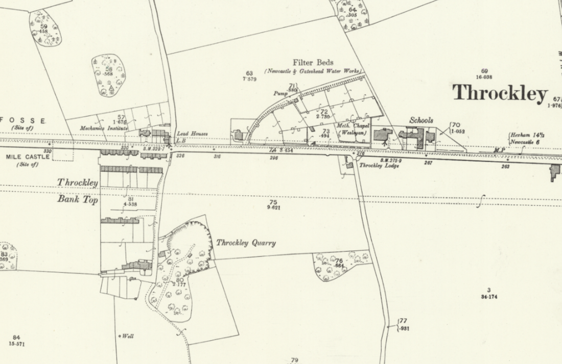
OS Northumberland (25" to 1 mile, Old Series) LXXXVII.15. Revised: 1895, Published: 1897. National Library of Scotland.
Showing former location of the Mechanics' Institute (at Bank Top), Newcastle & Gateshead Water Comapny Filter Beds, Wesleyan Chapel and Colliery Schools.
Tyne & Wear HER (Sitelines ref 1957) provides the following information:
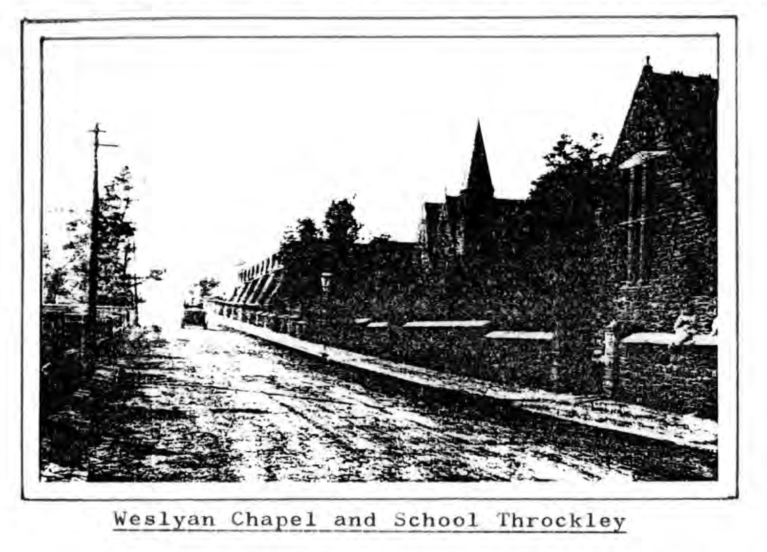
In September 1870 the Throckley Coal Company determined upon building day schools for the children of its employees, and the following year a site was chosen on the north side of the Hexham turnpike, belonging to the Lords of the Admiralty, at a cost of 1/- per annum. The school buildings, constructed of local sandstone after 1872, cost £1,293.16.4d. About the same date a Wesleyan Methodist Chapel was built immediately west of the schools (the chapel was demolished in 1998/9 and has been replaced by two houses). The school was opened in 1873, a fact recorded on a sign adjacent to the main entrance and on a commemorative stained glass window inside. The Throckley Colliery School was later renamed Throckley Undenominational School. During the Second World War air raid shelters were built on the north side of the playground. The original stone school buildings were altered and adapted throughout the 20th century, but were due for demolition in 2003.
Picture
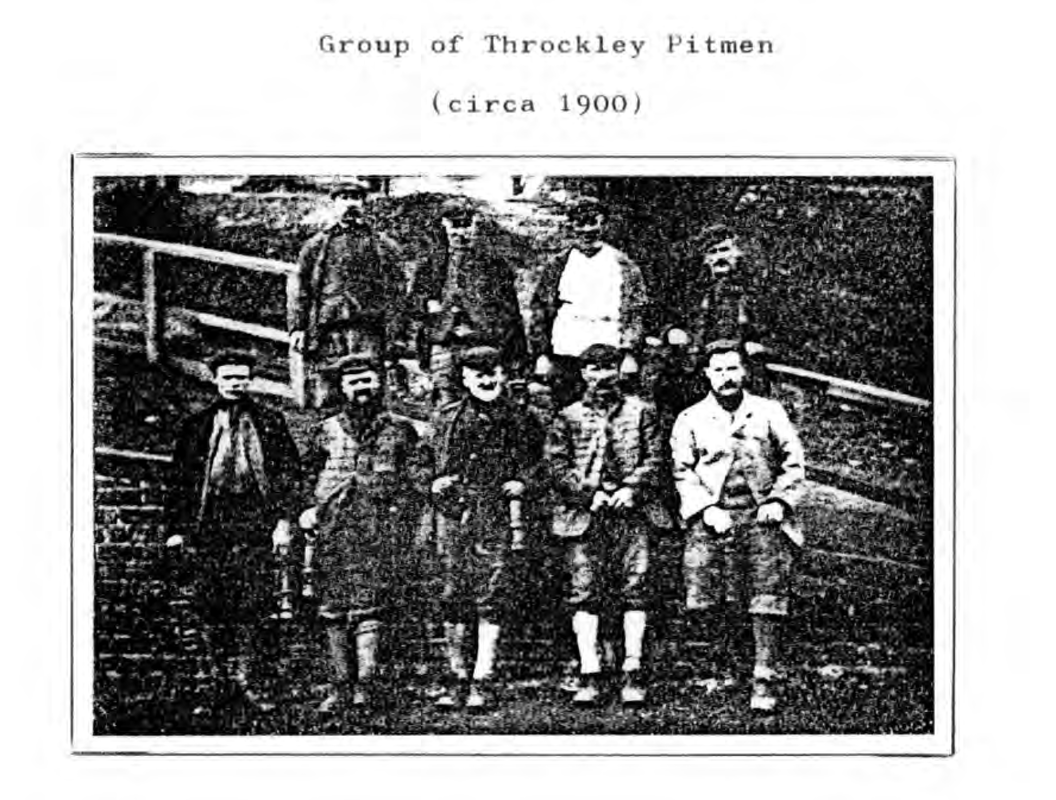
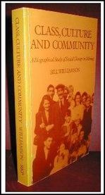
Photo from p.241 of Williamson, W. (1980) Class, culture and community a study of social change in mining through biography. Doctoral thesis, Durham University.
Picture
Photo from p.181 of Williamson (1980)
Picture
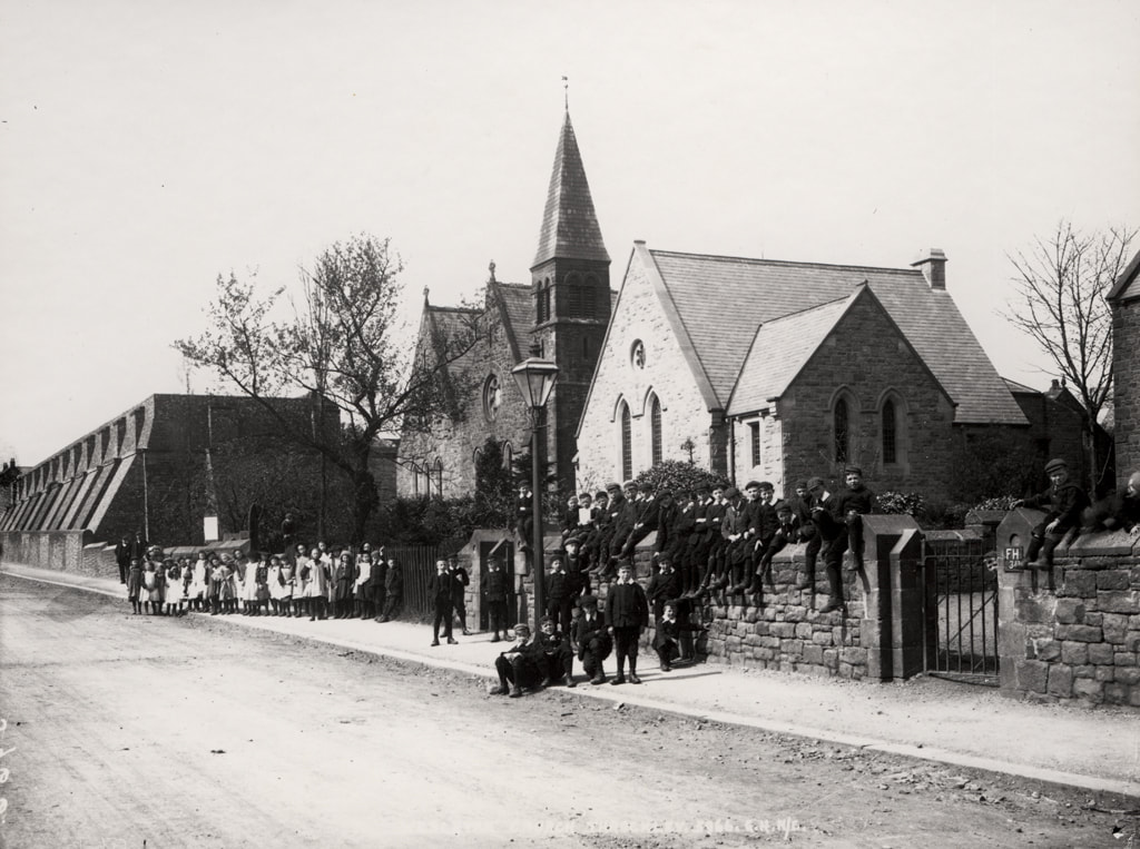
Throckley Methodist Church, 1906. Newcastle Libraries ref. 024553. A view of the exterior of Throckley Methodist Church Hexham Road Throckley taken 1906. The Church is in the centre with the Church Hall to the right and the Water Company Resevoir to the left. Two groups of children are standing/sitting outside the Church and Church Hall.The Wesleyan Methodist Church was built in 1871 and the Church Hall in 1905.
0 Comments
<<Previous

    RSS Feed

    Author

    Andy Curtis

    Archives

    July 2024
    June 2024
    May 2024
    April 2024
    March 2024
    January 2024
    November 2023
    February 2023
    November 2022
    September 2022
    August 2022
    June 2022
    May 2022
    January 2022
    December 2021
    November 2021
    September 2021
    August 2021
    June 2021
    May 2021
    October 2020
    June 2020
    May 2020
    March 2020
    November 2019
    August 2019
    July 2019
    March 2019
    January 2019
    November 2018
    October 2018
    August 2018
    July 2018
    June 2018
    April 2018
    March 2018
    January 2018
    October 2017
    September 2017
    July 2017
    June 2017
    May 2017
    April 2017
    March 2017
    February 2017
    January 2017
    December 2016
    November 2016
    September 2016
    August 2016
    July 2016
    June 2016
    May 2016
    April 2016
    February 2016
    January 2016
    December 2015
    October 2015
    September 2015
    August 2015
    July 2015
    June 2015
    May 2015
    April 2015
    March 2015
    February 2015
    January 2015
    December 2014
    November 2014
    September 2014
    August 2014
    July 2014
    June 2014
    May 2014
    April 2014
    March 2014
    February 2014
    January 2014
    December 2013
    October 2013
    September 2013
    August 2013
    July 2013
    June 2013
    May 2013
    April 2013
    March 2013
    February 2013
    January 2013
    December 2012
    November 2012
    October 2012
    September 2012
    August 2012
    July 2012
    June 2012
    May 2012
    April 2012
    March 2012
    December 2011
    November 2011
    October 2011
    September 2011
    August 2011
    June 2011
    May 2011
    April 2011
    March 2011
    February 2011


    Categories

    All
    Agricultural Engineering
    Archaeology
    Barrow
    Bays Leap
    Beamish Museum
    Beer
    Beer-mat
    Bewcastle
    Books
    Border Line
    Brewery
    Brown
    Cabinetmaker
    Charlton
    Cheviots
    Churches
    Civil War
    Clennell Street
    Close House
    Coal Mining
    Cullercoats
    Cumbria
    Eachwick
    Earl Grey
    Elswick
    Family History
    Fishing
    Fishwives
    Folkestone Warren
    Forth Banks
    Furniture
    Gardens
    General
    George Clark
    Gibson
    Goods Station
    Hadrian's Wall
    Harbours
    Heddon
    Heddon Hall
    Hexham
    Hidden Chains
    Houghton
    Howick Hall
    Hunting
    Iron Sign
    Isaac Jackson
    John Grundy
    John Smith
    Knott
    Landscape
    Landslide
    Lead Works
    Lemington
    Lidar
    Lindisfarne
    Maritime
    Meetings
    Military Road
    Mill
    Monument
    Newburn
    Newcastle
    Newcastle Assizes
    News
    North Lodge
    North Shields
    Northumberland
    Northumberland Records Office
    Old Middleton
    Oral History
    Ouseburn
    Outings
    Photography
    Pit
    Place Names
    Place-names
    Ponteland
    Ports
    Postcards
    Prehistory
    Pubs
    Quarries
    Railways
    Redesdale
    River Tyne
    Rock Art
    Roman
    Sadler
    Sanderson
    Schools
    Seaton Delaval
    Ships
    Shot Tower
    Slave Trade
    Songs/Poems
    Spearman
    Stagecoach
    Stained Glass
    St. Andrews
    Stephenson
    Swann
    Tea Robbery
    Throckley
    Town Farm
    Transportation
    Trinity House
    Victorian Panorama
    Walbottle
    Walk
    Water Supply
    William Brown
    Williamson
    Woodhorn
    Ww1
    Ww2
    Wylam
    Yetholm

Powered by Create your own unique website with customizable templates.