
Although this is the Heddon Local History Society website, I realise that I have not yet made blog posts of two things that have greatly interested me from my time in the North-East. One of the topics, pre-historic rock-art, will have to wait for another time when I feel I can do it justice. There is very little rock art in the Cheviot Hills but it is a beautiful range of quiet hills which I have loved to explore. They are also very rich in archaeological remains which are often superbly preserved.
A recent visit sparked a little interest in the old cross-Border roads. I thought I had a reasonable idea where these ancient Border-crossing routes went, but an observation during a walk on the Scottish side of Clennell Street suggested things aren't so clear cut as I had thought.
A recent visit sparked a little interest in the old cross-Border roads. I thought I had a reasonable idea where these ancient Border-crossing routes went, but an observation during a walk on the Scottish side of Clennell Street suggested things aren't so clear cut as I had thought.
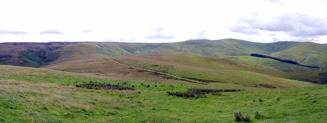
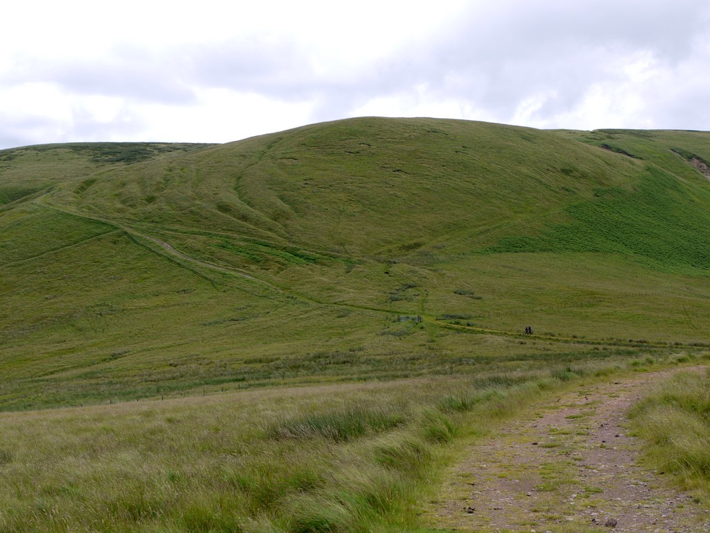
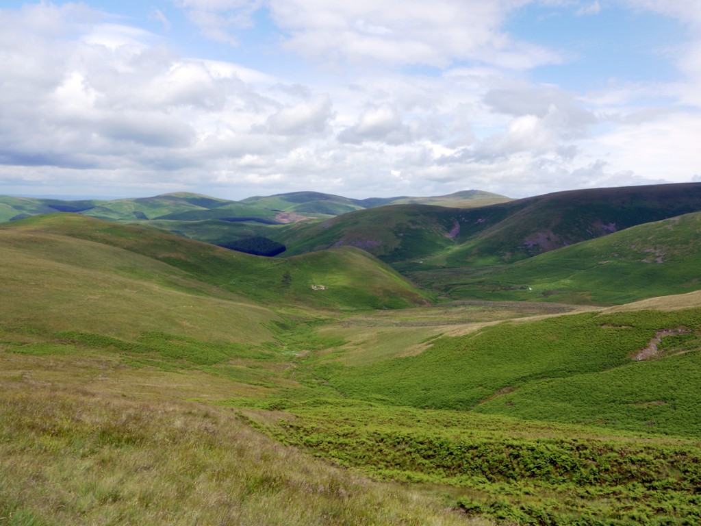
Clennell Street at Cock Law and The Bank. Photo A Curtis (2012).
I had left the car near Cocklawfoot Farm at the end of a blind-end road deep into the Scottish side of the hills. The road, in the valley of the Bowmont Water, is itself on the route of one of these ancient roads which ran to the Anglo-Scottish Border ridge from the Scottish town of Kelso via Kirk Yetholm or Morebattle. There is even an old milestone still standing along the roadside, inscribed as 11 1/2 miles to H{ (Harbottle) heading south, and 15 miles to Kelso, heading north.
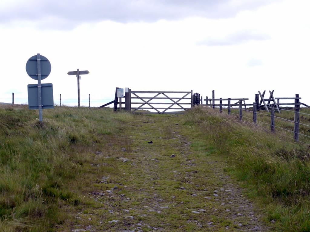
The route which climbs the ridge of Cock Law above the farms of Cocklawfoot and Kelsocleugh arrives at a gate on the Border fence about 2km north-east of Windy Gyle. Here it crosses the Pennine Way footpath and splits into three main branches. One of these is known, at least on the English side, as Clennell Street, and crosses south-easterly through the Cheviot Hills to Alwinton on the River Coquet. Other branches take a more southerly route and join the Coquet valley much further to the west, at Barrowburn.
I was of course aware of the even more westerly cross-Border tracks, crossing at the dizzy height of Windy Gyle itself, and others further west, including The Street and Gamel's Path on the route of the Roman Road, Dere Street, crossing near Coquet Head.
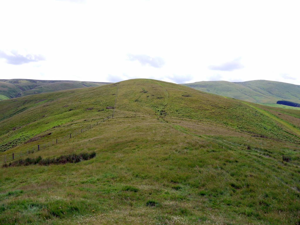
Hexpathgate on the Scottish side of the Border. Photo A Curtis (2012).
|
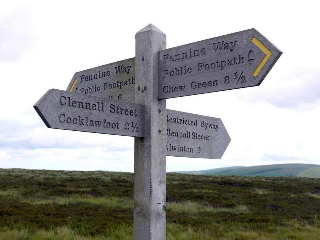
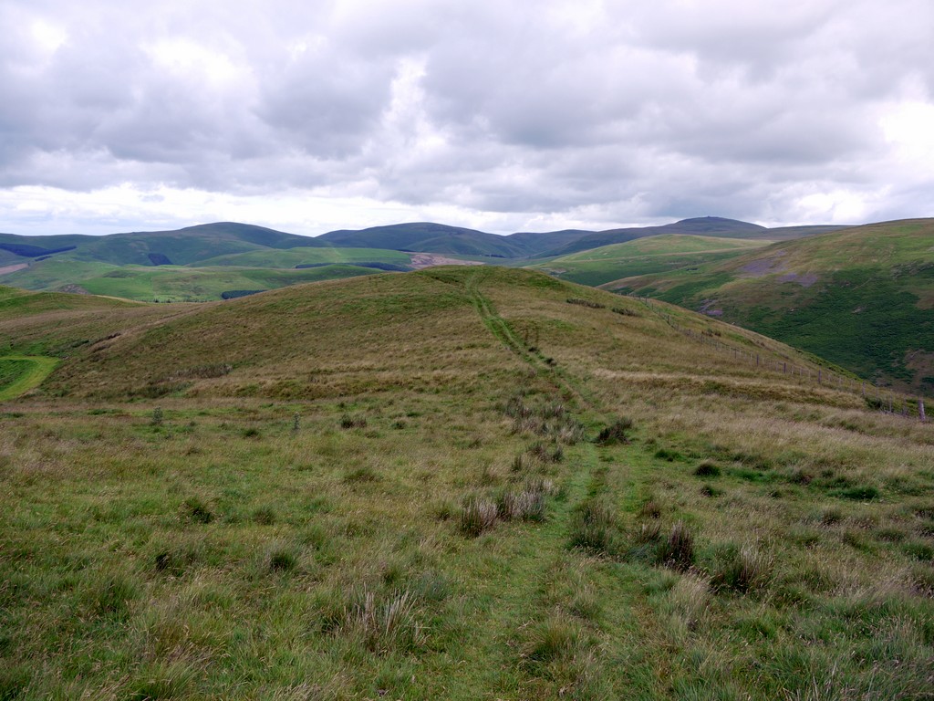
Crossing paths - Clennell Street & Pennine Way. Photo A Curtis (2012).
|
Clennell Street was used in the past by drovers, soldiers, traders and the so-called Border Reivers, bands of raiders, thieves and cattle rustlers. Smugglers, unlawful traders and other vagabonds would also use these unregulated routes to pass unseen between the two countries. The Border crossing was known as Hexpethgate. Wardens of the Marches who had the job of keeping peace north and south of the Border would often meet here in the 15th and 16th centuries to make terms. At one of these meetings, during a truce in 1585, the English Lord Francis Russell was shot and killed in this vicinity. The large Bronze Age Burial cairn on Windy Gyle was named Russell Cairn in his memory.
Clennell Street at Cock Law and The Bank. Photo A Curtis (2012).
|
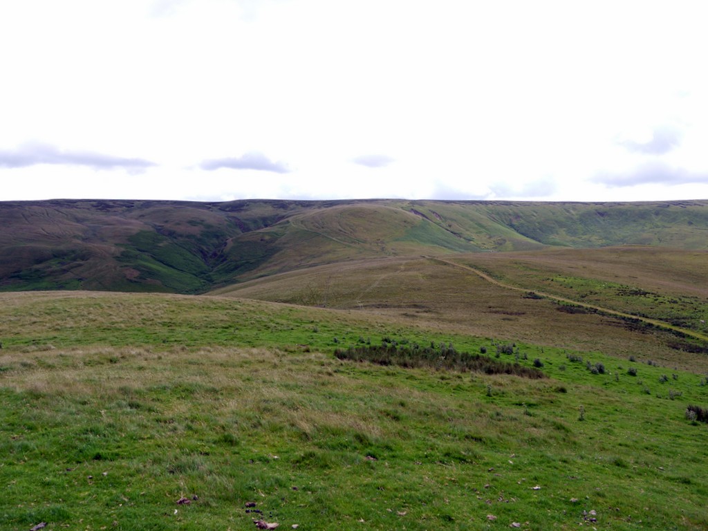
Clennell Street below Outer Cock Law. Photo A Curtis (2012).
|
On the steep slopes of Outer Cock Law, below the final climb to the summit ridge, Clennell Street braids into a number of parallel roads or hollow-ways. These are very visible in the right hand photo above. The current track, well terraced and graded, takes a route round the hill to the left. Another similar, now unused track, ascends to the right into the valley of Bank Burn where it is broken by a landslip, joining the main track on the ridge above. Between these routes there are a number of deep, curving parallel grooves.
View Cross Border roads in a larger map
Over to the left, visible both in the panorama and the left hand photo, to the east of the deep valley of Hexmoor Cleugh, there is another, even more extensive, series of similar parallel tracks ascending the hillside. It looks very much, as if substantial traffic used to take this more easterly course, now unused by the modern routes, and more or less invisible at the level of the Border ridge. A brief search of that excellent Scottish archaeological resource, the Royal Commission on the Ancient and Historic Monuments of Scotland (RCAHMS) provides a few more clues. The Canmore Mapping resource, in particular, allows access to a huge amount of information. The braided old roads of Outer Cock Law are described here as are a few linear earthworks of the kind I knew as 'cross-dykes'. When these were actually made doesn't seem to be known; they could be medieval constructions or much earlier, possibly even extending back to prehistoric times.
These are found in the vicinity of the old cross Border routes on both the Scottish and Northumberland sides. They were often built to cut off ridges between steep valleys, but with gaps through which the old roads appear to have been constrained. They have been interpreted as both ditches to act as land boundaries or as the means to control or even tax transport along the the roads, either for droves of cattle or individuals. I had observed similar cross-dykes during my climb on the Scottish side of Clennell Street.
Camp Tops from north side of White Knowe (view north). Photo by A Curtis (2012).
|
White Knowe from Camp Tops (view south). Photo by A Curtis (2012).
|
A linear earthwork or cross dyke is visible in the two photos above. It divides the ridge between Camp Tops, the site of an Iron Age enclosure, and White Knowe. Although the 'modern' Clennell Street now runs on the west side of this ridge (you can see it below the hills in the two photos), the original route undoubtedly ran along the crest. This particular earthwork is well described in Canmore. Interestingly, two old tracks appear to converge on a gap in its bank and ditch on the crest of the ridge, each taking routes on opposite sides of White Knowe. On the slope of Outer Cock Law there is another linear earthwork of a similar type.
Although Canmore fails to record the extensive braided hollow-ways I had observed east of Hexmoor Sike, here too there are linear earthworks of the cross-dyke sort, which appear to confirm it as an ancient routeway. For instance, there is one east of White Knowe at the south end of Fundhope Rig which takes the old track branching east from the Camp Tops ridge from the cross-dyke gap below White Knowe. This track would have crossed Hexmoor Sike near its junction with Thief's Slack.
Futher up the slope where the many hollow-ways of the eastern route become clear, there is another of these linear earthworks.
Where did this eastern route cross the Border and what can be seen there today?
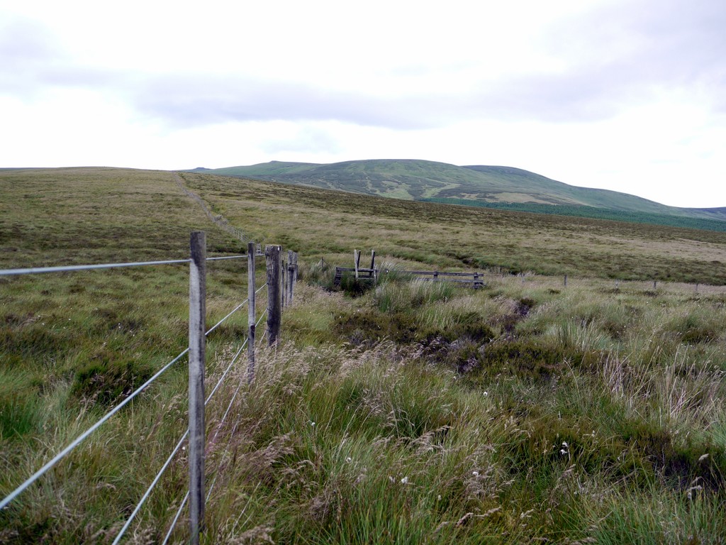
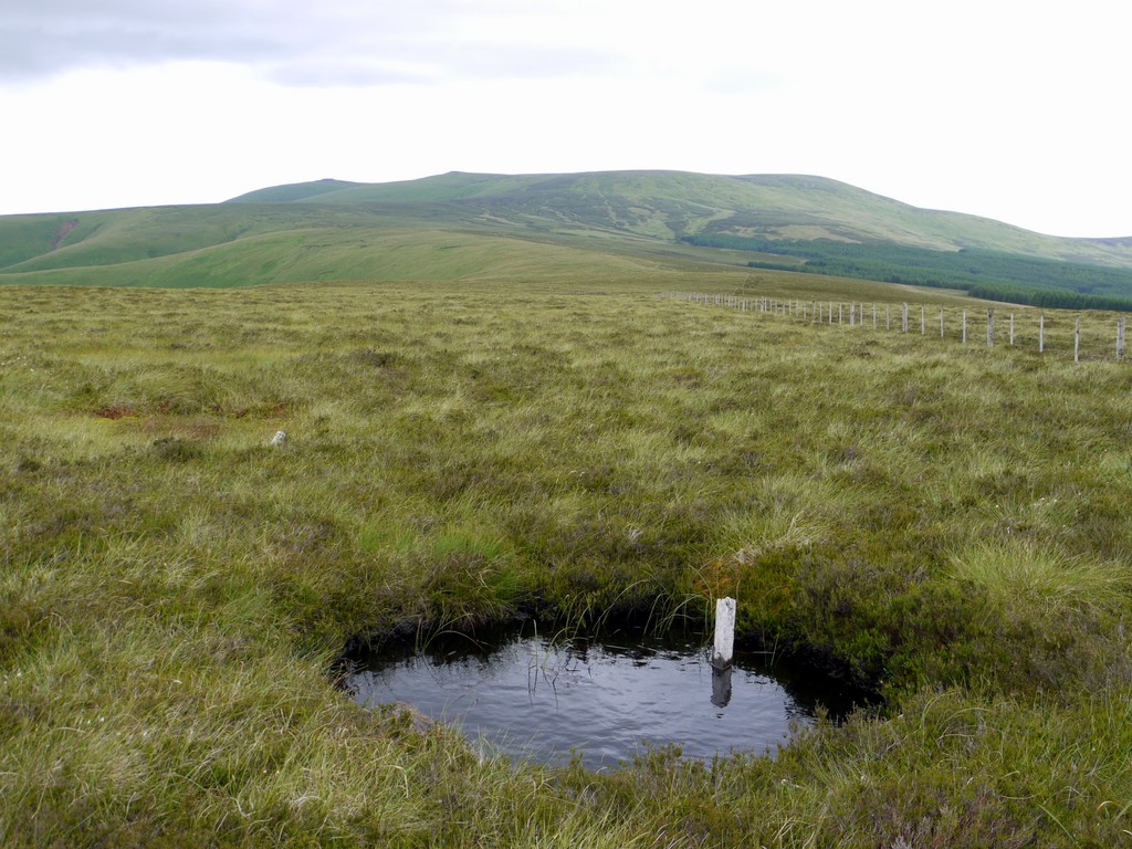
Border fence at Butt Roads. Photo A Curtis (2012).
The part of the Border for which these old roads head is called on the map, Butt Roads. The Border here is wet and boggy, formerly a nightmare for walkers of the Pennine Way before flag-stones were laid which now make the path along the line of the Border fence easy.
Although slightly lower than the modern Clennell Street crossing shown above, it is an exposed site. The high Cheviot plateau looms to the north, often windy and cloud covered, grim in winter. Recent forest plantation on the Northumberland side flank both side the valley of the Usway Burn. No routes cross the Border here today,.and there is little visible on the English side, although a wide ride though the forest down to the Usway has been left alongside Buttroads Sike. On the Scottish side a place name. Randy's Gap, may refer to the ridge between two unnamed streams, or is perhaps a memory of a crossing point. The line of the route would take a more northerly line over the Usway to join Salter's Road, another ancient route descending to the valley of the River Breammish at Bleakhope, crossing the Cheviots in a straight south-easterly direction to Alnham.
I had always assumed that the Salter's Road route crossed the Usway near Davidson's Linn and joined Clennell Street just south of its Border crossing, as the line of its right of way does today.
Confirmation of my suspicions on this route came again from the RCAHMS in their 1956 publication 'An Inventory of the Ancient and Historical Monuments of Roxburghshire'. Record number 758 on pages 363-365 in Vol 2 describes the route much as I had speculated. They say that the lower end of the Butt Roads route on the Scottish side has been destroyed by cultivation but no doubt branched off a road in the valley bottom at or near Cocklawfoot. It is joined near Fundhope Rig, by the track which branches off the Cock Law route as described above , crosses Hexmoor Sike near Thief's Slack and ascends the slope in an extensive series of almost parallel routes. These they describe as being either hollowed or terraced according to the lie of the land. They show evidence for the passage of a great deal of traffic, but have clearly been out of use for a long period of time. The crossing of a chasm at Randy's Gap is described as being practically destroyed by erosion.
View north along Hexmoor Sike. Photo A Curtis (2012).
|
Peaty pool and Border fence at Butt Roads. Photo A Curtis (2012).
|
The fact that traffic coming from the Bowmont Water required two separate routes between Cocklawfoot and the Border is somewhat surprising especially considering the presence of a third route leading from Mowhaugh to Windy Gyle. It is possible, they say, that the Butt Roads route was directed towards the Breamish with the Cock Law route primarily directed towards the Coquet.
The description of this route by the RCAHMS also references some historic documents. A State Paper dated 1543 listing 'Hexpathgate' among the "ingates and passages forth of Scotland upon the Middle Marches". Another document dated 1597 describes both the Cocklaw route to "Hexpeth gate heade" and the route via "Butrod Head". showing both were in use in the 16th century and probably much earlier.
In 1829, the Butt Road route was described as a "miserable track impassible in winter", and as being "frequented by smugglers and vagabonds of every description".
In 1829, the Butt Road route was described as a "miserable track impassible in winter", and as being "frequented by smugglers and vagabonds of every description".
Links
The Anglo-Scottish Border Roads of The Cheviot Hills - An historical and archaeological background from Northumberland National Park website.
Droving in Northumberland National Park - An historical and archaeological background from Northumberland National Park website.
The Anglo-Scottish Border Roads of The Cheviot Hills - An historical and archaeological background from Northumberland National Park website.
Droving in Northumberland National Park - An historical and archaeological background from Northumberland National Park website.
 RSS Feed
