
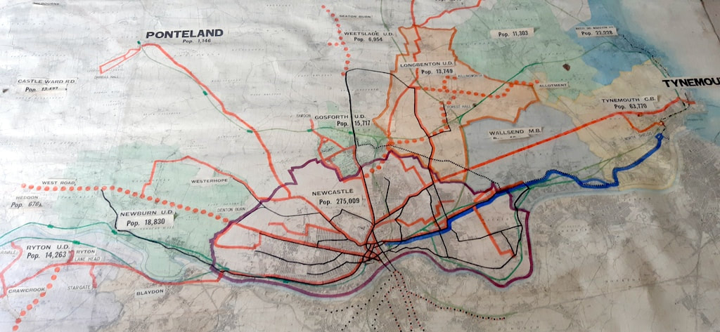
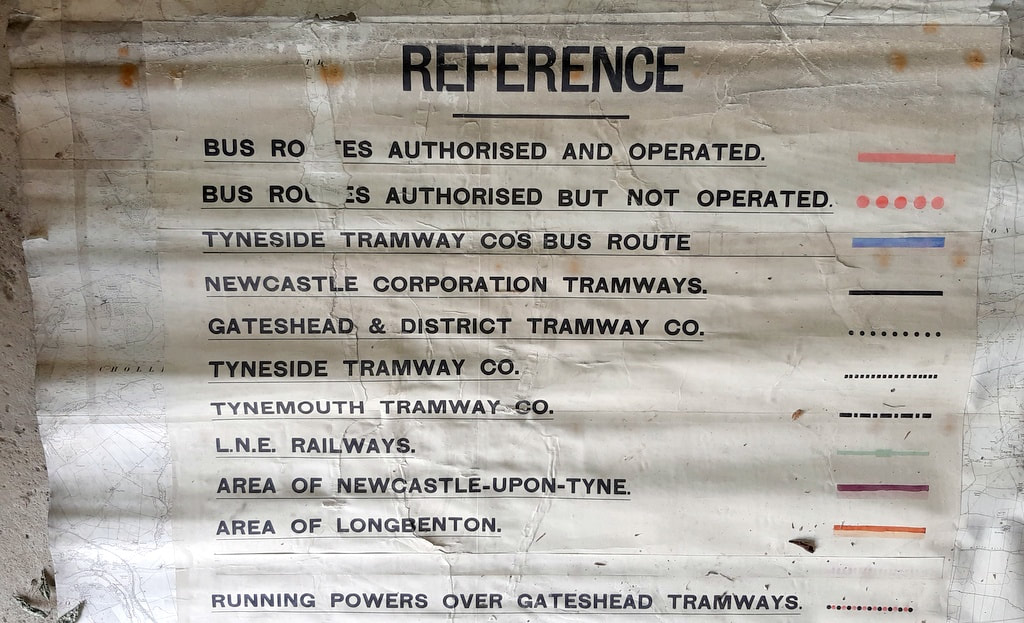
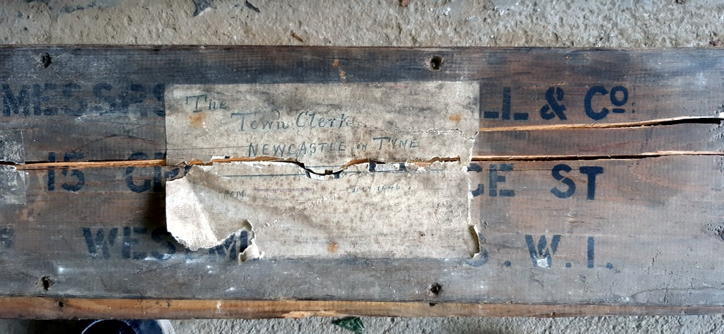
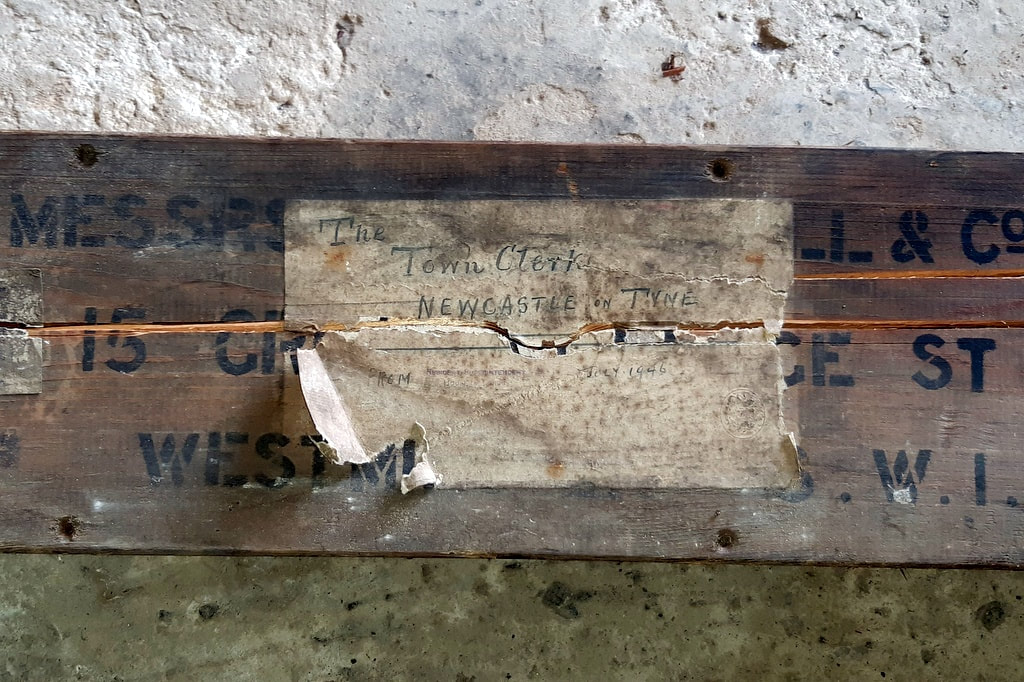
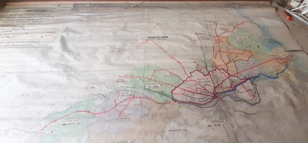
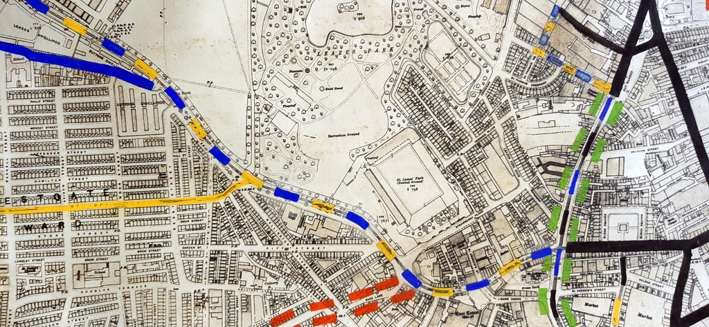
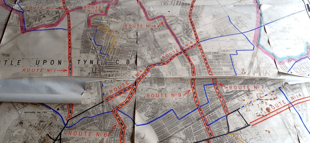
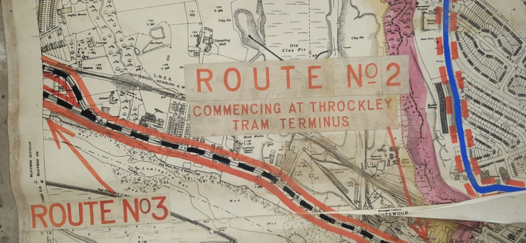
  I was privileged to be invited to see these two massive old maps last week. Based on sections of large scale Ordnance Survey maps, they have routes of Newcastle's buses, trams, trolley-buses and train routes painted on by hand. They had been designed to be hung up on a large wall somewhere and had been stored in a long and heavy wooden box. They had been rescued from disposal by David Vardy and brought to my attention by both Bill and Lil of Heddon who use a local Facebook page. See below for more details and some recent research. The origin of the box with its two maps was from a demolished property somewhere along the River Tyne, perhaps a storage warehouse of the town council. An auction label on the wooden box showed that the maps had been in an auction by ADG Auctions of Blyth on 10th July 2021 as lot 736. The lot was described only as 2 x 1920 local maps huge size approx. 18ft x 10ft, reused in war period 1944. Contained in large oak container. There was no reserve price and the lot appeared to remain unsold and probably disposed of due to its condition. The background maps can be identified as below:
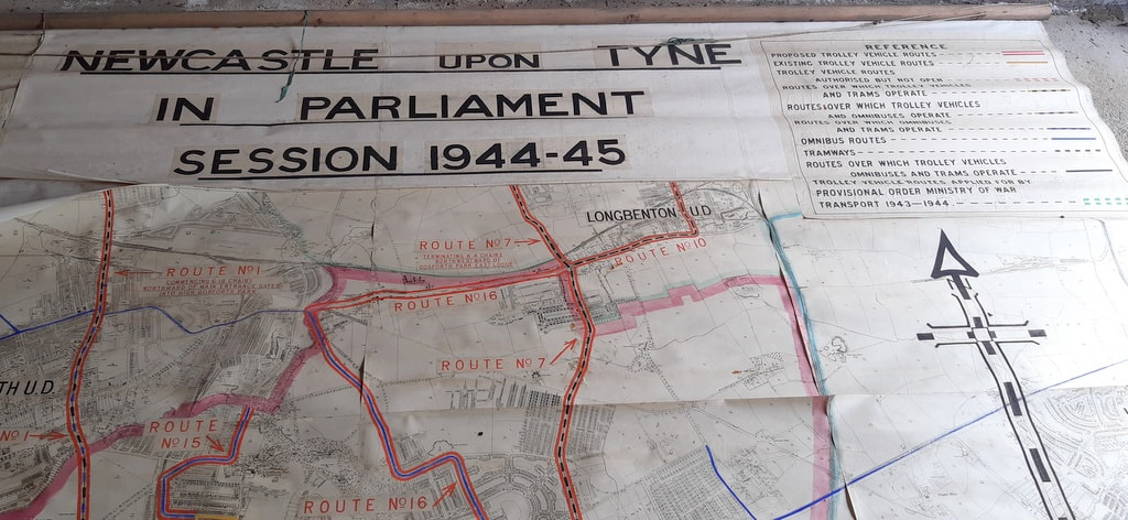
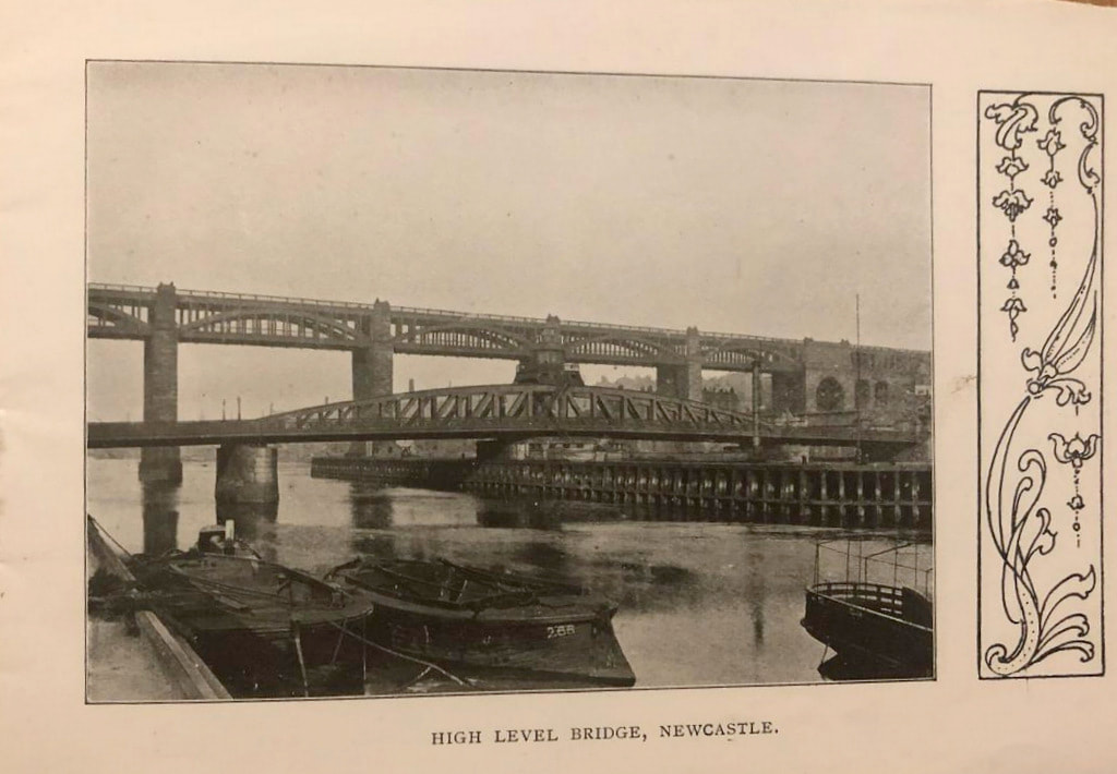
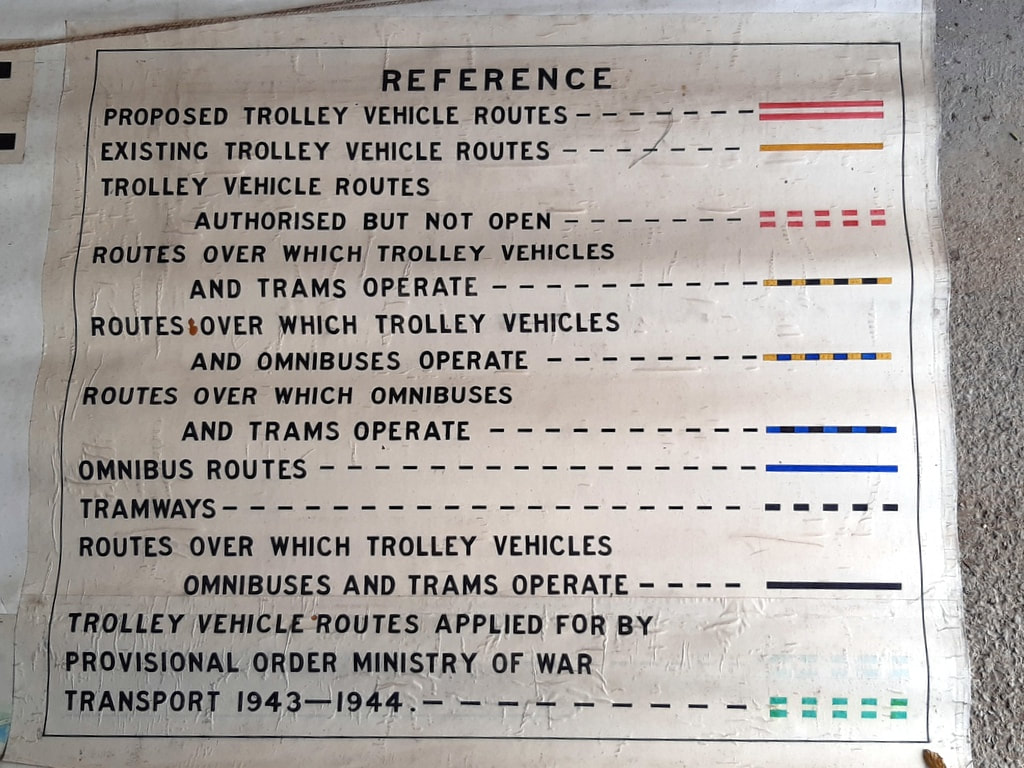
The plan based on the 6" OS Map shows the existing tram line on the Scotswood Road though Lemington and Newburn terminating at the cross roads in Throckley. The population of Newburn Urban District is given as 18,830. An existing bus route along the West Road terminates at Denton Burn but is marked as authorised but not operated further west as far as Heddon on the Wall. The population of Heddon is recorded on the plan as 676. To the north, a bus route serves Ponteland and Darras Hall (population 1,146). The train line to Ponteland Station via Gosforth is also shown on the plan but had been closed to passenger traffic on 17 June 1929 due to competition with the buses. Ponteland remained open for goods traffic until 14 August 1967. The larger scale map is titled: Newcastle upon Tyne in Parliament Session 1944-45. Both plans are stored in a long wooden box which appears to have come from Westminster (probably made by a company at 15 Great George Street in W1 although that is only a guess from the incompletely read labels), and addressed to The Town Clerk of Newcastle upon Tyne. It had been sent by Resident Superintendent, House of Lords in July 1946. Both maps are massive and would require conservation if anyone wants them, as the paper maps are peeling off their backing. A quick check of parliamentary records suggests they could have been something to do with proposed Newcastle trolley-bus routes. Entry in Journal [15th May, 1945] read: —Bill "to confirm, a Provisional Order made by the Minister of War Transport under the Newcastle-upon-Tyne (General Powers) Act, 1935, relating to Newcastle-upon-Tyne Trolley Vehicles," read the First and Second time, and (the Bill having been reported and considered in the last Parliament) ordered to be read the Third time To-morrow. 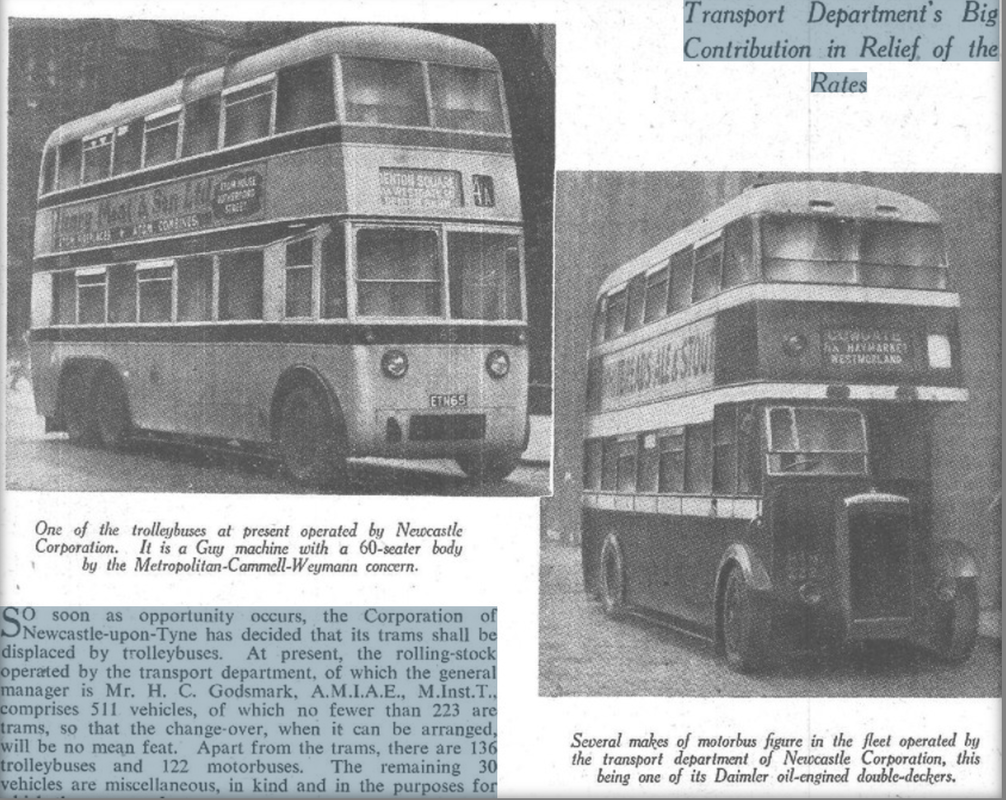 So soon as opportunity occurs, the Corporation of Newcastle-upon-Tyne has decided that its trams shall be displaced by trolleybuses. At present, the rolling-stock operated by the transport department, of which the general manager is Mr. H. C. Godsmark, A.M.I.A.E., M.Inst.T., comprises 511 vehicles, of which no fewer than 223 are trams, so that the change-over, when it can be arranged, will be no mean feat. Apart from the trams, there are 136 trolleybuses and 122 motorbuses. The remaining 30 vehicles are miscellaneous, in kind and in the purposes for which they are used. Beamish Transport Online have a nice Newcastle Corporation Transport map (trolley-buses, trams and buses) from 1949 (published for use by public) although with no background OS. It is nice to imagine that the 1944-45 maps shown here were a forerunner for this later public service map. Some of the tram routes on the 1944-45 maps (Throckley/Lemington) have been replaced by buses. However, trams still cross the Tyne & High Level Bridges on their way from Newcastle town centre to Gateshead. 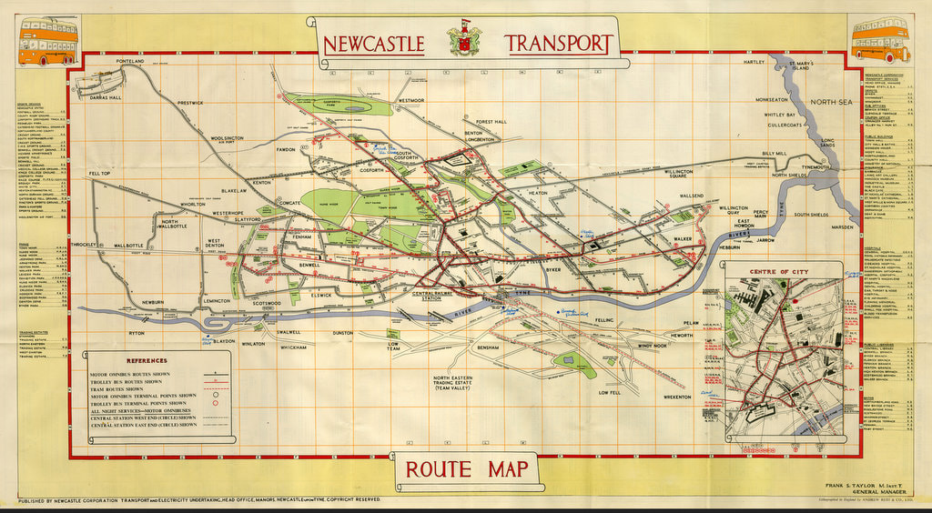 A comment on this map on the website Transit Maps points out: Interestingly, the main map seems to be presented at a slightly oblique angle almost as if the view was from an aeroplane high above the city. Distances along the north-south axis are somewhat compressed, and everything leans to the left a little. The bridges over the River Tyne are drawn in a way that reinforces this perspective, so the effect is quite convincing. Perhaps someone had based it on the perspective of one of the massive maps laid out on the floor and observed from the bottom. Co-Curate provides the following potted history of Newcastle's Trolleybus network. October 2, 1935 Newcastle Trolleybus System opens The Newcastle upon Tyne trolleybus system opened on the 2nd of October 1935. These were electric buses, drawing power from overhead cables through spring-loaded trolley poles. Unlike the trams they replaced, trolleybuses didn't require tracks. The trolleybus system gradually replaced the Newcastle tramway network, eventually growing to a fleet of 204 trolleybuses covering 28 routes.. 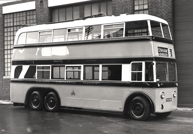 An undated view of a Newcastle Corporation Transport trolleybus parked outside the depot Newcastle upon Tyne. The trolleybus is used on the no.?6 route to Fenham via Barrack Road. Newcastle Libraries Collection Accession Number: 054254. 1946 Newcastle Trolleybus Network - Expansion Newcastle Corporation ran a programme of modernisation and expansion of it's trolleybus network between 1946 and 1949. During that period 186 new trolleybuses were ordered, replacing the original fleet of around 100, and expanding the network to cover 37 route miles. October 2, 1966 Newcastle Trolleybus System closes The Newcastle Trolleybus System closed in October 1966, after 31 years of operation. The electric trolleybuses were replaced by petrol buses. Some of the trolleybuses were scrapped, others were redeployed to trolleybus networks in other parts of the country. 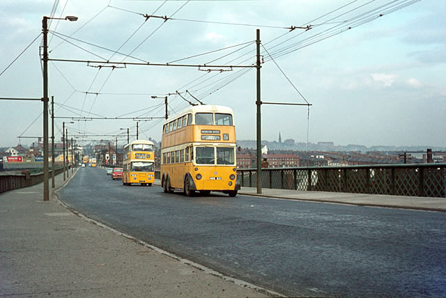 British Trolleybuses - Newcastle upon Tyne. Photo by Alan Murray-Rust (1966). Photo from Geograph © Copyright Alan Murray-Rust (cc-by-sa/2.0) Link Byker Bridge in 1966 looking east. The distinctive supports for the overhead wires have disappeared, and we seem to need crash barriers these days. The trolleybus is no.621, one of the batch of BUT 9641T vehicles built in 1950 to the same design as the last trolleybuses built for London. By this stage only the main route 35 corridor was still operated by trolleybuses, the final closure coming the following year. . David Vardy managed to find a new home for the maps - the museum of the Blyth Battery. 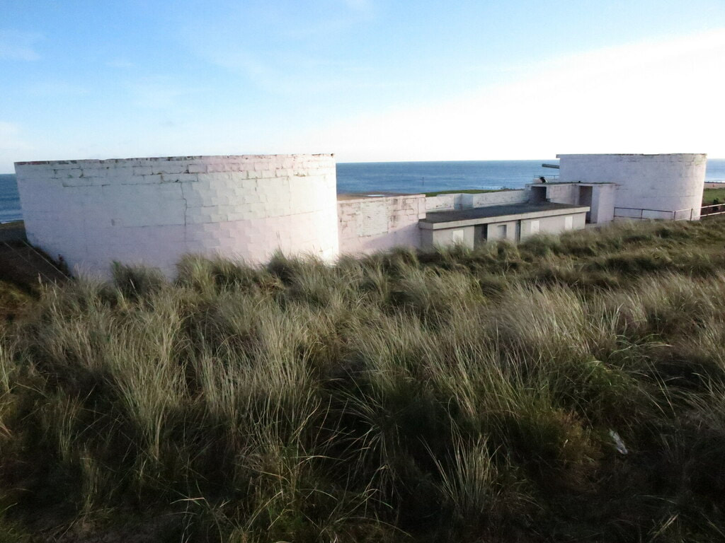 Gun Emplacements, Blyth Battery, South Beach, Blyth. Photo by Geoff Holland (2020) Anthony Fox
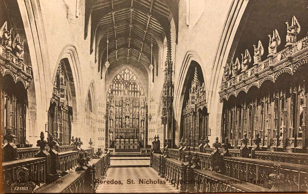
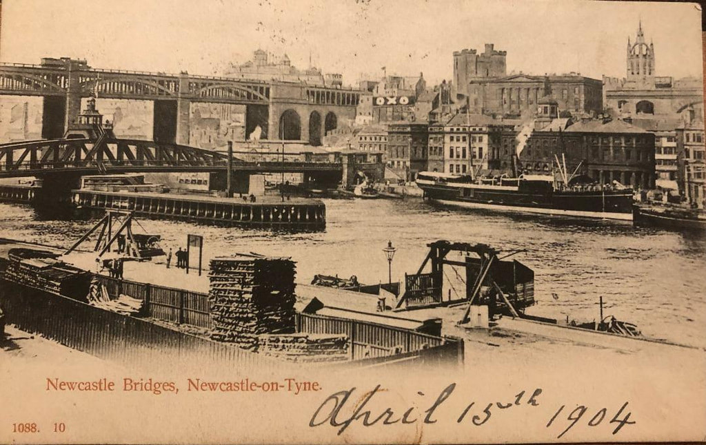
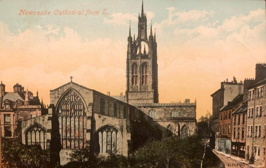
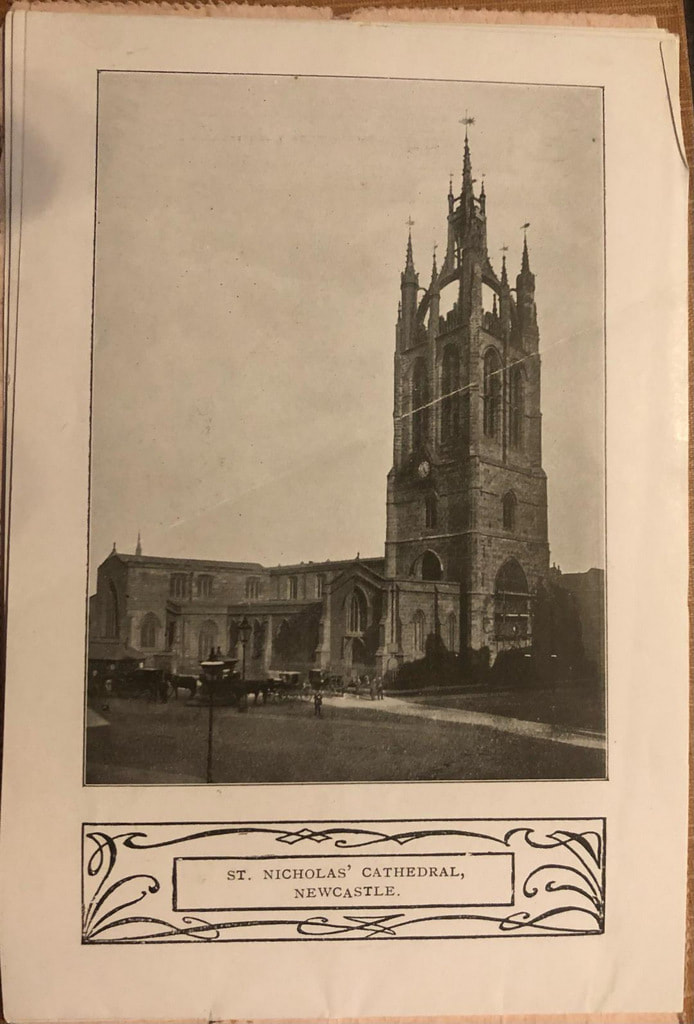
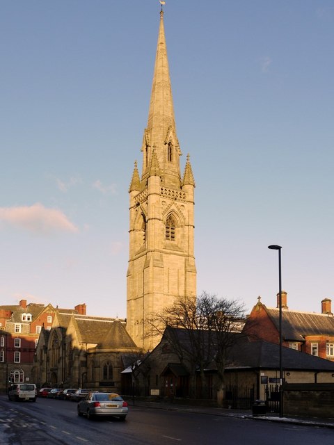
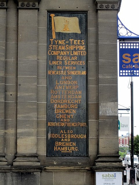
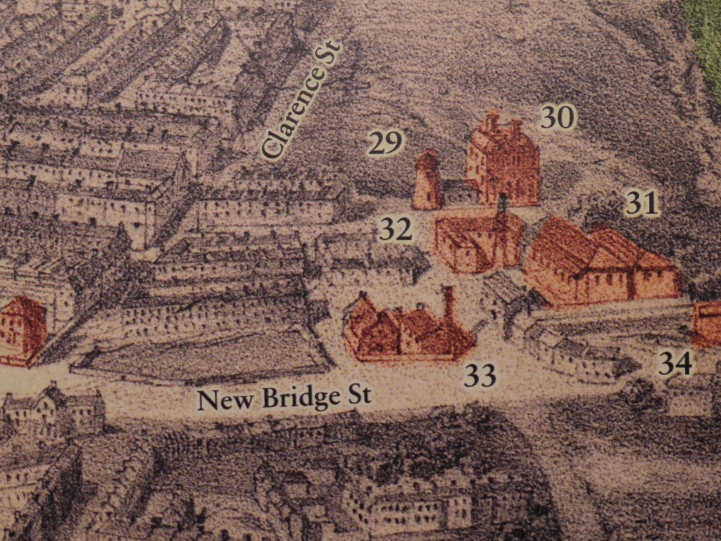
30th September 2021 Hi Just noticed your item about the two Newcastle Corporation Transport maps. In April 1931, the Corporation applied to the new Traffic Commissioners for Road Service Licences for the stage carriage services it wished to continue operating. This was a process gone through by all bus service operators as a result of The Road Traffic Act of 1930. The 6" map matches exactly the bus routes that the Corporation listed in its application so can be dated as early 1931. In corroboration, the map shows the no. 12 Haymarket to Two Ball Lonnen route that started in July 1930, so the map must be later than that date, and the 11a Haymarket to North Shields via the New Coast Road, that no longer appeared in the December 1931 timetable, so the map must be earlier than that date. The other map is much easier to date, not least because of the label! The proposed trolleybus routes in the Osborne Road/South Gosforth area are of note in that what actually happened was quite different. Hope this is of interest. Tony Fox, Market Drayton On Monday 13th June 2016 Christopher Wardale talked at our monthly meeting about one of his lifetime passions, stained glass. His first degree from Newcastle was in Fine Art and he has been designing and researching the ancient and modern art of stained glass ever since. He trained as an Anglican priest, now retired, and has considerable knowledge of of some fine examples of stained glass in the north-east. His talk revolved around a Metro tour of Newcastle but was interspersed with historical information and personal anecdotes. William Wailes (1808–1881) established a stained-glass firm in Newcastle-on-Tyne in 1838 which became one of the largest in the country. Wailes made a name for himself through the provision of windows for local churches and at the height of the business had 76 employees turning out a new window every day. Christopher Wardale described how Wailes' produced windows often show particular colour combinations making them easily recognised. 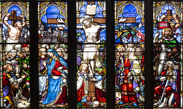 St Nicholas Cathedral, Newcastle upon Tyne, east window (detail) by William Wailes. Photo by William Starkey (2014). 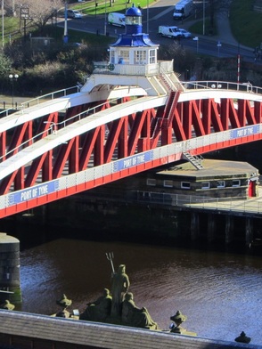 Neptune and Swing Bridge, Newcastle. Photo A Curtis (2014). Newcastle's Swing Bridge, thought to have been the fourth bridge that crossed the River Tyne at low level on the site, was designed by Lord Armstrong and the Tyne Improvement Commission. It was built at Armstrong's Elswick works between 1868-76 at a cost of £222,000. At the time of its opening it was the largest such bridge in the world. It was a necessary development to allow for upriver navigation by sea-going vessels but required the removal of the current nine-arched stone bridge built in 1781. The bridge mechanism is still driven by the original Armstrong hydraulic engines, although the steam pumps were replaced by small electric pumps in 1959. The pumps force water into the chambers of hydraulic accumulators, sunk down into the bed of the river. When the motors cut out, 60-ton weights above the chambers force water out under pressure which run the machinery to turn the bridge. The bridge now opens only very rarely and is controlled from the cupola above the superstructure. 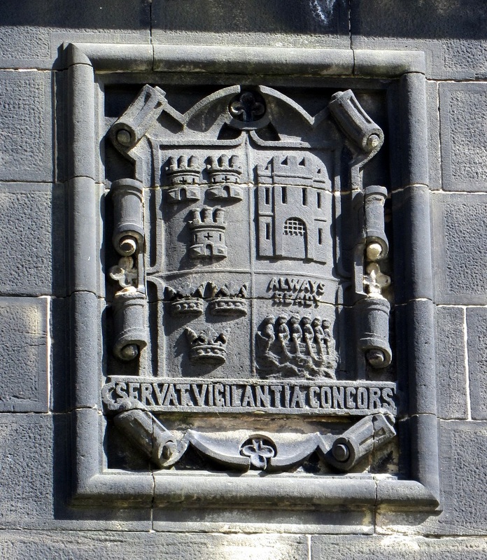 Tyne Improvement Commission coat of arms, Swing Bridge Newcastle abutment. Photo A Curtis (2013). 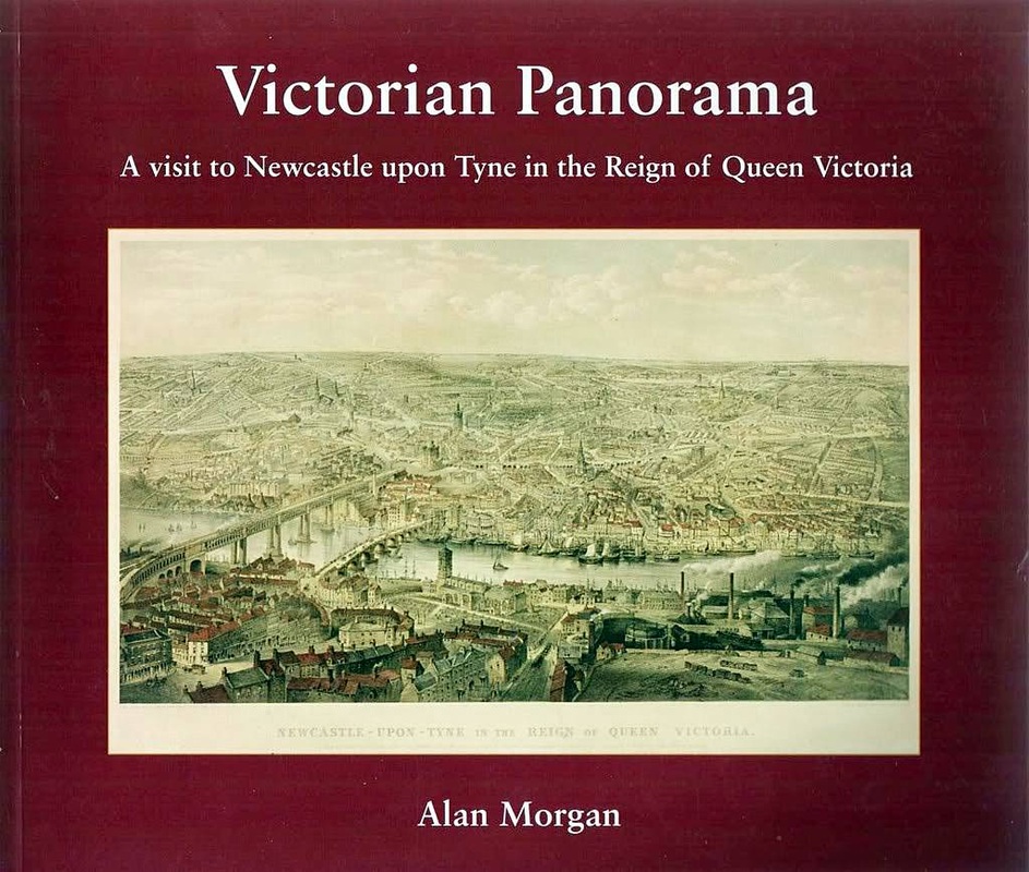 Victorian Panorama: a visit to Newcastle upon Tyne in the Reign of Queen Victoria by Alan Morgan, Tyne Bridge Publishing, 2007). At short notice, due to a cancellation in our program of talks, the Newcastle City Guide, Alan Morgan, gave us an excellent talk on his book, the cover of which is shown above. The basis of his book was the watercolour painting, Newcastle upon Tyne in the Reign of Queen Victoria, by John Storey (1862) and a lithograph of it Alan had seen in the Newcastle City Library. It shows a highly detailed view of the streets and buildings of the city at that time, taken from a vantage point high above Gateshead's former railway station, Brandling Junction. 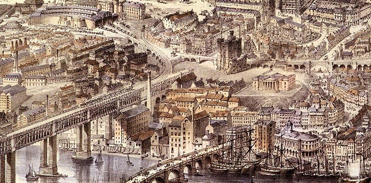 There has been much interest since publication of the book. How did John Storey achieve this lofty viewpoint? Did he have access to a balloon? How did he manage to represent certain buildings and landmarks that were not yet built at the time of painting? These include the Tyne Brewery (1868), St Mary's Cathedral spire (1872) and the Tyne Tees Shipping Office (1875). How did the painter manage to predict the future? These buildings had been long planned, and John Storey presumably had access to the plans.
The book divides the painting into 13 areas covering a great swathe of Newcastle from the Tyne west of the High Level Bridge, to The Swirle on the Quayside (then a stream flowing into the Tyne), to the east. Detail is visible as far north as The Great North Road, Town Moor and Jesmond. Gateshead is also represented directly below the viewpoint. For each of these areas we are treated to detailed illustrations from the painting with added street names, and highlighted buildings which are numbered and discussed in detail in the text. There are a large number of other illustrations and photographs from the period, and many old maps, which provide context and scale as the painting was done with some element of distortion and artistic license. 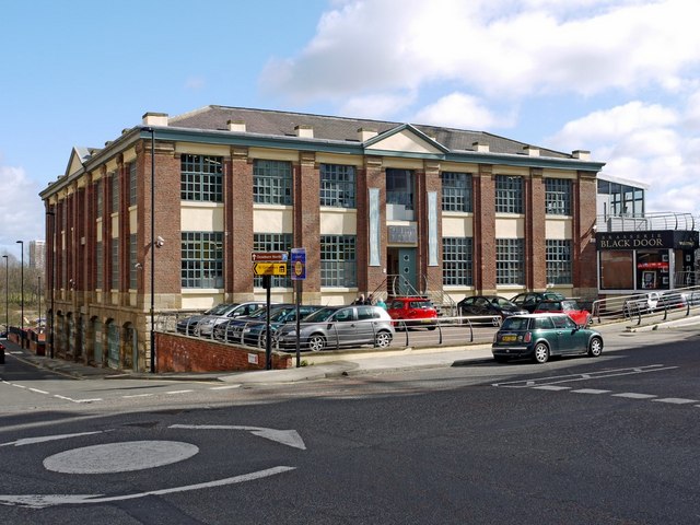 The Biscuit Factory, Stoddart Street, Shieldfield. Photo by A Curtis (2010). I have had an interest for some years in the history of Newcastle's buildings and I found this book a wonder. Many of the old buildings can still be found although now have other uses as my example above of the Biscuit Factory shows.
It is now Europe's largest commercial art gallery (opened in 2004). There is a history of the building here. 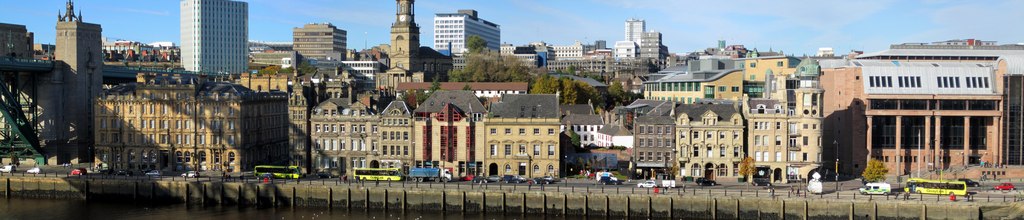 Newcastle Quayside panorama. Photo by A Curtis (2010).
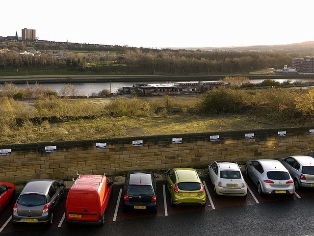
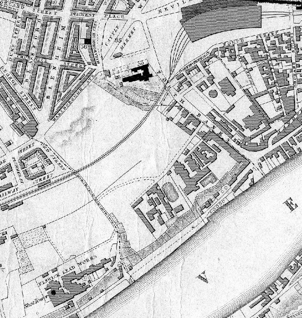
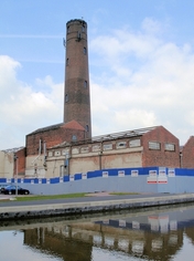
As the site of the former Elswick Lead Works just below the Metro Radio Arena in Newcastle continues to get cleaned up, presumably for eventual development, we remember one of the city's former famous landmarks that stood here from 1796 until 1969, The Shot Tower.
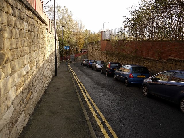
The only reminder now of the presence of this building is in the street name, Shot Factory Lane, that descends steeply from the junction of Pottery Lane, just east of the Arena, almost below the approaches to the new Redheugh Bridge, to Skinnerburn Road that runs parallel to the River Tyne. There are many remains of Tyneside's old industries in this now largely derelict area, on the steep bank above the river. Change in this area may be just round the corner, although dependent on the planning authorities, clean up of many difficult sites and the current economic climate.
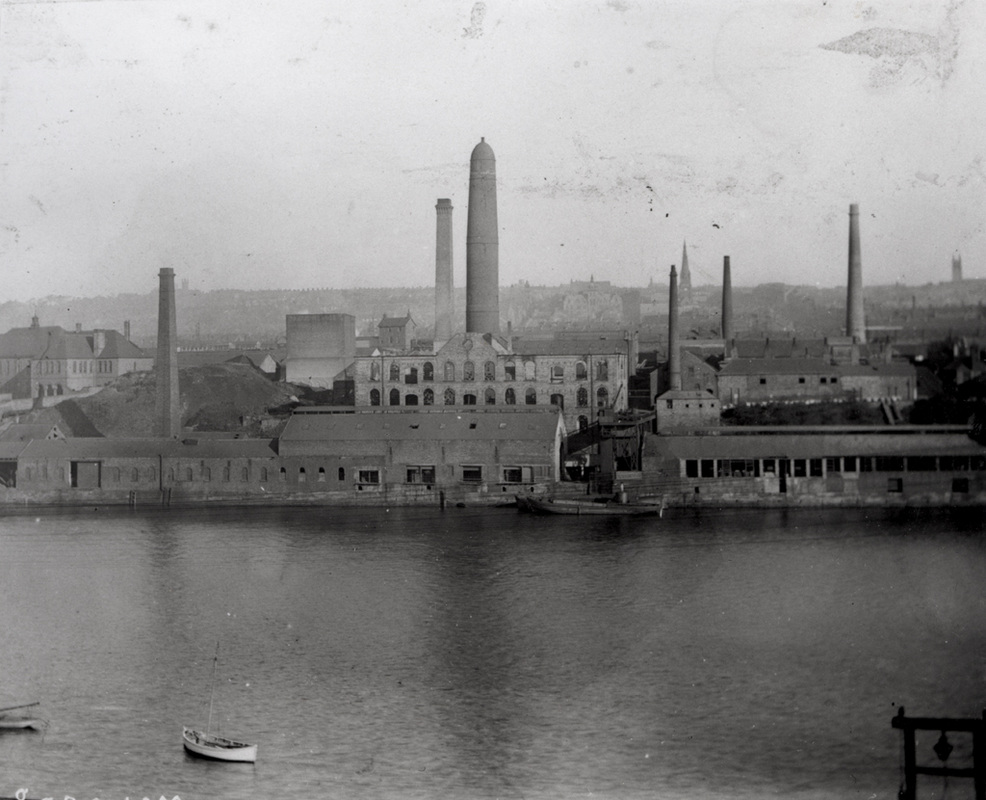
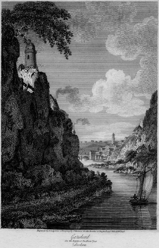
Of course though, Newcastle's Shot Tower was here a long time, and is remembered in other ways. It features in a number of illustrations and paintings, many more modern photographs, and also in the written memories of those who worked there. 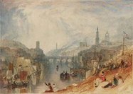 Newcastle upon Tyne by J.M.W. Turner (c1823) Newcastle upon Tyne by J.M.W. Turner (c1823) One of the most famous paintings which features the shot tower (in the background above the Tyne Bridge) is that by Joseph Mallord William Turner (1775-1851) in London's Tate Gallery. Turner's painting of Newcastle upon Tyne was engraved by F. Lupton as Plate 7 of the Rivers of England series, published on 2 June 1813 by W.B. Cooke. It is reproduced in the Newcastle Libraries Collection. The landmarks of the city visible in this painting from Newcastle's Quayside, are discussed in a fine article by Timmonet called Turner Town, which was an inspiration for my personal discoveries in this area of Newcastle.
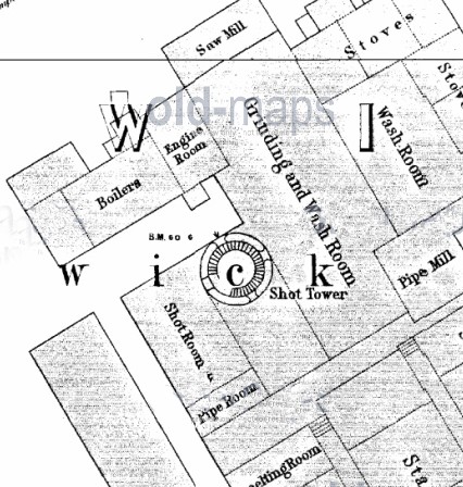
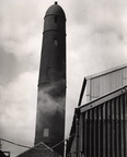
The early maps above show the Elswick Lead Works and the Shot Tower. The 1:500 plan shows remarkable detail of the internal spiral stairway. The Newcastle Libraries Photograph Collections has the two old photographs shown below including one from 1968, just before the tower was demolished (click the photos for the links).
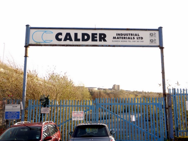
Elswick Lead Works opened in 1778 under the name Walkers, Fishwick & Co. After a few changes of ownership, ending with Calder Industrial Materials, it finally closed in 2002. There is a good summary of the history of the lead industry here on the Newcastle University website, Structural Images of the North East (SINE).
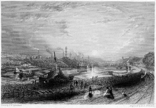 Newcastle. Drawn by J.W. Carmichael. Engraved by T. E. Nicholson (1838). The Shot Tower is almost in the centre of the above engraving published in Views on the Newcastle and Carlisle Railway, from drawings by J.W. Carmichael ; text by John Blackmore (Newcastle, 1838). As the drawings were done to illustrate the newly completed Newcastle & Carlisle Railway, the view is eastward, opposite to that of Turner, from the vicinity of Redheugh Station on the Gateshead shore. There is a zoomable image on Durham University's Pictures in Print.
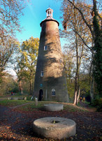
The shot tower was a British invention by a plumber from Bristol called William Watts in 1782. He realised that raindrops falling far enough through the air are actually spherical, pulled into shape by surface tension. Molten lead has a much higher surface tension than water, and forms very precise spheres. The size of rounded shot that can be produced depends on the length of the fall and large shot needs high towers (or deep pits). There is a British Pathé news reel clip of the process filmed in 1950 here. Droplets are formed by forcing a molten alloy of lead, antimony and arsenic through holes in a sieve at the top of the tower. After the fall, the shot is caught and cooled by falling into a deep basin of cold water at the base. After Watt's patent, which was a huge improvement on shot previously made by casting, there was little further change apart from adding an updraught of air, and ways to sort out deformed shot. Watts's old house in Bristol - his original shot tower - kept producing shot until 1968. The full story can be read here. Lead works can't have been pleasant or healthy places to work in their early days. There is a very interesting account relating to the Elswick Works on Family Tree Forum written in 2009 and another, by Alan Edgar, on the Port of Tyne Writer in Residence site. In an interesting connection with Heddon, the latter author reports that slag from the blast furnace at Elswick Lead Works was eventually recycled – to reinforce the Tyne riverbank on the north side between Newburn and the Hedwin streams. He wrote: To me, there’s a certain sadness that the place is no more. It was a Newcastle institution in its heyday, and a great many very fine people worked there.
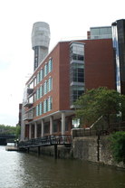
Photos taken from Geograph website and remain © Copyright of their photographers although licensed for reuse under this Creative Commons Licence (click the photos for link) Several shot towers still exist in Britain and around the world as historic artefacts. Some have even been modified into parts of modern buildings such as the Sheldon Bush Shot Tower in Bristol (above left) which replaced Watt's original tower in 1968 and is now part of an office ‘boardroom in the sky’ of a building called Vertigo.
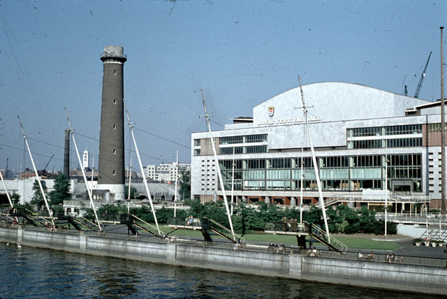
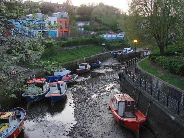
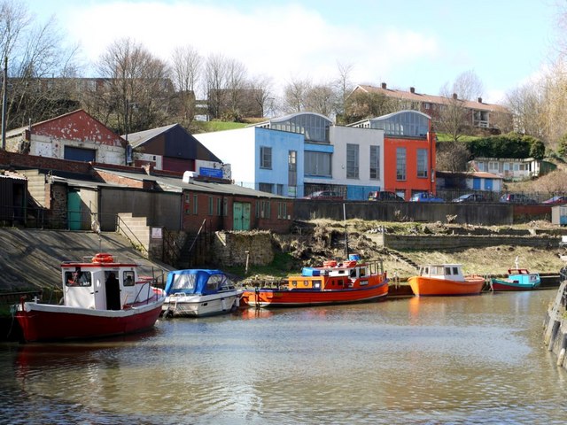
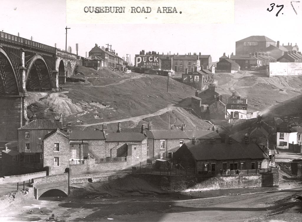
Coop's Tower in Melbourne has been preserved under a 84m high conical glass roof of a shopping centre. Many more, like those at Elswick, and at Lambeth on London's South Bank (above right), were demolished when their productive use was no longer necessary. A talk on 21st May 2012 to Heddon Local History Society about life in the Newcastle area of Ouseburn during Victorian times by Mike Greatbatch. Mike was active in the Ouseburn Trust in opening the Victoria Tunnel to the public. 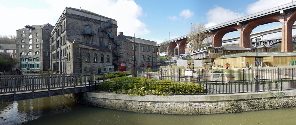 Ouseburn panorama. Photo by A Curtis (2010) Historical context taken from: Ouseburn Valley Urban Landscape Study, May 2007 Insite Environments commissioned by Newcastle City Council. The Lower Ouseburn Valley was originally part of the township of Byker, one of the first outside of the town walls and prior to the industrial revolution of the 19th Century, was largely agricultural. The Ouseburn is the longest of Newcastle’s Tyne River tributaries and is tidal up to the base of Stepney Bank. It was traditionally a fast flowing stream, however the nature of the water course has changed considerably due to developments up stream and is now slower moving and of poor water quality. The Ouseburn is edged from Stepney Bank to its confluence with the River Tyne by a mix of retaining structures from a range of periods. The overall character of the area has been shaped by the industrialisation of the Ouseburn and its banks during the 17th, 18th and 19th centuries although few buildings remain today. The Ouseburn was a major factor in the type of industrial development attracted to the Valley and its built form. The Ouseburn was an effective transport route, its tidal nature permitting keels and the later wherries to travel up stream from the River Tyne. As a result, processing industries located in the Valley and relied on the watercourse for the delivery of materials and export of the finished products. The dense corridor of buildings (mills, warehouses etc.) were built right up to the stream's edge and incorporated slipways and shoring for boats, as well as loading equipment, mill races and waterwheels.
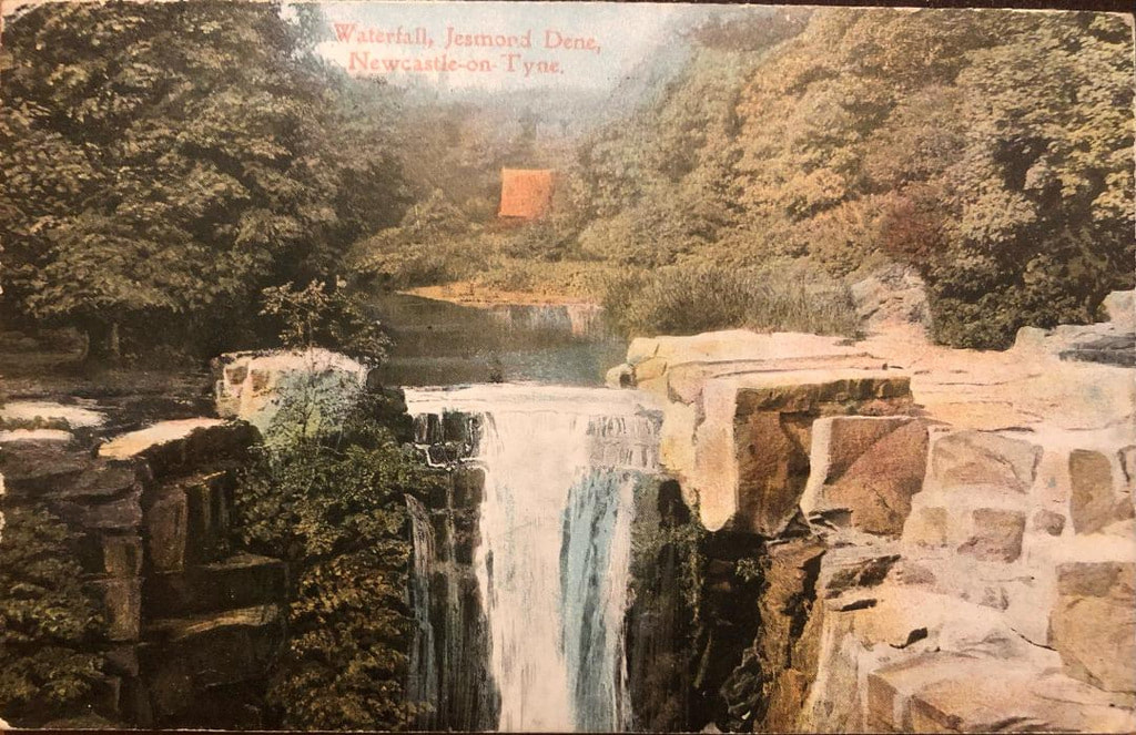
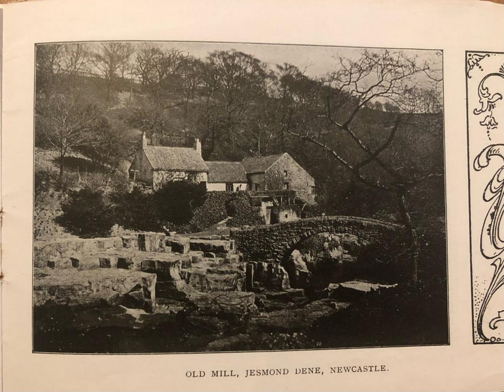
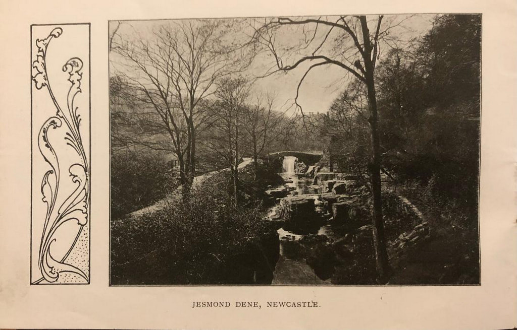
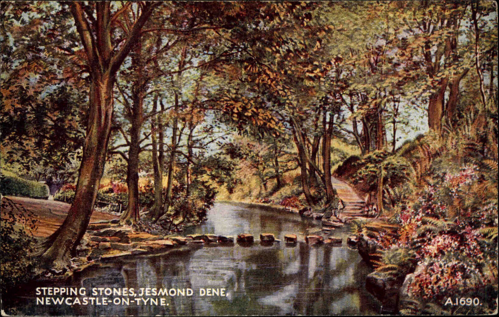
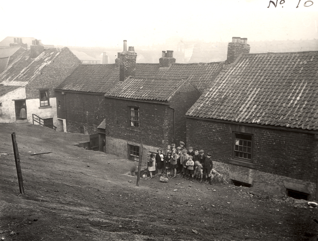
Glass making was the first known industry to be located in the valley with three glasshouses established by 1619 at the mouth of the Ouseburn. 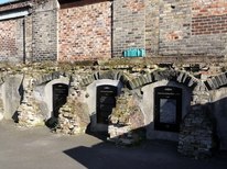 Ouseburn Glassworks. Photo by A Curtis (2012). The pottery industry located in the valley in 1782 and culminated in the establishment of the Maling Pottery on Ford Street in the 19th Century. The population in the valley expanded and types of industrial commercial activity developed to include shipbuilding, masonry, lead works, iron foundries, soap manufacturers, tanners, saw mills, corn mills and flint mills. The area provided substantial employment and had the infrastructure to support the development of a self-contained community with brick terraces, tenements, a doctor’s practice, school and approximately fifteen public houses. The industrialisation of the Lower Ouseburn Valley was in direct contrast with the upper section of the Ouseburn valley which lent itself to the development of Victorian parks such as Jesmond Dene, Heaton Park and Armstrong Park. North of the railway viaduct (the site of the City Stadium and the former Ouseburn Lead Works) the Ouseburn was culverted and the valley was used as a tip until the 1950’s. The landfill effectively cut off the Lower Ouseburn valley from the Victorian parks to the north. The landfill was used to create the bowl of the stadium and steep sided valley landscape facing the viaducts; these sides where planted in the 1970s to create an area of semi-natural woodland with open fields which have been used since as pastures by the Ouseburn Farm. 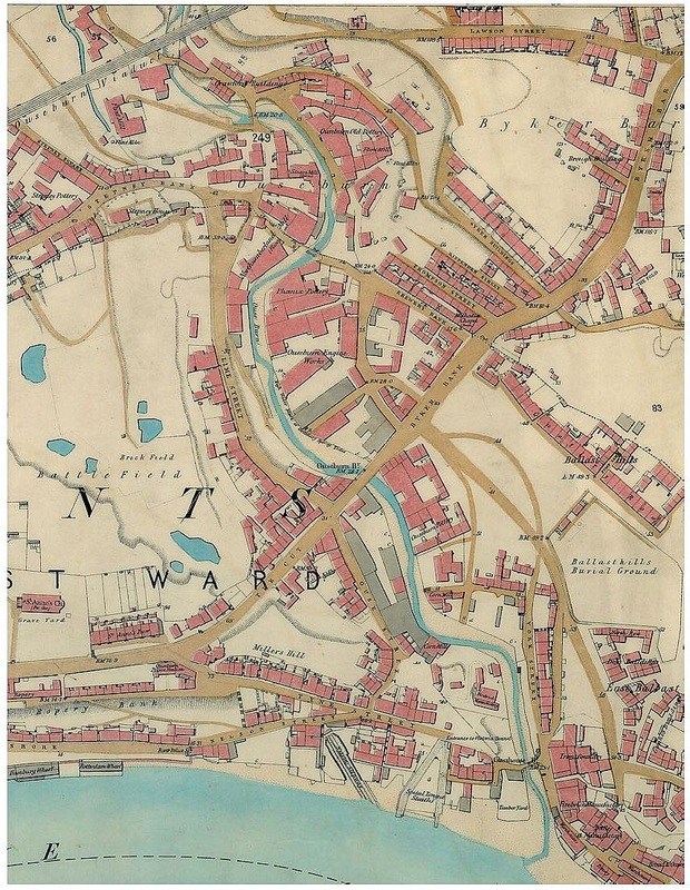 OS 1:2500 (1860) Mike Greatbatch told us about what life was like for the people who lived and worked in the Ouseburn valley, illustrated with old photographs and maps. It was a vibrant community of squalid tenements where people shared a limited space with heavy, dirty, and frequently dangerous industrial processes. 'Slaughter houses, coal wharves and dwelling houses of not the most desirable appearance environ the burn… Just above the bridge the keels may be seen lying and delivering coal in carts while horses stand impatiently in the cold water. In the cold water too, we see ragged groups of people with baskets and bags, wading and groping with their hands for coals which has fallen overboard. Where Lime Street now is, on the right bank used to stand the lime kilns by the waterside, and opposite where the engine works are, used to be a little boat builders' yard, while a little higher up gardens ran to the quay wall of the burn and their trees hung over the edge.' ILLUSTRATED LONDON NEWS, 16 JULY 1887
Ouseburn links: Ouseburn Trust Welcome to the Ouseburn Photographs of Newcastle Geograph project - Ouseburn
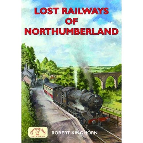
On October 10th, John Gillot, a member of our Society, gave us a talk about Railways in Northumberland. I walk a lot in many different areas of the countryside and often come across disused railway lines and wonder where they came from and where they went to. Railway history has always seemed so well documented that there can't be much left unknown, and it's a subject I've always left well alone. Inspired by John's talk, I looked for a suitable book and after a little research picked 'Lost Railways of Northumberland' by Robert Kinghorn published by Countryside Books in 2006. It seemed to cover all the lines that might interest me, is not too big, and has a nice painting on the cover of a steam train at Lambley Station with the viaduct behind. It's a statement in the first chapter that I want to discuss here which gave me a glimpse into a more confused world of railway history research than I had expected.
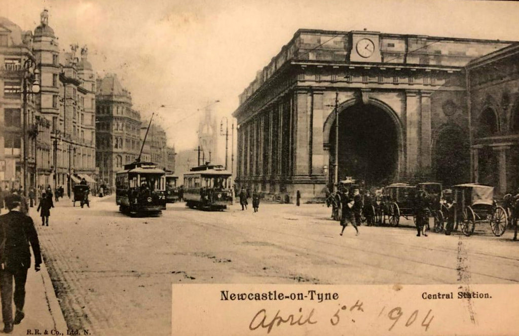
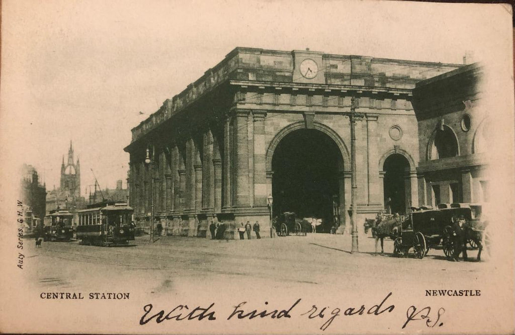
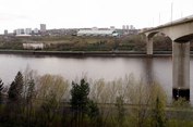
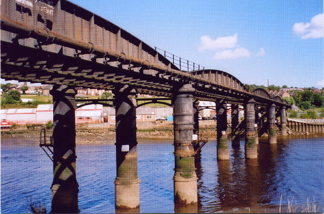
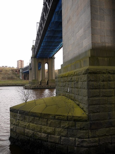
The chapter deals with the Newcastle & Carlisle Railway (N&CR). The existing line from Newcastle Central Station now crosses the river by the King Edward VII Bridge and runs on the south side of the Tyne. The railway, however, first crossed the river by the first (wooden) Scotswood Railway Bridge, built in 1839, and approached Newcastle on the north bank. The disused bridge (the third) that still crosses at this point, was built in 1871, and was used until 1982, when passenger trains were re-routed via the King Edward Bridge.
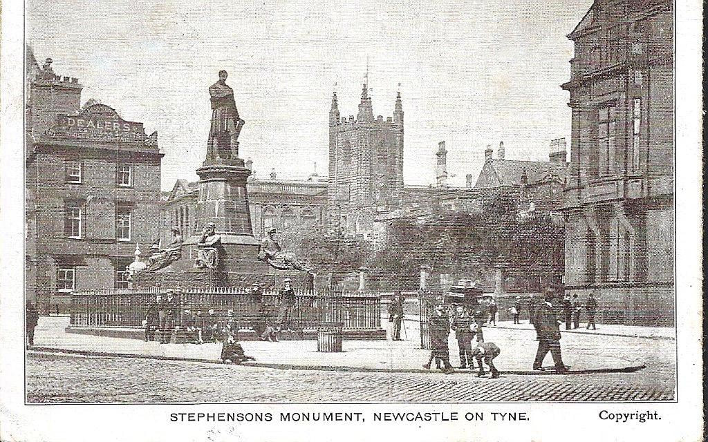
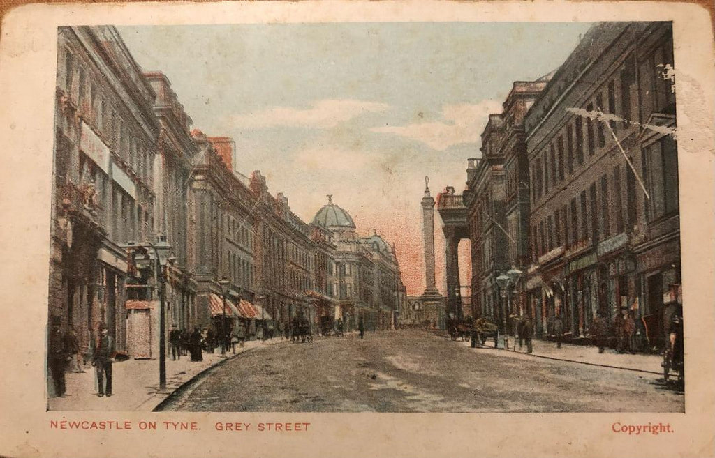
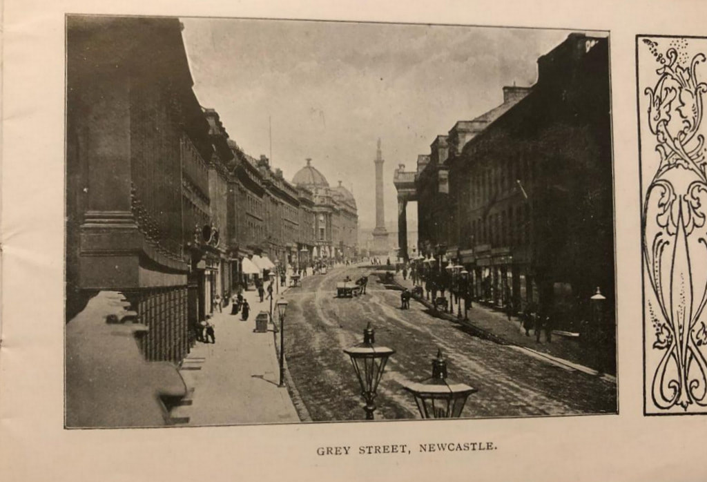
On Monday 14th November 2011, the Chairman of Heddon Local History Society, Mike Furlonger, talked to us about the life and loves of Earl Grey, the man commemorated by the Monument in Newcastle City Centre. 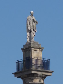 Earl Grey atop his monument. Photo by Mike Quinn (2011). © Copyright Mike Quinn and licensed for reuse under this Creative Commons Licence A hollow Doric column designed by Benjamin Green towers 135 feet (41m) above the top of Grey Street and bears a 13 foot (4m) high statue of Charles, the second Earl Grey, sculpted by E H Bailey. It was erected in 1838. The Earl's head was knocked off by a bolt of lightning in 1941 and a new one sculpted by Roger Hedley. The view from the platform below the figure is described here. 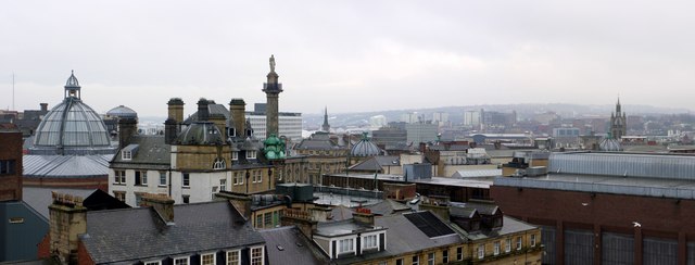 Roof tops around Grey's Monument by A Curtis (2010) Charles Grey was the eldest surviving son of General Sir Charles Grey, the Second Baronet of Howick (1729-1807) who became Lord Grey of Howick in 1801 and Viscount Howick and Earl Grey in 1806. 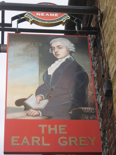 Earl Grey (1764-1845). Photo by David Anstiss (2010) © Copyright David Anstiss and licensed for reuse under this Creative Commons Licence Not a military man like his father, but a politician supporting Charles Fox, leader of the Whigs, Charles Grey became Northumberland's only Prime Minister between 1830-1834. In these years he steered through parliament important political reform that had enormous impact on the development of democracy in Britain. The Reform Act of 1832 was a particular triumph. 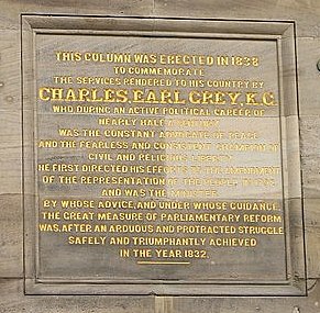 Inscription on the Monument written by the Rev. Sydney Smith. Photo by Richard Webb (2009). © Copyright Richard Webb and licensed for reuse under this Creative Commons Licence Men so driven by politics often have interesting private lives and Charles Grey was no exception. In 1794 aged 18, he married Mary Elizabeth Ponsonby and over the next 24 years they had 16 children. He also managed a series of affairs with other women. The first, before his engagement with Mary, was with Georgiana Cavendish, Duchess of Devonshire with whom he fathered a daughter in 1792. The story is told in the 2008 film, The Duchess, starring Keira Knightley. After resigning in 1834, Grey did not linger in politics. He was greatly attached to his family, and the family seat at Howick Hall where he spent his remaining years. 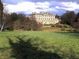 Howick Hall. Photo by Oliver Dixon (2009). © Copyright Oliver Dixon and licensed for reuse under this Creative Commons Licence The tea flavoured with oil of bergamot, named for Earl Grey, is said to have been specially blended by a Chinese mandarin to suit the lime-rich water at Howick Hall, The most famous biography of Earl Grey is 'Lord Grey of the reform bill: the life of Charles, Second Earl Grey' by George Macaulay Trevelyan (1952). However, much of the scandal of the period discussed is overlooked, as it was by the press at the time. |
AuthorAndy Curtis Archives
July 2024
Categories
All
|
- Home
- Calendar
- Introduction
- Where are we?
- History Map
- Timeline
-
Heddon's History
- Prehistory
- Hadrian's Wall >
-
Six townships
>
-
1 Heddon township
>
- Heddon in the Middle Ages
- Common Land
- Middle Marches
- Tithe Award
- St Andrew's Church >
- Village property
- Heddon Hall >
- Heddon Banks Farm
- Frenchman's Row
- Methodist Church >
- Men's Institute
- Women's Institute
- Welfare Field
- Knott Memorial Hall
- Memorial Park
- Schools
- River Tyne
- Coal Mining
- Quarrying
- Water Supplies
- Transport
- Waggonway & Railway
- Occupations from 1800
- Miscellaneous
- 2 West Heddon township
- 3 East Heddon township
- 4 Houghton & Close House township >
- 5 Eachwick township
- 6 Whitchester township
-
1 Heddon township
>
- Rudchester
- People
- Old Photos
-
Old News
- Community News
- Letter from the Emigrant Clergy of Frenchman's Row (1802)
- Alleged Brutal Murder at Heddon-on-the-Wall (1876)
- Sad boat accident at Ryton (1877)
- Coronation tree (1902)
- 65 Years on a Ferry Boat (1929)
- Come claim your kiss at Heddon (1953)
- The Swan (1972)
- Heddon WI (1987)
- Church House (1966)
- Happy return (1993)
- Hexham Courant (1997)
- Butterfly Garden (1999)
- Foot & Mouth (2001)
- Remembrance Day (1996)
- Remembrance Day (2016)
- RAF at Ouston (2007)
- Close House Golf Course (2009)
- Heddon pupils celebrate British heritage (2011)
- Roman Wall Forge (2011)
- Diamond Jubilee (2012)
- Auction of Bronze Statue, Close House (2012)
- Heddon WI (2012)
- Puffing Billy Festival (2013)
- Heddon Village Show (2014)
- View of the North (2014)
- The Wall at Heddon (2014)
- Heddon Village Show (2015)
- War veterans singing send-off (September 2015)
- Anglo-Saxon history (2014)
- Heddon WI at 100 (2017)
- Hadrian's Wall discovery (2019)
- Tulip Mews (2020)
- Mike Furlonger
- Hadrian's Wall 1900 Festival
- Memories
-
Other documents
- Mackenzie (1825)
- Bates (1886) >
- History, Topography & Directory of Northumberland (Bulmer's) - 1886
- History of Northumberland (1930)
- Collingwood Bruce (1853)
- Whellan (1855)
- Post Office Directory (1879)
- Prominent people in Heddon
- Place names
- Ad Murum
- Archived documents
- Thomas Bewick's History of British Birds (1826)
- Census data 1801-1991
- Historical Records 1888-1890
- Knott Sale of Village Property (1924)
- Extracts from Parish Council Records
- Local colliery records
- Blackburn (1938)
- Clark (c.1963)
- History of Church (1968)
- Boundary Commission Report 1984
- Village Atlas 2022
- Walks
- Blog
- Contact us
- Links
- What's new
- Site search
- Past & Present
- Photo of the Month
- Place Name Studies
- Heddon from Above
 RSS Feed
