
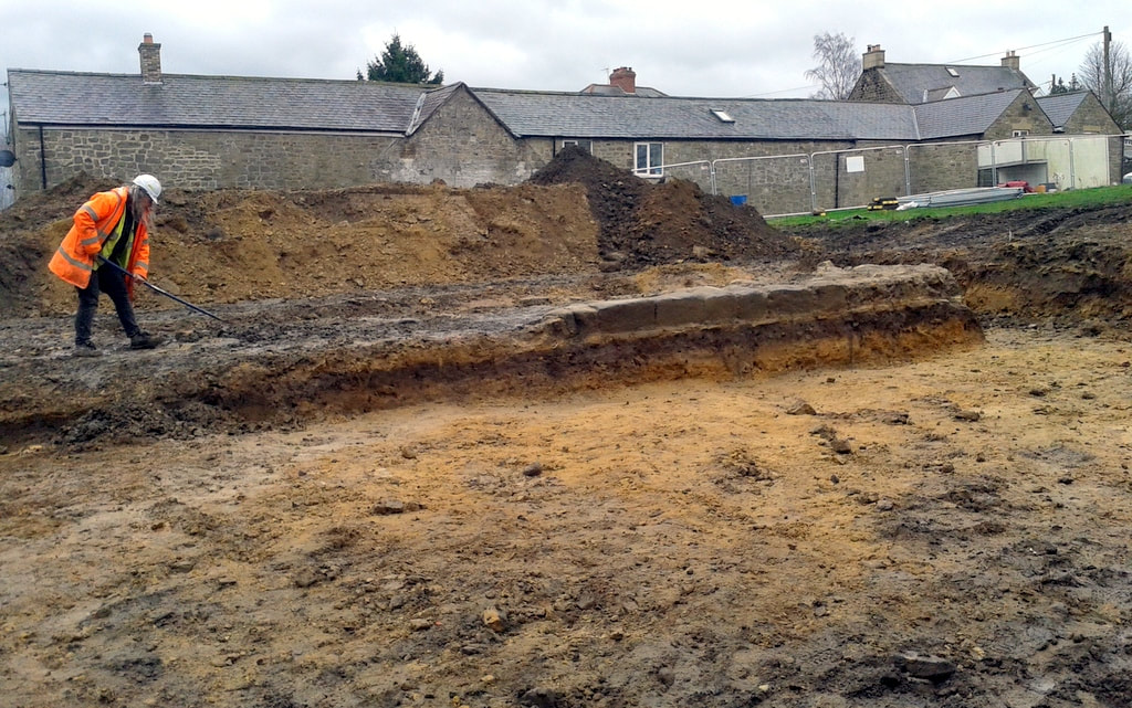
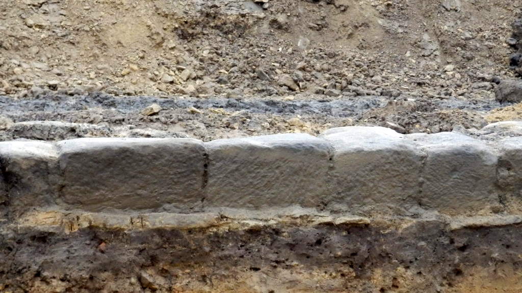
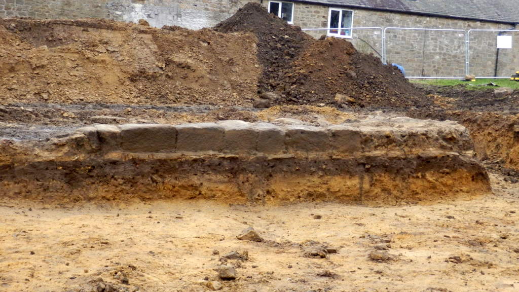
Archaeologist clears soil from eastern section of the rubble core of uncovered section of Hadrian's Wall. Facing stones of the lower course only found on the N side, to the right of the photo. A Curtis (2019).
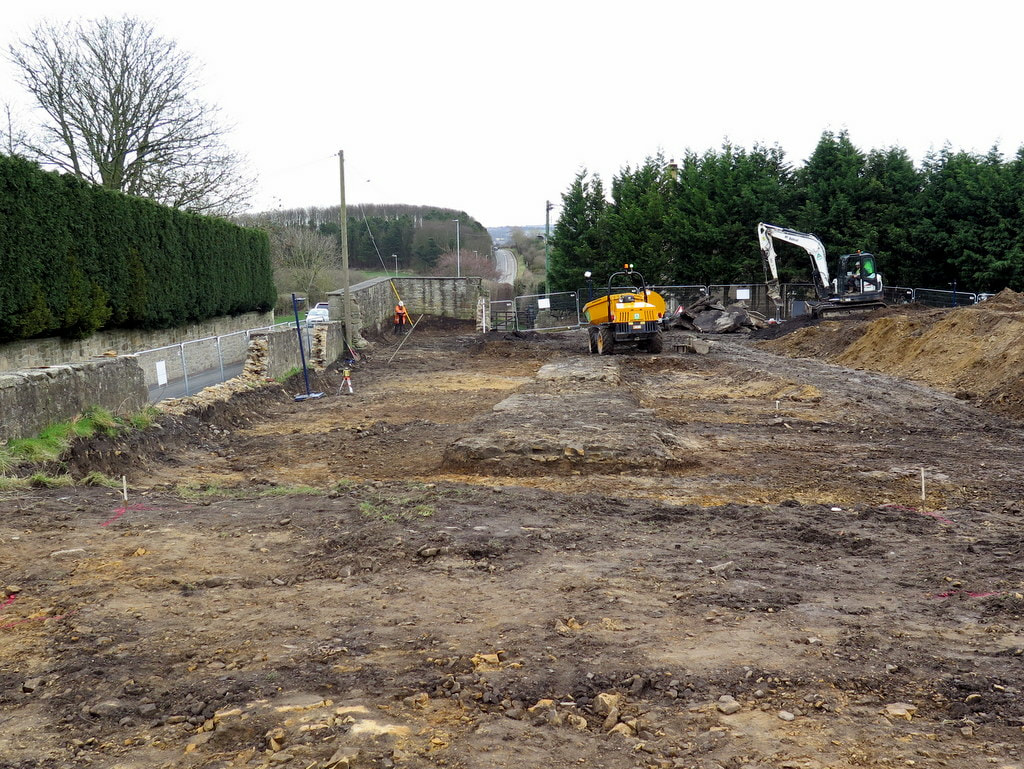
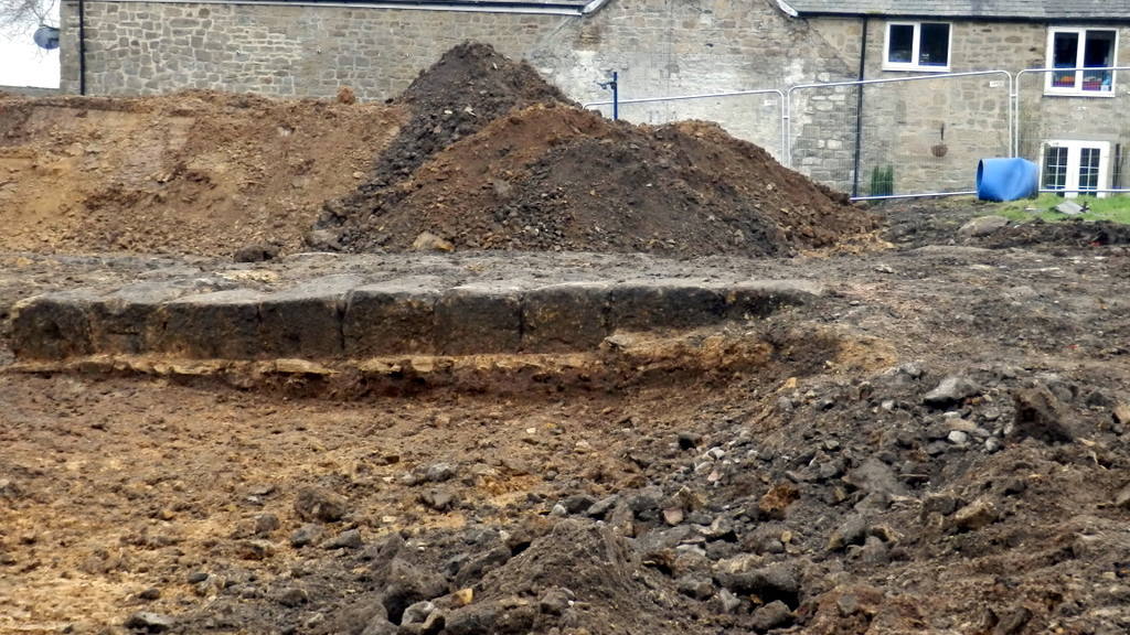
View E along line of newly uncovered section of Hadrian's Wall. In the distance is Hexham Road climbing over Great Hill on the way to Throckley. The conserved section of the Wall is located to the right of the road. Photo A Curtis (2019).
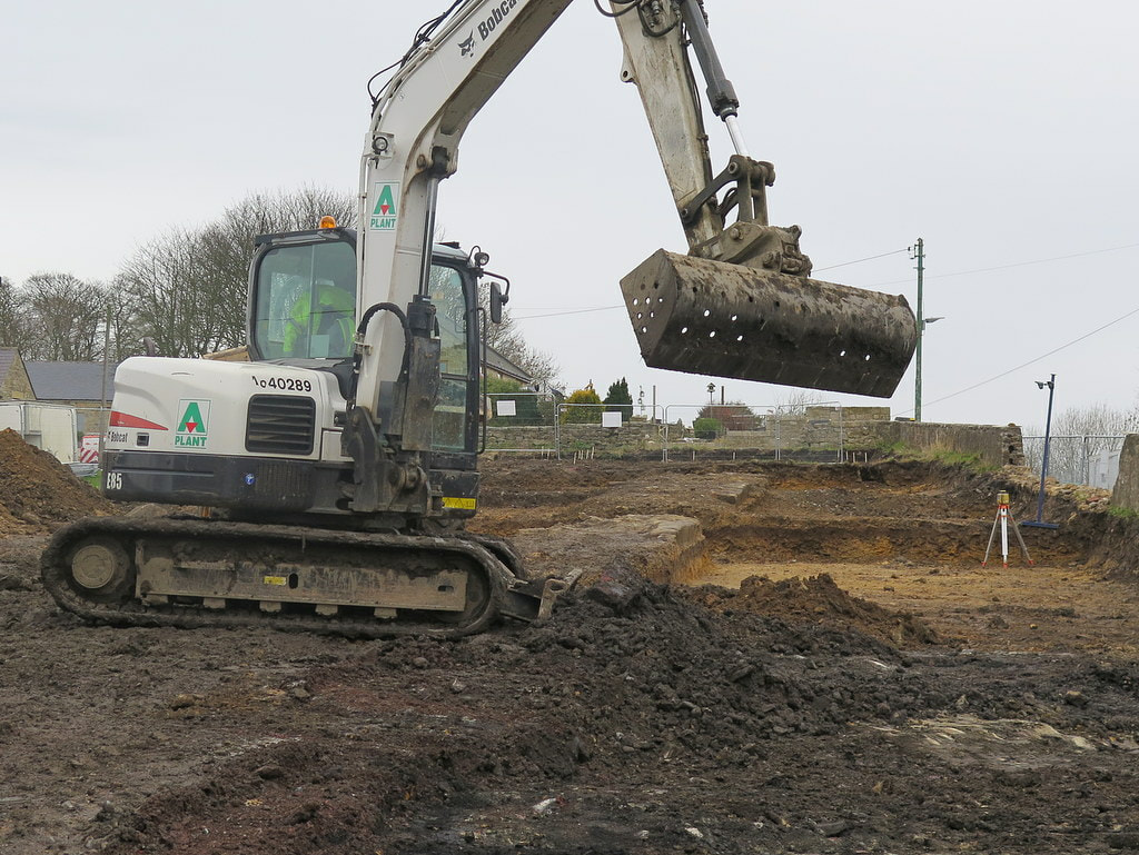
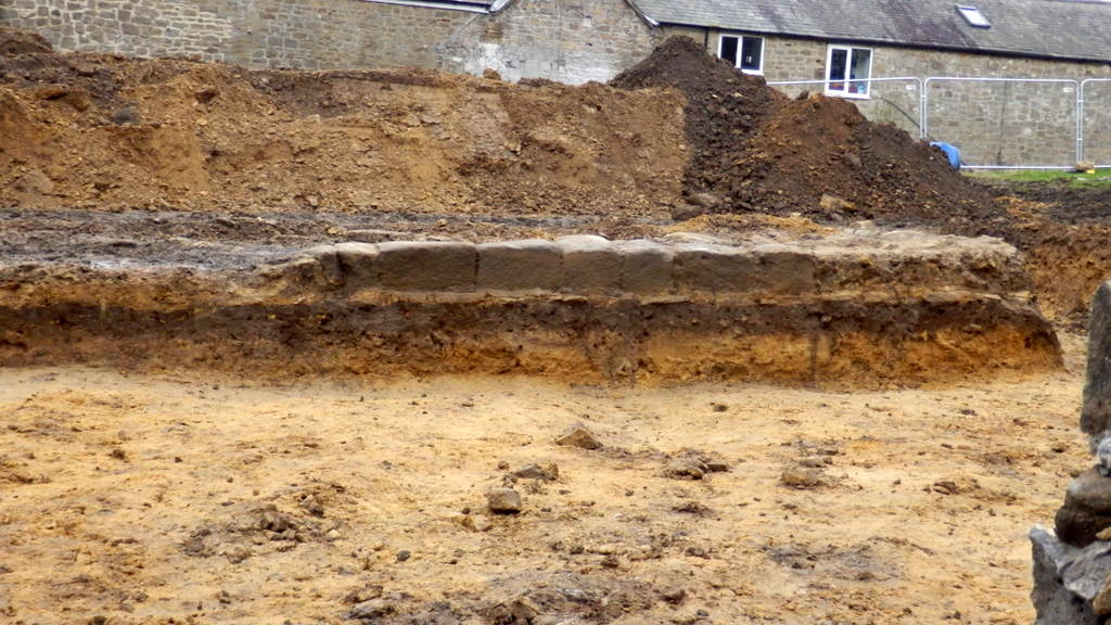
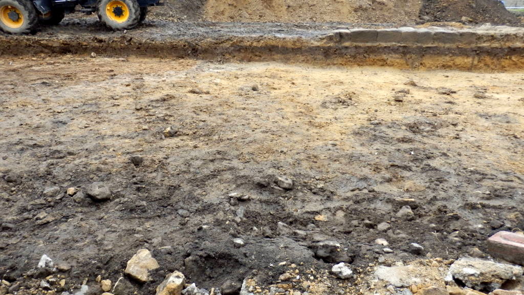
Below and just beyond the digger lies the newly uncovered section of Hadrian's Wall viewed to the W. Tank House can be seen behind the digger cab. Only the lower course of facing stones remain on the N side of the Wall, set in clay on a flagged base. Photo A Curtis (2019).
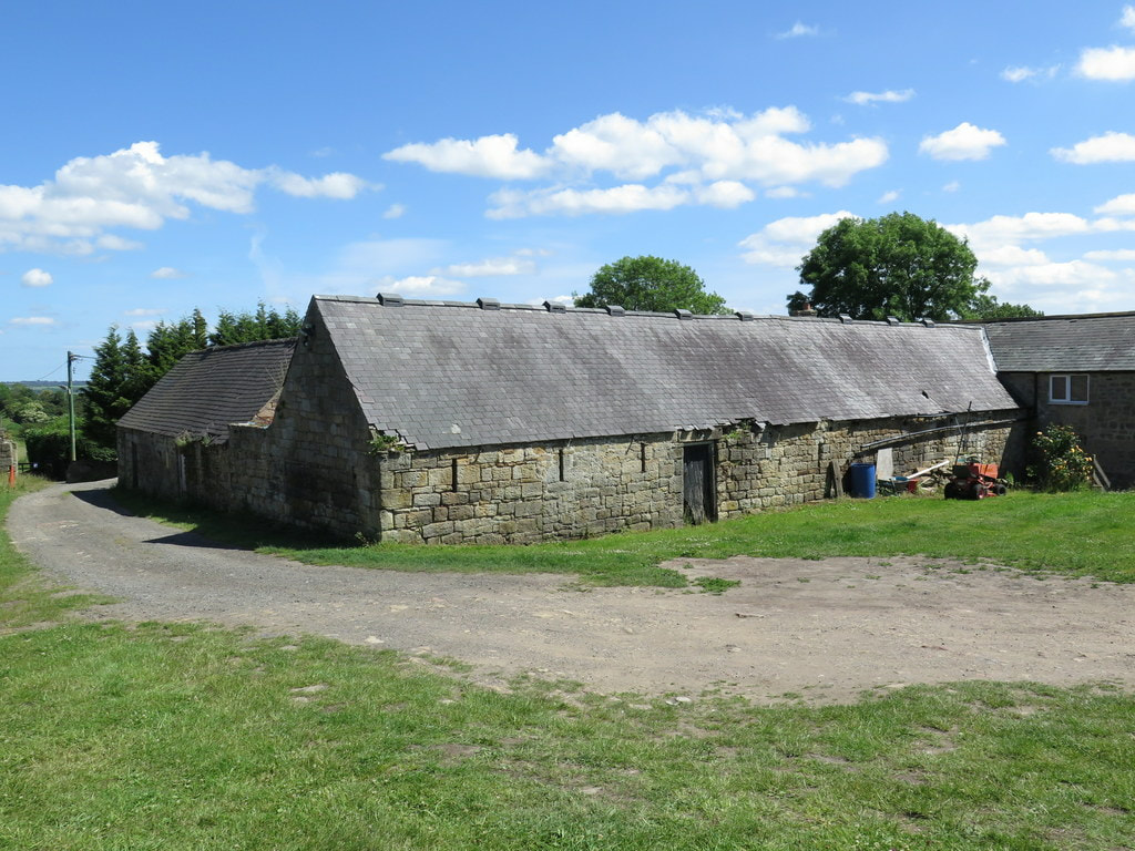
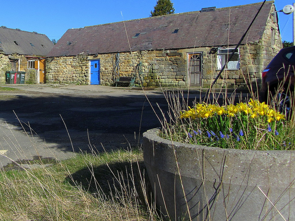
Photos below, taken in June 2017, are of the old Town Farm (Tulip's Yard) before demolition of the old buildings.


Photos below of the revealed section of Hadrian's Wall taken by Bill Pointer 8th March 2019.

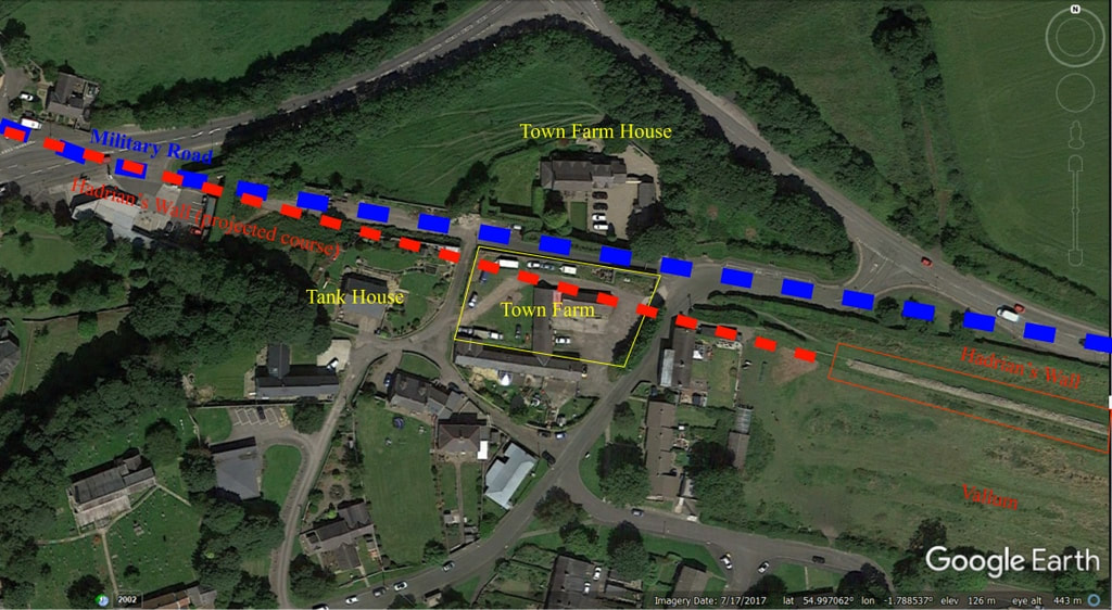
Location aerial view. Google Earth (2019).
Those who have followed developments of the former site of Town Farm, later Tulip’s Haulage Yard, on the East side of the village will have seen in the past weeks, the old, derelict buildings of the farmstead demolished, a new section of Hadrian’s Wall briefly found and cleared, and the site prepared for the building of five new bungalows.
I don’t know much about the early history of Town Farm but have speculated that it was in place in 1750 requiring the slight adjustment of General Wade’s Military Road from using the line (and foundations) of Hadrian’s Wall, west from Great Hill. This led to the preserved section of the Wall otherwise largely destroyed and covered by the road. This road, the first properly constructed road in Northumberland since Roman times, became the Newcastle to Carlisle Turnpike and later the A69, before it was abandoned and the bypass constructed.
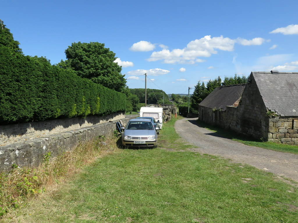
Beside the old road, below the retaining wall of the Town Farm site, still stands a milestone recording a distance of 7 miles from Newcastle’s West gate. It is probably one of the original milestones of the turnpike road from around 1780.
The original farm may have adjoined the old buildings, incorporating both farmhouse and barn as one long building. The two-storey farmhouse still standing on the north side of the old road, previously Four Winds and now Glanville House, was probably a much later addition.
At one time, like much of the village, it was owned by the Clayton family. The farmer in 1901 was William Stephenson who lived in the farmhouse with his wife Sarah and six children. William had been born at Rudchester and was nephew of William Stephenson who founded Throckley Brick Works and whose son, Sir William Haswell Stephenson of the Throckley Coal Company was seven times Lord Mayor of Newcastle.
In 1901 a gamekeeper, George Charlton, lived in what is now Keepers Cottage. He died in 1931 and has a gravestone in St Andrew’s churchyard erected by Brigadier General Sir Loftus Bates of Heddon Hall ‘in memory of an old friend’.
There was a large fire at Town Farm in 1913 which destroyed buildings and livestock. It was fought by local people until the fire brigade arrived from Newburn, alerted by a youth on a bicycle.
In 1918 it was bought for £3000, along with many of the other village properties, by Sir James Knott who had a vision of turning Heddon into a model village. However, after the events of the First War and loss of his two sons, his interest in the village came to an end. Town Farm was Lot 1 in his sale of 1924. Town Farm, on the site of the Roman Wall, including 38 acres of old grass land, was sold to Adam and James Hedley for £2800. They were already faming Bays Leap, bought from the Claytons in 1918. James Knott retained the small field containing the currently preserved section of Hadrian’s Wall which he later instructed to be gifted to the Society of Antiquaries of Newcastle upon Tyne.
Around 1927, Town Farm was rented from the Hedleys by William Ward Sanderson. He lived in the farmhouse and farmed the fields on the east side of the village, milking cows in a parlour at the farmstead, cutting hay on the site of the Roman Wall and running a local shop selling cigarettes and confectionary. The end of farming came when the land was sold for the building of the Vallum housing estate in the 1950s. The farm buildings became part of Tulip’s Yard, base for a successful haulage company.
The wall of the farm next to the old road sported adverts for the local shop and a Heddon on the Wall road-sign on a photo of army cadets resting on the grass below taken around 1950. Part of this photo was used on the album of The Eton Rifles by The Jam in 1979.
Demolition of the farm buildings in the past weeks and thorough archaeological excavation of the site has revealed the continuation of Hadrian’s Wall in two runs of large stones marking the lower course of its north face, and rubble core set in clay remaining below the old buildings. Most of the stones had been previously robbed and presumably reused elsewhere, perhaps including the church and even the buildings of Town Farm. Milecastle 12, known by measurement to be in this vicinity, hasn’t yet been found and may have been further west, perhaps under the garden north of Tank House. Similar remains of the Wall are known to exist below the tarmac of General Wade's road something that causes all sorts of problems for utility companies wanting to dig holes.
Cadwallader Bates in his History of Heddon published 1886: This mile-castle probably stood to the east of the pond, on the hill-top now covered with ruins of cottages. The Rev. G. Bowlker, vicar of Heddon, has heard that the people who lived in these cottages, in digging a hole in front of them for burying a horse, came on old foundations and what they described as a grave-stone with letters on it. This they promptly broke up.
Nothing has been agreed to date but interest has been expressed in the village obtaining at least some of the Hadrian’s Wall stones if they are not wanted elsewhere, perhaps to enhance the area around the Victrix sculpture, letting us put the centurion close to a little part of the fabric of the original Roman Wall.
I don’t know much about the early history of Town Farm but have speculated that it was in place in 1750 requiring the slight adjustment of General Wade’s Military Road from using the line (and foundations) of Hadrian’s Wall, west from Great Hill. This led to the preserved section of the Wall otherwise largely destroyed and covered by the road. This road, the first properly constructed road in Northumberland since Roman times, became the Newcastle to Carlisle Turnpike and later the A69, before it was abandoned and the bypass constructed.
Beside the old road, below the retaining wall of the Town Farm site, still stands a milestone recording a distance of 7 miles from Newcastle’s West gate. It is probably one of the original milestones of the turnpike road from around 1780.
The original farm may have adjoined the old buildings, incorporating both farmhouse and barn as one long building. The two-storey farmhouse still standing on the north side of the old road, previously Four Winds and now Glanville House, was probably a much later addition.
At one time, like much of the village, it was owned by the Clayton family. The farmer in 1901 was William Stephenson who lived in the farmhouse with his wife Sarah and six children. William had been born at Rudchester and was nephew of William Stephenson who founded Throckley Brick Works and whose son, Sir William Haswell Stephenson of the Throckley Coal Company was seven times Lord Mayor of Newcastle.
In 1901 a gamekeeper, George Charlton, lived in what is now Keepers Cottage. He died in 1931 and has a gravestone in St Andrew’s churchyard erected by Brigadier General Sir Loftus Bates of Heddon Hall ‘in memory of an old friend’.
There was a large fire at Town Farm in 1913 which destroyed buildings and livestock. It was fought by local people until the fire brigade arrived from Newburn, alerted by a youth on a bicycle.
In 1918 it was bought for £3000, along with many of the other village properties, by Sir James Knott who had a vision of turning Heddon into a model village. However, after the events of the First War and loss of his two sons, his interest in the village came to an end. Town Farm was Lot 1 in his sale of 1924. Town Farm, on the site of the Roman Wall, including 38 acres of old grass land, was sold to Adam and James Hedley for £2800. They were already faming Bays Leap, bought from the Claytons in 1918. James Knott retained the small field containing the currently preserved section of Hadrian’s Wall which he later instructed to be gifted to the Society of Antiquaries of Newcastle upon Tyne.
Around 1927, Town Farm was rented from the Hedleys by William Ward Sanderson. He lived in the farmhouse and farmed the fields on the east side of the village, milking cows in a parlour at the farmstead, cutting hay on the site of the Roman Wall and running a local shop selling cigarettes and confectionary. The end of farming came when the land was sold for the building of the Vallum housing estate in the 1950s. The farm buildings became part of Tulip’s Yard, base for a successful haulage company.
The wall of the farm next to the old road sported adverts for the local shop and a Heddon on the Wall road-sign on a photo of army cadets resting on the grass below taken around 1950. Part of this photo was used on the album of The Eton Rifles by The Jam in 1979.
Demolition of the farm buildings in the past weeks and thorough archaeological excavation of the site has revealed the continuation of Hadrian’s Wall in two runs of large stones marking the lower course of its north face, and rubble core set in clay remaining below the old buildings. Most of the stones had been previously robbed and presumably reused elsewhere, perhaps including the church and even the buildings of Town Farm. Milecastle 12, known by measurement to be in this vicinity, hasn’t yet been found and may have been further west, perhaps under the garden north of Tank House. Similar remains of the Wall are known to exist below the tarmac of General Wade's road something that causes all sorts of problems for utility companies wanting to dig holes.
Cadwallader Bates in his History of Heddon published 1886: This mile-castle probably stood to the east of the pond, on the hill-top now covered with ruins of cottages. The Rev. G. Bowlker, vicar of Heddon, has heard that the people who lived in these cottages, in digging a hole in front of them for burying a horse, came on old foundations and what they described as a grave-stone with letters on it. This they promptly broke up.
Nothing has been agreed to date but interest has been expressed in the village obtaining at least some of the Hadrian’s Wall stones if they are not wanted elsewhere, perhaps to enhance the area around the Victrix sculpture, letting us put the centurion close to a little part of the fabric of the original Roman Wall.
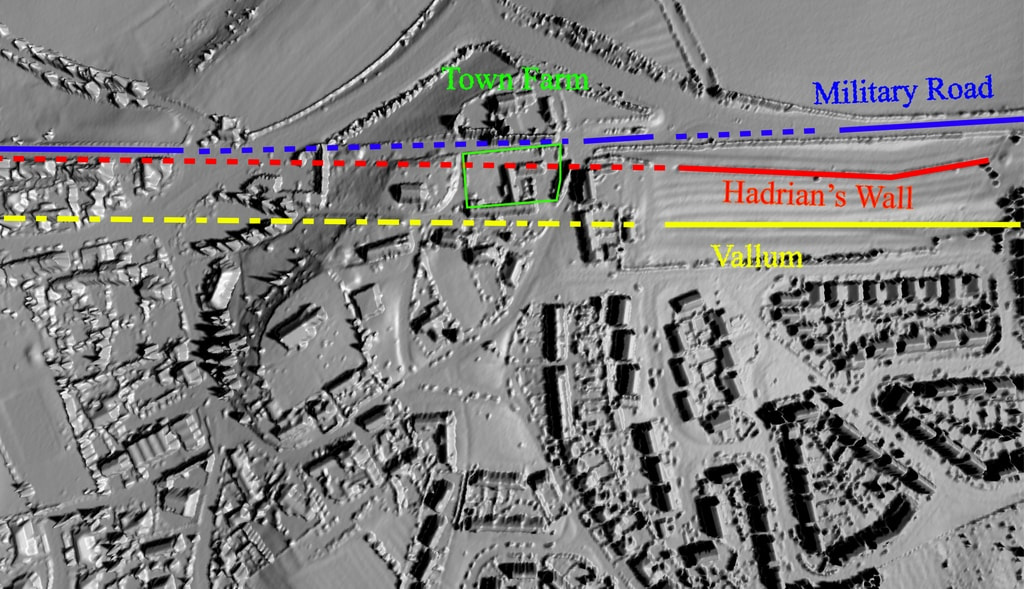
1m LIDAR 3D. houseprices.io lab (2019).
Map rendering provided by houseprices.io free to use under Creative Commons Attribution Licence CC BY 4.0
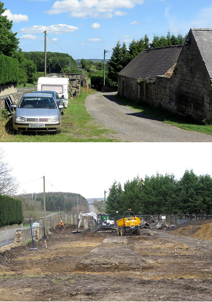
Before & after. Photos A Curtis.
The sections below are taken from:
Wardell Armstrong - Tulip Mews, Heddon-on-the-Wall, Northumberland. Watching Brief Report (2020).
Wardell Armstrong - Tulip Mews, Heddon-on-the-Wall, Northumberland. Watching Brief Report (2020).
The remains of Hadrian’s Wall identified at the site measured c.20 min length and comprised facing stones laid on a foundation of flat sandstone slabs, with a core of irregular sized sandstone fragments set in puddled clay. The Wall survived to a maximum height of 0.45m and was 2.9m at its widest surviving point. The width of the surviving remains is consistent with the Broad Wall sections of the monument, which was originally designed to be 2.9m wide (Symonds & Mason 2009, 38; Table2). It is also consistent with the surviving extant section of the Wall located to the east of the site (NHLE 1010616) which measures between 2.8m and 3m in width.
In addition to remains associated with Hadrian’s Wall, the watching brief also identified a well preserved stone‐lined kiln with associated firepit and flue. The kiln was initially considered to be associated with the Roman activity at the site, but the recovery of several sherds of medieval pottery from the feature (the only medieval pottery recovered anywhere during the watching brief) and its location on the northern side of the Wall has highlighted that it relates to a later phase of activity, probably the 14th or 15th century. Apart from the recovery of oak charcoal, primarily from the firepit, no indication of use of the kiln was identified, although it is possible that the feature was used as a corn drying kiln similar to the medieval kiln built into the extant section of the Wall immediately to the east of the site.
LINKS
The Wall at Heddon
Heddon History - Hadrian's Wall
Hadrian's Wall on Tyneside (pdf)
Hexham Courant - 19th March 2019
The Wall at Heddon
Heddon History - Hadrian's Wall
Hadrian's Wall on Tyneside (pdf)
Hexham Courant - 19th March 2019
 RSS Feed
