
|
A recent interest of mine has been in using LIDAR for archaeology research and as part of this I've been looking again at my local area.

Jenny Pit, Heddon on the Wall. LIDAR (DTM 1m) © Environment Agency 2022.
One of the features that has caught my eye is a LIDAR Digital Terrain Model (DTM) of the disused Jenny Pit which is located at NZ143662, just SE of Heddon Hall. Heddon Hall was named Mount Pleasant on the 1st edition 6" OS map. The old coal pit lies on Heddon land but just west of the boundary with Throckley.
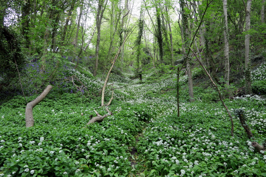
I have always considered it likely that some of the early waggonways to the many coal pits on the east side of Heddon parish may have crossed the Throckley boundary to connect up with the changing routes of Throckley waggonways leading eventually to the staiths at Lemington. Like many of the old pits and spoil heaps in our area, Jenny Pit was reclaimed by planting its area with trees, as was also done on Throckley land. The extent of the plantation now hiding Jenny Pit is, however, larger than many of the others nearby. For example, it is several times larger than the near circular plantation which surrounds Engine Bank Pit just to the south. Luckily LIDAR DTM can see through trees. The data within the LIDAR image has been processed (exagerated) to reveal more detail.
What is revealed below the trees is a impression shaped like a tennis racket, with the handle pointing to the SE where it ends at the fence which forms the Throckley boundary. The field to the east has been cultivated for many years and appears completely smooth on LIDAR unlike the narrow rig & furrow ploughing which remains around the disused pit in the pasture land below Heddon Hall.
This looks very much like the pit-head terminus of a former waggonway extending onto Heddon land. Directly below the site of the pit, running straight west to east (not entirely level as slightly downhill to the west) is what I had considered to be an old field boundary. Indeed it is shown as such on the 1st edition map, with trees shown along its length. The LIDAR image suggests that it is double banked, some 7m in width, although possibly with a ditch on its N (uphill side). Could this also be the remains of a waggonway. Its direction takes it just to the north of King Pit, on the 1st edition map. This eventually became the location of Heddon Margaret Colliery. There is also a Richard Pit to the north. A waggonway connection to these Heddon pits with the Throckley waggonway system would have predated the collieries eventual connection to the south, with the railway successor of the Wylam Waggonway. 
Location of Jenny Pit. Side by side georeferenced maps, National Library of Scotland: Six-inch 1st edition and ESRI World Imagery.
Beyond the racket-handle of Jenny Pit, on Throckley land, there are the small tree-covered remains of another coal pit, shown as Coronation Pit on a plan of Throckley estate. This could also have been served by the suggested waggonway as could several other old pits to the north of Reigh Burn, e.g. West Engine & East Engine Pits. There is a similar sized depression shown on the LIDAR image, close to Jenny Pit on the Heddon side of the boundary, which could be the remains of a ventilation shaft.
I contacted Les Turnbull about the LIDAR observation at Jenny Pit and he suggested the similarity to the waggonway termini depicted at The Far Pit (E) and The Middle Pit (D & C) of Heaton Main Colliery, shown on Watson's plan of 1805.

Figure of Watson's Waggonway Plan of Heaton Main Colliery from Les Turnbull, Coals from Newcastle, 2002.
It has to be said that there is speculation of other waggonways or tramways across these fields around Heddon Hall. For example, Historic England's Aerial Archaeology Mapping Explorer shows several possible features, but these appear to me less convincing. For example, one is the straight bank running W-E just above Jenny Pit, and another is one of the two converging features to the west.

Part of Historic England's Aerial Archaeology Mapping Explorer suggesting possible waggonways in the area surrounding Heddon Hall (2024). Jenny Pit is just right of centre (represented as an area of coal working).
If the LIDAR image of Jenny Pit does suggest a waggonway terminus, presumably branching sidings where waggons could be stored, waiting to be filled or transported, then what could the circular feature at the northern end be. It is about 15m in diameter, too wide for a mine shaft. One possibility could be the platform of a horse-drawn gin. Perhaps something similar to the winding machinery for a close-by shaft sketched by Sir John Clerk and reproduced in Les Turnbull's book on page 48. Maybe Jenny Pit was operated in the pre-steam era or too far out to be considered for conversion.
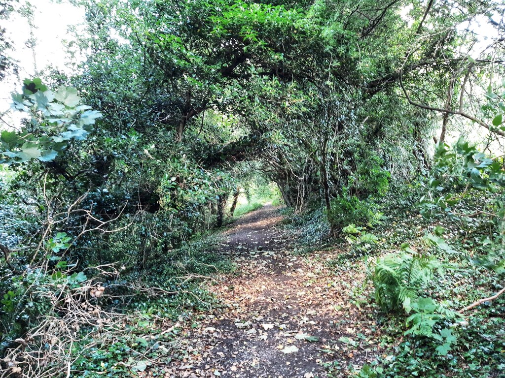
Footpath on a track north of Throckley Pond looking very like a waggonway. Photo A Curtis (2024).
If the feature does represent a waggonway serving Jenny Pit on Heddon land then its trajectory onto Throckley land would appear to take it along the gently curving boundary to the east (now a footpath into land which is now part of Tyne Riverside Park). The area further east has been greatly altered by the subsequent location of Throckley Isabella Colliery and eventual restoration of the land. The waggonway would have run north of the Reigh Burn, joining the Wylam Waggonway somewhere just below Newburn Grange Farm. Part of this route could have been later used by the mineral line which served Isabella Colliery.
I have plotted the conjectured line (the lower purple line) on my revised plan of the Throckley Coal Pits & Waggonways.

 Defended settlement 400m south-west of South Farm, Houghton (Heddon-on-the-Wall). Enhanced LIDAR (DTM 1m 2022) © Environment Agency and/or database right 2022. All rights reserved. Keys to the Past (N10871) Houghton is one of a small category of earthworks which, in general, are circular or oval in form, and are situated on slopes. They have an internal area consistent with other forts and settlements, and are usually univallate, with an internal mound, median ditch, and counterscarp bank. They possess few other distinguishing features; some may be merely stock enclosures. Both inner and outer banks, where still apparent, are very slight, and the ditch is largely silted up, except for the north side where it attains a depth of 1.3m. Opposing entrances in the east and west sides are probably original. There are no internal features. Quite clearly the earthwork pre-dates the surrounding medieval field system, but there is little other dating evidence. Listed by Challis and Harding as a slight univallate hill slope enclosure (Iron Age). NZ 123 666. Heddon-on-the-Wall. Listed in a gazetteer of British hillforts as a ?univallate structure enclosing 1.1ha. The enclosure survives as earthworks and is visible on air photographs, centred at NZ 1224 6657. It has medieval ridge and furrow within the enclosure and surrounding it (see NZ 16 NW 124). It has an inner an outer bank and opposed entrances as described above. It lies north of the River Tyne. Historic England Scheduled Monument (1014076) The monument includes a defended settlement of Iron Age date on gently sloping ground set a short distance back from a rocky ridge which commands extensive views across the valley of the River Tyne. The enclosure, oval in shape, measures 104m east to west by 74m north to south within a ditch varying between 7m to 8m wide and up to 1.3m deep. The ditch is infilled with silt for much of its circuit and is most prominent on the northern side. Within the ditch there are traces of an inner rampart of stone and earth which is best preserved at the western end where it is a maximum of 6m wide and 0.3m high. Outside of the ditch fragmentary remains of a counter-scarp bank are visible on all sides but the north, where it has been levelled by the construction of the road and is best preserved at the western end. There are opposing entrances through the east and the west sides of the enclosure, carried across the ditch on causeways 3.6m wide and 4.8m wide respectively. Although it states above that there are no visible internal features, the LIDAR image above does perhaps suggest the possibility of two roughly circular depressions on opposite sides of the enclosure. Could these be ploughed out platforms for Iron Age round-houses? The one on the west side is more irregular in shape and is perhaps the result of quarrying. A long causeway, clearly visible on LIDAR, which heads towards the east entrance of the enclosure from the road close to Houghton North Farm may be a later feature. It is described by Historic England (Mon. No. 1440602) as a medieval holloway (sunken track) and boundary ditch. It lies within an area of medieval ridge and furrow between two plough headlands. They suggest that it may be associated with Houghton medieval deserted settlement recorded from documentary evidence. The Keys to the Past entry for the defended settlement also refers to two small finds made in the area. An oval cornelian intaglio, largely complete, showing the figure of Mercury carrying a herald's wand and an elongated money bag has been recovered from High Close House, west of Heddon-on-the-Wall. The intaglio dates to the early 2nd century AD. A pair of glass beads of Guido's Groups 6iia and 6ivb have also been recovered. These types of bead continue well into the post-Roman period. The reference given for these finds is: Tolan-Smith, M, and Tolan-Smith, C, 2011. 'Miscellaneous Antiquities From The Tyne Valley', Archaeologia Aeliana 5th series 40, 259-267 (263 & 265). Link. The location for these finds given in the reference is NZ117667 which is located north of Hexham road and north-west of the enclosure. However, the discussion states that: The intaglio and two glass beads were all retrieved from within the boundaries of Close House West Romano-British enclosure. The location of this second enclosure (only visible as a crop mark on aerial photographs) is closer to NZ117657, in the field immediately west of High Close House and the strip of West Wood. This enclosure is recorded on Keys to the Past (N10877). I found it very hard to see on freely available satellite imagery (e.g.historical imagery from Google Earth, or Bing Virtual Earth) but there is a hint of it on these enhanced images shown below. It is not visible on the ground and leaves no surface trace on LIDAR.  Enclosure west of High Close House, and another to the south-east, as shown on Historic England Aerial Archaeology Explorer The western enclosure is recorded by Historic England as Monument Number 22882 Grid Ref : NZ 11811 65743 Summary : Iron Age or Roman rectilinear enclosure is visible as cropmarks on air photographs. The ditched enclosure (55 x 58 metres) has an entrance on its eastern side. Also on its eastern side is a possible small (20 metres wide) enclosure, with only three sides visible. More information : NZ 118 658. High Close House West. Crop-mark of a single-ditched rectangular enclosure with rounded corners and an east-facing entrance. The sides measure between 150 and 200 feet. Situated circa 200 yards west of High Close House at an altitude of 200 feet. (Listed under rectangular enclosures some of which are likely to fall into the pattern of Romano-British rectilinear settlements.) (1-2) Nothing visible on the ground, but the crop-mark is consistent with that of a rectilinear type native domestic enclosure. NZ 1182 6572. (3) Iron Age or Roman rectilinear enclosure is visible as cropmarks on air photographs, centred at NZ 1180 6574. The ditched enclosure (55 x 58 metres) has an entrance on its eastern side. Also on its eastern side is a possible small (20 metres wide) enclosure, with only three sides visible. (4)  Immediately west of this (in a field now part of Close House Golf Course) is recorded another rectilinear enclosure. Keys to Past: N27218 & HE Monument Number: 1440761 NZ 12299 65629 Iron Age or Roman rectilinear enclosure is visible as cropmarks on air photographs. The ditched enclosure (62 x 60 metres) is incomplete. I can see no trace of this enclosure on Goggle Earth imagery.  Horsley Wood rectilinear enclosure & promontory fort, Wylam. Enhanced LIDAR (DTM 1m 2022) © Environment Agency and/or database right 2022. All rights reserved. Horsley Wood hillfort (Horsley) Keys to Past (N10919) This is the site of an Iron Age hillfort. It was discovered in 1989 during survey of an ancient woodland. It stands on a hill above Howdene Burn, close to its junction with the Tyne. It is surrounded by a large bank and ditch. This hillfort is recorded in the following reference: Tolan-Smith, M. (1997). A Newly Discovered Promontory Fort in the Tyne Valley. Archaeologia Aeliana (5th Series) 25, 145-7. Link. The enclosure is situated within Horsley Wood, 12 km west of Newcastle upon Tyne at NZ 104648. It is at 35 m OD on a steep promontory above the Howdene Burn, close to its confluence with the River Tyne. It was discovered during a brief episode of clear felling before replanting and has now again retreated under a dense cover of trees. The remains consist of a substantial bank 13 m wide and 1.25 m high above the bottom of a broad external ditch. The ditch measures on average 9 m wide and has a slight counter-scarp bank. There is an internal quarry ditch which measures a maximum of 5 m wide. A modern causeway carrying a track across the southern end of the earthworks may occupy the site of an original entrance 6 to 7 m wide. The earthworks have been placed across the neck of a narrow promontory to form an irregular enclosure 90m by 93 m, bounded on the three other sides by steep natural slopes. The remains suggest that they are those of a previously unknown promontory fort of probable Iron Age date. The rectangular enclosure separated from the hillfort by the stream on its west side, is recorded as N28957. It may be associated with the hillfort or a later feature. A rectangular enclosure is visible as an earthwork on lidar imagery beneath woodland. It measures about 60m by 40m and has rounded corners. A road or track crosses the north-western corner of the enclosure and runs down the hillside. The tree-penetrating LIDAR (DTM) picks out many small depressions in this area of the woodland which are probably coal mine pits. In a field to the west of Horsley Wood (NZ 094 647) another enclosure has been identified on aerial photographs. It is recorded on Keys to the Past as N10127: A ditched enclosure, about 60m east-west by 55m north-south, enclosed by a spread earthen bank. The sides are slightly bowed. The eastern side of the enclosure coincides with the boundary of Horsley Wood and may be attached to it and contemporary with it. Some aerial photographs show a vague circular structure within the enclosure which is interpreted as the possible remains of a round house, as well as a possible sunken yard in the south east corner. The enclosure is clearly visible in Google Earth historic imagery from September 2007. No upstanding earthworks have been seen and no features associaioted with it were seen during xxcavation of a pipeline trench in 2012.  Crop-mark of Horsley Wood enclosure. Google Earth 09/2007). A Conservation Area Character Appraisal of Horsley village published by Tynedale Council in 2009 records: The Tyne valley would have been inhabited in prehistory. Its rich hunting grounds, agricultural fertility, defensive topography and supply of fresh water would have attracted nomads and settlers for millennia. The lower slopes and base of the valley would have been densely forested and visited and crossed rather than settled. There is clear evidence of prehistoric settlement in and around Horsley. There is the site of an Iron Age hillfort which stands on a hill above Howdene Burn close to its junction with the Tyne about a kilometre to the south east of the village. It is surrounded by a large bank and ditch and was discovered in 1989 during survey of an ancient woodland. Another set of earthworks, probably an Iron Age settlement, with associated prehistoric field boundaries sits on top of Horsley Hill just to the north of the village. Aerial photography has revealed more of the area’s prehistory. These include a rectangular enclosure which was destroyed as a consequence of the development of Horsley Crofts and a rectangular enclosure including a round house in a field immediately west of Horsley Wood.  Horsley Hill circular enclosure & field system. Enhanced LIDAR (DSM 1m 2022) © Environment Agency and/or database right 2022. All rights reserved. Defended settlement and field boundary on Horsley Hill Keys to the Past (N10018) Historic England Research Records (Mon. No. 20423) Scheduled Monument (1016470) The monument includes a defended settlement of Iron Age date, situated in a prominent location on the highest part of Horsley Hill, where it commands extensive views in all directions. The settlement is visible as the remains of a roughly circular enclosure, 46m in diameter, within a slight stone and earth rampart. For much of its circuit, the rampart is visible as a slight scarp or as a low spread bank, but where it is best preserved on the north west side it measures a maximum of 9m wide and stands up to 0.5m high. An area of erosion on the north eastern side has revealed the stone core of the rampart. On the western side of the enclosure there are traces of a surrounding ditch measuring 7m wide which it is thought originally continued around the south side where it has become infilled. The northern and eastern sides of the enclosure are protected by natural slopes beyond the rampart. There is a clear entrance through the eastern side of the enclosure associated with a spread field boundary or trackway. This feature, which runs in an easterly direction for 16m, is thought to be part of a formerly more extensive field system.
A preliminary attempt at drafting a summary of the history of coal mining in Throckley. The problem as always, what to leave out? Throckley – coal mining
Primary source for this summary is: Morrison, Jennifer (2007) Newburn Manor: an analysis of a changing medieval, post-medieval and early modern landscape in Newcastle Upon Tyne. Masters Thesis, Durham University.
Tyne & Wear Sitelines HER No: 1316 Throckley village General Period: Medieval Specific Period: C12 Site Type: Shrunken Village The first reference is 1161 when the dreng (a pre-Conquest term) of Throckley paid 3 marks to the exchequer. A member of the Saxon burgh and later medieval manor, of Newburn. Six taxpayers were recorded in 1296, 8 in 1312. Throckley passed to the Radcliffes in the early 15th century, then to Greenwich Hospital, which in 1777 bought the freeholds scattered in the ancient enclosures of the township. The village originally lay south of the Roman Wall and Hexham Road, on an east-west axis. It appears to have been a 2-row green village, reached from the north by the modern Hill House Road. Its plan shows clearly on a map of 1781, and it still looked fairly substantial in 1847, but on the 1st edition Ordnance Survey plan the only surviving dwellings were 2 cottages in the north row.  'Throcklaw' on Armstrong's Map of Northumberland, 1769 (Ref: ZBK sheets 8 & 9).  The old village of Throckley on Plan of Throckley c1780.  Extract from plan of enclosed lands of Throckley, 1781 (NRO SANT_BEQ_9_1_1_37).png  Throckley (south of Military Road) on Fryer's Map of Northumberland, 1820 (Ref: NRO 1356/P/1 sheet 6)  Throckley moved up to the Military Road on Ordnance Survey 6" 1st edition Northumberland XCVI, Surveyed: 1858 to 1859, Published: 1864. National Library of Scotland. Tyne & Wear Sitelines HER No: 3951 Drove Road General Period: Post Medieval Specific Period: C18 Site Type: Drove Road Drove Road, Throckley appears on a 1769 ‘Plan of Enclosure Lands’ (Northumberland Record Office), and the name is marked on the 1st edition Ordnance Survey plan as if it was the name of the road rather than its function. The present Drove Road is still a broad road and may be a medieval or earlier route for leading livestock to and from Throckley Fell, an area now north of the A69. A Roman surface was recorded in excavations in 2002 on Hexham Road in advance of installing renewed water mains. This raises the possibility that Drove Road may be of even greater age, perhaps originally representing a track leading through the milecastle. Tyne & Wear Sitelines HER No: 1315 NZ1567 General Period: Medieval Specific Period: Site Type: Common Land At the beginning of the 15th century Throckley passed by marriage to the Radcliffes of Dilston and Derwentwater, who therefore became lords of the manor, and from them it went to Greenwich Hospital. There survives a record of late 18th century/early 19th century trespasses and encroachments on the Fell - the running of cattle, sheep and horses without entitlement, and the taking of turf and stones. The act for the enclosure of the Fell was passed in 1816, and the award made in 1830. Some of the Fell has been opencasted. The site of Throckley Fell was mostly north of the Throckley bypass (A 69), and slightly more than half was within the modern boundary of Northumberland. Morrison, Jennifer (2007) Newburn Manor: an analysis of a changing medieval, post-medieval and early modern landscape in Newcastle Upon Tyne. Masters thesis, Durham University. The two-row village originally lay south of the Roman Wall with its access unusually orientated north-south (Wrathmell 1975, 124) but the main street on an east-west axis. The 1620 plan (AC 0/xvii/1; fig. 246) shows the village at the crossroads of a north - south road and a west - east road. There are properties at the crossroads, each lying within a croft of varying size. Figure 246. Linear village south of Hadrian's Wall surrounded by regular fields and commons. The boundary with Newburn is in dispute. Hallowell Wood lies to the west of the village. A wide driftway (later to become Drove Road) leads to Throckley Fell. The first major change had been the construction in 1751 of the Military Road (discussed in section 6.2.2), which effectively cut the township into two and re-orientated the access into Throckley village from east to north. It is tempting to suggest that this played a part in the downfall of the original Throckley village. Formerly the village was directly accessed on a main route-way. However once the Military Road was built the village was no longer situated on the main thoroughfare and travellers would have to turn off the main road to enter the village. It is not difficult to see why soon after the road was completed, buildings began to be constructed alongside the road in preference to the old village (Rippeth 1993, 44). Settlement shifts to main route- ways gave commercial advantages and enabled the village to serve the needs of travellers (Roberts 1987, 33). The second major change was the enclosure of the open fields of Throckley in 1769 (NRO Sant/Beq/9/1/1/37; NRO 536.1, 2). This is when some of the curved irregularly shaped fields around the village were replaced by more regular rectangular fields with straightened boundaries (fig. 38). It is pertinent to suggest that the surviving curvilinear boundaries are relict features of the former medieval landscape. A road network had by this time been built with straight roads and buildings at the crossroads. Industry had also begun to seriously impact on the landscape. At some point between 1847 (fig. 39) and 1858 (figs. 40, 252) Throckley village was all but obliterated, presumably to make way for the sandstone quarry which appeared on the site of Hall Riggs. A farm, Throckley House, was built south of the former village with an access road from the south and a quarry lies to the east. The farm at Fell Butts Close was renamed Throckley North Farm. Many of the fields were either subdivided or merged. Several coal pits are shown, each at the edges or corners of the fields, and most shafts are surrounded by small copses of trees. Some are marked as 'old' suggesting that these are out of use. The most extensive colliery workings were located at Throckley Colliery (Meadow Pit), which was served by a waggonway. To the east of this lay Throckley Brick and Tile Works. Fig. 41 These old stone boundary walls on Hill House Road are the only upstanding remnants of the former village. The road aligns with the route leading north out of the settlement, shown on the 1736 map (fig. 248). The site ot the last steadings on Ordnance Survey first edition (fig. 40) has been built over by the present Hill House. Today land south of Hill House and to the west of Hall Riggs wood is bumpy and weedy, possibly representing the southern part of the village (HER 1316). Aerial photographs show that ridge and furrow also survives here. In the northern part of the township, the construction of the A69 has destroyed much evidence, such as most of the former Heddon Road shown on the map of 1805 (NRO 691/1/19; fig. 250). The quarry (fig. 42) which obliterated so much of Throckley village is now a small wood, as is the quarry next to Throckley South Farm. The most dramatic survivals in the landscape are the former coal pits which survive largely as tree-covered mounds.  Drove Road, Throckley. Photo A Curtis (2009).  Hill House Road, Throckley. Photo A Curtis (2013).  Hill House Road, View towards Bank Top. Photo A Curtis (2013).  Path south of Bank Top, Throckley. Photo A Curtis (2011). 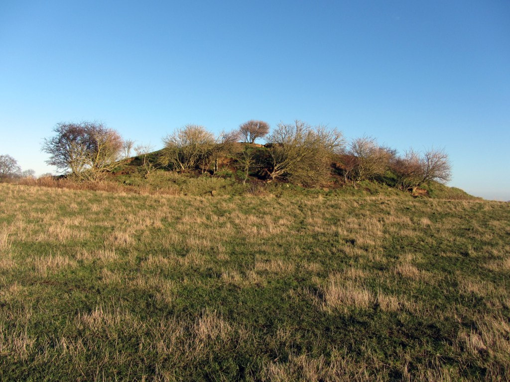 Dewley Hill. Photo A Curtis (2013) An alleged round barrow, Dewley Hill (also known as Dewley Law, Dewley Mound) is generally regarded as a natural feature - a kaim (or kame) of glacial origin. However, a number of finds suggest that it was utilised in prehistory. Although doubts have been cast on the existence of some flints claimed to have been recovered from its surface, a fragment of a Neolithic polished stone axe plus Mesolithic cores, blades, flakes and a graver are known to have been found on or in the hill. The axe is in private possession, while the Mesolithic flints are in the Hancock Museum (Preston Collection), the Museum of the Society of Antiquaries, Newcastle Upon Tyne, and Sunderland Museum. The hill, which has been shceduled as a monument, has been reduced in size by ploughing but measured a maximum 43 metres wide and 4.2 metres high when visited by the Ordnance Survey in 1978. It has been dug into on several occasions, some by the farmer while pursuing foxes. Nothing has ever been noted to suggest anything other than a natural sand and gravel feature. Historic England - Research Record 22704  The Glacial Phenomena of the Country between the Tyne and the Wansbeck. By J. A. Smythe. Transactions of the Natural History Society of Northumberland, Durham & Newcastle upon Tyne, vol. 3 (1908-1911). The finding of small flints on the surface, many of which exhibit human workmanship, might be thought to confirm the common view that the pile is of human origin, but its size and position, the nature of its pebbles and the general resemblance to the other kaims, make this extremely improbable. It is quite likely that such a prominent feature might be used by primitive man for burial or other purposes, which would sufficiently account for the presence on it of relics of his handiwork.
Sockett, E. W. (1971). Stone axe from Dewley Law. Archaeologia Aeliana Series 4. Vol 49, p. 246. Aerial photographs of the monument indicate that the barrow is surrounded by a number of cropmarks. These include a circular cropmark, interpreted as a bank and ditch immediately surrounding the barrow, a hut circle and a further enclosing feature, believed to be a boundary bank and ditch enclosing the raised ground around the barrow. Further circular cropmarks, interpreted as hut circles, are evident in the north west corner of the field. These surrounding features are also included in the scheduling. Whether Bronze Age burial mound or natural glacial feature (a kaim), Dewley Hill is a Scheduled Monument (List Entry Number: 1018678) and protected by law. 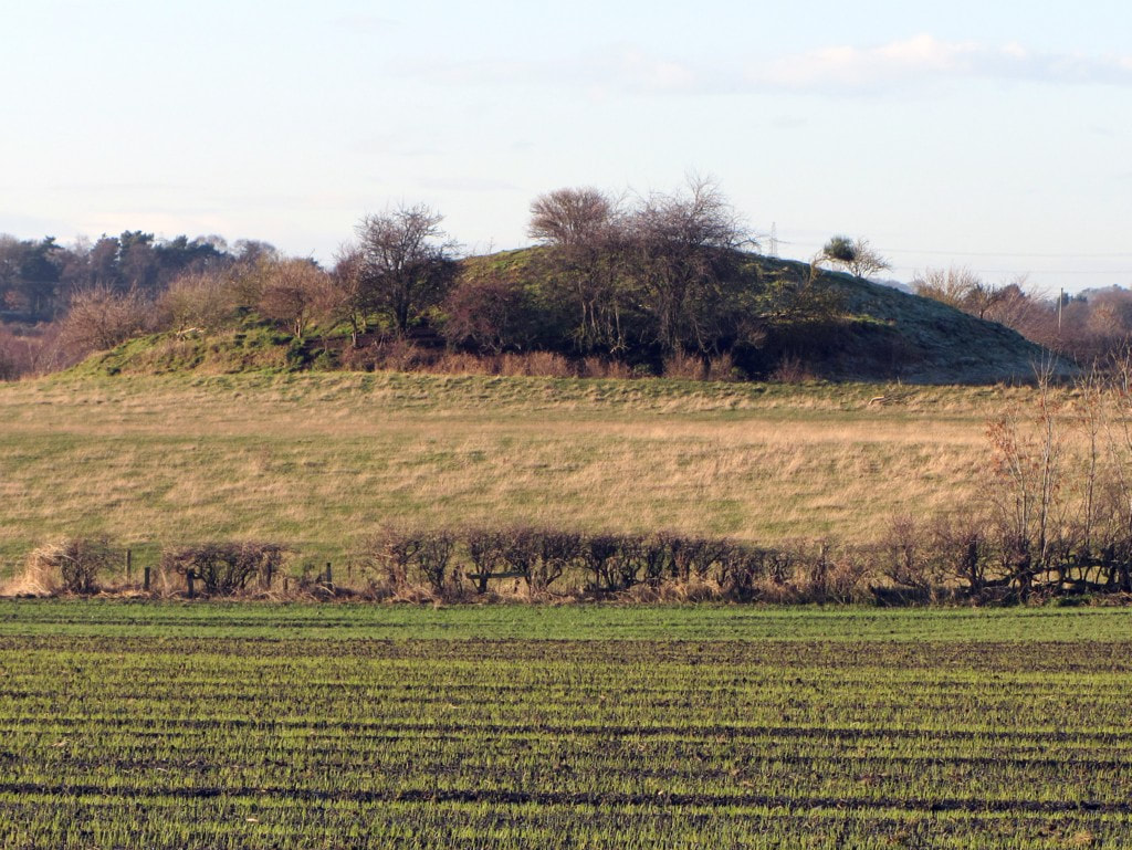 Dewley Hill. Photo A Curtis (2013)  Dewley Hill in centre of extract from LIDAR (NZ16ne_FZ_DSM_1m) © Environment Agency copyright and/or database right 2022. All rights reserved. Although now safe from the prospects of nearby open-cast coal mining (mainly the result of a local campaign), the Dewley Hill Scheduled Monument was added to Historic England's Heritage at Risk Register (list entry: 27470) with the following assessment: Assessment InformationAssessment Type: Archaeology Condition: Extensive significant problems Principal Vunerability: Animal burrowing - extensive Trend: Declining Ownership: Private  Heritage at Risk: animal burrows in the Dewley Hill mound. Photo A Curtis (2013). An interactive map of Throckley as an aid to exploring records from the Tyne & Wear Historic Environment Record online as Sitelines. There is also a summary of the history of Throckley here https://sitelines.newcastle.gov.uk/sites/default/files/Throckley.pdf  Screenshot of interactive Throckley Sitelines map. To get a copy of the interactive map, download the zip file (below) and extract the single html file within the compressed folder.
The extracted html file should open in your default internet browser. Using the map you can change the background mapping (menu top right), search for markers by colour or text (menu top-left). Click on markers for pop-up information and links. Triangle symbols (in black) refer to coal mining sites (pit shafts, collieries) and waggonways. Circle symbols are colour-coded depending on their historical period: prehistoric - red Roman - pink Medieval - green Post-medieval C17/C18 - yellow Post-medieval C19/C20 - blue
 Engine Plantation, Throckley. Formerly the site of Throckley Isabella Colliery. Photo A Curtis (2021). Information on the reclamation of former industrial land between Throckley & Newburn in the creation of Tyne Riverside Country Park. Hesselberth A & Hobson D (2003). Land reclamation in the North East: the last 30 years. Chapter 4 (p. 81-89) in: H.M. Moore, H.R. Fox, S. Elliott, Land Reclamation - Extending Boundaries: Proceedings of the 7th International Conference, Runcorn, UK, 13-16 May 2003. ABSTRACT: The North East of England has a long and glorious industrial heritage. This has led to a legacy of derelict land, but also to opportunities for reuse and regeneration. Government priorities and means of funding have changed over the last 30 years. The paper examines how land reclamation has progressed from the 1960s to the present time. It also looks at what has happened to land reclaimed during the earlier times and draws conclusions about the lessons that can be learned. 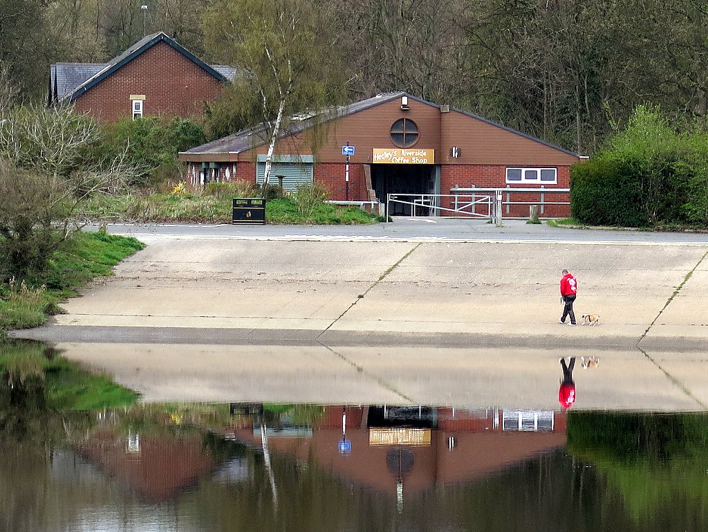 Slipway, Tyne Riverside Country Park. Photo A Curtis (2016). 4 Case Studies 4.1 Isabella colliery An area of approximately 50 ha of land on the North bank of the River Tyne between Newburn and Throckley lay derelict for many years following the cessation of mining and the closure of a railway line. The site contained a number of interesting features including a scrap yard, railway track bed, waste heaps, lagoons, shafts from which mine water continuously discharged, and an area used by the water company for the disposal of liquid sludge from its settlement beds at a nearby treatment works, Natural drainage of the area had been disrupted by mining subsidence and flooding of the surrounding fields occurred during winter periods. The mine water was badly discoloured with yellow ochre and this was discharged via approximately 1.5km of open water course into the River Tyne. The site was not considered to be contaminated and therefore was not subject to chemical testing. The site was reclaimed to create what is now known as the Tyne Riverside Park at Newburn. It was financed through l00% Derelict Land Grant. additional funding from the County Council and a small contribution from the Sports Council. For a period of about three years prior to reclamation, surplus soils were brought onto the site from various sources. These were mainly from private developments being undertaken in the region and soils primarily comprised subsoils and clays. In most cases a small charge was made for accepting the materials and this provided additional funds for the project. These operations were not considered as waste disposal and therefore were not licensed under the Control of Pollution Act 1974. The scheme involved the creation of a new land-form by regrading and covering over with the imported soils to form a growing medium. The scrapyard was cleared and visually dirty materials were removed off site for disposal in landfill. Mine shafts were capped but not filled and the drainage of the area improved as tar as possible by cleaning out channels and the installation of a flap valve upstream of the mine water discharge in order to prevent back flow into the areas worst affected by flooding. The most challenging part of the scheme was the treatment of the area used for disposal of water company sludge. This had collected in a depression to a depth of about 3m and was of a consistency similar to jelly paint. Dewatering of this material was achieved by spreading it in thin layers and allowing it to freeze during the winter. The material was also found to. be useful as a soil enhancer although. because of the high moisture content it was extremely difficult to handle. Provision for future disposals of sludge was provided in cooperation with the Newcastle and Gateshead Water Company. The water company agreed to spray future discharges of sludge in order to spread it in a very thin layer that would be capable of drying over the winter. A large grassed area was therefore created under which a layer of gravel and system of pipes were installed. This would not have been feasible without a ready source of a large quantity of gravel. This was obtained by the excavation of a large slope into the bank of the River Tyne which comprised excellent quality river gravel. This operation was considered eligible for Derelict Land Grant because it was essential to the restoration of the site. The excavated area conveniently produced a slipway which was concreted over and this is still the largest access into the river for recreational purposes today. The whole site was landscaped creating areas of grass and woodland with about 30% being returned to grazing land and the remainder being made available as a country park. The scheme was awarded first prize in the RICS/Times Conservation Awards RICS (1982). It is now a well used and mature country park.
 Polluted land from water filter beds at Tyne Riverside Park. Photo A Curtis (2013).
Buildings at the junction of Drove Road and the Military Road were known as 'Lead House' by 1858, when they appear on the first edition Ordnance Survey plan, and were apparently store houses for the Langley Lead Company. The crossroads is captioned 'Lead gate' on the county maps of Greenwood and Fryer in the 1820s. Tyne and Wear HER(1966): Throckley, Hexham Road, Lead Houses Link  John Fryer & Sons' Map of the County of Northumberland, 1820. This name is applied to a small house in former times it was used as a store for lead it is now Inhabited and in good repair. Northumberland Ordnance Survey Name Book(c.1860): Newburn 403 p.42  Ordnance Survey 25" Northumberland (Old Series) LXXXVII.15, Revised: 1895, Published: 1897. National Library of Scotland. Mr. Walton having been at Throckley the other Day observed a great Quantity of Lead lying at the End of the Lane leading from the Turnpike Road to Newburn. We desire you will acquaint the Carriers that unless they remove it and deliver it either at Newcastle or Newburn immediately, we will take care to give Directions to have it taken away, and certainly will not pay one farthing carriage for it from the Mill to the place where it now lyes. The Carrier who delivered his Lead at Newburn contrary to Direction must not have any more Lead unless he can give a sufficient reason shewing that he could not deliver it at Newcastle without being put to very great Inconvenience. Letter – Nicholas Walton to Peter Mulcaster – 22 Mar 1782. Archives of Greenwich Hospital (TNA ADM 66 97) Transcribed by Dukesfield Smelters & Carriers Project Link There is no lead in the Newburn area, but the industry has nevertheless affected the region. According to Linsley (n.d.) a bridle path which once ran past Cutty Coats Farm (see chapter eight), would have once been used by lead-carrying packhorses and Cutty Coats may actually have been the home base for a smallholder involved in the lead-carrying trade (Linsley, n.d.). The crossroads on the toll road at Throckley is captioned 'Lead Gate' on Fryer's map of 1820 (fig. 113) and adjacent buildings were known as 'Lead House' by 1858 (first edition Ordnance Survey map) and were apparently lead store houses for the Langley Lead Company (Walton 1994, 17; Northern Counties Archaeological Services 2001, 11).
An 'old lead wharf' is shown on the Newburn Tithe Map of 1849 (NRO DT 341 M). The Primitive Methodists who built a chapel at Throckley in 1891 were mainly miners who moved from the lead mines of Allendale to work in the coal mines (Rippeth 1993, 51). The link between the lead industry and Throckley appears to be the landowner: the lead mines on Alston Moor were owned by the lords of Throckley, the Radcliffe family then Greenwich Hospital from 1734 (Poole and Raistrick 1949, 90). The eighteenth century 'Lead Road', which survives in part as a modern carriageway at Greenside near Ryton, linked the mines and smelt mills at Alston Moor and Allendale to Ryton (Raistrick 1972, 132) which lies opposite Newburn on the south bank of the Tyne. Presumably the ford was used to bring the lead across the river and for whatever reason the mine owners built lead storage buildings within their holdings on the main road into Newcastle. Morrison, Jennifer (2007) Newburn Manor: an analysis of a changing medieval, post-medieval and early modern landscape in Newcastle Upon Tyne. Masters thesis, Durham University. |
AuthorAndy Curtis Archives
July 2024
Categories
All
|
||||||||
- Home
- Calendar
- Introduction
- Where are we?
- History Map
- Timeline
-
Heddon's History
- Prehistory
- Hadrian's Wall >
-
Six townships
>
-
1 Heddon township
>
- Heddon in the Middle Ages
- Common Land
- Middle Marches
- Tithe Award
- St Andrew's Church >
- Village property
- Heddon Hall >
- Heddon Banks Farm
- Frenchman's Row
- Methodist Church >
- Men's Institute
- Women's Institute
- Welfare Field
- Knott Memorial Hall
- Memorial Park
- Schools
- River Tyne
- Coal Mining
- Quarrying
- Water Supplies
- Transport
- Waggonway & Railway
- Occupations from 1800
- Miscellaneous
- 2 West Heddon township
- 3 East Heddon township
- 4 Houghton & Close House township >
- 5 Eachwick township
- 6 Whitchester township
-
1 Heddon township
>
- Rudchester
- People
- Old Photos
-
Old News
- Community News
- Letter from the Emigrant Clergy of Frenchman's Row (1802)
- Alleged Brutal Murder at Heddon-on-the-Wall (1876)
- Sad boat accident at Ryton (1877)
- Coronation tree (1902)
- 65 Years on a Ferry Boat (1929)
- Come claim your kiss at Heddon (1953)
- The Swan (1972)
- Heddon WI (1987)
- Church House (1966)
- Happy return (1993)
- Hexham Courant (1997)
- Butterfly Garden (1999)
- Foot & Mouth (2001)
- Remembrance Day (1996)
- Remembrance Day (2016)
- RAF at Ouston (2007)
- Close House Golf Course (2009)
- Heddon pupils celebrate British heritage (2011)
- Roman Wall Forge (2011)
- Diamond Jubilee (2012)
- Auction of Bronze Statue, Close House (2012)
- Heddon WI (2012)
- Puffing Billy Festival (2013)
- Heddon Village Show (2014)
- View of the North (2014)
- The Wall at Heddon (2014)
- Heddon Village Show (2015)
- War veterans singing send-off (September 2015)
- Anglo-Saxon history (2014)
- Heddon WI at 100 (2017)
- Hadrian's Wall discovery (2019)
- Tulip Mews (2020)
- Mike Furlonger
- Hadrian's Wall 1900 Festival
- Memories
-
Other documents
- Mackenzie (1825)
- Bates (1886) >
- History, Topography & Directory of Northumberland (Bulmer's) - 1886
- History of Northumberland (1930)
- Collingwood Bruce (1853)
- Whellan (1855)
- Post Office Directory (1879)
- Prominent people in Heddon
- Place names
- Ad Murum
- Archived documents
- Thomas Bewick's History of British Birds (1826)
- Census data 1801-1991
- Historical Records 1888-1890
- Knott Sale of Village Property (1924)
- Extracts from Parish Council Records
- Local colliery records
- Blackburn (1938)
- Clark (c.1963)
- History of Church (1968)
- Boundary Commission Report 1984
- Village Atlas 2022
- Walks
- Blog
- Contact us
- Links
- What's new
- Site search
- Past & Present
- Photo of the Month
- Place Name Studies
- Heddon from Above


 RSS Feed
