
Cheviot Hills - OS Name Books Explorer
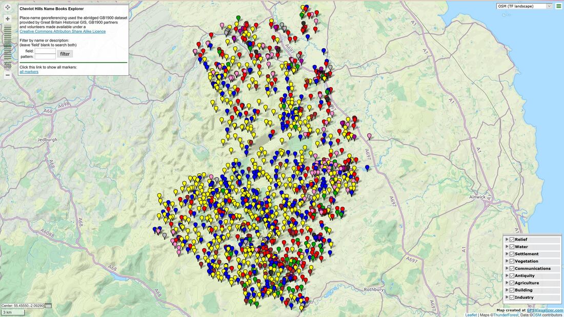
Screenshot of unzoomed interactive map
Interactive web map for exploring Ordnance Survey Name Book entries for place-names in the Cheviot Hills. These names were collected and described for the 1st edition OS maps during the survey in the 1860s. For information see the Northumberland Name Books website.
Place-names in the Cheviot Hills were recorded in the name Books for the Northumberland parishes of Alnham, Alwinton, Ilderton, Ingram, Kidland, Kirknewton and Wooler.
Place-names in the Cheviot Hills were recorded in the name Books for the Northumberland parishes of Alnham, Alwinton, Ilderton, Ingram, Kidland, Kirknewton and Wooler.
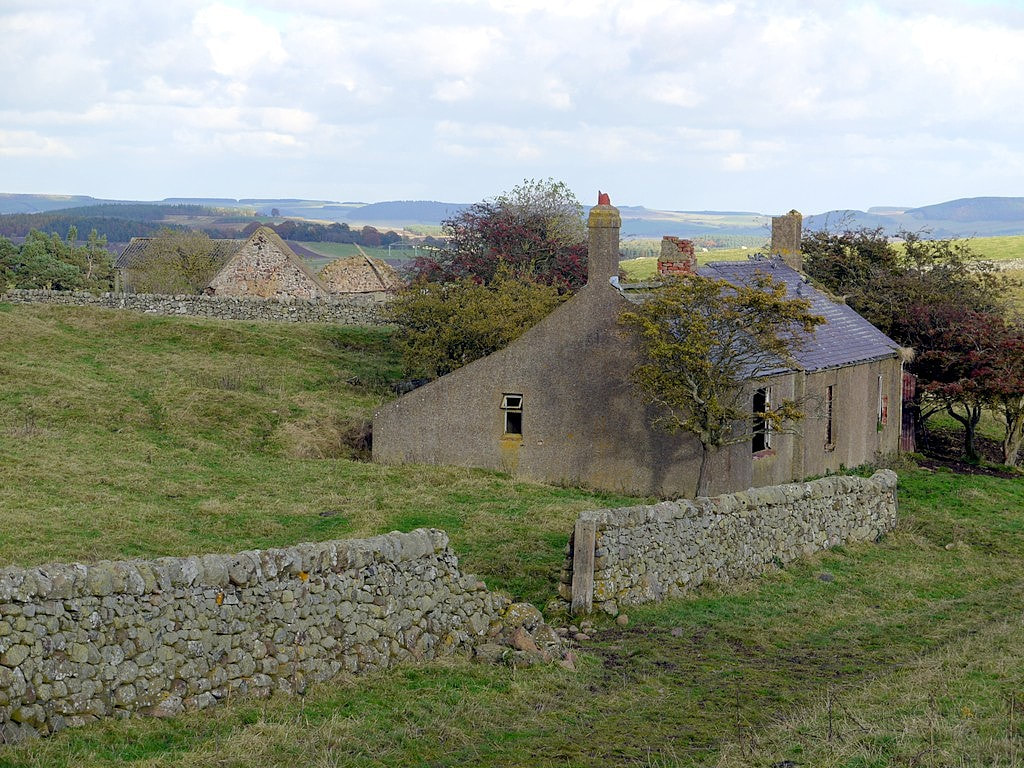
Ruined cottages, Middleton Old Town. Photo A Curtis (2012).
Old Middleton
"A Shepherds house & byre so called, this was once the farm town for both Middletons but is now decayed and dilapidated."
OS Name Book for Ilderton Parish (c.1860) page 19: Link
Download the zip file below, extract (decompress) the html file on your PC and double click to open in the file in your default browser.
The map should open in full screen mode. Background maps can be changed in the menu top right. The best is called OSM (TF Landscape) as it has hill shaping. contours and a large number of place-names. I didn't set it as default as it uses a API key to limit the download of tiles. When the limit is reached you may see the 'API KEY REQUIRED' watermark across the map.
Left-click on the map and drag to pan, use the mouse wheel or +/- menu top left to zoom. Recentre the map using the icon top-left.
Hover over markers to show names used on the first edition map and click on them to show pop-ups.
As before, I have roughly categorised place-names as:
Settlement red
Relief yellow
Vegetation green
Water blue
Agriculture brown
Building purple
Antiquity pink
Communications grey
Industry black
You might not always agree all my choices and some could easily fall into more than one. Categories can be toggled on/off in the menu, bottom right. The entries in this menu depend on whether a filter is applied.
Search for place-names using the menu top-left. It uses partial matches and regular expressions. You can specify either name or description for the field, or leave blank to search both. Enter what to search for as the pattern. Click the all markers link to remove the filter. Many names changed after the fist edition map and alternative names are often shown in the description.
I have now georeferenced nearly the whole of of the Northumberland Name Book entries and intend to release other parish or area maps on this web-site in the near future.
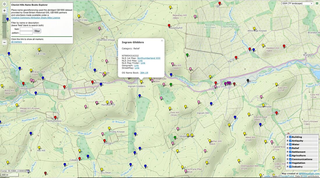
Screenshot showing zoomed view of Ingram area showing OSM (TF Landscape) background and pop-up for Ingram Glidders
| cheviot_hills_name_books-map.zip |
