Heddon-on-the-Wall Local History Society
  • Home
  • Calendar
  • Introduction
  • Where are we?
  • History Map
  • Timeline
    • Prehistoric
    • AD43 to 1599
    • 1600 to 1799
    • 1800 to 1899
    • 1900 to 1999
    • 2000 to 2099
  • Heddon's History
    • Prehistory
    • Hadrian's Wall >
      • Vallum excavation (1893)
      • Hadrian's Wall excavation 1926
      • Wall ditch, Bays Leap (1958)
      • Hadrian’s Wall: Archaeological research by English Heritage 1976-2000
      • Throckley & Heddon entanglements
      • WallWatch
      • English Heritage (2020)
      • Wardell-Armstrong Archaeolgy Reports
      • Historic England Archives
    • Six townships >
      • 1 Heddon township >
        • Heddon in the Middle Ages
        • Common Land
        • Middle Marches
        • Tithe Award
        • St Andrew's Church >
          • Stained Glass Windows
          • Churchyard
          • Monuments of church & churchyard (1991)
          • Monuments Page 2
          • Vicars of Heddon
        • Village property
        • Heddon Hall >
          • Sale of Heddon Hall 2012
        • Heddon Banks Farm
        • Frenchman's Row
        • Methodist Church >
          • Heddon Methodist Church Centenary 1877-1977
        • Men's Institute
        • Women's Institute
        • Welfare Field
        • Knott Memorial Hall
        • Memorial Park
        • Schools
        • River Tyne
        • Coal Mining
        • Quarrying
        • Water Supplies
        • Transport
        • Waggonway & Railway
        • Occupations from 1800
        • Miscellaneous
      • 2 West Heddon township
      • 3 East Heddon township
      • 4 Houghton & Close House township >
        • Close House
      • 5 Eachwick township
      • 6 Whitchester township
    • Rudchester
  • People
    • Sir James Knott
    • Cadwallader J. Bates
    • Richard Burdon
    • Hugh Sinclair (Tim) Swann
    • George Clark
  • Old Photos
    • Postcards
    • Old photos 1
    • Old photos 2
    • Old photos 3
    • Old photos 4
    • Old photos 5
    • Old photos 6
    • Old Photos 7
  • Old News
    • Community News
    • Letter from the Emigrant Clergy of Frenchman's Row (1802)
    • Alleged Brutal Murder at Heddon-on-the-Wall (1876)
    • Sad boat accident at Ryton (1877)
    • Coronation tree (1902)
    • 65 Years on a Ferry Boat (1929)
    • Come claim your kiss at Heddon (1953)
    • The Swan (1972)
    • Heddon WI (1987)
    • Church House (1966)
    • Happy return (1993)
    • Hexham Courant (1997)
    • Butterfly Garden (1999)
    • Foot & Mouth (2001)
    • Remembrance Day (1996)
    • Remembrance Day (2016)
    • RAF at Ouston (2007)
    • Close House Golf Course (2009)
    • Heddon pupils celebrate British heritage (2011)
    • Roman Wall Forge (2011)
    • Diamond Jubilee (2012)
    • Auction of Bronze Statue, Close House (2012)
    • Heddon WI (2012)
    • Puffing Billy Festival (2013)
    • Heddon Village Show (2014)
    • View of the North (2014)
    • The Wall at Heddon (2014)
    • Heddon Village Show (2015)
    • War veterans singing send-off (September 2015)
    • Anglo-Saxon history (2014)
    • Heddon WI at 100 (2017)
    • Hadrian's Wall discovery (2019)
    • Tulip Mews (2020)
    • Mike Furlonger
    • Hadrian's Wall 1900 Festival
  • Memories
    • Olive White
    • Betty Cockburn
    • Betty Cockburn - miscellaneous information
    • Isabel Snowdon
    • William & Winnie Watson
    • Edith Ward
    • Mark Parker
    • Jack Lawson
    • Winnie Spoor
    • P Reay
    • Mr and Mrs Hall
    • Peter Chapman
    • Elizabeth Elenora Eames
    • Harry Murray
  • Other documents
    • Mackenzie (1825)
    • Bates (1886) >
      • Early & Roman
      • Townships
      • Heddon Church
      • Heddon & Houghton
      • Whitchester
      • Eachwick
      • West & East Heddon
      • Records
      • Addenda
      • Appendix A
    • History, Topography & Directory of Northumberland (Bulmer's) - 1886
    • History of Northumberland (1930)
    • Collingwood Bruce (1853)
    • Whellan (1855)
    • Post Office Directory (1879)
    • Prominent people in Heddon
    • Place names
    • Ad Murum
    • Archived documents
    • Thomas Bewick's History of British Birds (1826)
    • Census data 1801-1991
    • Historical Records 1888-1890
    • Knott Sale of Village Property (1924)
    • Extracts from Parish Council Records
    • Local colliery records
    • Blackburn (1938)
    • Clark (c.1963)
    • History of Church (1968)
    • Boundary Commission Report 1984
    • Village Atlas 2022
  • Walks
    • Walks 2
  • Blog
  • Contact us
  • Links
  • What's new
  • Site search
  • Past & Present
  • Photo of the Month
  • Place Name Studies
    • Meas & Meres
    • OS Name Books: Elsdon
    • OS Name Books: Allendale
    • OS Name Books: Cheviot Hills
    • OS Name Books: Other Parishes
  • Heddon 3D landscape

Knott Memorial Hall

30/1/2019

0 Comments

 
Picture
Rear of Knott Memorial Hall. Photo A Curtis 2011.

The Knott Memorial Hall was given to the village of Heddon by Sir T. Garbutt Knott, in memory of his parents, Sir James and Lady Margaret Annie Knott.

Initially the hall was to be a more elaborate construction, the initial plans of 1935 included higher wings at the north east and south west corners to provide a news and games room at one end and a caretakers flat at the other.

In view of the relatively small size of the village, at that time, and the existing news and games room at the Men's Institute, and the availability of other meeting rooms, it was decided to scale down the plans and use the money saved to create an endowment fund to assist with the future upkeep of the hall. This suggestion was agreed to by Sir Garbutt and his legal advisers, and the Hall in its present form was subsequently built in 1936.

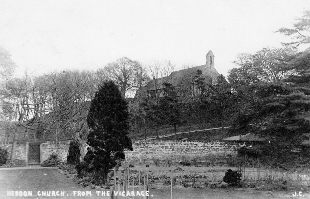
The site upon which it was built formed part of the Church Banks, this had been for many years previous an unofficial playground for the village children.

Mr. L.Walton-Taylor of Heddon and Newcastle was the architect and the Hall was built by Messrs. Lowry of Newcastle. The original official opening ceremony was to have taken place on Saturday the 18th July, 1936 at 3pm by Lt.Col. Sir Alexander Leith, Bart, M.C; D.L, and the dedication service by the Venerable Archdeacon of Northumberland, a tea to be provided for all invited guests.

The tragic death of the vicar, The Rev. Harold Nixon, in a motoring accident whilst on holiday in Wales,  brought a sudden cancellation of these plans. It was later officially opened by Mrs. G.E. Wilkinson of Wylam and dedicated by the Lord Bishop Billrough, of Newcastle, on the 24th October, 1936.
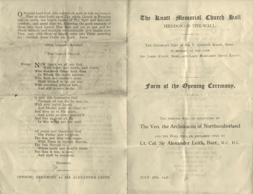
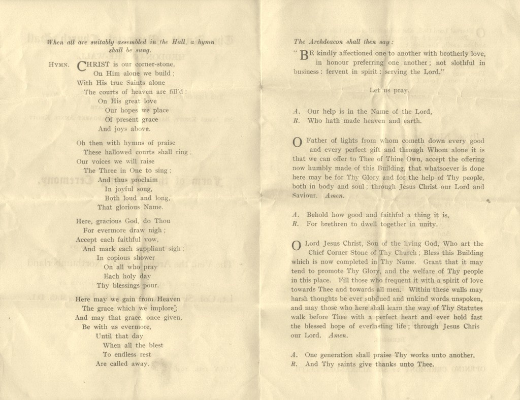
Program for original opening ceremony planned for 18th July 1936.

Picture
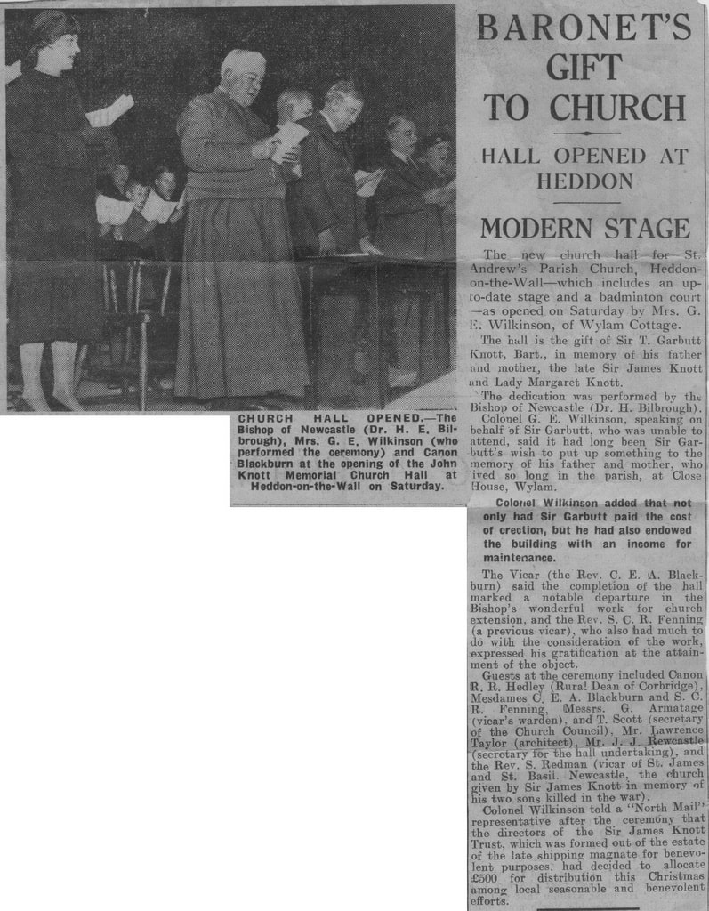
Newspaper report of opening ceremony on Saturday 24th October, 1936
0 Comments

St Andrew's Church from the Vicarage c1907

26/1/2019

0 Comments

 
Picture
St Andrew's Church, Heddon on the Wall, from the Vicarage. Real Photo Postcard c1907.
 The With thanks to Caroline and Lawence Scott for drawing my attention to this photo.

The view of the church is from within the Old Vicarage garden, approximately where the modern Vicarage now stands. The direction pointed by the camera is to the south-east and would now be blocked by the Knott Memorial Hall on Towne Gate which was built in 1936.

The path up to the church-yard from behind the hall appears to have been paved. It is still there but now a grass sward. The map below shows the side door from the Vicarage garden (probably that shown in the photo) directly opposite the track which descends from the church. Where the track meets the road (Towne Gate) is the present location of the Knott Memorial Hall which was built in 1936.
Picture
OS 1:2500 map (1897)
0 Comments

Ralph Carr-Ellison

4/1/2019

1 Comment

 
I quote the following story about one of the Upper Coquetdale landowners at the time of the Ordnance Survey in the early 1860s as it fits with a project on transcribing the OS Name Books for Northumberland that I am involved with at the moment.
Picture
The story is part of a short biography of Mr. Carr, in a regular section called Men of Mark ‘twirt Tyne & Tweed in The Monthly Chronicle of North-Country Lore and Legend Vol. 3 (1887-1891)’, p. 385-387.

You can read this, and other works during the life of Ralph Carr for yourself here.
 
RALPH CARR-ELLISON (1805-1884, originally Ralph Carr) was the eldest son of John Carr, Esq. of Dunston Hill and Hedgeley.
 
Mr. Carr, 'landowner, antiquary and naturalist', was one of the few men who ever made the Ordnance Survey officials admit an error in topographical nomenclature.

He owned the estate of Makenden at the head of Coquet, which runs up to what is locally known as "the Scotch Edge," where it "marches" with the property of the Duke of Roxburgh. In this district the boundary line between England and Scotland usually follows the water shed (or, as Dandie Dinmont [a character in Guy Mannering by Sir Walter Scott, 1815] expressed it, "the tap o' the hill, where win and water shears") between the valleys of the Teviot and Bowmont on the Scotch side, and those of the Rede, Coquet, and Breamish on the English.

But in various places the Scotch, like "Jock o' Dawston Cleugh", have encroached over the crest of the hills. These encroachments are usually marked on old maps as "batable" i.e., debatable ground. One such plot of "batable" land lay between the properties of Mr. Carr and the Duke of
Roxburgh, where, according to the contention of the Scotch, the march leaves the "tap o' the hills and bauds down by the Syke" in which the Coquet rises, thus cutting off the Plea Shank, which, like Dandie Dinmont's ground, "lying high and exposed, may feed a hogg [a sheep up to the age of one year; one yet to be sheared], or aiblins twa [perhaps two] in a gude year."

The spot is familiar to antiquaries, for the ancient Roman Camp, "Ad Fines", now known as Chew Green, lies just below it, and the Roman Road of Watling Street [Dere Street] here crosses the moors into Scotland.

For the sake of peace it had been arranged, at some former time, between the owners and occupiers, that half the Plea Shank should be pastured by each party. But when the Ordnance Survey came to be made, the Scotch revived their claim to the whole, and by some means or other contrived to win over those who were conducting the survey.

Little more was heard of the matter till the maps were issued, showing the boundary between England and Scotland drawn along the English side of the debatable ground. Then the English tenant was politely invited by his Scotch neighbour to keep his sheep on his own side of the new boundary.

On hearing this, Mr. Carr took steps to obtain all possible evidence from ancient maps and documents in the British Museum and elsewhere ; and instructed his tenant to turn a few sheep on to the disputed land in the meanwhile.

Meeting the farmer shortly afterwards, Mr. Carr said, "Well
Thompson, I suppose you put half-a-dozen sheep or so on
to the Plea Shank?
" "Oh, no, sir," was the answer, "I just wysed on [used] fifty score!"

The result of Mr. Carr's investigations was to show that the land had been either English or debatable for centuries. This was brought to the notice of the officials in charge of the Ordnance Survey, the already issued maps were recalled and cancelled, and new ones restoring the Plea Shank to its
old " batable" character were published.
The name 'Plea Shank' doesn't appear to have made it onto the 1st edition map although there is a 'Plea Knowe' on the border further away to the north-east, and another 'Plea Shank' near the line of Dere Street (formerly recorded as Watling Street) but on undisputedly Scottish land in the Borders, much further north.
1 Comment

    RSS Feed

    Author

    Andy Curtis

    Archives

    July 2024
    June 2024
    May 2024
    April 2024
    March 2024
    January 2024
    November 2023
    February 2023
    November 2022
    September 2022
    August 2022
    June 2022
    May 2022
    January 2022
    December 2021
    November 2021
    September 2021
    August 2021
    June 2021
    May 2021
    October 2020
    June 2020
    May 2020
    March 2020
    November 2019
    August 2019
    July 2019
    March 2019
    January 2019
    November 2018
    October 2018
    August 2018
    July 2018
    June 2018
    April 2018
    March 2018
    January 2018
    October 2017
    September 2017
    July 2017
    June 2017
    May 2017
    April 2017
    March 2017
    February 2017
    January 2017
    December 2016
    November 2016
    September 2016
    August 2016
    July 2016
    June 2016
    May 2016
    April 2016
    February 2016
    January 2016
    December 2015
    October 2015
    September 2015
    August 2015
    July 2015
    June 2015
    May 2015
    April 2015
    March 2015
    February 2015
    January 2015
    December 2014
    November 2014
    September 2014
    August 2014
    July 2014
    June 2014
    May 2014
    April 2014
    March 2014
    February 2014
    January 2014
    December 2013
    October 2013
    September 2013
    August 2013
    July 2013
    June 2013
    May 2013
    April 2013
    March 2013
    February 2013
    January 2013
    December 2012
    November 2012
    October 2012
    September 2012
    August 2012
    July 2012
    June 2012
    May 2012
    April 2012
    March 2012
    December 2011
    November 2011
    October 2011
    September 2011
    August 2011
    June 2011
    May 2011
    April 2011
    March 2011
    February 2011


    Categories

    All
    Agricultural Engineering
    Archaeology
    Barrow
    Bays Leap
    Beamish Museum
    Beer
    Beer-mat
    Bewcastle
    Books
    Border Line
    Brewery
    Brown
    Cabinetmaker
    Charlton
    Cheviots
    Churches
    Civil War
    Clennell Street
    Close House
    Coal Mining
    Cullercoats
    Cumbria
    Eachwick
    Earl Grey
    Elswick
    Family History
    Fishing
    Fishwives
    Folkestone Warren
    Forth Banks
    Furniture
    Gardens
    General
    George Clark
    Gibson
    Goods Station
    Hadrian's Wall
    Harbours
    Heddon
    Heddon Hall
    Hexham
    Hidden Chains
    Houghton
    Howick Hall
    Hunting
    Iron Sign
    Isaac Jackson
    John Grundy
    John Smith
    Knott
    Landscape
    Landslide
    Lead Works
    Lemington
    Lidar
    Lindisfarne
    Maritime
    Meetings
    Military Road
    Mill
    Monument
    Newburn
    Newcastle
    Newcastle Assizes
    News
    North Lodge
    North Shields
    Northumberland
    Northumberland Records Office
    Old Middleton
    Oral History
    Ouseburn
    Outings
    Photography
    Pit
    Place Names
    Place-names
    Ponteland
    Ports
    Postcards
    Prehistory
    Pubs
    Quarries
    Railways
    Redesdale
    River Tyne
    Rock Art
    Roman
    Sadler
    Sanderson
    Schools
    Seaton Delaval
    Ships
    Shot Tower
    Slave Trade
    Songs/Poems
    Spearman
    Stagecoach
    Stained Glass
    St. Andrews
    Stephenson
    Swann
    Tea Robbery
    Throckley
    Town Farm
    Transportation
    Trinity House
    Victorian Panorama
    Walbottle
    Walk
    Water Supply
    William Brown
    Williamson
    Woodhorn
    Ww1
    Ww2
    Wylam
    Yetholm

Powered by Create your own unique website with customizable templates.