
I've not found a good local story for a while then this turned up which is definitely quite interesting. It comes from Chris Mitchell from Queensland, Australia who has strong evidence for being an ancestor of John Smith (1787-1853) who was brought up by George and Isabella Smith at what was then called High Close Farm. They had four other children, Margaret, Jane, George and Ann, all baptised at Heddon on the Wall.
At the time, High Close House, now a private residence surrounded by a golf course, was probably the Home Farm of Close House Estate, owned by the Bewicke family.
At the time, High Close House, now a private residence surrounded by a golf course, was probably the Home Farm of Close House Estate, owned by the Bewicke family.
The family are remembered by a gravestone in St Andrew's Churchyard [14] which reads:
Sacred to the memory of Isabella Smith wife of George Smith of Close House who died the 13th of November 1822 aged 71 years. Also to the memory of George Smith husband of the above Isabella Smith who died the 5th of June 1836 aged 82 years. Margaret Smith daughter of the above died at Close House 25th July 1858 aged 75 years.
Sacred to the memory of Isabella Smith wife of George Smith of Close House who died the 13th of November 1822 aged 71 years. Also to the memory of George Smith husband of the above Isabella Smith who died the 5th of June 1836 aged 82 years. Margaret Smith daughter of the above died at Close House 25th July 1858 aged 75 years.
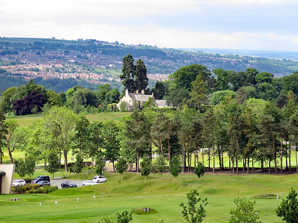
High Close House seen over Close House golf driving range. Photo A Curtis (2017)
John Smith married Frances Jackson from Southwell, Nottinghamshire on 21 October 1816 and emigrated with one infant, George, on the vessel, Shipley, bound for Australia on 18 December in the same year. By coincidence this was the same vessel which carried John Gill to Australia in 1821, having been convicted for the Great Heddon Tea Robbery.
In January 1818 John Smith received a land grant of 500 acres at Bringelly, about 50km west of Sydney. He named it Close House. Owing to the effect of heat on Frances' health, in 1820 they decided to move to Tasmania. John applied for and received a location order for 500 acres at Breadalbane about 7 miles south of Launceston. The property was named Marchington, after property inherited by Frances from her father Magnus Jackson.
Although Chris seems sure of John Smith's connection with High Close House he is not quite so certain of the rest of the tale, a collection of family stories, heirlooms, family likenesses and genetics which suggest that John Smith might actually have been the son of Prince George (later King George IV 1820-30) and Maria Fitzherbert. They were secretly married in 1785 but later annulled.
Could John have been paid off for his silence and encouraged to emigrate as far away as possible? He is only one of several who claim to be children of George. If true, John Smith would have been a cousin of Queen Victoria.
Is there another reason John could have been placed with the Smiths at High Close House? No connection is yet known between Maria Fitzherbert and George and Isabella Smith. However, there are local connections. Maria's cousin, Sir Edward Smythe owned Esh Hall near Durham until his death in 1811, and her uncle, Henry Errington posessed Beaufront Castle near Hexham, only 15km west of Close House estate. Henry's will referred to his nephews (Maria's brothers), Charles and Henry 'Smith'.
Chris has produced a nicely written, well documented and balanced assessment of the evidence which you can read below. Perhaps more will come to light in the future. Read it and make up your own mind.
 RSS Feed
