
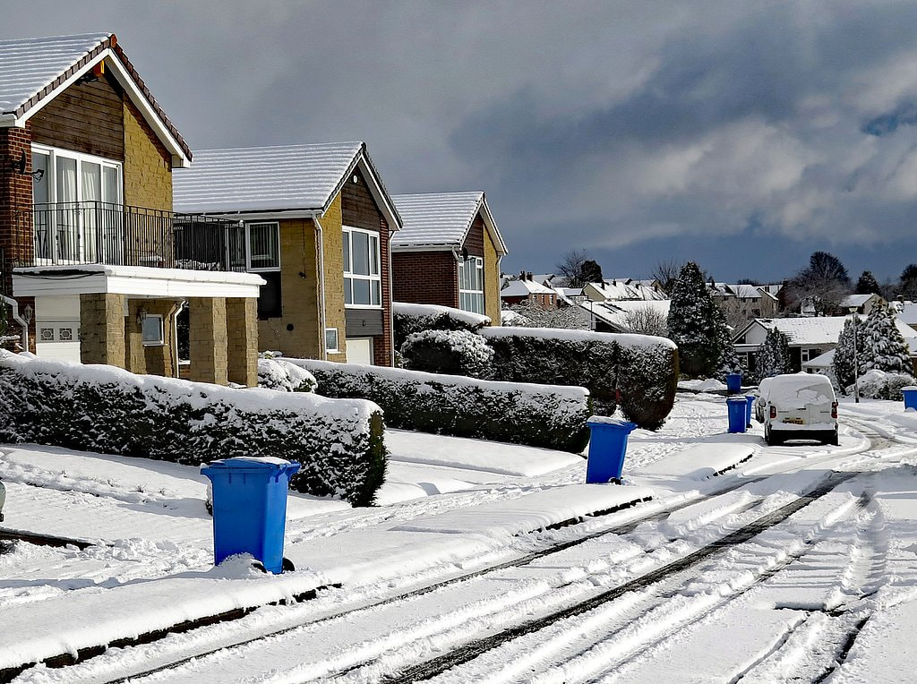
Killiebrigs, Heddon on the Wall. Photo A Curtis (2018).
The western housing estate in Heddon on the Wall, sometimes called the Bainbridge Estate (from the builders; to differentiate it from the Vallum Estate on the east side), mainly occupies what was originally Crag(e) Field of the Heddon Banks Estate.
There is a nice aerial photo of housing estate as it was being built, discussed on the blog here.
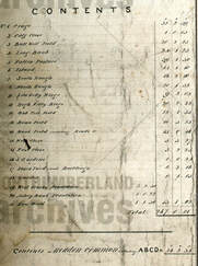
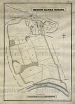
I have (below) annotated parts of the two adjoined sheets (LXXXVII and XCVI) of the first edition 1:10,560 scale OS maps (1864-65) with the field-names taken from a plan of Heddon Banks Estate dated 1827 (NRO 00309/M/69).
There is a nice aerial photo of housing estate as it was being built, discussed on the blog here.
I have (below) annotated parts of the two adjoined sheets (LXXXVII and XCVI) of the first edition 1:10,560 scale OS maps (1864-65) with the field-names taken from a plan of Heddon Banks Estate dated 1827 (NRO 00309/M/69).
All of the streets on the new housing estate were given Roman sounding names: Trajan Walk, Remus Avenue, Aquila Drive, Campus Martius, Mithras Gardens, Taberna Close. Similar names were used on the Vallum Estate and of course for Centurion Way that connects the two.
One street on the south side of the western estate was a slightly later addition and was named Killiebrigs. I often wondered where this name had come from as it is clearly not Roman and seems more Irish or Scottish.
Comparison of the maps shows that this street extends through the original fields to the south of Crag Field, named on the 1827 plan as West Close and East Close.
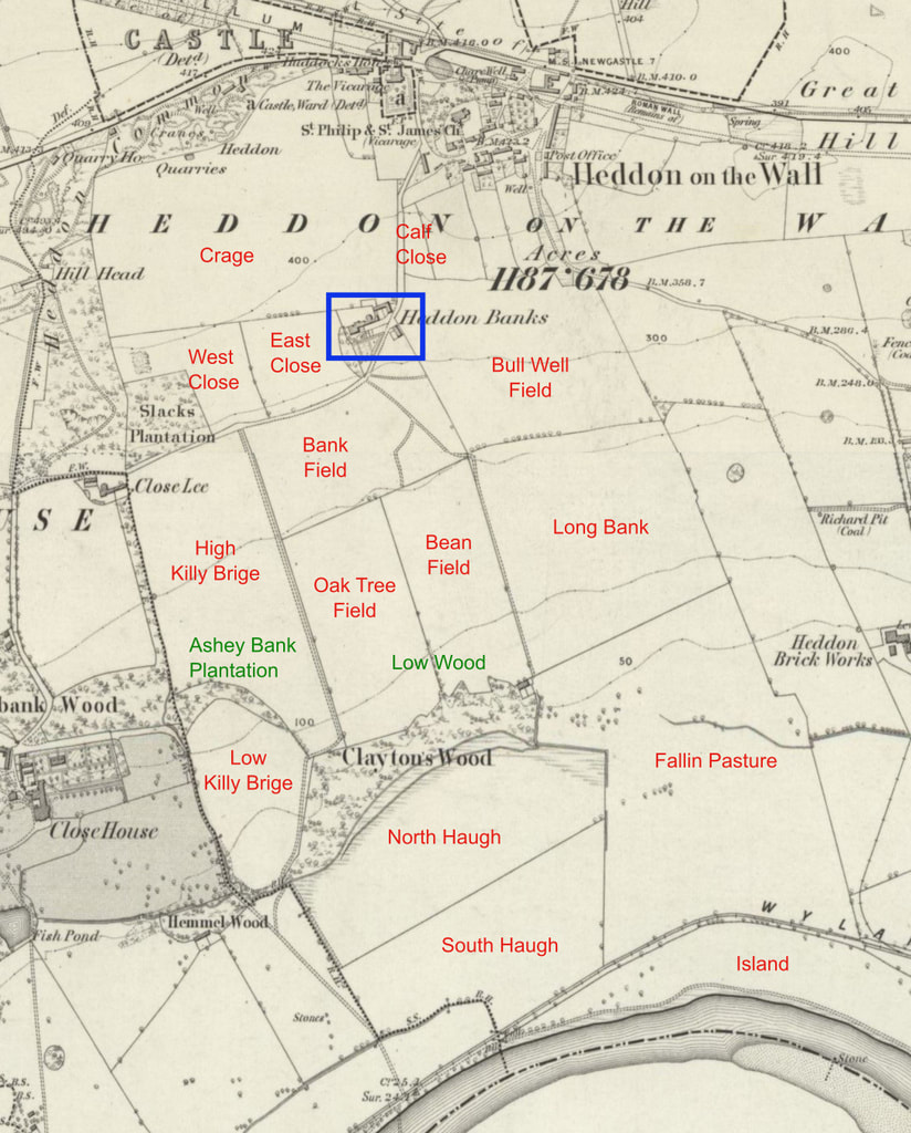
OS 1:10,560 First Edition (1864) annoted with field-names taken from 1827 plan of Heddon Banks Estate (NRO 00309/M/69)
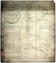
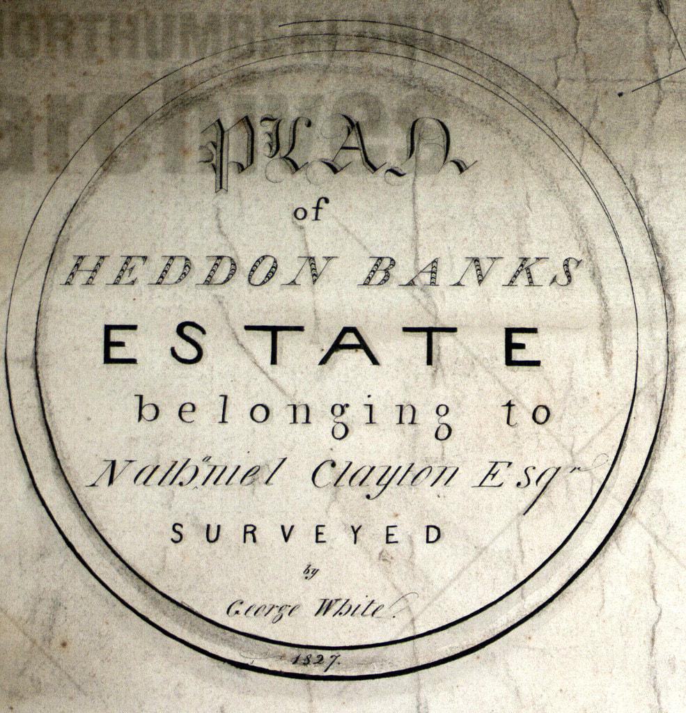
Plan of Heddon Bank estate, Heddon-on-the-Wall (1827). Northumberland Archives: NRO 00309/M/69. Click for link.
Excert from Plan of Heddon Bank estate, Heddon-on-the-Wall (1827). Northumberland Archives: NRO 00309/M/69
Excert from Plan of Heddon Bank estate, Heddon-on-the-Wall (1827). Northumberland Archives: NRO 00309/M/69
The Tithe Map of Heddon Banks Estate from 1849 shown below is very nicely drawn but doesn't provide the names of the fields.
 Tithe map of Heddon Bank estate, Heddon-on-the-Wall (1849). Northumberland Archives: NRO 00309/M/68 | 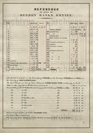 Tithe map of Heddon Bank estate, Heddon-on-the-Wall (1849). Northumberland Archives: NRO 00309/M/68 |
We can now see where the name of the street, Killiebrigs, came from. It was derived from the names of two fields, High and Low Killy Brig(e), close to that location on the Heddon Banks Estate. What, however, could be the origin of the names given to the fields?
Brig clearly indicates a bridge.
There is still today a very well-built stone bridge, just east of Close Lea, close to the location of these fields. It took the course of the quarry incline under the track from Heddon Banks to Close Lea. There is a photo of the bridge here.
However, the quarry in Slack Plantation was opened much later than the 1827 plan that shows the field names. The quarry and its tramway incline are indeed not present on the first edition OS map.
Could there be an Irish or Scottish connection to the field-names?
Killybegs (Irish: Na Cealla Beaga) is a town in County Donegal, Ireland. It is the largest fishing port on the island of Ireland. Its Irish name, Na Cealla Beaga, means 'little cells', a reference to early monastic settlements.
Gaelic cill (pronounced keel) originally meant ‘cell, church’ from Old Irish cell, (ultimately from Latin cella) and now usually means ‘chapel, churchyard’ in modern Gaelic. It is found in a large number of place-names, whose widespread distribution reflects the spread of the both Gaelic language and Celtic Christianity across Scotland. It is frequently used in combination with the name of the saint to whom the church is dedicated (e.g. Kilmartin, Kilmory, Kilpatrick).
Although no remains are visible now, there was a chapel just west of the field of Low Killy Brig, west of the boundary between Heddon on the Wall and Houghton & Close House townships. It stood close to the mansion of Close House:
The area of Close House was probably occupied since at least the thirteenth century but the present house dates only from 1779. The name was originally thought to be Albery Close, which became corrupted as Abbey-le-Close, and gave rise to the belief that it was formerly the site of a monastic house. There was a chantry here though, first referred to in 1313, whose patron was one John Turpyn, the son of Richard Turpyn (Turpin) of Whitchester. The old chapel was pulled down in 1779 when the present mansion was built.
Could there have been a bridge somewhere in the vicinity of the fields, providing access to the Close House Chantry?
It seems perhaps more likely that the origin of the field-name was rather more prosaic.

NORTHUMBERLAND WORDS. A GLOSSABY OF WORDS USED IN THE COUNTY OF NORTHUMBERLAND AND ON THE TYNESIDE. BY Richard Oliver Heslop. Published for the English Dialect Society(1893-84).
Volume 1 and Volume II
KILLY-COUPER, an upset heels over head.
Killicoup, a somerset [archaic spelling of somersault].
Killie is a plank or beam placed on a wall so that one end projects a good way further than the other. A child then places himself upon the long end, while two or three press down the short end, so as to cause him to mount."— Jamieson.
John Jamieson (1759-1838), was author of the Etymological Dictionary of the Scottish Language, published in 1808, which was a landmark in the development of historical lexicography and in the study of the Scots language.
Jamieson's dictionary is available online.
Killie is given in the Supplement (Vol. 4; p.14).
Jamieson's dictionary is available online.
Killie is given in the Supplement (Vol. 4; p.14).
This suggests that the field-names could be just a memory of a simple plank bridge, perhaps across a ditch or small stream. Maybe one that was prone to accidental upending.
It seems a little similar in this folk-lore origin of the name of Bays Leap farm.
If anyone has another theory or has more information, please let me know.
It seems a little similar in this folk-lore origin of the name of Bays Leap farm.
If anyone has another theory or has more information, please let me know.
 RSS Feed
