Meas & Meres
An experimental map showing Mea and Mere place-names in UK.
The data used on this map is based on the GB1900 (abridged) data-set:
GB1900 GAZETTEER (ABRIDGED) RELEASED UNDER CC-BY-SA LICENCE
Details of that project can be read here. The full distribution map of UK place-names can be found here
The data used on this map is based on the GB1900 (abridged) data-set:
GB1900 GAZETTEER (ABRIDGED) RELEASED UNDER CC-BY-SA LICENCE
Details of that project can be read here. The full distribution map of UK place-names can be found here
This map was created using GPS Visualizer's do-it-yourself geographic utilities.
Please wait while the map data loads...
Interest in the Mea place-names of the Northern Pennines arose from the Northumberland Ordnance Survey Name Book Project run by Prof. Diana Whaley, and a fellow volunteer on that project and archaeology colleague, Malcolm Mccallum. The latter also has a personal interest through family connections with Moudy Mea near South Stainmore.
The Allendale Name Books have four examples of Mea place-names: Whetstone Mea, along with two derivatives: Whetstonemea (a farmhouse) and Whetstonemea Burn (stream), and Rushymea, another small farmhouse on the edge of Carrshield Moor. Whetstone Mea is described in the Name Book entry as 'a portion of moorland within Allendale Common. It is principally white land of a wet nature.' Three authorities provided the name Whetstone Mere and an aditional two, Whetstone Mea. The accepted name used for the plan was altered to the latter and adopted for the first edition 6" map.
The 'Mea' names in general appear to be associated with boggy ground particularly in the uplands. They are shown on the map below in red. The Name Book entries show confusion with 'Mere', names which are also common in the upland areas and as the map below shows (as blue dots), overlaps somewhat with the distribution of the 'Mea' place-names.
The map only shows place-names which end with 'mea' which excludes derivative names such as those with a following sike, burn, well or rigg. Selection of these derivative names (which apply to another feature) is useful too as it may, for example indicate the presence of a forgotten mea place-name (as indicated perhaps by Blackmea Crag and Coltmea Gill). The search also finds 13 occurences of the name, Crimea which can be presumed to be irrelevant.
We have been told that the place, Moudy Mea, a hilltop above Stainmore, is pronounced Moudy 'May' or even Moudy 'Me' by locals. It would be interesting to know if this is the common for the other Meas. Of course if a long 'a' is stressed at the end of the word or it is mis-pronounced by those not familiar with the usual form, it could easily be confused with the perhaps better known word, 'mere'.
What can also be noticed from the map is that the upland meres are quite distinct in character from those of the Lake District, Yorkshire Wolds and Norfolk and those in Cheshire, Shropshire and further south. Commonly these are all open water bodies, large lakes or smaller village ponds. Where a water body can't be found at the location of these meres it can be supposed to have once existed and perhaps drained. This use of mere in place names is discuseed by Ann Cole (1993) in 'The distribution and use of mere as a generic in place names', EPNS Journal 25: 38-50.
In the North Pennine bogs there may be small patches of open water but a marsh or upland bog seems more likely for many. The names more often than not describe the bogs or marshes high on the moorland hills. These give rise to streams, sikes and burns which run down the hills and often have derivative names, such as Goldenmea Sike or Red Mea Sike.
There appears to be overlap and similarity in the feature described by both the upland Mea and Mere place-names. Is there any evidence that one has changed in time into the other, and which of the two terms might be the oldest or original formr?
Usage of Mea names is almost completely confined to western moorland areas of Northumberland and County Durham, and the Pennine regions of Eden and South Lakeland. There is a sizeable cluster in the Richmondshire area of North Yorkshire. There are a few interesting outliers, Skem Mea (NZ1488), an area of farmland in lowland Northumberland, north-west of Morpeth, and the River Mease in the West Midlands.
The entry for Skem Mea in this page of the OS Name Book of Mitford Parish describes it as "a small district of arable and pasture lands". Below, possibly added later: "The word mea signifies meadow - see Brockett's Glossary. These fields have never been a mere or marsh". It may be suspected that this statement justifies the correction of the name (by the OS surveyors) from Skem Mere, as it was originally written against three of the five authorities, to Skem Mea. Skemmere was, however, left uncorrected against one further authority, and its entry on the Property Plan.
There is also a Mea Beck on the North Yorkshire Moors. Another possible outlier in southern Northumberland is Fairley May (NZ0456) whose name appears to have been corrected from Fairley Mea in the Bywell St Peter OS Name Book (p.132). It is a small farmhouse on sloping farmland above Fairleymay Gill.
We are of course not the first to notice these unusual Mea place-names. They were described by D Embleton in Catalogue of Place-Names in Teesdale published in volume 9 of Natural History Transactions of Northumberland, Durham & Newcastle upon Tyne (1888), p.1-225.
The author equates mea with "A-S mæd, what is mown or cut down, medewe, mædewe, mædwe, meadow, meading (Streatfield)." Along with a variety of uses in other languages he says, "Mea appears to be synonymous with Lea". He provides the following examples: Golden Mea (colour), Moudy Mea (mouldy, damp, wet, 1701' high), Stony Mea, Swinket Mease Rigg. He mentions Maize Beck, "probably same as Celt. maes, a field, and mees, a grass field."
Although they might resemble green fields from down in the valleys, many of the upland Meas are not meadows at all although grass may grow well there and provide good feed for sheep. They seem in some cases to describe wet, boggy areas of moorland.
D Embleton quotes from a slightly earlier source, Mr Egglestone in Weardale Names (1886) who records,
"in Teesdale, west of Newbiggin [actually north of Newbiggin], there is Flushy Mea (Flushie Mere in the Ordnance Survey), Harwood Sow Mea, and not far from Green Hurth Lead Mine, Border Mea. In Garrigill (in Alston parish) there are the Ashgill Meas. These, except the first are not on my map.
The Weardale Meas are extensive stretches of land where springs of water abound, and consequently, where rushes, moss and long grass flourish,"
This author also mentions, "in Stanhope Hall Estate, Pity-Mea, a farm on the Mea full of pits or holes", and "There is a Pity-Me on the road from Chester-le-Street to Durham, in a colliery district."
I have added the nine occurances of Pity Me from the gb1900 data (and a Wae's Me) to the map above (in black). They are all names of houses and their distribution suggests to us that their derivation is unlikley to be the same as the upland Meas.
In a series of articles on the place-names of Tessdale in the Teesdale Mercury, J W Stokoe discusses bog and marsh names, including Meas, on Wednesday 27th February 1929 (p.10).
He equates Mea from O.E., merse, a marsh. "These are long stretches of the heath usually the home of rushes and long grass, many streams seem to have their source here and are afterwards known as mea sikes or mea becks.
The examples he gives are: Carnigill Mease ("O.N. kiarr, marshy ground. Stretches of land where springs abound."), and Swinket Mease ("O.N. Svioa, to burn. The place which was cleared by burning.")
Watts, V. (2001) in Place-name evidence on the Stainmore Pass. pp. 12-18. In: Stainmore: the archaeology of a North Pennine pass. Tees Archaeology Monograph Series, volume 1. London: English Heritage discusses the origin of the name Moudy Mea. He reports that it was Moudy Mere in 1843, becoming Mea in 1863. The derivation of Moudy from Northern dialect moudie, moudy, 'a mole' (short for moudy-warp, OE moldweorp) and ModE dialect mea pasture. This information comes from A H Smith's The Place Names of Westmorland, volume 43, Cambridge University Press (1967). Many of the entries appear to be detailed on the web-site of the English Place-name Society.
My objection to this derivation is the thought that I feel unsure that moles would thrive or indeed live at all in a wet moorland location. Perhaps I need to visit Moudy Mea to see if this would fit. This mea name appears to be applied these days to a hiil-top moorland location and a boggy area which might have originated the name is not immediately apparent. The origin of the name from mouldy seems much more likely.
My objection to this derivation is the thought that I feel unsure that moles would thrive or indeed live at all in a wet moorland location. Perhaps I need to visit Moudy Mea to see if this would fit. This mea name appears to be applied these days to a hiil-top moorland location and a boggy area which might have originated the name is not immediately apparent. The origin of the name from mouldy seems much more likely.
There are two further uses of the term, mere (or its alternative, meer) that need to be considered, and may have had an effect on place-names. It has been used to denote a boundary, usually in combination as Mere Dyke or Mere Sike or Mere Stone. One of the outlier meres on our map above is Shaw's Meer which is actually a salmon pool on the River Tweed. The pool names seems to refer to the English side of the river and its name likely relates to that boundary, something proposed by Williamson, E. (2018) Names of salmon pools in Berwickshire. Onomastica Uralica, 12, pp. 87-100.
Three other names on our map (above), West Mere, Middle Mere and East Mere in County Durham, sit on a very straight section of the parish boundary between Cotherstone and Lartington. Each of these names is now applied to a boundary stone. However, the boundary cuts right across the shallow head of Yoke Sike which is fed by patches of boggy ground so it is perhaps just as likley that the names originally refered to individual bogs.
The gb1900 dataset shows five examples of Mere Burn used as a place-name in Northumberland. In all but one of these cases (Netherwitton, NZ1190), the burn delineates a parish boundary. Four are located north of Morpeth and one in Shotley Low Quarter north of Consett. A Mere Sike (NY6742) defines the parish boundary between Glassonby and Alston Moor in Cumbria, and a Mere Gill (SE0394) on the parish boundary between Redmire and Castle Bolton parishes in Richmondshire, North Yorkshire. The Grey Mere Stone (NY7136) lies on the parish boundary between Culgaith and Ousby in Eden, Cumbria. There are many further examples of the use of mere as a boundary from around the country.
Another use of mere or meer is as a measure of land in lead mining areas. The best known are the Meer Stones of Grassington Moor. Miners were granted mining rights on areas of land on the mineral veins, called meers, in return for a share of the smelted lead being paid to the owner of the mineral rights. A meer was about 30 yards by 15 yards, and the original finder of the vein was granted two meers. One example of a place-name with this origin could be Twelve Meers' Mine near Eyam in the Derbyshire Dales. On our map (above) there is a Twenty Meres in a lead-mining area of Conistone Moor, south-east of Kettlewell. This is just north of Grassington Moor and probably has the same origin.
Shown on the above map are four places with identical names, The Meres. They are each recorded in the Ordnance Survey Name Book for Allendale Parish (references given below) and have quite similar descriptions:
The names of the second on the list were not subject to amendment but an alternative name, Mohope Meas, had been written below, although with no authority, and then scored out. The fourth entry was named White Meres by one of the four authorities, and Knockshield Meas was written above the entry with the authority given as "W B Beaumonts Esq. Estate Plan".
- The Meres, West Allen, NY7953, ref. 331:133
"A tract of wet benty grass west of the Middle Edge" - The Meres, West Allen, NY7649, ref. 332:27
"A district or tract of rough pasture land in Mohope Moor" - The Meres, West Allen, NY7848, ref. 332:58
"A small district on Allendale Common" - The Meres, Allendale, NY8248, ref. 332:141
"A tract of white benty land on the west side of Knockshield Burn"
The names of the second on the list were not subject to amendment but an alternative name, Mohope Meas, had been written below, although with no authority, and then scored out. The fourth entry was named White Meres by one of the four authorities, and Knockshield Meas was written above the entry with the authority given as "W B Beaumonts Esq. Estate Plan".
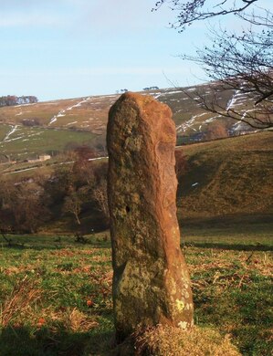
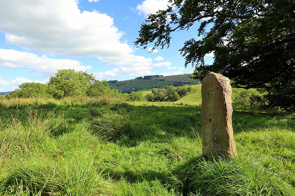
Some of these meres are in or close to lead mining areas and it is likely that the use of the word mere records tracts of land and relates to land use or division (mining or agriculture). Interestingly, there is a Mere Stone nearby in the Mohope valley shown in the photo below (from Geograph) which has the following caption [from a guide book on Isaac's Tea Trail] "the lone mere stone is a poignant reminder of the time when land at Mohope was held under common ownership until around the late 1700s. It would also have acted as a marker for the established path for livestock to be driven. It also served to differentiate land use between summer hay crops and winter pasture."
Although I strongly suspect that the stone shown in the photographs below is more likely to have once been a gatepost (from its location NY 7747 5103 where a track passed through a former field wall), this does not detract from the message. Indeed a standing stone nearby was cited by a witness in a parish boundary dispute between William Ord of Whitfield and Sir Walter Blackett of Hexham in 1757. It was probably somewhere in the vicinity of Blackpool Bridge across the River West Allen. It may have been prehistoric or specially erected to mark the boundary.
Although I strongly suspect that the stone shown in the photographs below is more likely to have once been a gatepost (from its location NY 7747 5103 where a track passed through a former field wall), this does not detract from the message. Indeed a standing stone nearby was cited by a witness in a parish boundary dispute between William Ord of Whitfield and Sir Walter Blackett of Hexham in 1757. It was probably somewhere in the vicinity of Blackpool Bridge across the River West Allen. It may have been prehistoric or specially erected to mark the boundary.
As well as The Meres, discussed above, the Allendale Name Books record seven further mere place-names. These are listed below:
- Hartley Mere, West Allen, NY8147, ref. 332:126
"A minor district (within Allendale Common) of rough benty land, part of which is very wet, which gives rise to the name mere". - White Mere, Allendale, NY8145, ref. 332:194
"A portion of marshy ground on Allendale Common". - Rough Meres, Allendale, NY8246, of ref. 332:197
"A minor portion of Swinhope Moor, lying on the east side of Swinhope Burn, it is principally wet benty grass". - Long Mere, Allendale, NY8345, ref. 332:209
"A long narrow portion of marshy land on Allendale Common". - Byerhope Mere, Allendale, NY8646, ref. 332:219
"A portion of wet benty ground on Allendale Common adjoining Byer Hope". - Low Mere, Allendale, NY8646, ref. 332:220
A dwelling house located just west of Byerhope Mere. - Bowey Mere, Allendale, NY8344, ref. 332:249
"A portion of white land on Middlehope Moor".
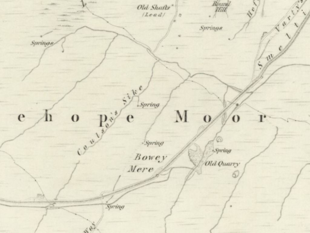
Some of these are distinctly marshy in character and have been depicted as such on the 6" OS map. Bowey Mere, for example, occupies an area of marsh with stream inflow and outflow between Coulson's Sike and the Allendale Smelt Mill chimney flue. It is depicted more of a distinct marsh on the second edition map. The place-names of both Long Mere and White Mere are orientated downhill following lines of drainage. However, as apaparent on the maps these are all in the Allendale Lead Mining area and the alternative use of mere in lead mining land division needs to be considered.
To garner further information about the possible use of mea/mere in the north Pennines, I approached Dr Greg Finch of the Dukesfield Smelters & Carriers Project and through him, Ian Forbes and Alan Blackburn, two local historians from Weardale who specialise in their local lead mining history.
A search of the transcribed Dukesfield Documents for names ending in mea for example found the following:
Letter – Nicholas Walton to William Corbett – 14 Oct 1737 (ref. TNA ADM 66 106)
Within a list a 42 "open and unopen Lead mines in Alston Moor and other parts of the Derwentwater Estate not Wrought by Geo Liddell Esqr etc." there is a "Sleate Mea". Apart from one or two obvious exceptions (North Vein, Middle Vein), and despite atrocious spelling, most of the names can be identified with place-names in the gb1900 data-set and all are named after existing topographic feature which include cleughs, riggs, sikes, burns, crags, mosses or settlements. There is no reason to suppose that Sleate Mea is not also an existing feature.
Letter – Nicholas Walton to Thomas Corbett – 24 Jan 1736 (ref. TNA ADM 66 105)
This earlier document has a Slate Mea with its location described:
Is distant from hors Edge abt ¼ of a Mile lying South Is bounderd on the East by part of AmeShaugh Common on the So by part of the Same on the west & north by the same, it was last tryed by John Jackson & Wm Hewatson about 5 years ago but did not prove here is little prospect
Horse Edge can still be found on the maps. It is a moorland ridge above Gilderdale, south-west of Alston in NY6844, but the place-name Slate Mea is no longer extant.
Letter – John Watson to Thomas Corbett – 18 Jul 1735 (ref. TNA ADM 66 105)
The list here of lead mines in Alston Moor provides several more historical mea place-names:
Slaley Mea, Hindley Mea, Gudamhill Mea, Hulgill Near Liverick Mea, Smal Burn Mea head, Wellgill Mea, Weatherall Mea, Broadmeay and Gorbatmeay. None of these appear on the first edition or later OS maps but the approximate location can sometimes be inferred from the mapping of related place-names.
Gorbatmea also appears in Deed – William Johnson – 6 Jan 1694 (ref. NRO ZRI 21 11), where the following statement is made:
"... the Said Humphrey Wharton did Lett and Sett unto the Said William Hymnas and Arthur Myres Three hundred yards of Ground in Length Westward and Twenty in breadth upon a Veine of Lead or Lead Oare called Gorbutmea in Rookhope in the parish of Stanhope ...".
There is a Corbitmere Dam near Rookhope Head (NY8744) with Old Shafts shown nearby. This was named Corbitmere Shaft on the first edition 6" OS of 1861.
There is another important thing to note from my limited survey of the names of the old lead mines (at least on Alston Moor) - there are no existing mere place-names on these lists, only meas.
Alan Blackburn told me the following (personal communication, August 2020):
"I could also, I think, compile a good argument to clarify that meres, as in Derbyshire lead mining, were never used in the North Pennines. They certainly were not used in Weardale. The mining customs of Weardale have used Taks or Takes for mining areas, measured in Yards, and described by ground features, for centuries. Meres and the measurement system with it, are part of the customary laws of Derbyshire, and our mining Customs derive from the Prince Bishops ownership of the lead mining rights, or for other parts of the North Pennines, from the old Mines Royal of the 12th cenury. In my humble opinion I don’t see these as wet hollows, more as summer Sheiling grazing meadows, high up yes, but capable of running beasts in the Summer. For instance, Gorbut Mea could well be a persons name. I suspect many Northern meres were meas, but got written down and interpreted incorrectly as meres, probably because mea or meade was an Old English term, and not used, but mere was known and sounded very similar."
Ian Forbes provided supporting evidence about lead mining exploration grants across the North Pennines being given by "tack notes", and that whereas the Derbyshire mere was for a very small area, in this region they covered a much longer length along the veins. He also sees the pronounciation as significant.
Meas (and some meres) are often still pronounced in the vernacular with the long "a". Thus, Handsome Mea at Nenthead is "Handsome May" and Corbitmere (as it is written on the 1st edition OS), at the head of the Rookhope valley, is "Corbitmay". This further differentiates the origin of the word from "mere" meaning a length of vein. If we suggest that mea was pronounced may locally, then we can add a number of mea place-names to the Weardale picture from 17th century lists of lead mines. Alan has mentioned some already and there was also Broadmasike on Middlehope fell, and Broadmay grove and Broadmayfoote on Swinhope fell. When considering Broad meas there is Broad meres in the Killhope valley on the Ordnance survey map which could well be a corruption of Broad meas. So meas seem to have been quite common on the fells of Weardale and some were broad.
I do wonder whether many of the meres you list from the OS books were originally meas but were subject to gentrification by the vicars and local worthies consulted for place names by the original OS mappers.
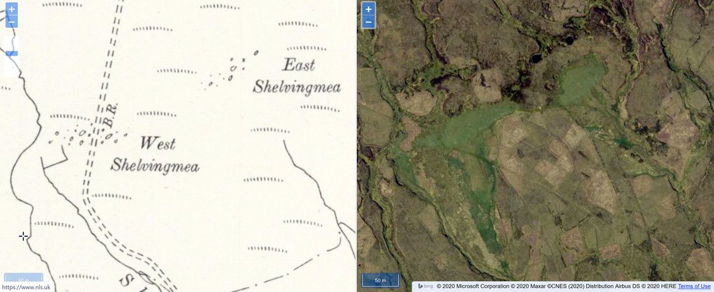
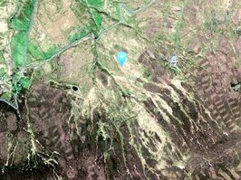
Without first hand evidence of the Name Books it can often be difficult to decide what kind of feature a place-name actually refers to. However, many meas and meres in the North Pennines coincide with wet patches of vegetation often around the springs and marshes at the head of sikes or streams. West and East Shelvingmea (NY7928) provide good examples. The satellite images coincide exactly with bright green areas which do look like marshes. Both the areas depicted on the maps are drained to the south by Shelvingmea Sike and Cocklake Sike respectively.
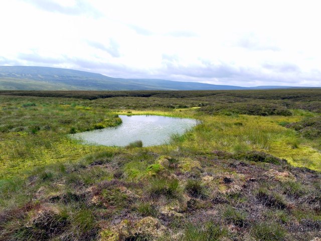
The one problem with this theory is that it is not right, as a recent visit shows (see below). The Shelvingmeas, and probably also Long Mea to their east, are actually small distinct areas of quite dry limestone grassland. The are defined by the underlying geology, green oases in a patchwork of otherwise coarse and boggy grassland and heather.
The one problem with this theory is that it is not right, as a recent visit shows (see below). The Shelvingmeas, and probably also Long Mea to their east, are actually small distinct areas of quite dry limestone grassland. The are defined by the underlying geology, green oases in a patchwork of otherwise coarse and boggy grassland and heather.
So what then do we make of the other two mea place-names close to the Shelving Meas: Golden Mea to the west (NY7827), and Long Mea to the east (NY8028)? The OS maps write these names over considerable tracts of apparently featureless moorland. Could both these names have originally referred to distinct marshy areas like the Shelvng Meas?
The best candidate for Golden Mea is the large area of marsh at the head of Goldenmea Sike. The OS names this as Goldenmea Head, with the name is written in blue on the 1:25,000 map. Aerial imagery suggests similar marshy areas very close to where the name, Long Mea is written. There is certainly bog land in this area probably draining south in long runnels, much disturbed by modern drainage. Could the names be hints of upland marshes, now forgotten or mislocated, presumably pre-dating the visits of the Ordnance Survey?
The best candidate for Golden Mea is the large area of marsh at the head of Goldenmea Sike. The OS names this as Goldenmea Head, with the name is written in blue on the 1:25,000 map. Aerial imagery suggests similar marshy areas very close to where the name, Long Mea is written. There is certainly bog land in this area probably draining south in long runnels, much disturbed by modern drainage. Could the names be hints of upland marshes, now forgotten or mislocated, presumably pre-dating the visits of the Ordnance Survey?
Further south in Great Sled Dale, North Yorkshire, there are good examples of mea/meres that seem to be marshes near others that don't. Adam Gill Mea (SD8398), for example, is shown on the 6" OS map as a series of short broken streams and marshes forming the head of Adam Gill. Just to its east though, Daddy Mea (SD8398) is written horizontally on a ridge west of Wavery Gill where marshy land seems unlikely. There is however, a Daddymea Edge written parallel with the west side of the stream slightly higher up. In Lancashire, south of Belmont, there is a moorland area called Daddy Meadows just above Daddy Meadows Springs (SD6714).
Higher up Great Sled Dale there is a similar pair, Short Gill Mea (SD8298) written above and parallel to Short Gill, and Red Mea (SD8198) looking much more like a tract of land to its north, although has a Red Mea Hole. This is of course a lead mining area, but if there is a connection these areas were never exploited.
Further west again on Abbotside Moor, there is a How Mea (SD8196) which contains a distinctly represented Howmea Bog just below the source of How Gill. Capley Mea (SD8296) on the east side of West Gill also looks like a division of the moorland between Bright Sike and Roundhill Sike. Capley Mea Hags occupy the flat moorland watershed above (SD8297).
Harry Mea (SD7696), west of the River Eden, is clearly identified as a discrete marshy area on Aisgill Moor. White Mea to its south (SD7692) much less clearly so.
The historical evidence for the name Moudy Mea described above suggests that Moudy Mere was an earlier form but there is some evidence for the contrary view.
There is an entry in the EPNS database for Dobson Mere Foot & Sike. The Sike flows south from below Stony Mea into Maize Beck, while Dobson Mere Foot is west of that junction. The data cites two historical forms, Dobson maie ffoote (1588) and Dobson Mea Sike from the 1859 OS. However, this is not the case as examination of the 6" scale first edition OS (Westmorland VI, survey 1859, published 1863) shows mere is recorded for both locations. The author states, "Mere is simply a spelling for ModE dia. mea 'pasture', which also occurs elsewhere in this parish; cf. Seavy Man."
Seavy Man, south-east of Kirkby Stephen, in the parish of Muker, North Yorkshire is recorded as being Seavy Mea in 1636 and Seve Man in 1652. "Originally 'sedgy pasture', from a derivative of ON sef 'sedge, rush' and ModE dial. mea 'pasture' (cf. Braidamaya YW vi, 251), which occurs in a dozen other local names like Flowery Mea (ii, 6supra ), Capple Mere (infra ), Moudy Mea, Dobson Mere (ii, 78, 109 infra ), etc. The name referred to a pile of stones on the county boundary at grid 90–803027, hence the substitution of man, which is used in the Lake District of a cairn on the top of a hill (v. NED s.v. man ), as in Greatrigg Man (i, 200supra ) and Knock Old Man (ii, 116infra)". Knock Old Man is actually in the North Pennines near Dufton but the Old Man of Consiton might have been a suitable example.
On the 6" OS map, Seavy Man is located some 350m east of the county boundary close to where a small tributary of Uldale Gill rises and is quite likely to be boggy ground, where mea would be appropriate. I am not aware if there is a cairn in that location although there is certainly a small pile of stones on High Pike Hill to the north-west.
There are a group of Capple Mere place-names in High Abbotside parish (North Yorkshire): Capple Mere Sike, Far Capple Mere and Low Capple Mere. The EPNS provides the following historical names for Capple Mere Sike: Chappell may sike (1652), Capell meysike (1684) and Caplay Meay Sike (1776). These all support mea being the earlier term, becoming mere at a later date. Two place-names in Craven, Thornton in Lonsdale: Braidamaya and Blakeamaya, may have a similar origin to the Mea names and both areas could well have been boggy moorland in past times.
What conclusions (if any) can we make from all this? We tentatively propose the following;
- The Mea place-names are almost completely restricted in their distribution to a limited area of the north Pennine uplands.
- In this area of the country, Mea and Mere appear almost interchangeable, probably applying to similar features, with perhaps the two forms coined as a result of local pronounciation or dialect.
- There does appear to be some heterogeneity in the features to which they have been applied. Unlike the Meres of the Lake District, eastern and southern England, the Meres and Meas of the north Pennines do not refer to open bodies of water.
- Many of the names appear to apply to wet areas of moorland and some can apparently be identified more particularly with distinct marshes or upland bogs. In some cases it is possible to speculate from topology that the names may well have referred to bogs in the past. However, other bog names were used in the same areas, mosses, flows and bogs.
- If the North Pennine mea and mere place-names don't refer to upland marshes then Alan's suggestion above would appear the best candidate, "summer Sheiling grazing meadows, high up yes, but capable of running beasts in the summer".
- If the lack of mere names in the lead mining notes can be confirmed then mea looks like the original form
- Others meas, though, appear to delineate larger tracts of moorland (which may or may not be particularly marshy) and may have originated from former land division or land-use, particularly with regard to lead-mining or agricultural use.
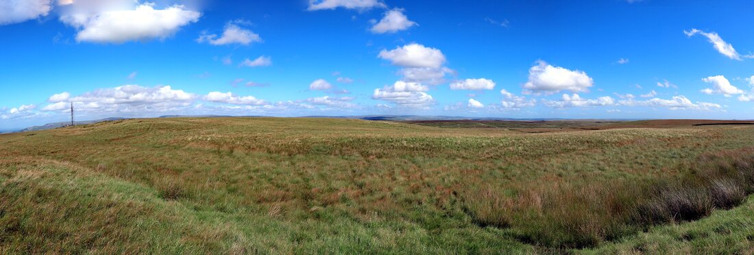
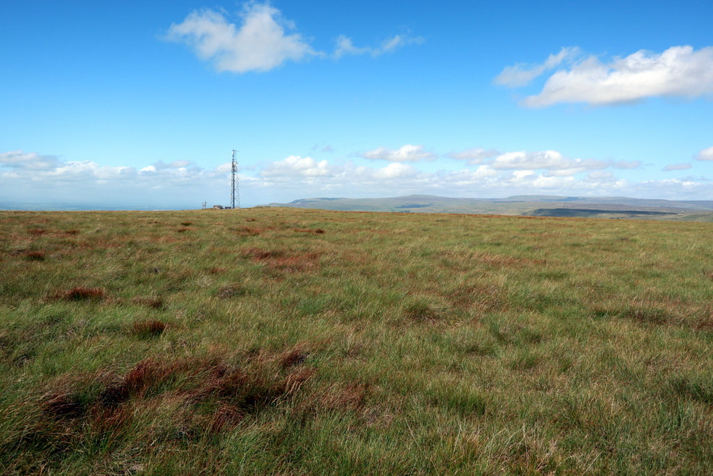
Back to just one example, our old friend Moudy Mea. Could we consider the following scenario? Moudy Mea is now applied to the 1701 foot (518m) hill top just east of the telecommunications mast at the top of the track which ascends the hill from the west. It is rather an undistinguished summit, a moorland plateau, and it is hard to determine the highest point which on the modern map reaches 522m a short distance to the south-east.
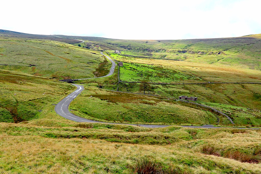
The hill forms part of the watershed between the River Greta and the River Eden. It is more impressive on the west side and form the north, where it drops steeply 200m to Stainmore Pass, and here on a slight bulge in the hillside contours, the name Margaret Hill is given on the OS maps. Perhaps the top of the hill never merited more distinction. What though was the feature originally responsible for the Mea? The first edition 6" map has a Greystone Moss just south of the access track to the west of the summit so the Mea. It has been drained but still recognisable from the springs at the head of a small sike which flows north under the access track. The map suggests it goes undergorund in the vicinity of the farm of Bleathgill. This seems to imply that Moudy Mea was unlikely to have been a Moss.
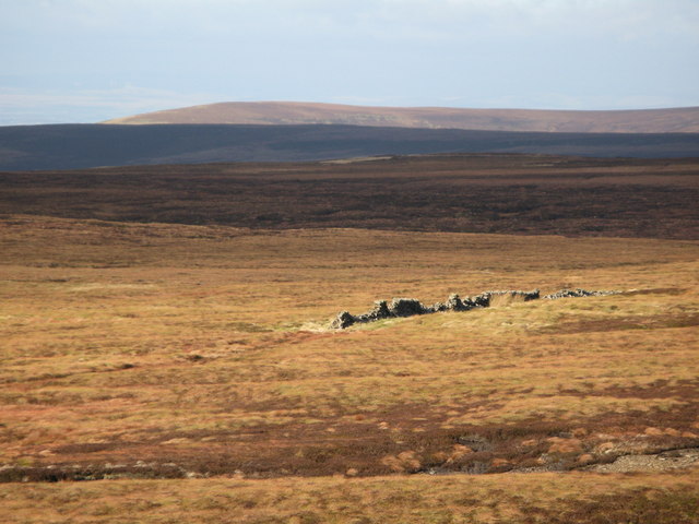
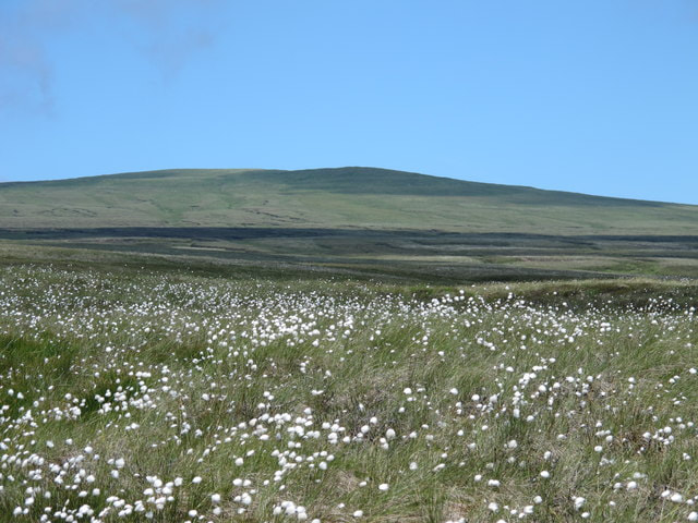
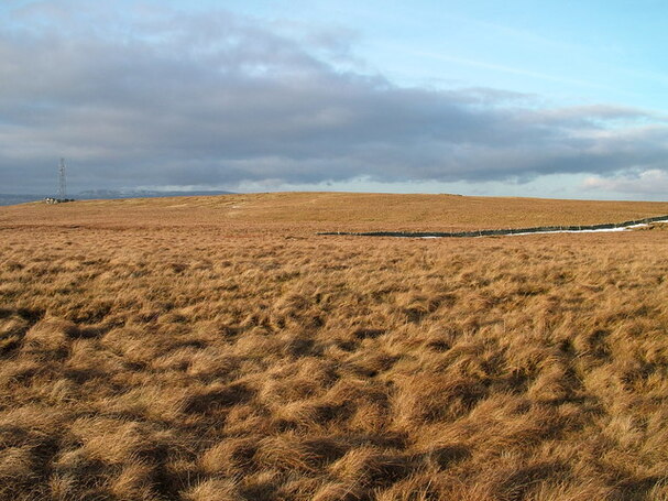
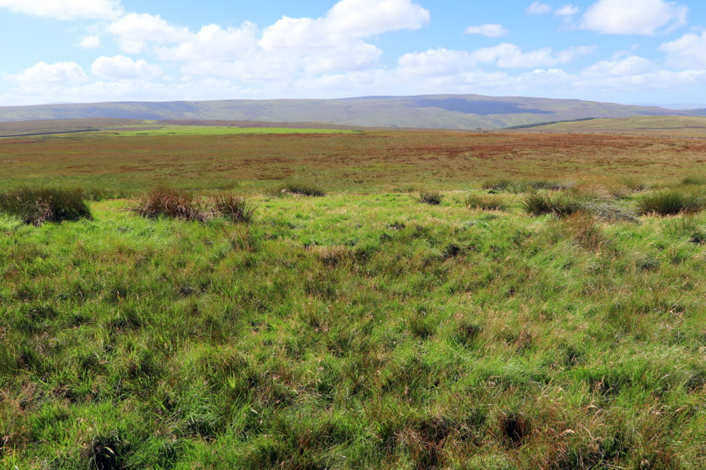
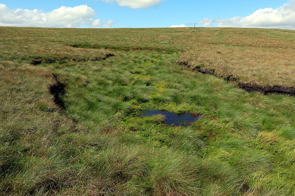
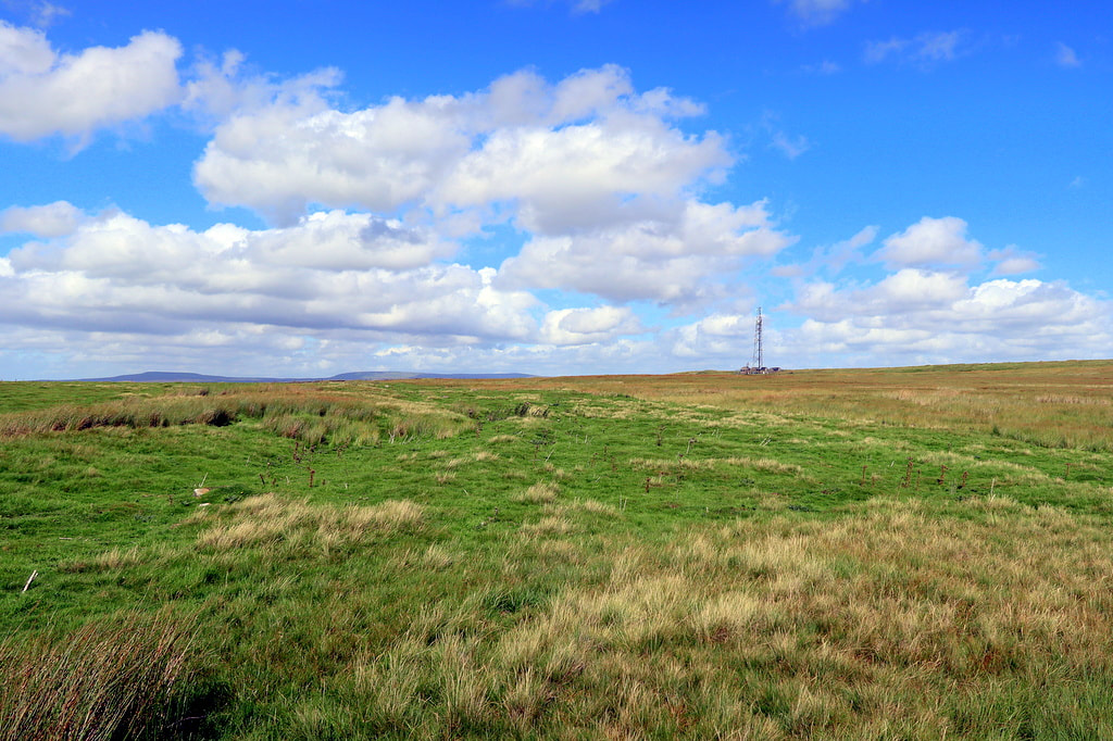
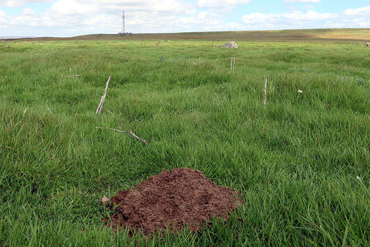
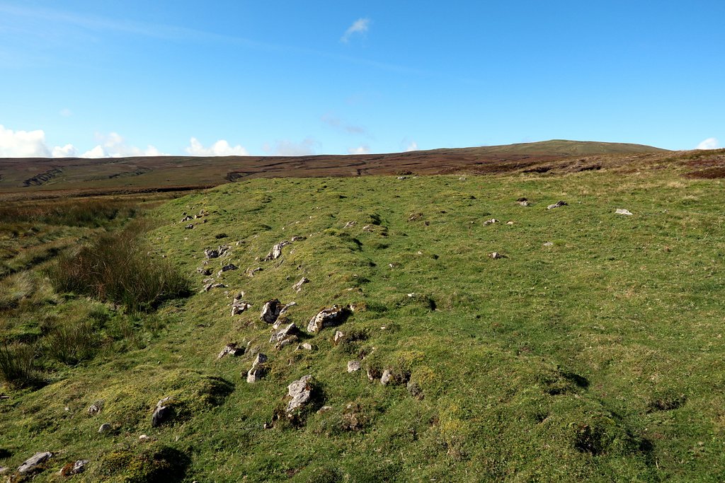
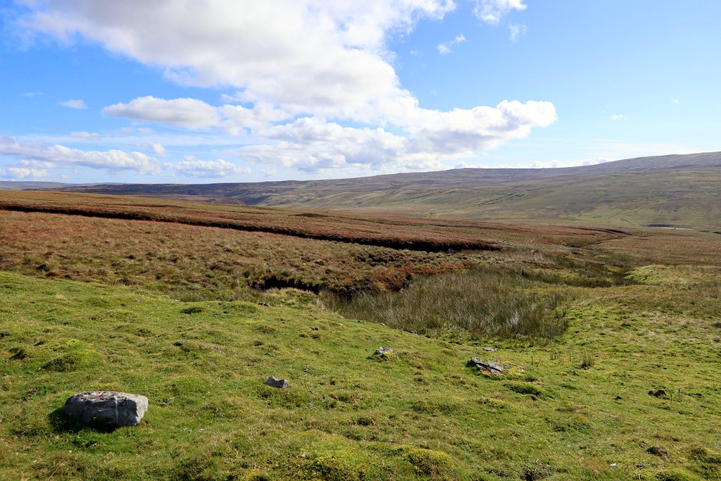
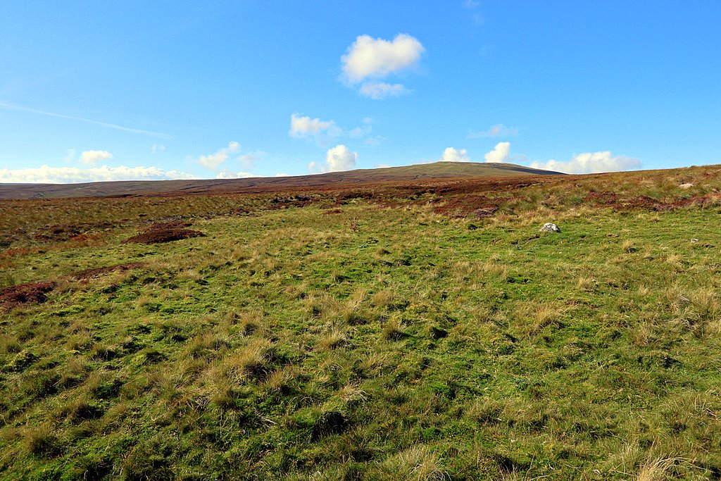
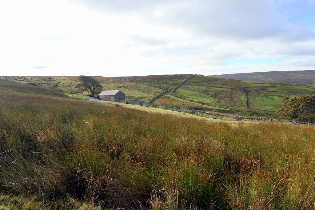
A visit with Malc in the summer of 2020 suggested four possibilities for the location of Moudy Mea, illustrated above
- the summit area itself (where the name was written on the first edition OS map and remains today). It is largely a boggy expanse of very rough grazing land with liitle to distinguish it from the surrounding area.
- a smaller defined zone of better grassland extending in a narrow band east from the communications mast along a low ridge. There is no distinguishing geology but it is likely to be better drained than the surrounding area because of its topography. It is distinuishable by its light green colour on the satellite images and may have extended below what is now the communications compound.
- three drainage channels shown on the first edition map.with bog and running water arising just east of the summit and place-name. There are similar channels to the south between Moudy Mea and Risp Howe. Drainage of the three channels is to the north and probably goes largely undergound where they reach the northern band of the Little Limestone. Not a good habitat for moles but definitely mouldy.
- an extensive area of fine grassland on a band of the Little Limestone south of Moudy Mea in the vicinity of Risp Howe. The area is replete with rabbits, soil from their burrows, and a few mole-hills! These last suggestions require a move of the place-name (predating the OS) which become associated with the top of the hill itself.
Below in Excel (.xlsx) format is Malcolm's Gazeteer of mea and mere place-names in the north of England. Locations are taken from online OS 1:25,000 scale mapping.
| gazeteer_of_mea_and_mere_place-names.xlsx | |
| File Size: | 28 kb |
| File Type: | xlsx |
Meas & Meres of Allendale Common (Coalcleugh & Middlehope Moors)
September 2020
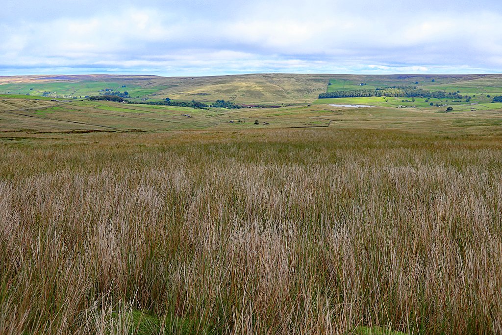
In September 2020 I visited the former lead-mining village of Coalcleugh and its nearby meas and meres: Whetstone Mea, Bowey Mere, Long Mere and White Mere. I can verify two things, that they are all wet places, marshes in any sense, and that some of them have been subject to Ordnance Survey mapping changes over the years.
As I mention above, two old miners cottages on the edge of a small area of enclosed land, east of Coalcleugh, known as The States, are named Whetstonemea and Rushymea. A family history reference about the area tells me that another, shown on the maps as Bracken House (perhaps from Breckon House) is shown in the 1841 census as Brekkonmea.
Whetstonemea Burn (stream) and Whetstone Mea (moorland marsh) are still known but there is no equivalent Rushy Mea or Brekkon Mea, perhaps also names of nearby forgotten marshes.
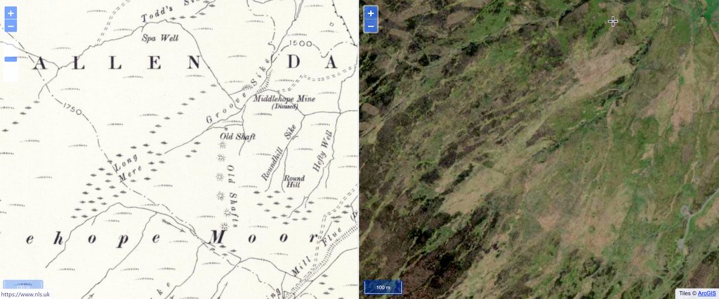
From the first edition OS in 1865, for almost 100 years, Whetstone Mea is indicated on the 1:10,560 scale on the east side of the branching system of streams (including Washpool Cleugh) feeding into Whetstonemea Burn. In 1969 with the new 1:10,000 scale, the name was removed from this location and is written twice, to the south side of the drainage network (west of Green Hills) and on the west side, just above the remains of Coalcleugh Reservoir. All three of these areas are marshy, poorly drained areas of grass, rushes and moss. Much further south in the drainage system towards the watershed which forms the (undefined) County boundary, grassy drainage channels cut deeply through the peat, separating drier islands of heather. The whole area of this stream catchment stands out on satellite images as a network of light green among the darker and much drier heath which is managed for grouse shooting.
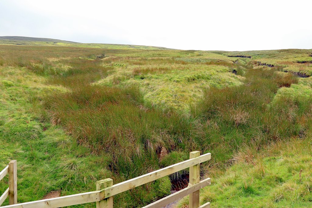
East of Killhope Law on Middlehope Moor at a height of about 580m is Bowey Mere. The mere occupies a natural bowl in the moorland fed by a spring and drained by a sike below a natural lip. There can be no doubt that this is a marsh as clearly indicated by symbols on the large scale maps and with the name marked in blue on the modern 1:25,000 map. The Northumberland OS Name Book description about "a portion of white land on Middlehope Moor" fails to tell the full story. After rain, you can hear much of the water running just below the surface but plenty is left higher up to test the footwear. It is a distinct upland marsh, probably determined by topography rather than geology.
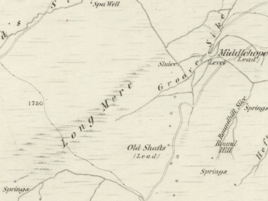
Long Mere is another distinct area of marshy grass and reeds at the head of Groove Sike. It drains to the north-east by an intermittent sike but of its intake captured in the former lead-mining days and taken south-east along the line of the 1750' contour by a now overgrown aqueduct.
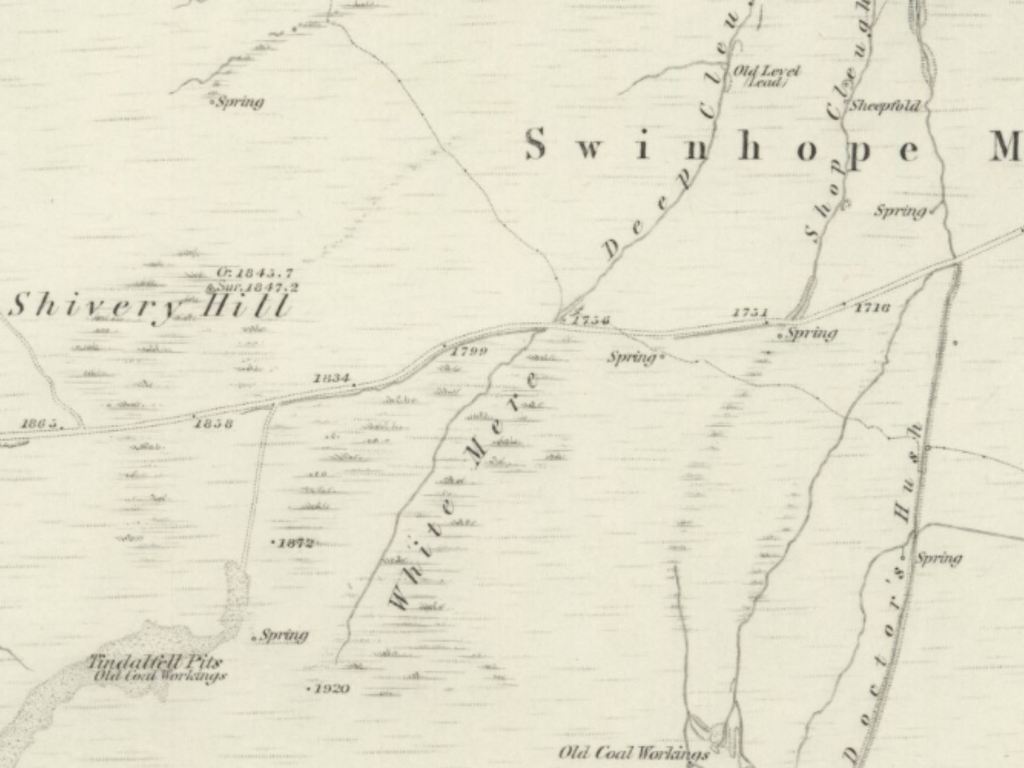
My final visit was to White Mere (above the road) which is the boggy grassy moorland catchment to Deep Cleugh (below the road). Study of the old OS maps shows how the depiction of the two streams has changed over the years resulting in pushing the place-name of White Mere on modern maps to the east. White Mere is most definitely another linear area of moorland marsh. The White part of the place-name could come from the appearance of the sun bleached stems of its extensive field of rushes.
Having experienced these four mea/meres of Allendale Common at first hand (and with my shoes drying on the radiator) I would have to agree with Weardale's Mr Egglestone as it seems here that:
Meas [and meres] are extensive stretches of land where springs of water abound, and consequently, where rushes, moss and long grass flourish.
This does not of course exclude a more agricultural definition. On a generally unproductive moor of rough pasture or heath, mineral-rich flushes of water may cultivate good grass for feeding stock on otherwise unfertile ground. However, when wet these areas are not comfortable, or sometimes even safe, to cross, and probably best avoided by man and beast.
Visit to West & East Shelvingmea above Cow Green Reservoir
September 2020
A visit to West and East Shelvingmea and Long Mea on the slopes of Meldon Fell above Birkdale with Malc in September 2020.
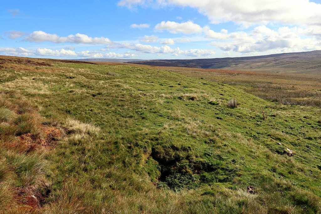
West Shelvingmea is a small area of dry limestone grassland just east of Shelvingmea Sike in what is otherwise boggy moorland and rough pasture. A narrow band of the Carboniferous Jew Limestone lies here just beneath the surface. East Shelvingmea is a similar area of grassland to the east along the same band of limestone. Drainage from the boggy moorland above these grassland areas goes below the surface via sink-holes on their northern edges.
Although a lot less obvious, Long Mea to the north-east, close to Great Cocklake, may have been a similar feature as small areas of limestone grassland are to be found close to where the maps show that place-name. The name, Cocklake, is nothing to do with open water but apparently derived from moorland areas associated with leck sites of the Blackcock or Black Grouse.
Visit to Byerhope Mere near Allenheads
October 2020
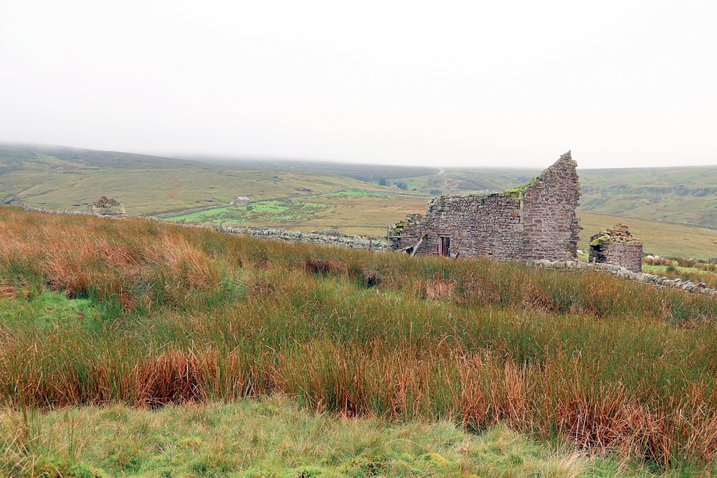
Byerhope Mere is described by the Ordnance Survey Book of Reference to the Parish (1862) as 'marshy ground', and gives its name to the nearby cottage of Byerhopemere Head (on the left, now converted into a shooting hut) and also probably, Low Mere, which is a ruin nearby (right, by the trees). The Poll Book of 1833 refers to a 'Low Byerhope-mea' occupied by Joseph Curry, and this is probably the same place. Byerhope Mere is a marshy area of dense rushes fed by emerging springs which run west to the Byerhope Burn.
It is interesting that in an area of very small farms (a former community of miner-farmers), the properties were distinguished by naming them after a nearby marsh, at the head of the valley of Byer Hope.
It is interesting that in an area of very small farms (a former community of miner-farmers), the properties were distinguished by naming them after a nearby marsh, at the head of the valley of Byer Hope.
Visit to Broad Mere on Hexhamshire Common
October 2020
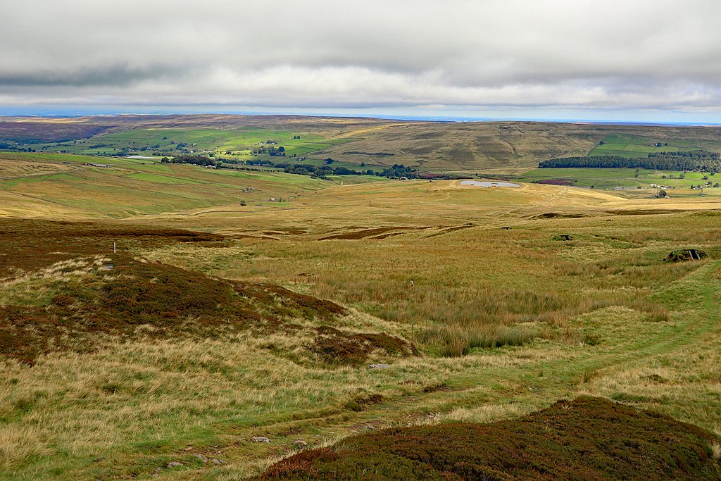
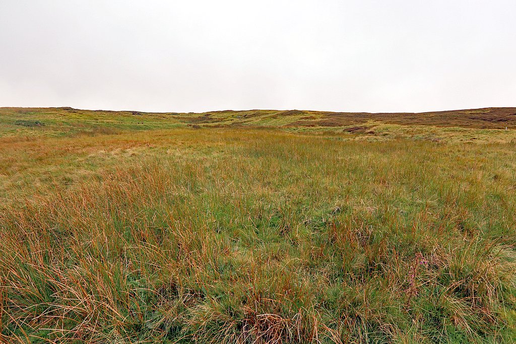
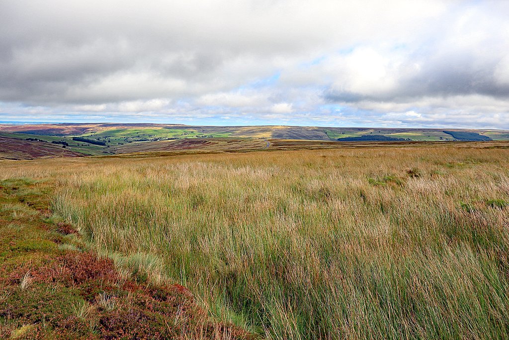
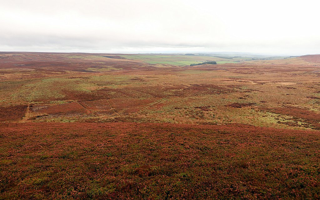
The place-name, Broad Mere, spans the flat area at the head of two unnamed sikes that drain north to Knight's Cleugh. The area is defined on the 1:25,000 OS map (1937-1961 series) by a sharp reentrant in the 1200 foot contour line (approximately 365m).
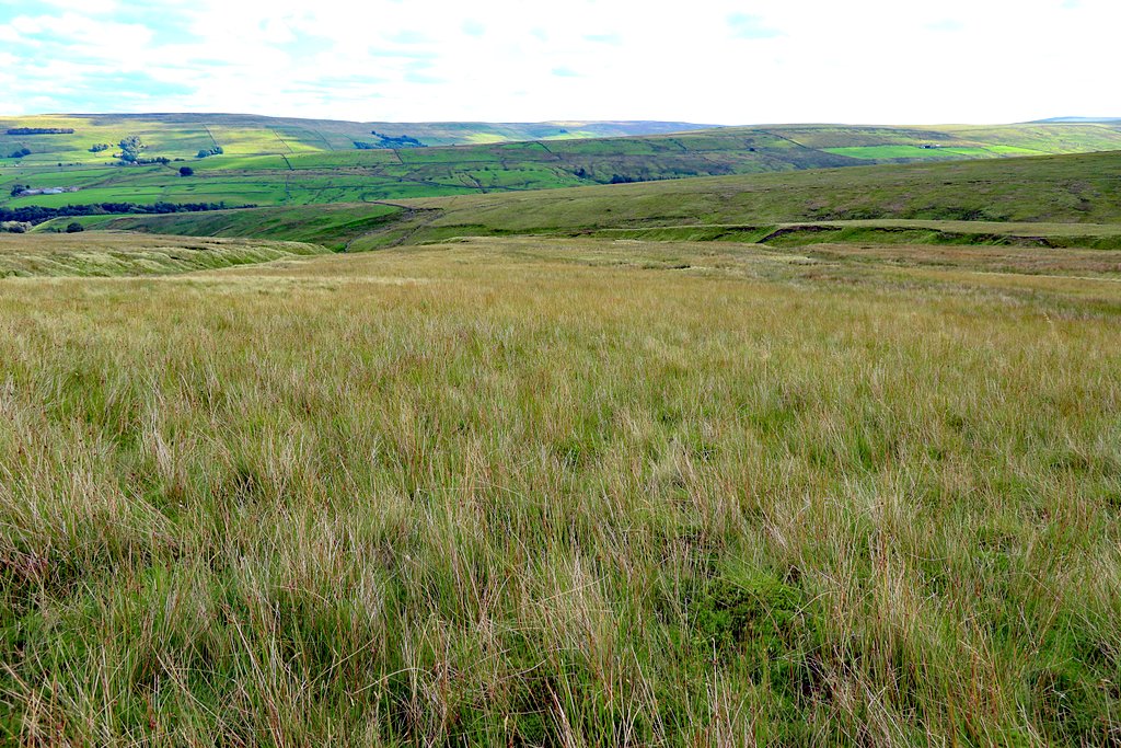
The vegetation, below where I stand on the higher and drier heather of the foreground ridge, is rough tussocky grassland and undoubtedly wet as indicated on the same map which has blue marsh symbols at the head of the two shallow valleys. The contours are less clear on the modern map of the same scale, and the marshes are no longer indicated. Satellite images show that the land has been subject to extensive modern parallel drainage. Drying out of the land encourages the growth of heather suiting the modern land-use of Westburnhope Moor to rear grouse for shooting. Improved drainage has probably shrunk the two former marshes, maybe once co-joined, suiting the name, Broad Mere.
The vegetation, below where I stand on the higher and drier heather of the foreground ridge, is rough tussocky grassland and undoubtedly wet as indicated on the same map which has blue marsh symbols at the head of the two shallow valleys. The contours are less clear on the modern map of the same scale, and the marshes are no longer indicated. Satellite images show that the land has been subject to extensive modern parallel drainage. Drying out of the land encourages the growth of heather suiting the modern land-use of Westburnhope Moor to rear grouse for shooting. Improved drainage has probably shrunk the two former marshes, maybe once co-joined, suiting the name, Broad Mere.

