
To focus my mind on the Wylam Waggonway for the Puffing Billy Festival I decided to create a map of the waggonway so that I could discuss some things that interest me along its route. As always I am particularly interested in finding clues to the past which can still be seen today.
This will be an ongoing blog and I will add to it as I feel inspired.
This will be an ongoing blog and I will add to it as I feel inspired.
View Wylam Waggonway in a larger map
Key to map above:
Red: North Wylam, Newburn & Scotswood Railway where it diverges from the route of the former Waggonway.
Blue: approximate route of Wylam Waggonway (1859 Map)
Green: Mineral line (single track) closely parallel to railway line (double track) - possibly on the original waggonway line.
Purple: Early Throckley Waggonway (1859 map)
Pink: Later Throckley Waggonway (1897 map)
Yellow: Throckley Isabella Mineral Railway (1897 map)
Light Blue: North Walbottle Waggonway (1859 Map)
Yellow Pin: Named feature
You might ask, with good reason, where is this blog going?
The answer to that, is from Wylam Colliery to Lemington Staiths, exactly the route taken by the original Wylam Waggonway. I probably won't stick to a linear route but might dodge around a bit in the following dialogue. Like everything I look at, there's often more questions than answers. In reality this will be a process in outlining the things about the Waggonway I don't know. Then I can find someone to tell me the answers.
The answer to that, is from Wylam Colliery to Lemington Staiths, exactly the route taken by the original Wylam Waggonway. I probably won't stick to a linear route but might dodge around a bit in the following dialogue. Like everything I look at, there's often more questions than answers. In reality this will be a process in outlining the things about the Waggonway I don't know. Then I can find someone to tell me the answers.
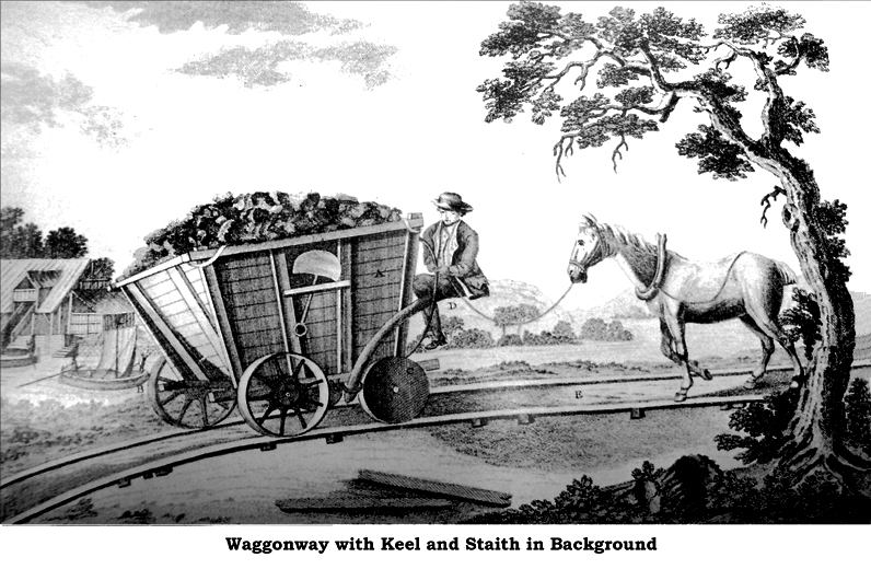
Illustration from the Esther M. Zimmer Lederberg Memorial Website collection.
First though a brief summary.
Wylam Waggonway summary:
- Built around 1748 for John Blackett, the owner of Wylam Colliery.
- Carried coal 5 miles from Wylam Colliery to staiths on River Tyne at Lemington where it was loaded on to keel boats.
- 5 foot ½ inch gauge timber rails, 3.5 inches wide, 4.5 inches deep attached to stone sleepers at 18 inch intervals.
- One loaded waggon was originally pulled by a single horse.
- Iron plate rails laid in 1808 enabled a single horse to pull two laden waggons instead of only one.
- Steam locomotives Puffing Billy (1813) & Wylam Dilly (1815) were built for the current owner of Wylam Colliery, Christopher Blackett. The locomotives weighed over eight tons each, and the tender a further four tons. Each could haul an average total load of about 50 tons (about 10 loaded waggons) at a speed of nearly five m.p.h. The engines ran until the early 1860s.
- The engines were originally mounted on four wheels, but because their weight frequently broke the cast iron rails, they had to be remounted on eight wheels two or three years later.
- Between 1827 and 1830, the plate rails were replaced by the, then standard, edge rails (for flanged wheels) at a four foot gauge.
- Wylam Colliery closed in 1868 and the waggonway became disused.
- The Scotswood to North Wylam railway line, a branch of the Newcastle to Carlisle Railway, opened in 1875-76, following part of the waggonway route.
- This railway line closed in 1966, the tracks removed in 1972, and part of the route of the Waggonway was turned into a public bridleway.
John Gibson's map of 1788

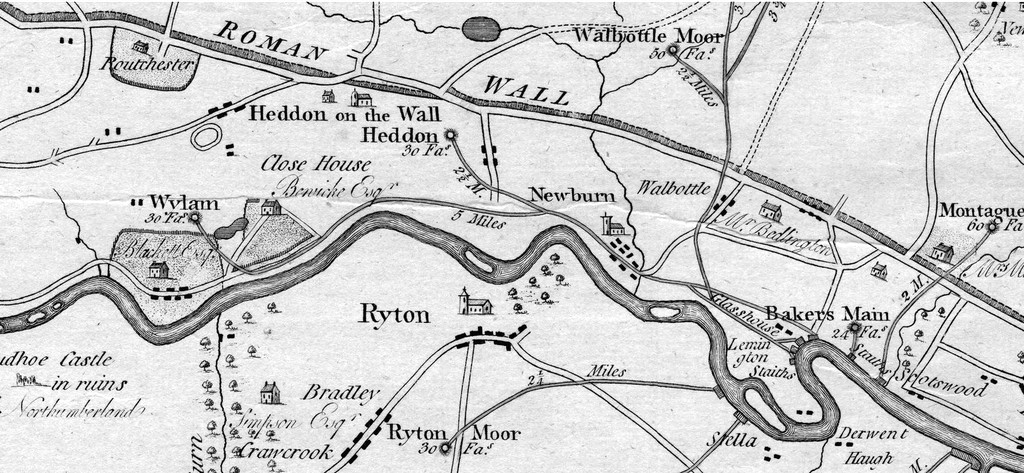
Plan of the collieries on the rivers Tyne and Wear by John Gibson (1788).
The section of John Gibson's 1788 map above shows the collieries and the main waggonways.
The colliery at Wylam Link is shown at some distance from the river and may actually refer to one of the early pits north of the village, perhaps in Engine Dene or even Dayhole Dene. The depth is recorded as 30 fathoms. The estate of Wylam Hall is shown with Blackett Esq. as the named incumbent.
The first edition OS map, however, show no old waggonways extending north of the village, the waggonway shown terminating at Haugh Pit, close to the river (near the present allotments), and another short loop to the north to serve Ann Pit just east of the village.
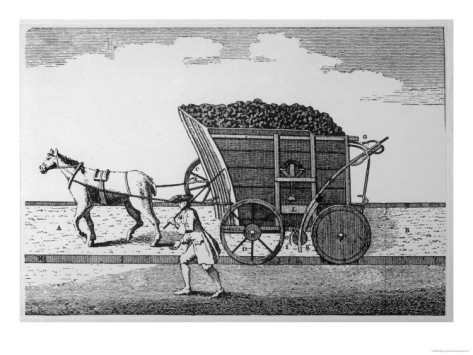
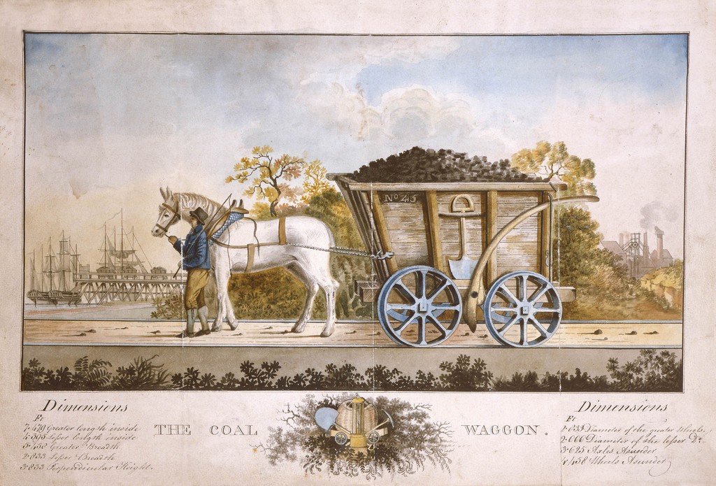 The Coal Waggon (c1870). Northumberland Archives Ref. ZMD 78/14. |  Dandy cart, Throckley Brickworks (1909). Newcastle Libraries Collection Ref. 050280. |
The map shows the waggonway passing to the south of Close House estate (Bewick Esq.) and the distance to the staiths at Lemington as 5 miles.
Interestingly, the Gibson map shows a similar situation at Heddon on the Wall, as the colliery is marked at some distance from the river, its depth again given as 30 fathoms. The location of the colliery shown here was probably that just south of Hexham Road, half way between Great Hill and the Royal French Arms worked around 1788. There are other old shafts near to Heddon Hall ('Mount Pleasant'). Pits named on the 1859 map are Humble, Fan's, Fence, Mary & Gee.
Mining rights were leased by Lord Carlisle to Mr Barkas who employed William Brown as his overman. Mr Barkas later gave up the lease and Wiiliam Brown went into partnership with Mr Bell, a wealthy Newcastle draper.
The coal was said to be conveyed 21/2 miles down a waggonway to Lemington Staithes, and linked up with the waggonway from Wylam.
Coal from the pits in Heddon was hauled down the hillside to the waggonway in so-called 'black wagons' with an accompanying 'dandy wagon'. The latter were railed-in, low platform wagons on which a horse stood, with a brake man to check the downhill progress. The empty wagons were dragged back up the hill by the horses.
Messrs. Bell and Brown built the row of houses on the Hexham Road in 1796 that were to become known as Frenchmen's Row.
Remains of early Heddon coal pit near Hexham Road. Photo A Curtis (2011).
There are few visible remains of this early Heddon pit and of its waggonway, and I am uncertain of its exact route. Estate maps and old colliery deeds may provide the evidence. Gibson's map shows it crossed the lane that runs down towards Ryton Island in the River Tyne (probably south of Throckley House). It may have joined the route along the Reigh Burn used by the later Throckley 'Isabella' Waggonway to join the Wylam Waggonway near to Newburn Waterworks (now the Keelmans) but there is no reference to it on the first edition OS map.
The routes of early waggonways were seldom fixed, often changing to account for worked-out pits, easier gradients or cheaper wayleave agreements.
Just east, was the junction of the Wylam Waggonway with the early Throckley Waggonway which ran down hill close to Newburn Grange from pits north of Hadrian's Wall. This is not shown on Gibson's map but was clearly in place by the first edition OS.
Below Heddon village, Heddon Colliery's Richard Pit was sunk in 1764. Margaret Pit was opened later and owned by the Bates family of Heddon Hall. It was both a deep mine and a drift mine, with drift workings going back into the hillside. In 1902, it was sold to the Throckley Coal company who operated it until the early 1930s.
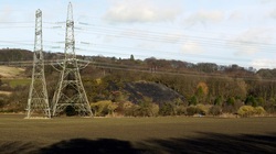
Margaret Pit, Heddon on the Wall. Photo A Curtis (2009).
The 1859 OS map shows Heddon Brick Works and the adjacent King Pit were connected to the Wylam Waggonway by a line running SSW, joining it in a graceful curve to the SE, near to Cathouse Plantation. The same course would eventually continue as the mineral railway alongside the passenger railway of the Scotswood, Newburn and Wylam Railway opened in 1885.
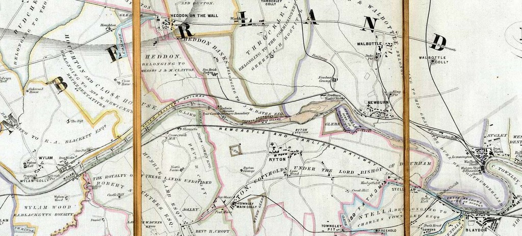
John Bell map (1861)
John Bell's 1861 Plan of the Western Coal District of Durham and Northumberland shows the 'Wylam Colliery Railway' running from Wylam Haugh Pit to the staiths at Lemington.
Notice the short connecting line from Wylam Iron Works to the Newcastle to Carlisle Railway south of the river via Wylam Bridge.
The southerly connection from Heddon's Fire Brick Factory is shown, as is that of the Throckley Railway from Throckley Maria Colliery and the nearby Tile Works, which descends close to Newburn Grange. Throckley Isabella would open later, in 1869.
East of Newburn, the maps show a loop in the line, passing both north and south of Lemington Hall, with possible junctions with the other waggonways descending from the Walbottle Pits.
Killiebrig Quarry, in Slacks Plantation just south of Heddon on the Wall village, also had a connection to the railway line on the Wylam Waggonway at a position west to that of Heddon Colliery, close to the current east boundary of the University playing fields. The quarry was opened in 1878. The stone was carried in wagons, down the incline from the quarry through Close House estate. to the railway. Its line is clearly shown on the 1897 OS map where it is marked as 'Mineral Railway (disused)'. Was this quarry line connected to the single mineral line from Heddon Colliery rather than directly to the main line railway, then built?
The 1897 1:2500 OS map suggests there may have been a connection to the western arm of the Heddon Colliery 'triangular junction' which still at the time retained a short western siding north of the railway, although the quarry and its tramway were both disused. Such a proposal is mentioned on the Quarrying page on this site, although the exact route described there is almost certainly incorrect.
The 1897 1:2500 OS map suggests there may have been a connection to the western arm of the Heddon Colliery 'triangular junction' which still at the time retained a short western siding north of the railway, although the quarry and its tramway were both disused. Such a proposal is mentioned on the Quarrying page on this site, although the exact route described there is almost certainly incorrect.
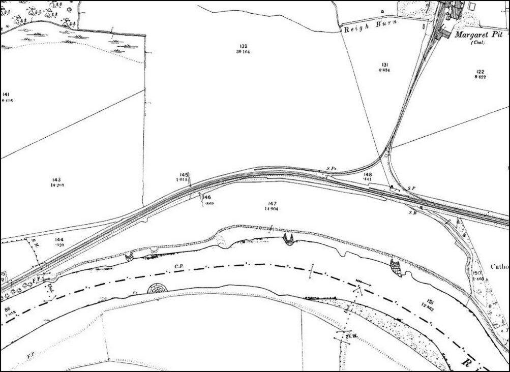
OS 1:2500 (1897).
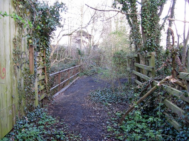
Close to the triangular junction made by the lines from Heddon Colliery there is another old disused branch line curving south through Cathouse Plantation to terminate on the bank of the River Tyne near to the Tide Stone. This was built between 1898 and 1912 by The Tyne Improvement Commissioners (TIC) who were involved with realigning and strengthening the river banks from Ryton Willows to Newburn Sands. I discussed this line as the 'Hedwin Streams Railway' in a previous blog.
Railways before George Stephenson by Les Turnbull (2012)
 | Les Turnbull's book, a study of the waggonways in the Great Northern Coalfield between 1605-1830, is available from the North of England Institute of Mining and Mechanical Engineers in Newcastle. |
The dialogue accompanying Map 5 in this book (p. 152) says that
Throckley Colliery was developed by a partnership of Bell and Brown in 1751 and the first waggonway (35) in the southern part of the royalty was a branch to the Wylam Waggonway which had been built in 1748. By 1765 the main focus of the colliery was further north and the route of the waggonway was changed to run down Walbottle Dene (35A). Walbottle Colliery was initially developed from the Duke Pit and a branch was constructed to the second Throckley Waggonway in 1767. This branch was extended northwards to Walbottle Moor and Callerton (35B). Later the Blucher Pit and Coronation Pit opened and a new line further east was built (35C) which was linked to the Duke Pit by a short line running east to west. The branch to Heddon Colliery (35D) used part of the route of the first Throckley Way.
The branch to Heddon Colliery in Map 5 runs is shown further north than the line via Engine Plantation I speculated on above so my proposed route is probably incorrect. The terrain may have changed too much after it went out of use to be now sure of its course without documentary evidence, although there may still be clues on the ground.
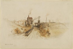 Wylam Colliery by Thomas Hair (1839). | 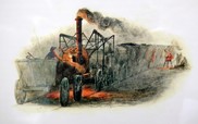 Old locomotive engine, Wylam Colliery by Thomas Hair (1839). |
The Wylam Waggonway is numbered 36 in the book:
The Wylam Way, opened in 1748, ran five miles westwards to Blackett's Colliery and was to achieve fame as a result of William Hedley's experiments with locomotives on the line. The gauge of the railway was unusually large being five feet. The plan of 1767 shows the staiths at Lemington: Blackett's Wylam staith is in the east adjacent to Cramlington's staith for Holywell Reins Colliery and further west the staith for Bell and Brown's Throckley Colliery. The position of these staiths altered after the redevelopment of the Throckley and Walbottle in the mid nineteenth century.
George Stephenson's Cottage
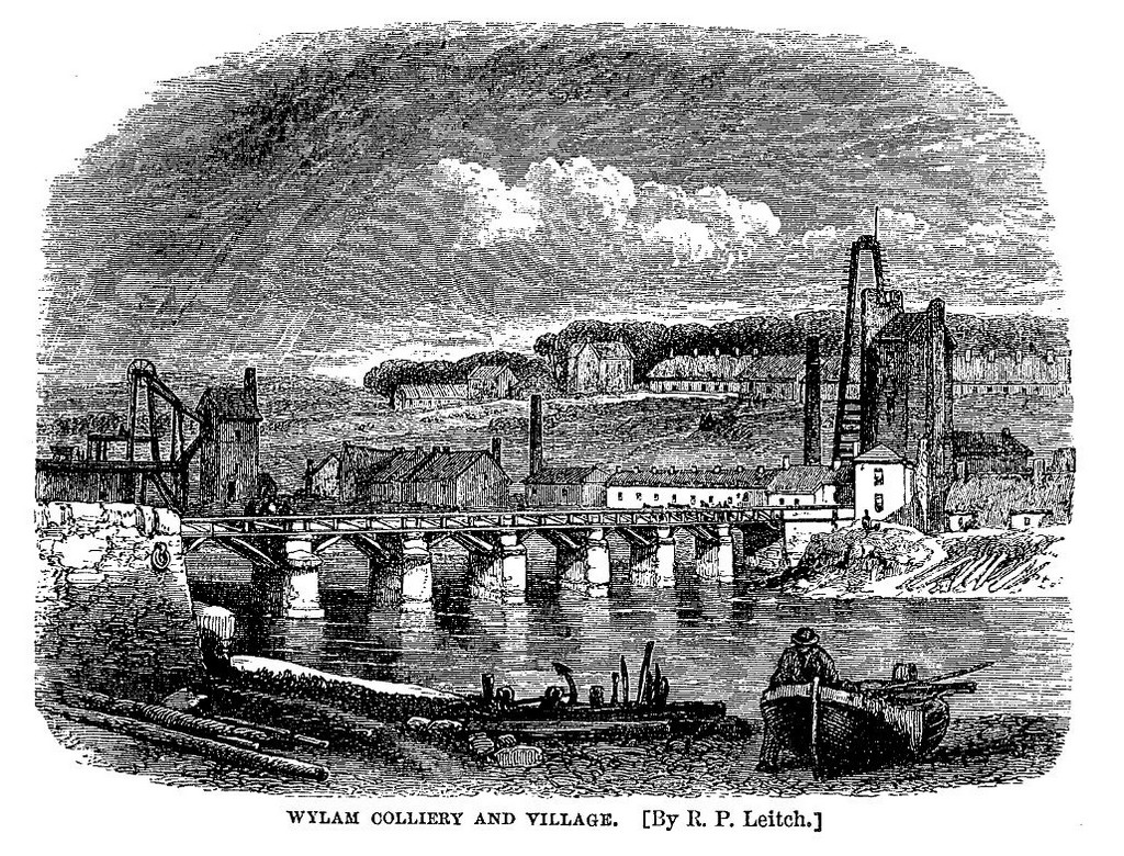 Wylam Colliery & Village by R P Leitch. | 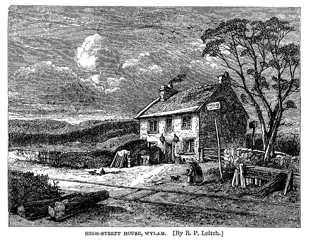 High Street House by R P Leitch. |
The Life of George Stephenson by Samuel Smiles (1868):
The colliery village of Wylam is situated on the north bank of the Tyne, about eight miles west of Newcastle. The Newcastle and Carlisle Railway runs along the opposite bank; and the traveller by that line sees the usual signs of a colliery in the unsightly pumping-engines surrounded by heaps of ashes, coal-dust, and slag, while a neighbouring iron-furnace in full blast throws out dense smoke and loud jets of steam by day and lurid flames at night. These works form the nucleus of the village, which is almost entirely occupied by coal-miners and iron-furnace-men. The place is remarkable for its large population, but not for its cleanness or neatness as a village; the houses, as in most colliery villages, being the property of the owners or lessees, who employ them in temporarily accommodating the work-people, against whose earnings there is a weekly set-off for house and coals. About the end of last century, the estate of which Wylam forms part belonged to Mr. Blackett, a gentleman of considerable celebrity in coal-mining, then more generally known as the proprietor of the "Globe" newspaper.
There is nothing to interest one in the village itself. But a few hundred yards from its eastern extremity stands a humble detached dwelling, which will he interesting to many as the birthplace of one of the most remarkable men of our times—George Stephenson, the Railway Engineer. It is a common, two-storied, red-tiled, rubble house, portioned off into four labourers' apartments. It is known by the name of High-street House, and was originally so called because it stands by the side of what used to be the old riding post-road or street between Newcastle and Hexham, along which the post was carried on horseback within the memory of persons living.
The lower room in the west end of this house was the home of the Stephenson family, and there George Stephenson was born, the second of a family of six children, on the 9th of June, 1781. The apartment is now, what it was then, an ordinary labourer's dwelling; its walls are unplastered, its floor is of clay, and the bare rafters are exposed overhead.
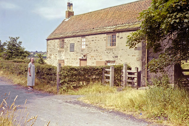 George Stephenson's Cottage. Photo by Robin Webster (1995). | 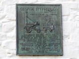 Plaque, Stevenson's Cottage. Photo A Curtis (2009). |
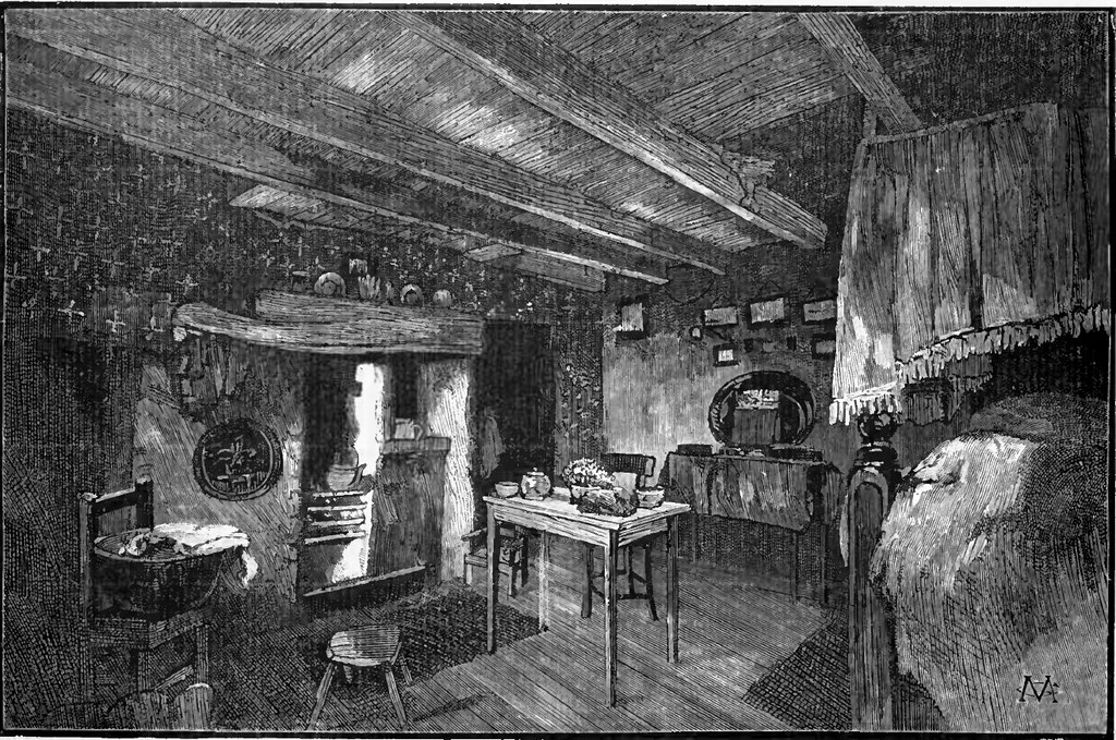
Interior of George Stephenson's Cottage. Monthly Chronicle of North Country Lore & Legend (1888).
One of his earliest duties was to see that the other children were kept out of the way of the chaldron wagons, which were then dragged by horses along the wooden tram-road immediately in front of the cottage door.
This wagon-way was the first in the northern district on which the experiment of a locomotive engine was tried. But, at the time of which we speak, the locomotive had scarcely been dreamt of in England as a practicable working power; horses only were used to haul the coal; and one of the first sights with which the boy was familiar was the coal-wagons dragged by them along the wooden railway at Wylam.
The above account tells why the cottage was known as High Street House as it stood alongside the old highway that ran from Newcastle to Hexham. The road crossed the waggonway by the cottage, taking a route closer to the riverside into Wylam village. William Hedley (1779-1843) would walk this route on the way from his home in Newburn to school in Wylam. He would eventually get the job of Colliery Manager at Wylam Colliery and play an important role in developing the early steam locomotives, Puffing Billy and Wylam Dilly, that were to pull coal waggons on the same waggonway.
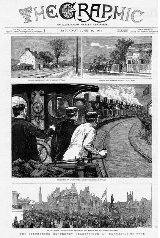 Stephenson Centenary Celebrations in The Graphic, 18th June 1881 | 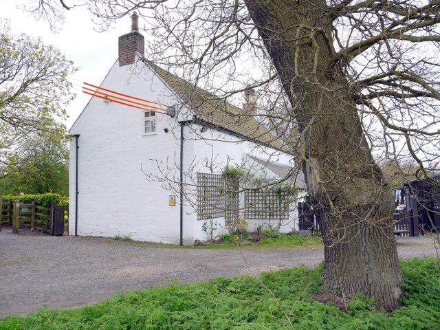 George Stephenson's Cottage from the rear showing the oak tree planted in 1881. Photo by A Curtis (2013). |
The illustration in The Graphic shows the celebrations that took place at Wylam and Newcastle on the centenary of his birth, in 1881. A regional holiday was declared, and among many other events that day a special train ran from Newcastle Central Station to North Wylam. It was accompanied by 16 'modern' locomotives loaned by the major railway companies. The trains stopped outside the cottage and after a suitable ceremony, the Mayor of Newcastle planted the oak tree shown in the foreground of the right-hand photograph. The tree is now 132 years old and in good health.
Newburn
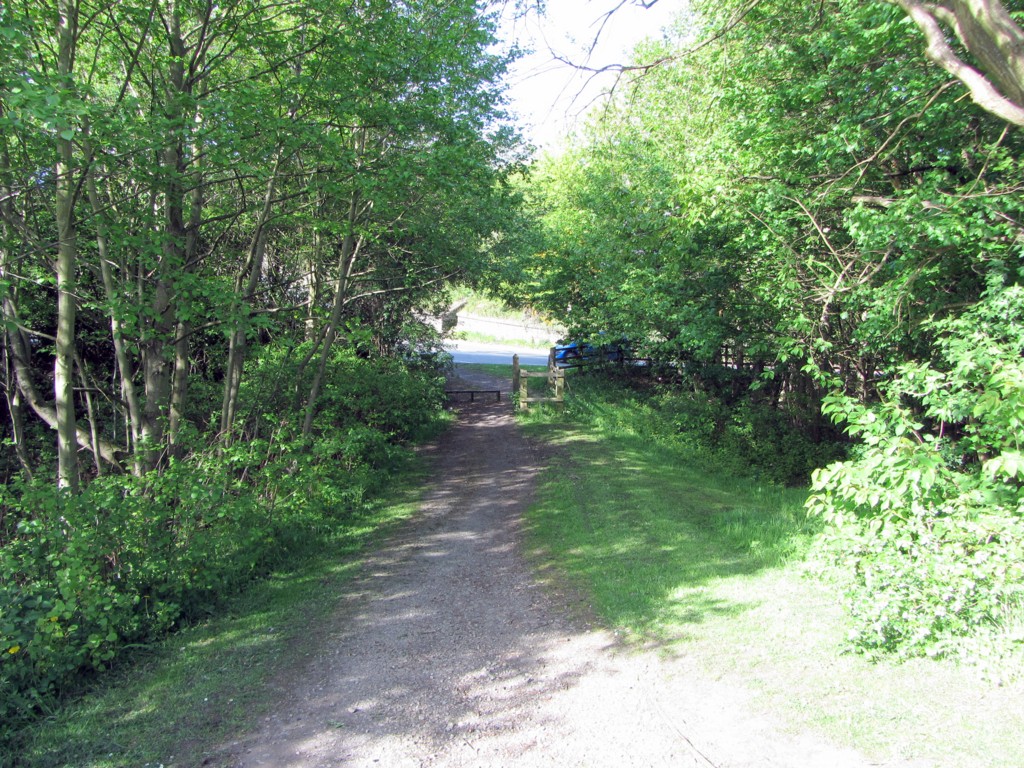
On the Goggle map of the Wylam Waggonway I distinguished the central section with place-marks in green. The purpose was to show how in this section there remains traces of a single track, running parallel to, and on the north side of, the double track of the Scotswood, Newburn & Wylam Railway. This is shown on later maps as a Mineral Railway.
The single track section starts where the track from Heddon Margaret Colliery joined the former Wylam Waggonway close to Cathouse Plantation. The junction is shown on the First Edition OS map of 1859 as shown above. My assumption in this zone is that the later railway was built alongside, but not on top, of the waggonway, as it probably was further west.
The single track section starts where the track from Heddon Margaret Colliery joined the former Wylam Waggonway close to Cathouse Plantation. The junction is shown on the First Edition OS map of 1859 as shown above. My assumption in this zone is that the later railway was built alongside, but not on top, of the waggonway, as it probably was further west.
The single track was maintained as a separate line north of the platforms at Heddon Station (where it is now a farm access track) and also at Newburn Station. Here, close to the Newburn Hotel at the bottom of Station Road, it was crossed by the Newburn Station footbridge as were the passenger lines.
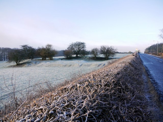
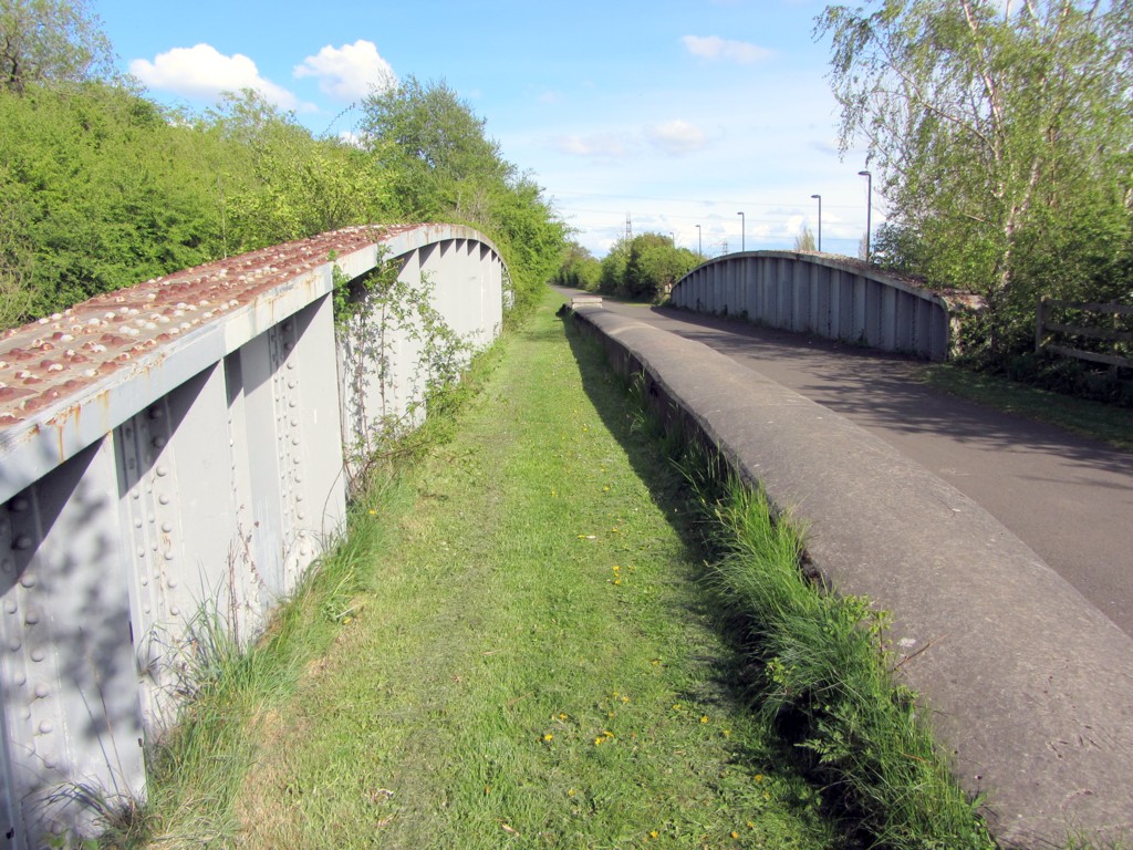
 Disused railway bridge over New Burn. Photo A Curtis (2013). | 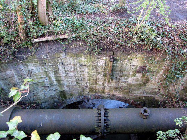 Disused railway bridge over New Burn. Photo A Curtis (2013). |
The single line crossed the New Burn, east of Newburn Station, by a bridge, which was separate, but closely parallel, to the bridge used by the double track railway to its south. It is still extant and has been interpreted as potentially incorporating the original waggonway bridge.
Tyne & Wear Sitelines describes the waggonway bridge as:
Tyne & Wear Sitelines describes the waggonway bridge as:
A surviving masonry skew bridge formerly carrying the Wylam Waggonway over the New Burn. Probably mid to late 18th century in origin. The later Scotswood Newburn and Wylam Railway bridge stands immediately adjacent to the structure which, after the closure of the waggonway, took a branch line from the above railway to Spencer’s Newburn Steel Works.
The Newburn, Scotswood, Wylam Railway bridge is described as:
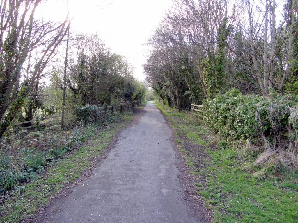
... immediately adjacent to the earlier Wylam Waggonway bridge (HER 1033). The line of the Scotswood, Wylam and Newburn railway was developed during the expansion of industry and residential housing in the west of the city towards Newburn. It was built in 1876 and was used until 1968, and ran all the way to the centre of the city. The bridge is a sandstone arch over a small river. It is primarily used for leisure purposes today as a popular cycle track which follows the route of the railway and utilises the bridge.
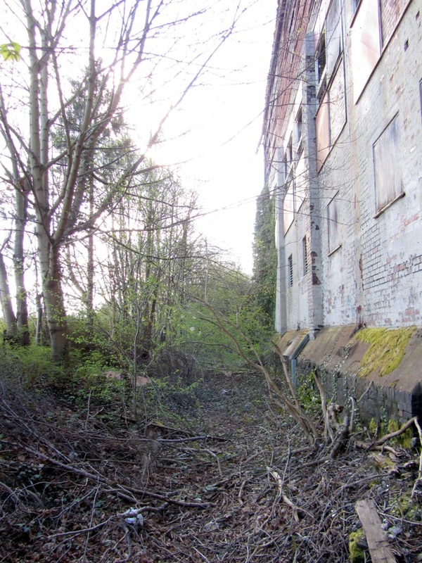
After crossing the New Burn, the single trackbed of the Mineral Railway, still close to, and on the north side of the double trackbed of the main line, runs close by the wall of Pringle's buildings (former cordage works) then diverges from the railway to lose height and closely approach the road just west of the railway bridge. Here the maps show it passed under the railway line to resume its route now on the south side. Its path through the Industrial Estate and sections of wooded land can still be partly followed, heading for Lemington Staiths.
Just east of the crossing of the New Burn the OS map of 1895 shows three branches from the mineral line into the site of Newburn Steel Works. A single track of these branch lines crossed Newburn High Street just east of its (then narrow) bridge over New Burn allowing access to the more northern parts of the Works.

Lemington
See the Lemington Staiths entry in the blog.
Archaeology
In 1996, 150m of an early wooden waggonway was excavated by Ian Ayris at the site of the former Lambton 'D' Pit at Fencehouses near Sunderland, revealing much about its construction. There is a good summary and several photographs in Structural Images of the North East.
In 2003, the laying of a high voltage electricity cable between Wylam and Street Houses provided a limited opportunity to investigate the buried remains of the Wylam Waggonway. There is a short report here.
An evaluation was carried out on part of the former Killingworth Waggonway north of Great Lime Road, Killingworth in 2005 prior to the re-instatement of the footpath which forms part of the “Stephenson Trail”.
In 2013, a remarkable find of a well preserved wooden waggonway was made by archaeologists at the former Neptune Shipyard at Walker near Wallsend. It is reported in the Blog.
Links
Samuel Smiles: The Life of George Stephenson an of his son Robert Stephenson (1868)
Andy Guy: Steam and Speed: Railways of Tyne and Wear from the Earliest Days. Tyne Bridge Publishing (2003).
Andy Guy: Steam and Speed: Railways of Tyne and Wear from the Earliest Days. Tyne Bridge Publishing (2003).
 RSS Feed
