Listen to the water mill
Through the livelong day;
How the clicking of the wheel
Wears the hours away.
Languidly the autumn wind
Stirs the withered leaves;
On the field the reapers sing
Binding up the sheaves;
And a proverb haunts my mind
And as a spell is cast,
"The mill will never grind
With the water that has passed."
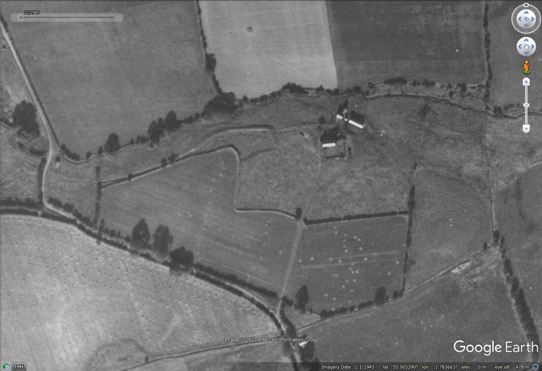
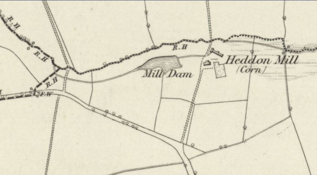
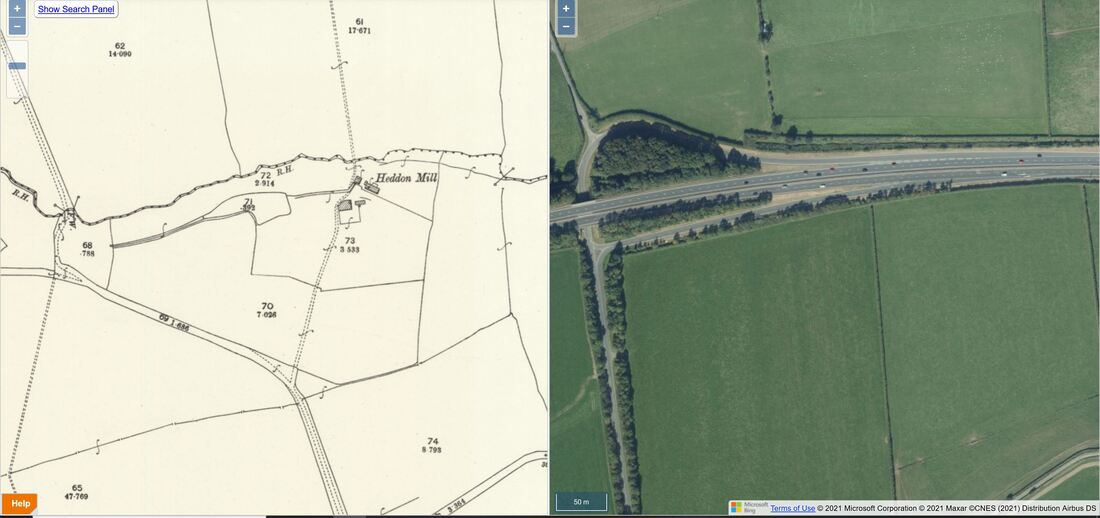
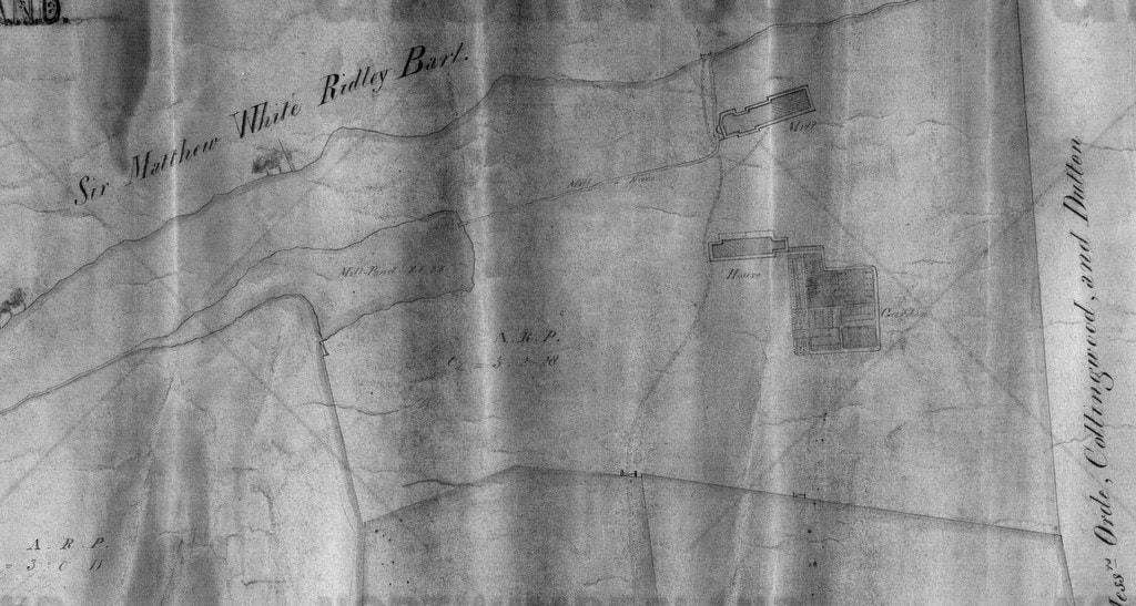
The corn mill was powered using water taken from the Dewley Burn and stored in a mill pond just west of the Mill buildings.
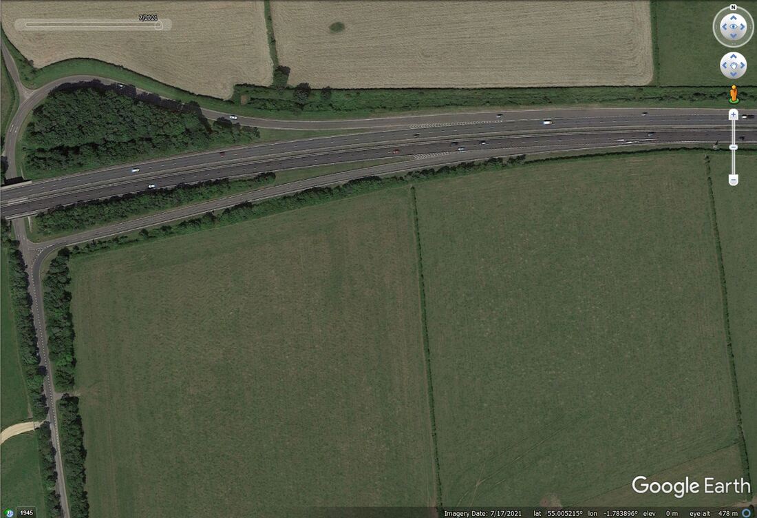
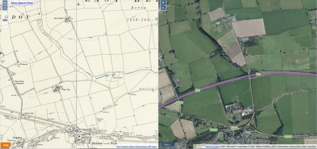
The original site of the Mill was erased by open-cast coal mining and the building of the new A69 dual-carriageway. Few people notice the burn now chanelled under the slip-road where the road from Heddon passes under and joins the main road. You have to concentrate there on the sharp bend and the possibility of oncoming traffic from the narrow lane which comes down from East Heddon.
Although the proverb of the opening poem is of course true, it doesn't tell the whole story. Water passing over the water-wheel at Heddon Mill joined the Dewley Burn just below the Mill and becomes available down-stream.
Further east, north of Throckley, was another corn mill, Dewley Mill. Water was also taken from the Dewley Burn and led from a mill pond to the east of Burnside Farm by a long mill race in the fields now north of the A69. The Mill itself was just west of Dewley Farm.
Dewley Burn passes Dewley Farm and runs south through Walbottle Dene. It waters were in use again further down to power the mills of Spencer's Steel Works in Newburn before they join the River Tyne. Much of this section is now hidden in a culvert.
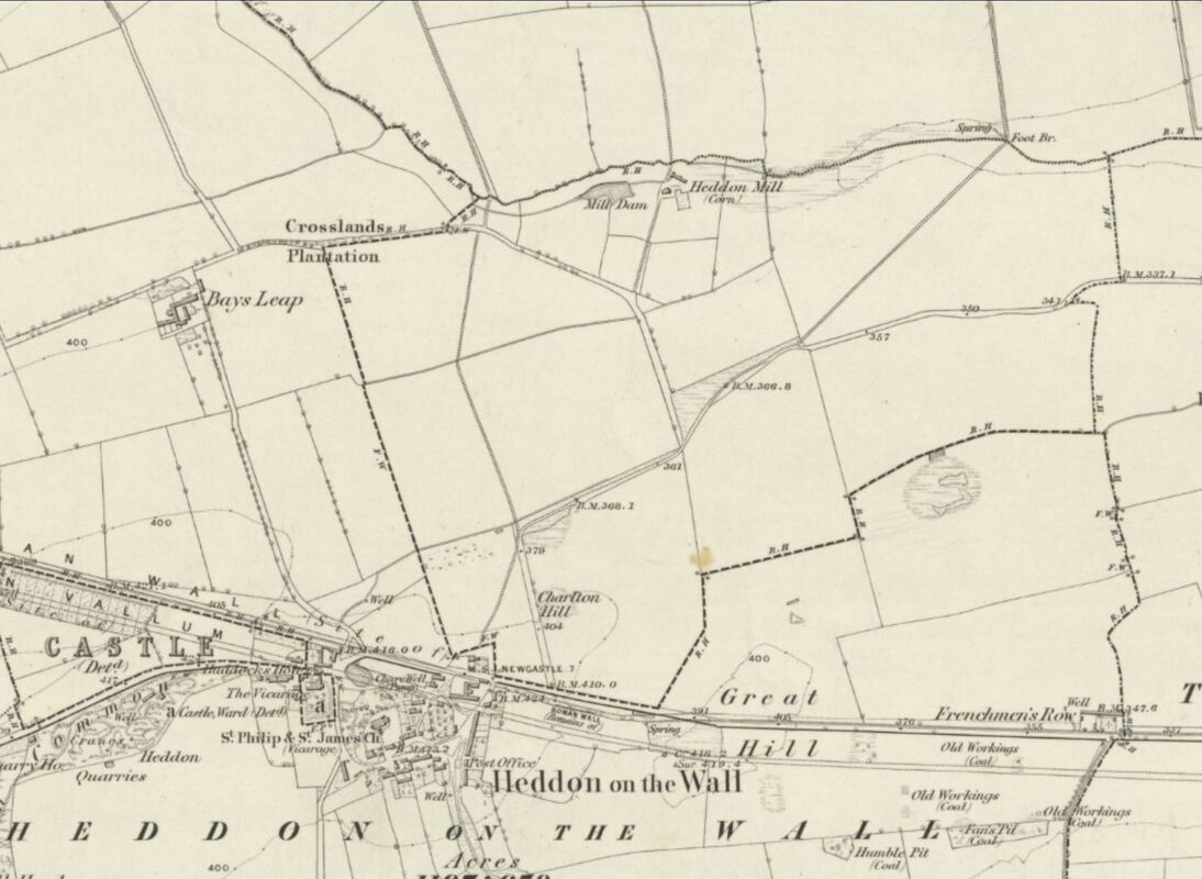
In this mode you can drag the slider above the map windows to change from the old map to the modern satellite image. It shows the site of Heddon Mill and the old Bays Leap Farm close to the line of the new A69. Also changes in the roads leading from Heddon to Heddon Mill and Bays Leap.
The original route to the Mill was from a junction on the Throckley Road near the bus shelter, over Charlton Hill (where the Bay [Horse] Leap'd) to join Mill Lane. Just along Mill Lane was another old lane connecting with the start of the current road up to East Heddon at what is now the Heddon junction on the A69. The old lanes north of the modern A69, running west via Whitchester, may have all connected up and probably predate the Military Road built on the line of Hadrian's Wall.
Following the death of Hugh de Bolbec, an extent (inventory) of the manor of Heddon was made:
"There are in demesne 160 acres at 6d per acre, sum £4; 3 acres of meadow at 8d per acre, sum 2s; 5 bondmen each of whom holds 24 acres worth yearly 18s 2d and they hold between them 12 acres 9s 1d; of the fishery of the said manor, 5 marks; the mills are worth yearly 5 marks; 22 acres worth yearly 15s 2d for farm and works; 13 acres worth 11s 1d; 5 acres of land which a certain widow holds worth yearly 2s 6d; 14 cottages worth yearly 26s 2d; Office of the smith worth yearly 2s 0d; of the Brew-house 4s 0d; Rent in hens yearly is worth 21d; pannage is worth yearly 2s 8d; birds taken at Wydestokes yearly 2s 0d; herbage of the same close yearly 12d; sum of the sums of Heddon £18 5s 5d."
- 504 acres on the west side of Heddon on the Wall township were assigned to the Earl of Carlisle
- 260 acres on the north-east to Julian Hindmarsh
- 256 acres on the south-east to Thomas Bigge, son of Isobel.
Tennants of the lands of Heddon retained the liberty to come to the Mill Dams with their cattle in a storm to fetch their water as was their usual practice.
In 1924, Sir James Knott sold East Town Farm to Adam and James Hedley for £2,800. A portion of East Town Farm was given over to the Ministry of Works to protect the Roman Wall as an Ancient Monument.
In 1957, the heirs of the Hedleys sold Bays Leap, Town House and Heddon Mill to the National Coal Board for open-cast mining.
70 acres of land was excavated to a depth of 200 feet to extract 2.5 million tons of coal. The land was returned to farming and Bays Leap was sold to Mr. J. Moffitt in 1965.
In 1959, James Hedley sold a portion of East Town Farm to Grady's the builders to build the Vallum housing estate.
The property currently bearing the name, Heddon Mill, is further west of the former Mill Farm location, on the lane that leads up to Halls of Heddon close to the interestingly named, Hassockbog Plantation (old maps show a small cottage called Hassock on the old lane just opposite Heddon House).
I can only assume that Heddon Mill was reinstated in this new location at the end of open-cast coal mining, as indeed was the farm of Bays Leap, also in a slighly different location from the original property, presumably taking into account the proposed line of the new by-pass.
The common land at the former Heddon Mill was, however, lost forever.so please refrain from taking your cattle there in a storm to use the water now!
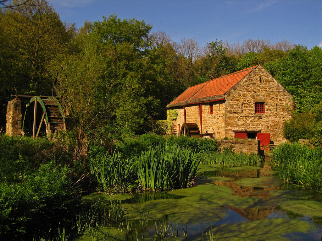
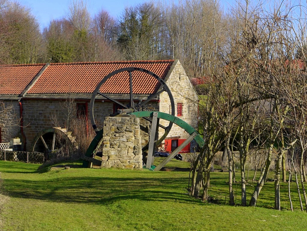
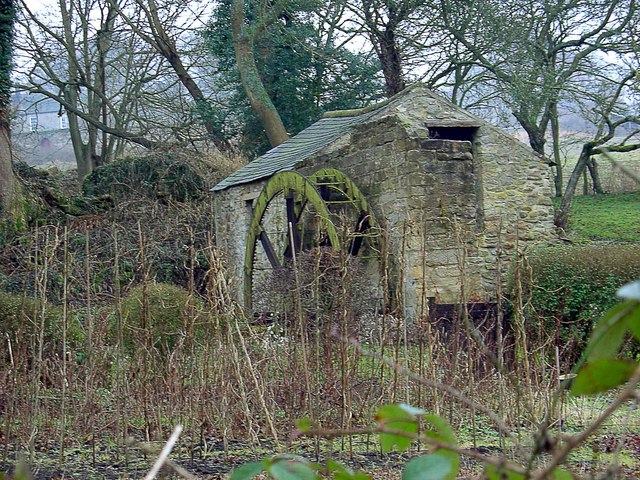
One nearby, is that at Path Head near Blaydon which takes its water from the Blaydon Burn. It's nice to imagine that Heddon Mill might have been similar.
Started in 1730 by the Townley family, the Path Head Mill worked as a corn mill until 1828. During its working life it changed owners to the Cowen family.
Around 1974 the farm buildings became derelict, of which the later 1930's farmhouse is the only survivor. The area was then surrounded by extensive gravel extraction and only poultry survived. Evidence of vehicles was found during the excavations around the mill building.
The mill pond was choked with fallen willow trees and these were removed to clear access to the building and the pond. The old corn stack terraces had their dry stone walls repaired and a pole barn was erected to cover some of our engineering artefacts.

 RSS Feed
