Heddon-on-the-Wall Local History Society
  • Home
  • Calendar
  • Introduction
  • Where are we?
  • History Map
  • Timeline
    • Prehistoric
    • AD43 to 1599
    • 1600 to 1799
    • 1800 to 1899
    • 1900 to 1999
    • 2000 to 2099
  • Heddon's History
    • Prehistory
    • Hadrian's Wall >
      • Vallum excavation (1893)
      • Hadrian's Wall excavation 1926
      • Wall ditch, Bays Leap (1958)
      • Hadrian’s Wall: Archaeological research by English Heritage 1976-2000
      • Throckley & Heddon entanglements
      • WallWatch
      • English Heritage (2020)
      • Wardell-Armstrong Archaeolgy Reports
      • Historic England Archives
    • Six townships >
      • 1 Heddon township >
        • Heddon in the Middle Ages
        • Common Land
        • Middle Marches
        • Tithe Award
        • St Andrew's Church >
          • Stained Glass Windows
          • Churchyard
          • Monuments of church & churchyard (1991)
          • Monuments Page 2
          • Vicars of Heddon
        • Village property
        • Heddon Hall >
          • Sale of Heddon Hall 2012
        • Heddon Banks Farm
        • Frenchman's Row
        • Methodist Church >
          • Heddon Methodist Church Centenary 1877-1977
        • Men's Institute
        • Women's Institute
        • Welfare Field
        • Knott Memorial Hall
        • Memorial Park
        • Schools
        • River Tyne
        • Coal Mining
        • Quarrying
        • Water Supplies
        • Transport
        • Waggonway & Railway
        • Occupations from 1800
        • Miscellaneous
      • 2 West Heddon township
      • 3 East Heddon township
      • 4 Houghton & Close House township >
        • Close House
      • 5 Eachwick township
      • 6 Whitchester township
    • Rudchester
  • People
    • Sir James Knott
    • Cadwallader J. Bates
    • Richard Burdon
    • Hugh Sinclair (Tim) Swann
    • George Clark
  • Old Photos
    • Postcards
    • Old photos 1
    • Old photos 2
    • Old photos 3
    • Old photos 4
    • Old photos 5
    • Old photos 6
    • Old Photos 7
  • Old News
    • Community News
    • Letter from the Emigrant Clergy of Frenchman's Row (1802)
    • Alleged Brutal Murder at Heddon-on-the-Wall (1876)
    • Sad boat accident at Ryton (1877)
    • Coronation tree (1902)
    • 65 Years on a Ferry Boat (1929)
    • Come claim your kiss at Heddon (1953)
    • The Swan (1972)
    • Heddon WI (1987)
    • Church House (1966)
    • Happy return (1993)
    • Hexham Courant (1997)
    • Butterfly Garden (1999)
    • Foot & Mouth (2001)
    • Remembrance Day (1996)
    • Remembrance Day (2016)
    • RAF at Ouston (2007)
    • Close House Golf Course (2009)
    • Heddon pupils celebrate British heritage (2011)
    • Roman Wall Forge (2011)
    • Diamond Jubilee (2012)
    • Auction of Bronze Statue, Close House (2012)
    • Heddon WI (2012)
    • Puffing Billy Festival (2013)
    • Heddon Village Show (2014)
    • View of the North (2014)
    • The Wall at Heddon (2014)
    • Heddon Village Show (2015)
    • War veterans singing send-off (September 2015)
    • Anglo-Saxon history (2014)
    • Heddon WI at 100 (2017)
    • Hadrian's Wall discovery (2019)
    • Tulip Mews (2020)
    • Mike Furlonger
    • Hadrian's Wall 1900 Festival
  • Memories
    • Olive White
    • Betty Cockburn
    • Betty Cockburn - miscellaneous information
    • Isabel Snowdon
    • William & Winnie Watson
    • Edith Ward
    • Mark Parker
    • Jack Lawson
    • Winnie Spoor
    • P Reay
    • Mr and Mrs Hall
    • Peter Chapman
    • Elizabeth Elenora Eames
    • Harry Murray
  • Other documents
    • Mackenzie (1825)
    • Bates (1886) >
      • Early & Roman
      • Townships
      • Heddon Church
      • Heddon & Houghton
      • Whitchester
      • Eachwick
      • West & East Heddon
      • Records
      • Addenda
      • Appendix A
    • History, Topography & Directory of Northumberland (Bulmer's) - 1886
    • History of Northumberland (1930)
    • Collingwood Bruce (1853)
    • Whellan (1855)
    • Post Office Directory (1879)
    • Prominent people in Heddon
    • Place names
    • Ad Murum
    • Archived documents
    • Thomas Bewick's History of British Birds (1826)
    • Census data 1801-1991
    • Historical Records 1888-1890
    • Knott Sale of Village Property (1924)
    • Extracts from Parish Council Records
    • Local colliery records
    • Blackburn (1938)
    • Clark (c.1963)
    • History of Church (1968)
    • Boundary Commission Report 1984
    • Village Atlas 2022
  • Walks
    • Walks 2
  • Blog
  • Contact us
  • Links
  • What's new
  • Site search
  • Past & Present
  • Photo of the Month
  • Place Name Studies
    • Meas & Meres
    • OS Name Books: Elsdon
    • OS Name Books: Allendale
    • OS Name Books: Cheviot Hills
    • OS Name Books: Other Parishes
  • Heddon 3D landscape

The Poem About the River Coquet by J Peter Athey

4/3/2024

0 Comments

 
Picture
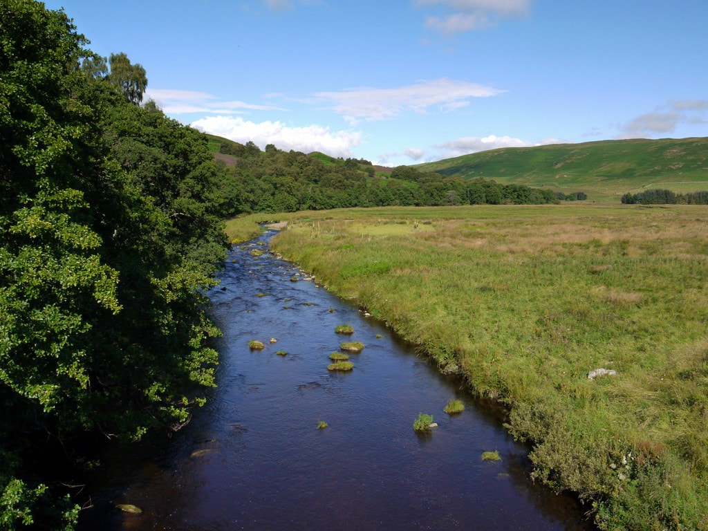
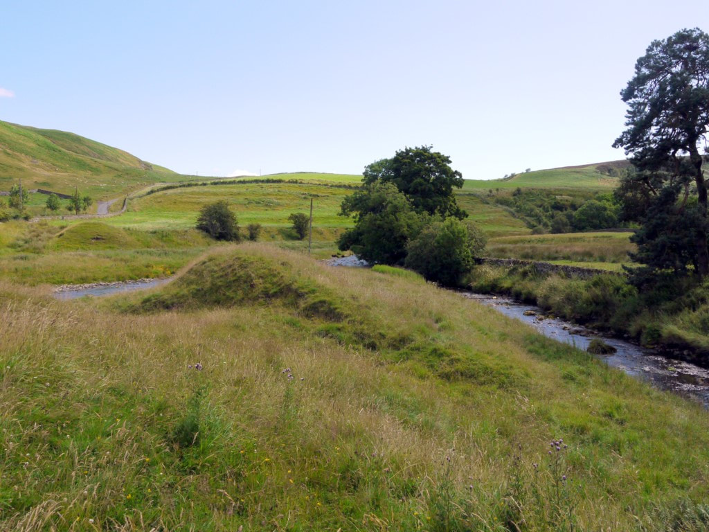
River Coquet west of Alwinton Bridge. Photo by A Curtis (2011).
My attempt (with help from friends) at transcribing a poem in the Northumbrian dialect by J Peter Athey. Any errors are mine.

An mp3 of the poem was posted to the website, Caught by the River, on 9th June 2011.


The Poem About the River Coquet by J Peter Athey
A mile oot by at Buckham’s Waals it first sees light o’ day;
The wee-bit wobbling twickling sike, barely strength to run away.
Noo like a bairn in its early years it grows with quickening speed;
As it starts its journey to the sea from the wastes of Coquet Heed.
Noo it’s here by the Usway Burn, then joined by the Ridlees Watter;
It’s running noo with yelp and skelp, with splash and foam and clatter.
Past Alwinton on Show Day, and aal the happy thrang;
Past Angryhaugh and Harbottle, with its ancient castle strang.
Mair slowly noo at Hepple, where speckled trooties lie,
To test the skilful angler with his fancy tethered fly.
Rothbury racecourse and Weldon Bridge, then Felton doon to Amble,
Past gentle staring sheep and coos, and lambs that skip and gamble.
Twixt the piers and o’er the bar, to freedom past the Isle,
This my friends is wonderland, for nigh on fifty mile.
So whichever village ye come from, for aeons the poets have spoke it,
It’s the silver threed that binds us aal, the queen of rivers, the Coquet.


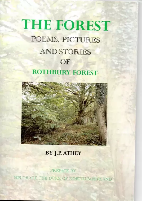
I was reminded of the work of Peter Athey by a letter from Ron Bailey published in The Northumbrian (p.61, Issue 196, October/November 2023). Athey posted poems at obscure locations in the countryside, including Cateran Hole on Bewick Moor, Redheugh Crag, Caller Crags and along with a constructed gallows on Rimside Moor. Many of the poems have subsequently disappeared.

There is some more information onthe website of Fabulous North.
Picture
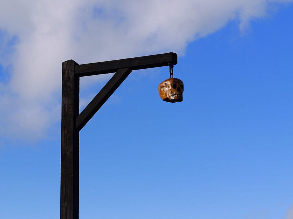
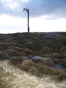
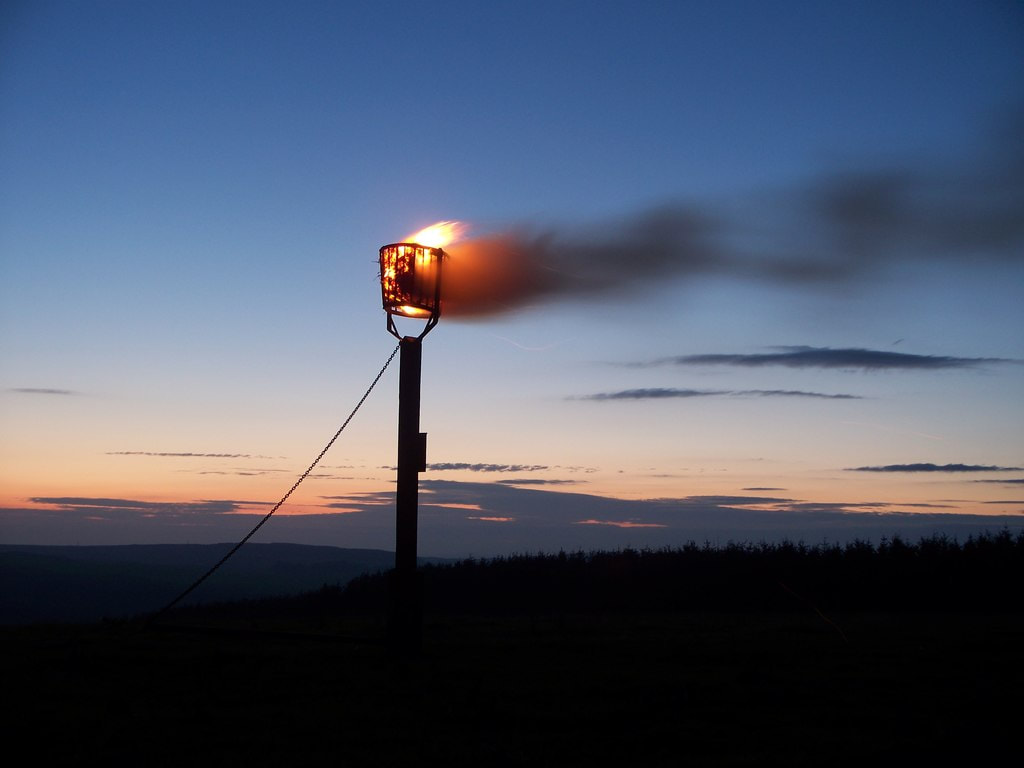
Gibbet on Rimside Moor. Photo A Curtis (2011).
Erected in 2010, just west of the wood at Old Moorhouse Inn
A poem, 'The Hungry Gallows Tree', written in a Northumbrian dialect by Peter Athey for the occasion is attached to the upright post:

The first stanza setting the theme of his 'fanciful tale' of betrayal and a grisly hanging is given below:
Twixt Greystone Knowe and Wellhope Knowe,
On the auld North Turnpike Road
Stood the Rimside Inn
In former times a place o' grim forbode.

Picture
Erected Sunday 7th March 2010 by Mr Peter Athey, supported by a group of friends.Gibbet on Rimside Moor, Photo by David Clark (2010).
Picture
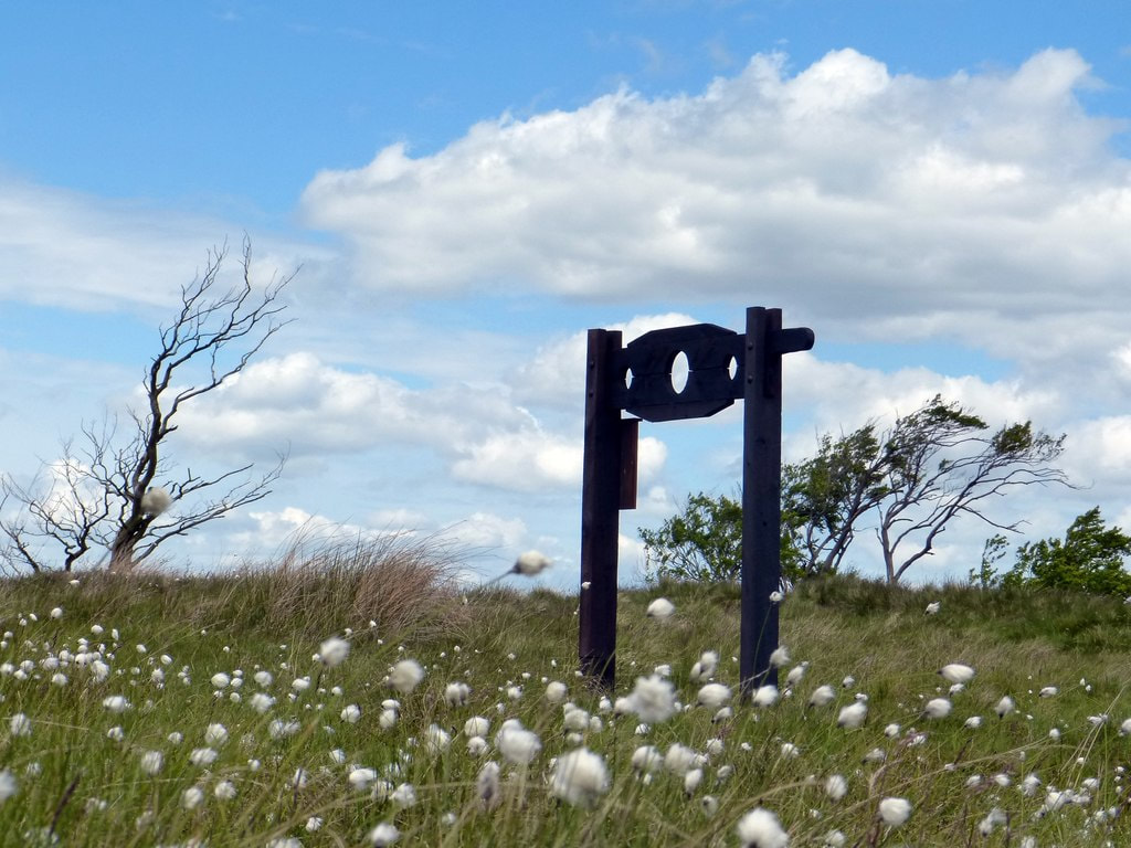
Peter's Pillory Another construction by Peter Athey of West Thirston was erected nerby with an accompanying poem attached. Photo by David Clark (2013).
Picture
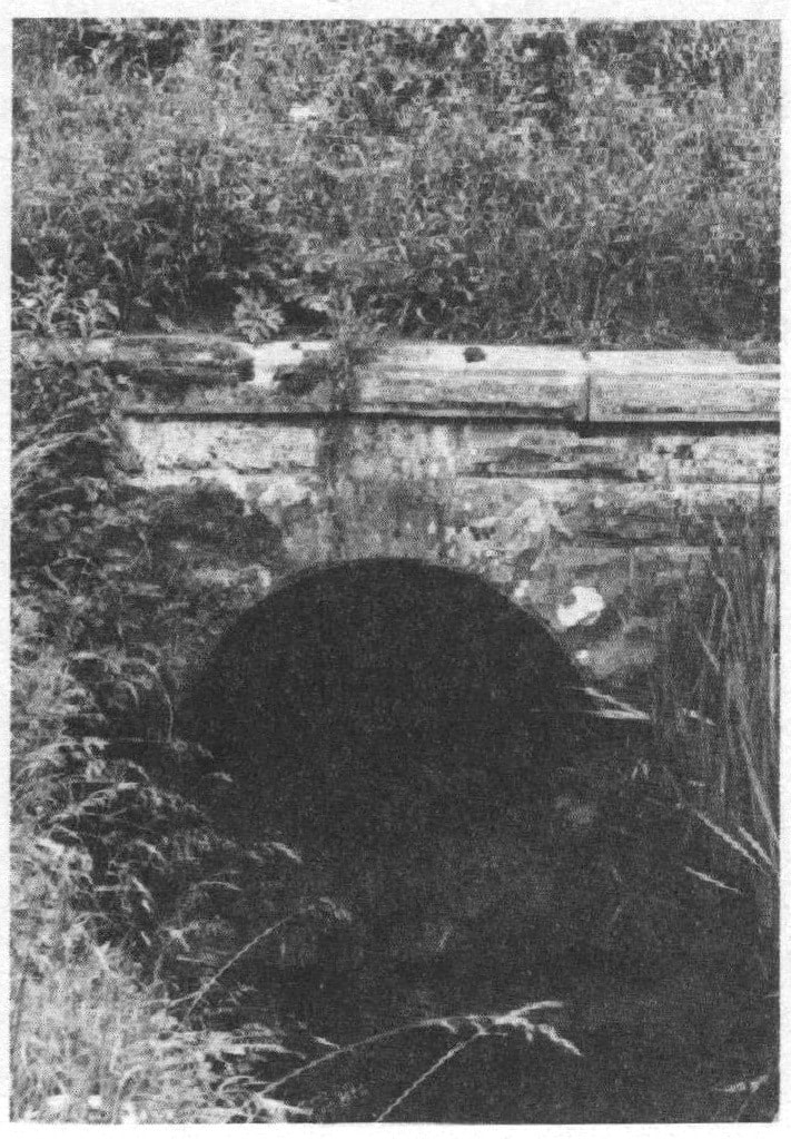
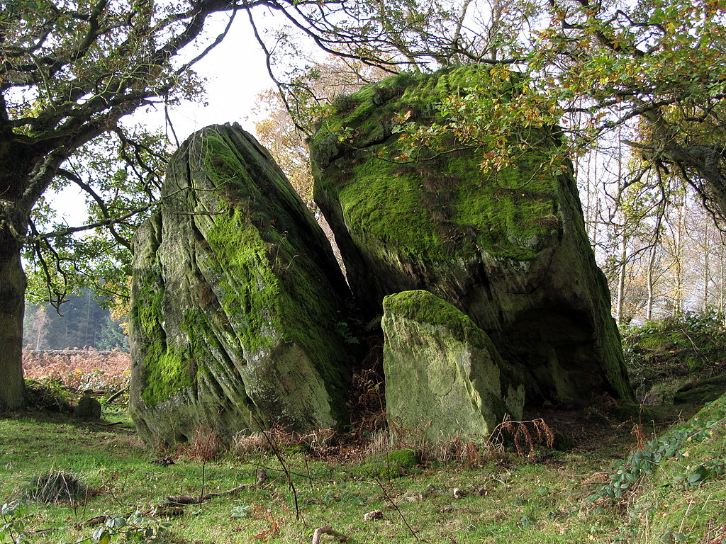
Redheugh Crag. Photo by Leanmeanmo (2017).
Leanmeanmo writes: "There is a small shelter below the Holly bush. The cave contains a surprise to which the bush is relevant!

Update. The surprise, 'Ode to Guyzant Meg' by local poet J. P. Athey, has sadly disappeared
."

This is one of the poems duplicated and replaced by Ron Bailey, referred to (and reproduced) in his letter to The Northumbrian.

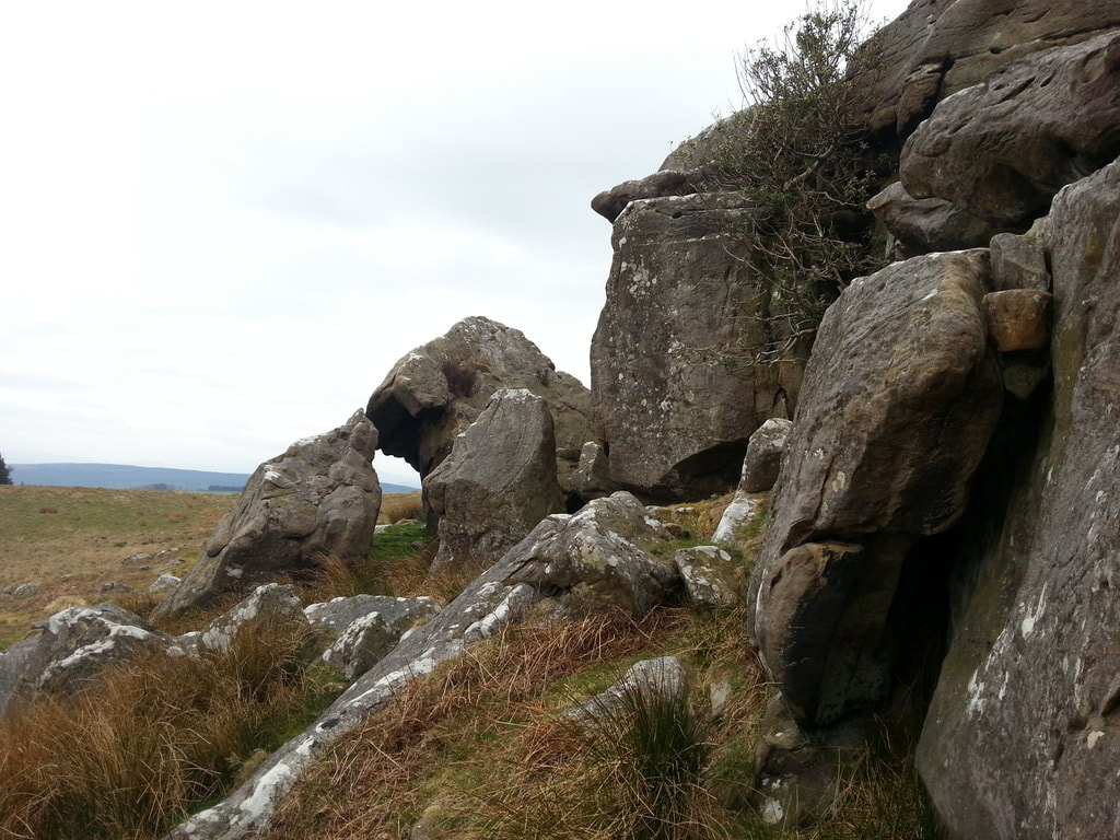
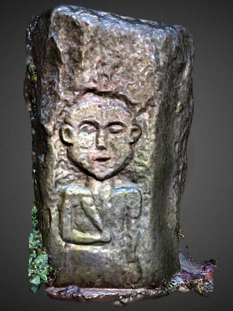
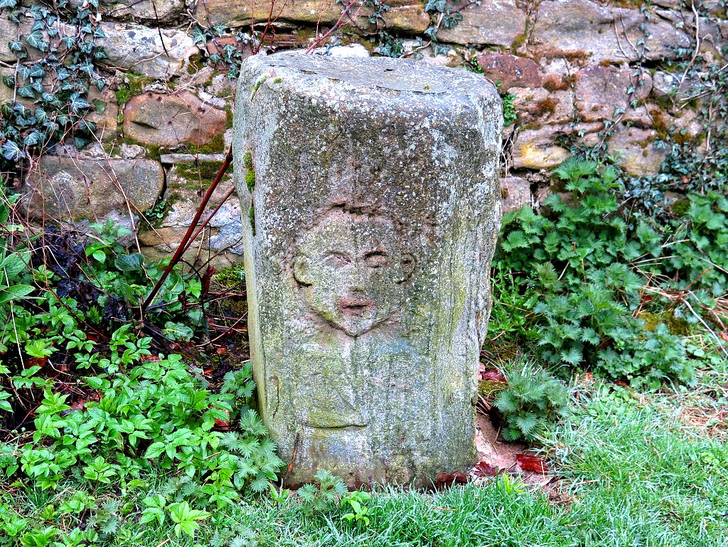
Athey's poem left at Caller Crags was photographed by Leanmeanmo in 2014 and posted on Geograph (below).

Picture
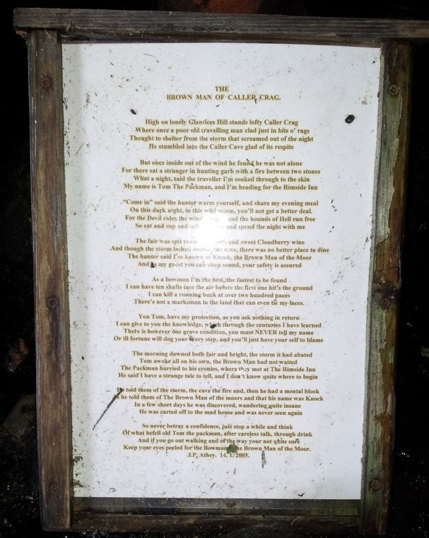
Ode to The Brown Man Of Caller Crag by Peter Athey. Photo Leanmeanmo (2014).
Picture
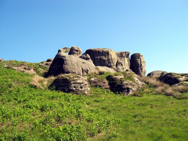
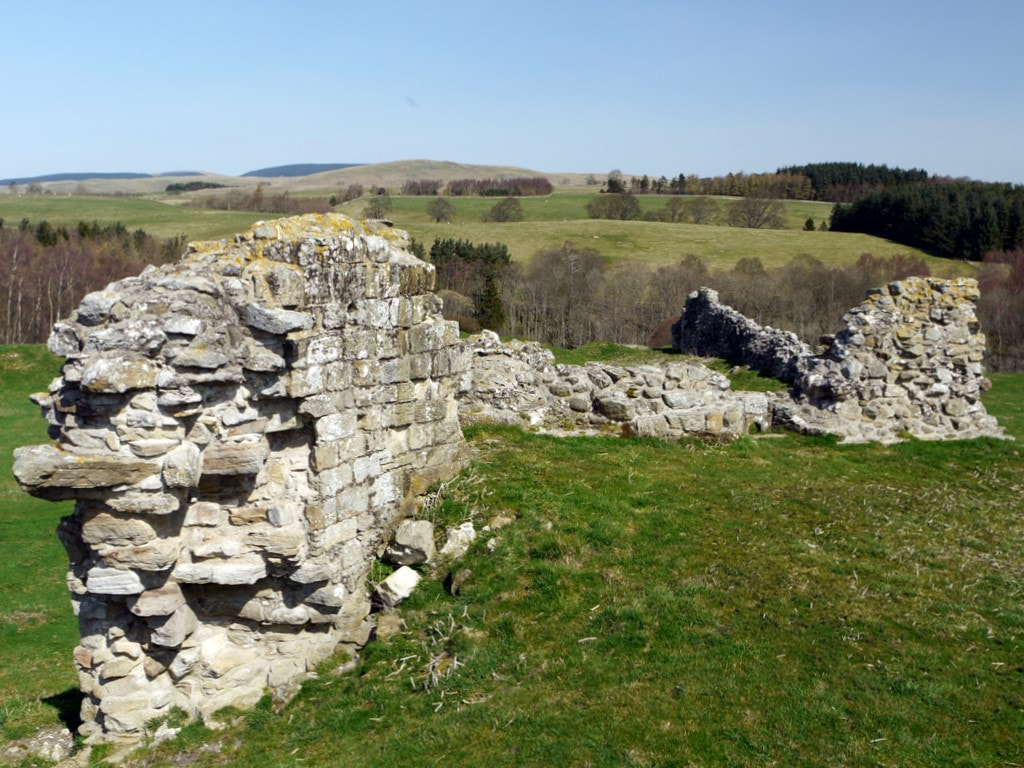
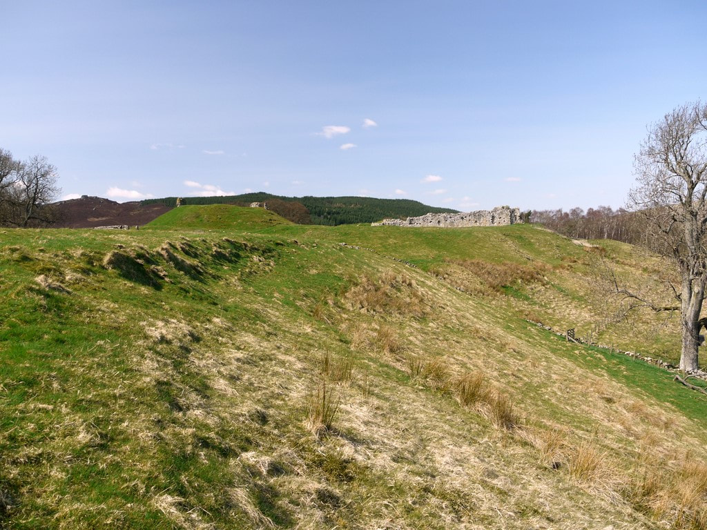
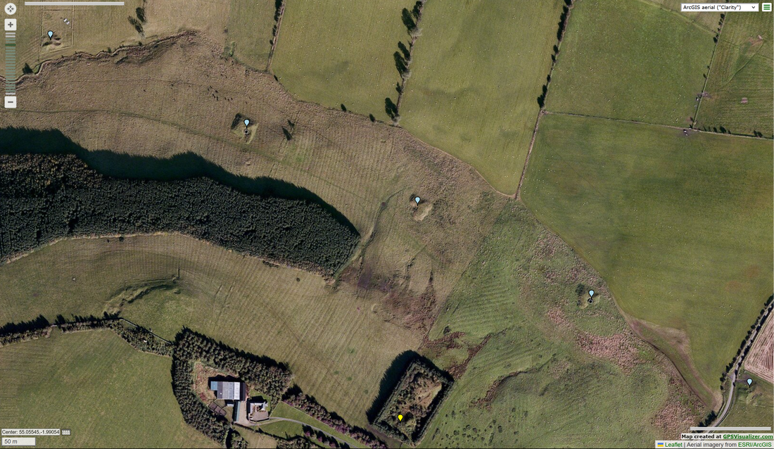
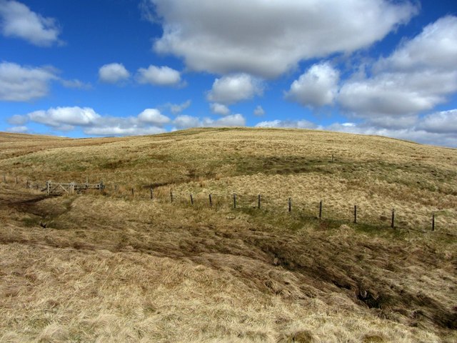
Caller Crags. Photo A Curtis (2006).
Picture
Glantlees Beacon. Photo by David Clark (2011).
Constructed by Mr P J Athey and erected on Glantlees Hill with kind permission of Mrs Judy Fortescue.

Lit for the first time on 15 October 2011 at 1900 hrs.
Picture
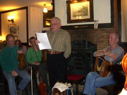
Peter Athey recites a spooky poem at the Railway Inn, Acklington in 2010.
Above photo taken from a post in 2010 on The Otter's Holt.
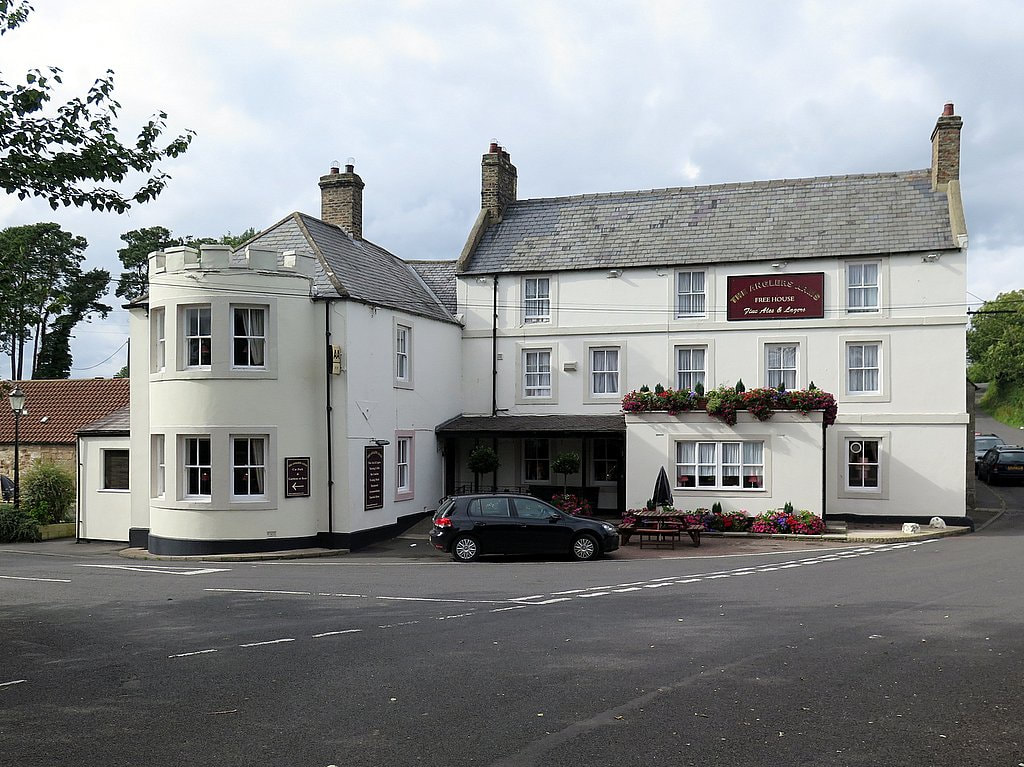
Five of the luxury bedrooms of the Northumberland Arms in Felton were named by J.P. Athey:
Eshot Castle
“Over seven hundred years it’s stood here, to bring you peace, to belay your fear”.
Brainshaugh Priory
“In this protective arm o’ the Coket river; peace and solitude bide forever”.
Thirston House
“In this stately, lovely genteel house, Lives friendship. Be ye rich or poor, Man or Mouse”.
Bockenfield Market
“Here neath the green grassy sod concealed, lays the ancient Market Town of Bockenfield”.
New Moor Tower
“Neath Overgrass farm, stands New Moor Tower. Counting the Century’s, as we Count the Hours”.
0 Comments

Ryal & Whittington tunnels

15/11/2023

4 Comments

 
The Ryal tunnel (1859) and Whittington tunnel (1905) were constructed to convey water from sources in the Hallington area, and further north-west, to the reservoirs at Whittle Dean. They were built to improve the supply of fresh water to the growing population and industrial use in Newcastle & Gateshead.
Picture
Map plotting the location of observable remains of the 12 shafts sunk in construction of the Ryal tunnel along with its entrance and outlet. Also shown are locations of the two shafts used to construct the later Whittington tunnel which is parallel and to the south of the first.
Around 1860, as part of creating the new 6" to 1 mile Ordnance Survey map for this area, the team whose job it was to collect the names to go on the new map recorded several instances of the name, Whittledean Water Course.

The OS Name Book for Stamforham p87 records:
"A work in the course of formation. When finished it will greatrly increase the comforts of the inhabitants of Newcastle as it will supply them with good water and plenty of it. The name only applies to the open water course & not to the tunnelled portion as that of course is not visible."

However the name, Whittledean Waterworks did get applied to part of the tunnelled section in the region of Cobs on the first edition 6" map (Northumberland Sheet LXXVIII Surveyed: 1859, Published: 1866), where the map shows part of the line of shafts, each in a small enclosure.

The Name Book description (St John Lee p17) states:
"It [water] is conveyed through an arch in this part of the parish it has a few shafts to facilitate communication
if repair be necessary, in the neighbourhood of Hallington it is an open water course having its sides faced with rubble
stone & is about 5 foot deep."
Picture
Northumberland Sheet LXXVIII Surveyed: 1859, Published: 1866.
Later OS maps do not show the name and although the locations of all 12 shafts are still quite visible today, and the eartrhworks themselves are shown on large scale maps, their purpose has been forgotten, and they are often interpreted as shafts for coal mining.

Perhaps this is not so surprising as 11 of the 12 shafts (and the two later ones used to construct the parallel Whittington tunnel) are shown as Mine Entries on the Coal Authority Interactive Map. The nearest true coal shafts, however, are to the south-east on Todridge Fell.
Picture
Excerpt from the Coal Authority Interactive Map showing shafts of Ryal & Whittington tunnels.
Picture
Remains of 5 shafts of the Ryal tunnel north of Grindstone Law (blue labels), and western shaft of the Whittington tunnel just east of the farm (yellow label).
The entrance to the Ryal tunnel is just west of Airbrough Hill, about 2km west of Ryal, where the open Whittledean Water Course from Hallington goes under the road close to the (now) aptly named, Waterworks Cottage. Water flows by gravity through the 2 mile long tunnel to emerge in a cutting near West Farm at Matfen. It is conveyed from there, mainly via open aqueduct, to the northern reservoir at Whittledean.

Picture
Outlet of Ryal Tunnel. Fig. 15 from Rennison (1979) p.69
If it is to be believed, the OS Name Books describe an impressive feature close to the works at the fourth shaft (from the tunnel's west end). Hell's Caldron (St John Lee p.17): "A slight indentation in the ground before
the formation of the water works (a few years ago)
it was a natural fountain the water boiling
to the height of about 4 feet a small indentation
in the grass is all that now remains of it
".

One of the authorities for the name was one William Coulson who lived at Grindstone Law. A paper by him was presented to the Society of Antiquaries of Newcastle in 1860 and published in their journal (W Coulson, 1861. Denisesburn. Archaeologia Aeliana Series 2. Vol 5, pp. 103-108). In the paper he describes the Caldron and its legend: "Grass covers its site, and the tradition is sinking into forgetfulness, living still, however, in the memory of many. Some there are who have seen the Cothem in its pristine state, and remember the awe which the story imparted to a sight of it."
Rennison (1979) wrrote (p.229) that around 1908 "... the old tunnel at Ryal became blocked by a collapse at its upstream end, requiring a new shaft to be sunk for access to it, following which the tunnel was timbered throughout the sections at risk and then religned".
Company engineer, Charles Hawksley, reported in December 1899 that the existing Ryal tunnel and its associated aqueduct were considered incapable of carrying more than 10-12 m.g.d. and as a result he recommended that a new 36" main be laid between Hallington Reservoirs and the entrance of the present tunnel near which would be the entrance of a new bigger tunnel. Both tunnels would discharge water into the River Pont (Rennison p.199).
The location of the two primary shafts from which the later Whittington tunnel was constructed are quite clear on maps and in aerial view. The western shaft is located just east of Grindstonelaw, and the eastern, just west of Delight. Both shafts and spoil heaps are within quite large sub-rectangular enclosures, now partly wooded.

Compressed air drilling equipment greatly aided the comstruction of the new tunnel although a third shaft was sunk later between Matfen and the eastern of the two original shafts to provide an additional two faces

The Whittington tunnel is described by Rennison as being 3 miles in length, parallel and south of the Ryal tunnel, The western entrance to the tunnel is however unclear. Rennison says its western end is fed by a pipe from Hallington so there is probably nothing to see on the ground. The eastern end could be the water outlet located just west of the Golf Club-house at Matfen Hall as this joins the River Pont also used further downstream by water from the Ryal outlet.
Picture
Satellite & LIDAR (DSM 1m) views of location of eastern shaft of Whittington tunnel near Delight. NLS side-by-side (2023)
All Saints' Church in Ryal has a plaque commemorating four workmen & five children or infants who died during the construction of Whittington tunnel and aqueduct works between 1901-1905. There are more details on the Find a Grave website.
Picture
Plaque in All Saints' Church, Ryal commemorating workmen & children who died during the construction of Whittington tunnel and aqueduct works 1901-1905.
The Hexham Courant reported on 04 April 1903 that an epidemic of smallpox continued to rage among the residents of the huts belonging to the Newcastle and Gateshead Water Company at Matfen. This probably accounts for the infant deaths on the Ryal church memorial.

On 25 April 1903 the epidemic had reached the Catcleugh Waterworks from where two cases of smallpox were notified. They are stated to have been imported from Matfen. In response, about 400 navvies at the works were vaccinated.
As shown below, many of the spoil heaps around the Ryal tunnel shafts are identified on Historic England's Aerial Archaeology Mapping Explorer.
 
Between some of these sites straight banks are also recorded, and interpreted as tramways, perhaps here built locally to aid transport of materials to and from the minor road (course of the Devil's Causeway Roman Road).
Further details are recorded as Monument No: 1458128

On the excerpt below, the spoil heap of the Grindstonelaw shaft of the Whittington tunnel can also be seen (Monument No: 1458178) but not the one near Delight. However, there appears to be no trace of the narrow-gauge railway that was run westwards along the line of the tunnel and reported by Rennison.
Picture
Screen capture (2023) from Historic England's Aerial Archaeology Mapping Explorer showing shafts and possible tramways.
Below I have attempted to overlay my map of the tunnel shafts and water-courses (the first in the blog) with Rennison's large scale plans (Map 5 & Map 15 shown in the Timeline section). As they had to be scaled and slightly rotated to fit, the result is far from perfect.

It does appear to show the course of the two parallel tunnels, a different outlet for the Whittington tunnel, and the course of the narrow-gauge railway built to serve that location in the parkland of Matfen Hall.
Picture
Timeline

Reference: R W Rennison (1979). Water to Tyneside. Newcastle & Gateshead Water Company.
 

1845-1863 Whittle Dean Water Company
 
1848
Construction of the original group of five reservoirs at Whittle Dean completed.
Water conveyed by a 24” pipeline to Newcastle (including that through Heddon to a reservoir at Throckley).
 
1853
Cholera epidemic in Newcastle.
Act of Parliament to enable company to obtain better water supply by aqueduct from River Pont.
Picture
1854
Act of Parliament allowing company to collect water by intercepting streams in the Hallington area and transport it to the main reservoirs at Whittle Dean by construction of an aqueduct. Work would include a 3,887 yard (3,554m) tunnel to allow water to flow by gravity through a ridge of higher land  at Ryal.
 
1856
Tenders requested for construction of the tunnel.
Contract awarded to R Mains & Co. who quoted £7,101 for the work.
Arrangement made with the Duke of Northumberland for brickworks at Tongues.
 
1857
Work started on tunnel.
 
1858
Mains & Co. paid £500 for work done and second contract awarded to Roper & Smith who was working on 7 out of 12 shafts by March.
Only 1,471 yds of tunnel excavated by 1st December and works taken over by Richard Cail thought to be employing 200-300 workmen.
 
1859
Ryal Tunnel completed by 31st December.

1860
Sale of plant including 9 steam engines, 60 tons of bridge rails, 14 sets of pumps & 2 brick and tile-making machines
Land at Tongues Farm returned to agricultural use.
Workmen’s huts demolished and most shafts arched over & filled in.
Picture
Railway Times, February 18th, 1860.
1863
Act of Parliament obtained for construction of reservoir at Hallington.
Company name changed to the Newcastle & Gateshead Water Company.
 
1863- Newcastle & Gateshead Water Company
 
1866
Act of Parliament obtained to extend time limit for construction of Hallington Reservoir
 
1869
Work started on construction of Hallington Reservoir
Construction aided by a narrow gauge railway to transport stone 3 miles from Moot Law Quarry
Locomotive obtained from Black, Hawthorn & Co. of Gateshead
 
1872
Work on Hallington Reservoir completed
Surplus plant and locomotive sold
Water transported from Hallington reservoir using the existing aqueduct and Ryal Tunnel (completed in 1859)
 
1877
Act of Parliament to authorise building reservoir at Little Swinburn and at the same time extended the time allowed to build West Hallington reservoir.
 
1879
Aqueduct between Little Swinburne and Hallington reservoirs commissioned
 
1880
Land was bought in 1880 for West Hallington Reservoir but construction did not start until Colt Crag reservoir, and the Swinburn reservoir were completed.
 
1884
Works began on West Hallington Reservoir using 60 navies.
Narrow gauge railway laid to transport stone from a quarry near Colt Crag Reservoir.
 
1889
West Hallington Reservoir filling
 
1892
Construction of pipeline from River Rede to Hallington. 23 of 27 miles completed by 1895.
 
1894
Act of Parliament allowing construction of a much enlarged Catcleugh Reservoir on River Rede
Using narrow gauge railway from Woodburn to Catcleugh
Hutted village for workmen at Catcleugh (1899: 331 men, 70 women, 94 children).
Picture
1898
Act of Parliament to improve carrying capacity of the tunnels and aqueducts.
Authorised construction of a new tunnel, 3 miles long, parallel to the Ryal tunnel, with its western end fed by a pipe from Hallington.
Also authorised narrow-gauge railway from Matfen to Wylam (part of which was already in operation for construction of filters at Whittle Dean).
Huts were erected on a site at eastern end of the tunnel, on land leased from Sir Edward Blackett. Here also were situated offices, a spoil heap, a canteen, and railway sidings for the narrow-gauge railway that was to run westwards along the line of the tunnel, and south-eastwards to Whittle Dean.
Arrangements were made to construct an aerial ropeway 600yds long crossing the River Tyne from Wylam (just west of the Wylam Pumping Station) to Prudhoe, where a terminal was constructed to link to a branch of the North Eastern Railway. The ropeway was supplied by Bullivant & Co. with 10 lattice steel towers some 28 feet high giving a clearance of 40 feet above river level, with a maximum span of 160 yeads. It was in place by 1903.

See advert below for Bullivant & Co. Ltd. taken from Grace's Guide.
Picture
Aerial ropeway at Wylam. Bullivant & Co. advert (1906)
Unlike the earlier Ryal tunnel which had been constructed from 12 shafts, the new one was at first driven from only two, so providing six driving faces, mainly in rock.
Tunnel was lit by electricity and compressed air drilling equipment used.
A third shaft was later sunk between Matfen and the eastern of the two shafts.
One third of the tunnel completed by 1903.
 
1905
Whittington tunnel completed.
Catcleugh Reservoir completed.
 
“The completion of Catcleugh reservoir, with its associated works, brought to an end a period of archetypal Victorian enterprise, a period of sixty years during which the quantity of water supplied daily had increased thirty-fold and the capital expended by the Company had risen from £55,000 to £3.6m.” (Rennison 1979: 227).
 
Responsibility for the reservoirs and other infra-structure passed to the Northumbrian Water Authority in April 1974, as a result of the passing of the Water Act 1973. It then passed to Northumbrian Water when the water industry was privatised in 1989.
4 Comments

Northumberland OS Name Books

27/8/2021

0 Comments

 
A set of dog-eared and characterful handwritten books record over fifteen thousand place-names from Abberwick to Youly Sike, with brief descriptions of the places, giving a fascinating overview of Northumberland (including Tyneside) around 1860, a time of great change, and they are now accessible on the Northumberland Name Books website which goes live on 1 September 2021.

The 104 Ordnance Survey Name Books for Northumberland (most housed in The National Archives, Kew) record the immense fieldwork project that lies behind the First Edition Six Inch-scale maps of the county, and all subsequent maps. The surveyors visited every corner of the county, consulting locals, describing the landscape and archaeological sites and recording gentlemen's residences, colliers' cottages, churches, chapels and now long-gone farms, ferries, wells, spas, pubs, mines and 'manufactories'.
Picture
Newton Seahouses (now Low Newton by the Sea) as described in the Name Books for Embleton parish
Thanks to the dedicated work of over thirty volunteers led by retired professor Diana Whaley, a full set of transcriptions and images, together with introductory sections, can now be freely searched and browsed on the website. For anyone interested in town and country, past and present, in names,
or in the story behind our mapping, this is a treasure trove well worth exploring.

Particular thanks to Irwin Thompson, Cornwell Internet, Explore, principal funders the English Place-Name Society (Jim and Mary Ann Wilkes Fund), the Society of Antiquaries of Newcastle upon Tyne and Catherine Cookson Charitable Trust.
There are a few interactive maps of some of the areas covered by the Northumberland OS Name Books - Allendale, Redesdale and the Cheviot Hills - on this website (live and/or for download) which can be found under the navigation tag, Place Name Studies. Maps of several other Northumberland parishes are currently under construction.
Picture
0 Comments

Ralph Carr-Ellison

4/1/2019

1 Comment

 
I quote the following story about one of the Upper Coquetdale landowners at the time of the Ordnance Survey in the early 1860s as it fits with a project on transcribing the OS Name Books for Northumberland that I am involved with at the moment.
Picture
The story is part of a short biography of Mr. Carr, in a regular section called Men of Mark ‘twirt Tyne & Tweed in The Monthly Chronicle of North-Country Lore and Legend Vol. 3 (1887-1891)’, p. 385-387.

You can read this, and other works during the life of Ralph Carr for yourself here.
 
RALPH CARR-ELLISON (1805-1884, originally Ralph Carr) was the eldest son of John Carr, Esq. of Dunston Hill and Hedgeley.
 
Mr. Carr, 'landowner, antiquary and naturalist', was one of the few men who ever made the Ordnance Survey officials admit an error in topographical nomenclature.

He owned the estate of Makenden at the head of Coquet, which runs up to what is locally known as "the Scotch Edge," where it "marches" with the property of the Duke of Roxburgh. In this district the boundary line between England and Scotland usually follows the water shed (or, as Dandie Dinmont [a character in Guy Mannering by Sir Walter Scott, 1815] expressed it, "the tap o' the hill, where win and water shears") between the valleys of the Teviot and Bowmont on the Scotch side, and those of the Rede, Coquet, and Breamish on the English.

But in various places the Scotch, like "Jock o' Dawston Cleugh", have encroached over the crest of the hills. These encroachments are usually marked on old maps as "batable" i.e., debatable ground. One such plot of "batable" land lay between the properties of Mr. Carr and the Duke of
Roxburgh, where, according to the contention of the Scotch, the march leaves the "tap o' the hills and bauds down by the Syke" in which the Coquet rises, thus cutting off the Plea Shank, which, like Dandie Dinmont's ground, "lying high and exposed, may feed a hogg [a sheep up to the age of one year; one yet to be sheared], or aiblins twa [perhaps two] in a gude year."

The spot is familiar to antiquaries, for the ancient Roman Camp, "Ad Fines", now known as Chew Green, lies just below it, and the Roman Road of Watling Street [Dere Street] here crosses the moors into Scotland.

For the sake of peace it had been arranged, at some former time, between the owners and occupiers, that half the Plea Shank should be pastured by each party. But when the Ordnance Survey came to be made, the Scotch revived their claim to the whole, and by some means or other contrived to win over those who were conducting the survey.

Little more was heard of the matter till the maps were issued, showing the boundary between England and Scotland drawn along the English side of the debatable ground. Then the English tenant was politely invited by his Scotch neighbour to keep his sheep on his own side of the new boundary.

On hearing this, Mr. Carr took steps to obtain all possible evidence from ancient maps and documents in the British Museum and elsewhere ; and instructed his tenant to turn a few sheep on to the disputed land in the meanwhile.

Meeting the farmer shortly afterwards, Mr. Carr said, "Well
Thompson, I suppose you put half-a-dozen sheep or so on
to the Plea Shank?
" "Oh, no, sir," was the answer, "I just wysed on [used] fifty score!"

The result of Mr. Carr's investigations was to show that the land had been either English or debatable for centuries. This was brought to the notice of the officials in charge of the Ordnance Survey, the already issued maps were recalled and cancelled, and new ones restoring the Plea Shank to its
old " batable" character were published.
The name 'Plea Shank' doesn't appear to have made it onto the 1st edition map although there is a 'Plea Knowe' on the border further away to the north-east, and another 'Plea Shank' near the line of Dere Street (formerly recorded as Watling Street) but on undisputedly Scottish land in the Borders, much further north.
1 Comment

Acomb Little Man

12/4/2018

0 Comments

 
Picture
3D model of 'Acomb Little Man' by A Curtis (2018). Click photo for link to model on Sketchfab.
I was re-reading the leaflets from last year's Tales of the Frontier which reminded me of another 'Little Man' located in the Tyne valley, potentially much older than 'Heddon Man', the subject of my, tongue in cheek, April 1st post.
The sandstone sculture was found in 1970 at Waters Meet, where the North and South Tyne Rivers converge, and is something of a mystery.

Believed to be of Romano-British origin, the stone represents a rare, previously unrecorded style. The figure, possibly ‘Hercules’, carries a club in right hand. The carving was kept in Acomb House for 30 years, then spent 5 years in a barn. It now stands just off the bridleway at the edge of the village.
Picture
The Little Man of Acomb. Photo A Curtis (2018).
The carved sandstone block about 86cm high bearing the figure of 'Acomb Man' was installed in 2011 where the bridle path joins The Green in the village of Acomb, Northumberland.

It was found in 1970 at Water's Meet (Howford), where the Rivers North & South Tyne join west of Hexham and remained at Acomb House for 30 years until the house was sold.

Stan Beckensall compiled a report on the carving and sent it to English Heritage. He said experts at the Museum of Antiquities and the Vindolanda and Arbeia Forts on Hadrian’s Wall had confirmed the carving was probably made during the Roman occupation in the 2nd or 3rd century.

"Paul Bidwell, an expert at Arbeia Fort (South Shields), says it’s in a native style and therefore very unusual and very rare – perhaps unique,” said Stan.

“The carving is obviously meant to be Hercules; he’s holding a club across his chest in one hand and a round object in the other that might be a purse or a dish."
Dr Sharpe remembers being intrigued by the ‘Little Man’ of Acomb, which appears in leaflet ‘No. 7 The Tyne Valley: Old Stones and New Faith’.

“It’s a carved figure of a man with a very sweet smile on his face. There is still some debate as to whether it’s actually Roman,” she says. “It was found at the Tyne Waters Meet in 1970 and was kept in a barn for many years before it reappeared. The villagers wouldn’t let it go to the museum – it’s now on a concrete plinth at the edge of the village."

Tales of the Frontier: The Life of Hadrian's Wall

Hexham Courant, 21st March 2011

The Journal, 10th March 2011


0 Comments

Rumbling Kern

24/2/2016

0 Comments

 
Picture
Dunstanburgh Castle by A Curtis (2016)
A recent visit to the fabulous Dunstanburgh Castle on the Northumberland coast north of Craster reminded me of some nearby place-names similar to the more famous, Rumbling Kern, further south at Howick.
Picture
Rumbling Kern. Photo by A Curtis (2009)
It has been described as a churn or barrel through which the sea runs noisily.

Bill Griffiths in 'Fishing and Folk: Life and Dialect on the North Sea Coast' (2008) describes two similar local features: 'Rumble Churn' at Dunstanburgh and 'The Churn' on the Farne Islands.

The latter feature is said to be a cavity in the rock near the north-west point of Inner Farne. It has a hole at the top through which the water is forced by the sea, producing a beautiful 'jet d'eau' (water-spout), particularly when the wind is from the north-east with a heavy swell. Presumably, he says, the noise resembles the rumbling sound of a churn.

Read More
0 Comments

More new Northumberland Rock-Art

1/5/2015

1 Comment

 
This new and beautiful example of Northumbrian rock-art has just turned up.

Sadly, at the moment, if I told you where it was found I would have to kill you, probably with a Neolithic hand-axe or an arrow tipped with an Early Bronze Age barbed and tanged arrowhead.

The panel, on the horizontal surface of natural sandstone bedrock has an array of cups with multiple rings, deep cups with more delicate, distorted rings, cups without rings, a dumb-bell, and a delightful and intriguing set of curving grooves which flow over the rock surface, connecting many of the motifs and uniting the overall design. It appears to have been made by an accomplished  prehistoric artist, made to fit with the natural cracks and cover the sections between. It is clearly a very good example of the 4000 year-old, Northumbrian rock-art tradition.
Picture
Picture
Art is certainly how it appears, but quite why these carvings were created we can now only speculate. See here for some of my thoughts.
Further study of this new panel and its locality will add to our knowledge of the important prehistoric rock art heritage of the area. It certainly brightened up my day.

Wallridge Moor by andrewcurtis53 on Sketchfab


LINKS

England's Rock Art - ERA

1 Comment

The Laidley Worm of Spindlestone Heugh

29/3/2015

2 Comments

 
Worm (Old English: wyrm) is a local word for a serpent or dragon. There are many legends or folk-lore tales regarding such mythical creatures and how they terrorised their districts before being vanquished by a local hero. Some may go back a long way in time with the stories endlessly retold and embellished.

The Lambton Worm is a much better known tale from the River Wear area of County Durham and is one of the area's most famous pieces of folklore. The Linton Worm from the Scottish Borders is similar.
Picture
Bamburgh Castle from Harkess Rocks. Photo by A Curtis (2014).
The Laidley Worm is Northumberland's alternative from the Bamburgh area but although all these stories were all presumably originally made up, this particular tale doesn't seem to have quite the same historical longevity.

Read More
2 Comments

Fourstones Fairy Tale

9/1/2015

2 Comments

 
My article on the Named Stones of Northumberland included a brief account of Fourstones, and the stones (described as Roman altars) which were said to have given the hamlet its name. For those that don't already know, Fourstones is a small hamlet close to the River South Tyne north-west of Hexham.

I have now had time to explore this story in more detail.

The earliest source I have found so far is 1825 by Eneas Mackenzie in An Historical, Topographical, and Descriptive View of the County of Northumberland ...

His account of the Parish of Warden includes the following on Fourstones (Vol.2, p.262):
Fourstones about 1 mile north west from Warden contains a farmhold with cottages for labourers. This place with an adjoining colliery belongs to Greenwich Hospital. This township is named from being bounded by four stones supposed to been formed to hold holy water.*
The footnote is as follows:
*A writer in the Newcastle Magazine (Feb. 1824) calls these stones Roman altars, and relates a story very current in this neighbourhood, from which one of them obtained the name of the Fairy Stone, in the rebellion of 1715.

“The Ratcliffes, Forsters, Fenwicks, and others of the Jacobite families in the neighbourhood had recourse to the following curious stratagem for the security of their correspondence. The focus of the Roman altar was cut into a square recess with a cover; a little boy, clad in green, came every evening in the twilight, to receive the letters deposited in this recess for the Earl of Derwentwater, and in retern laid down his lordship’s letters, which were spirited away in the same manner by the agents of his friends. The humour of these urchins, or the policy of their masters, probably led to those tricks, which are still related by the peasantry as characteristic ot the fairy stone."
Picture
St Aidan's Mission Church, Fourstones. Photo A Curtis (2015).

Read More
2 Comments

The Named Stones of Northumberland (revisited)

3/11/2014

3 Comments

 
Picture
The Tailor & His Man, Shaftoe Crags. Photo A Curtis (2014).
Some things came together recently to develop further my interest in the Northumberland countryside, place-names and rocks (carved or otherwise). Firstly, on a recent walk from Alnham in the Cheviot Hills my friends introduced me to 'The Grey Yade of Coppath'.
Picture
The Grey Yade of Coppath near Alnham. Photo A Curtis (2014).

Read More
3 Comments
<<Previous

    RSS Feed

    Author

    Andy Curtis

    Archives

    July 2024
    June 2024
    May 2024
    April 2024
    March 2024
    January 2024
    November 2023
    February 2023
    November 2022
    September 2022
    August 2022
    June 2022
    May 2022
    January 2022
    December 2021
    November 2021
    September 2021
    August 2021
    June 2021
    May 2021
    October 2020
    June 2020
    May 2020
    March 2020
    November 2019
    August 2019
    July 2019
    March 2019
    January 2019
    November 2018
    October 2018
    August 2018
    July 2018
    June 2018
    April 2018
    March 2018
    January 2018
    October 2017
    September 2017
    July 2017
    June 2017
    May 2017
    April 2017
    March 2017
    February 2017
    January 2017
    December 2016
    November 2016
    September 2016
    August 2016
    July 2016
    June 2016
    May 2016
    April 2016
    February 2016
    January 2016
    December 2015
    October 2015
    September 2015
    August 2015
    July 2015
    June 2015
    May 2015
    April 2015
    March 2015
    February 2015
    January 2015
    December 2014
    November 2014
    September 2014
    August 2014
    July 2014
    June 2014
    May 2014
    April 2014
    March 2014
    February 2014
    January 2014
    December 2013
    October 2013
    September 2013
    August 2013
    July 2013
    June 2013
    May 2013
    April 2013
    March 2013
    February 2013
    January 2013
    December 2012
    November 2012
    October 2012
    September 2012
    August 2012
    July 2012
    June 2012
    May 2012
    April 2012
    March 2012
    December 2011
    November 2011
    October 2011
    September 2011
    August 2011
    June 2011
    May 2011
    April 2011
    March 2011
    February 2011


    Categories

    All
    Agricultural Engineering
    Archaeology
    Barrow
    Bays Leap
    Beamish Museum
    Beer
    Beer-mat
    Bewcastle
    Books
    Border Line
    Brewery
    Brown
    Cabinetmaker
    Charlton
    Cheviots
    Churches
    Civil War
    Clennell Street
    Close House
    Coal Mining
    Cullercoats
    Cumbria
    Eachwick
    Earl Grey
    Elswick
    Family History
    Fishing
    Fishwives
    Folkestone Warren
    Forth Banks
    Furniture
    Gardens
    General
    George Clark
    Gibson
    Goods Station
    Hadrian's Wall
    Harbours
    Heddon
    Heddon Hall
    Hexham
    Hidden Chains
    Houghton
    Howick Hall
    Hunting
    Iron Sign
    Isaac Jackson
    John Grundy
    John Smith
    Knott
    Landscape
    Landslide
    Lead Works
    Lemington
    Lidar
    Lindisfarne
    Maritime
    Meetings
    Military Road
    Mill
    Monument
    Newburn
    Newcastle
    Newcastle Assizes
    News
    North Lodge
    North Shields
    Northumberland
    Northumberland Records Office
    Old Middleton
    Oral History
    Ouseburn
    Outings
    Photography
    Pit
    Place Names
    Place-names
    Ponteland
    Ports
    Postcards
    Prehistory
    Pubs
    Quarries
    Railways
    Redesdale
    River Tyne
    Rock Art
    Roman
    Sadler
    Sanderson
    Schools
    Seaton Delaval
    Ships
    Shot Tower
    Slave Trade
    Songs/Poems
    Spearman
    Stagecoach
    Stained Glass
    St. Andrews
    Stephenson
    Swann
    Tea Robbery
    Throckley
    Town Farm
    Transportation
    Trinity House
    Victorian Panorama
    Walbottle
    Walk
    Water Supply
    William Brown
    Williamson
    Woodhorn
    Ww1
    Ww2
    Wylam
    Yetholm

Powered by Create your own unique website with customizable templates.