
A talk on 21st May 2012 to Heddon Local History Society about life in the Newcastle area of Ouseburn during Victorian times by Mike Greatbatch. Mike was active in the Ouseburn Trust in opening the Victoria Tunnel to the public.
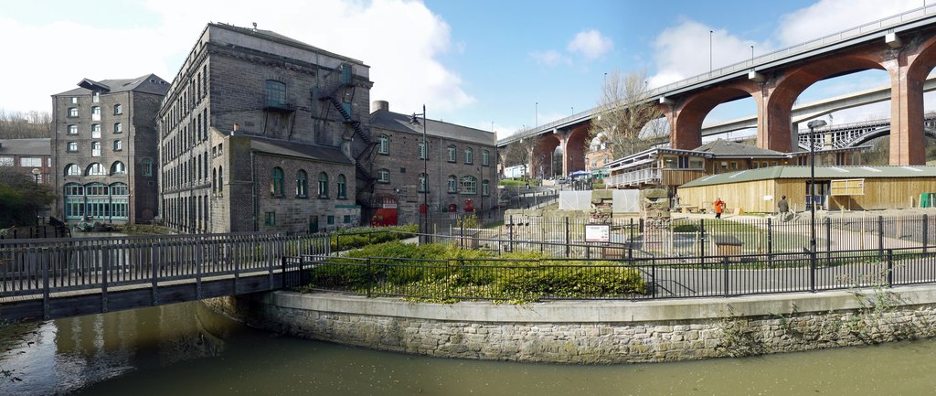
Ouseburn panorama. Photo by A Curtis (2010)
Historical context taken from:
Ouseburn Valley Urban Landscape Study, May 2007
Insite Environments commissioned by Newcastle City Council.
The Lower Ouseburn Valley was originally part of the township of Byker, one of the first outside of the town walls and prior to the industrial revolution of the 19th Century, was largely agricultural.
The Ouseburn is the longest of Newcastle’s Tyne River tributaries and is tidal up to the base of Stepney Bank. It was traditionally a fast flowing stream, however the nature of the water course has changed considerably due to developments up stream and is now slower moving and of poor water quality. The Ouseburn is edged from Stepney Bank to its confluence with the River Tyne by a mix of retaining structures from a range of periods.
The overall character of the area has been shaped by the industrialisation of the Ouseburn and its banks during the 17th, 18th and 19th centuries although few buildings remain today. The Ouseburn was a major factor in the type of industrial development attracted to the Valley and its built form. The Ouseburn was an effective transport route, its tidal nature permitting keels and the later wherries to travel up stream from the River Tyne. As a result, processing industries located in the Valley and relied on the watercourse for the delivery of materials and export of the finished products. The dense corridor of buildings (mills, warehouses etc.) were built right up to the stream's edge and incorporated slipways and shoring for boats, as well as loading equipment, mill races and waterwheels.
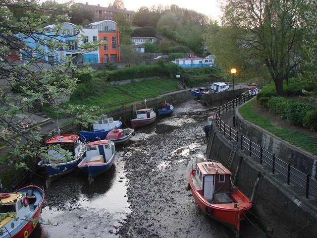 The Ouseburn at low tide. Photo by Bill Henderson (2007). | 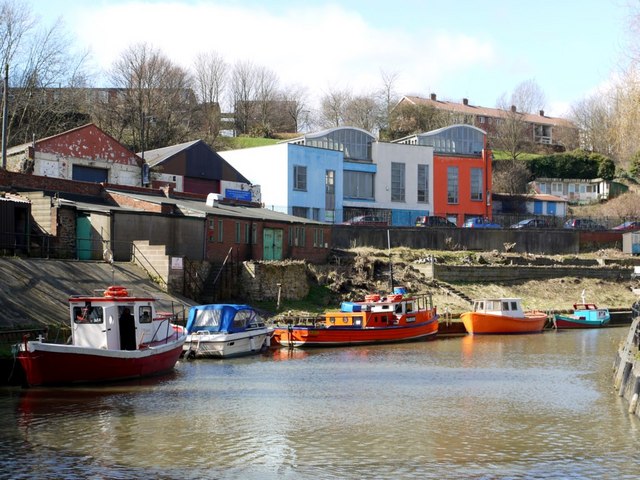 Small boats on the Ouseburn. Photo by A Curtis (2010). |
Glass making was the first known industry to be located in the valley with three glasshouses established by 1619 at the mouth of the Ouseburn.
Ouseburn Glassworks. Photo by A Curtis (2012).
The pottery industry located in the valley in 1782 and culminated in the establishment of the Maling Pottery on Ford Street in the 19th Century. The population in the valley expanded and types of industrial commercial activity developed to include shipbuilding, masonry, lead works, iron foundries, soap manufacturers, tanners, saw mills, corn mills and flint mills. The area provided substantial employment and had the infrastructure to support the development of a self-contained community with brick terraces, tenements, a doctor’s practice, school and approximately fifteen public houses.
The industrialisation of the Lower Ouseburn Valley was in direct contrast with the upper section of the Ouseburn valley which lent itself to the development of Victorian parks such as Jesmond Dene, Heaton Park and Armstrong Park.
North of the railway viaduct (the site of the City Stadium and the former Ouseburn Lead Works) the Ouseburn was culverted and the valley was used as a tip until the 1950’s. The landfill effectively cut off the Lower Ouseburn valley from the Victorian parks to the north. The landfill was used to create the bowl of the stadium and steep sided valley landscape facing the viaducts; these sides where planted in the 1970s to create an area of semi-natural woodland with open fields which have been used since as pastures by the Ouseburn Farm.
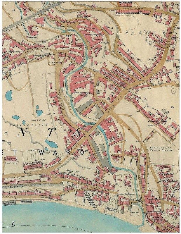
OS 1:2500 (1860)
Mike Greatbatch told us about what life was like for the people who lived and worked in the Ouseburn valley, illustrated with old photographs and maps. It was a vibrant community of squalid tenements where people shared a limited space with heavy, dirty, and frequently dangerous industrial processes.
'Slaughter houses, coal wharves and dwelling houses of not the most desirable appearance environ the burn… Just above the bridge the keels may be seen lying and delivering coal in carts while horses stand impatiently in the cold water. In the cold water too, we see ragged groups of people with baskets and bags, wading and groping with their hands for coals which has fallen overboard. Where Lime Street now is, on the right bank used to stand the lime kilns by the waterside, and opposite where the engine works are, used to be a little boat builders' yard, while a little higher up gardens ran to the quay wall of the burn and their trees hung over the edge.'
ILLUSTRATED LONDON NEWS, 16 JULY 1887
ILLUSTRATED LONDON NEWS, 16 JULY 1887
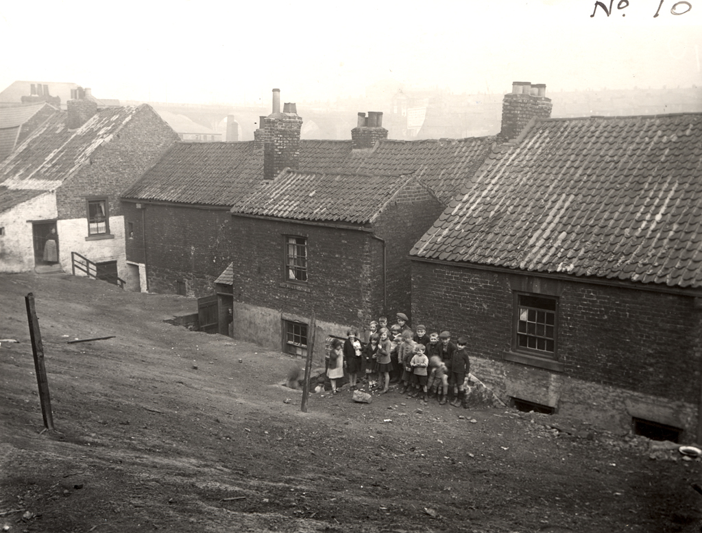 A view of the rear of nos 31-39 Lime Street, lower Ouseburn. Photo in Newcastle Libraries collection. | 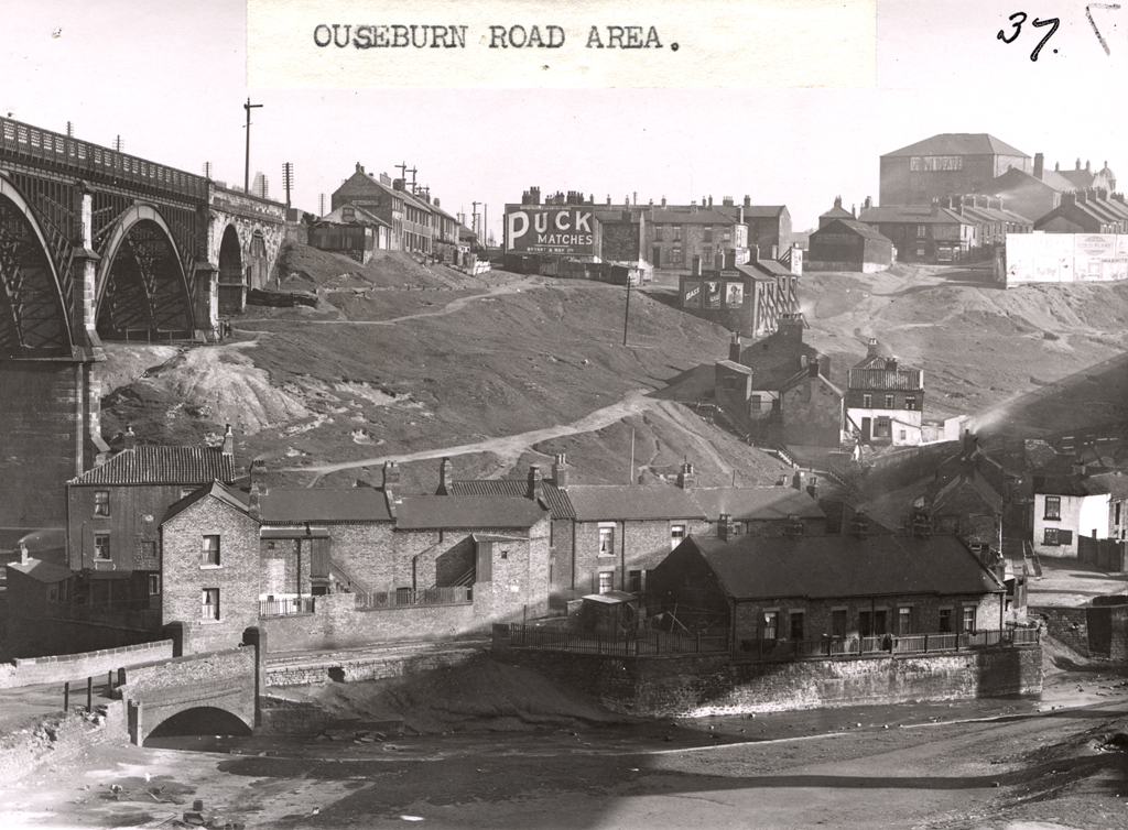 A view of the Ouseburn Road Area taken c.1935. Photo in Newcastle Libraries collection. |
Ouseburn links:
Ouseburn Trust
Welcome to the Ouseburn
Photographs of Newcastle
Geograph project - Ouseburn
Ouseburn Trust
Welcome to the Ouseburn
Photographs of Newcastle
Geograph project - Ouseburn
 RSS Feed
