
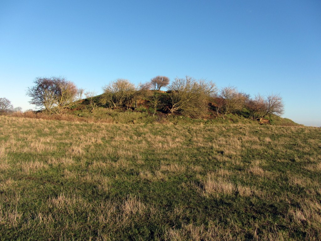
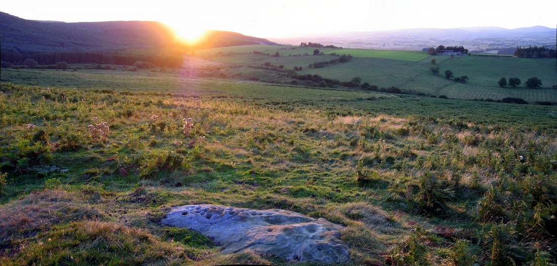
Dewley Hill. Photo A Curtis (2013)
An alleged round barrow, Dewley Hill (also known as Dewley Law, Dewley Mound) is generally regarded as a natural feature - a kaim (or kame) of glacial origin. However, a number of finds suggest that it was utilised in prehistory.
Although doubts have been cast on the existence of some flints claimed to have been recovered from its surface, a fragment of a Neolithic polished stone axe plus Mesolithic cores, blades, flakes and a graver are known to have been found on or in the hill. The axe is in private possession, while the Mesolithic flints are in the Hancock Museum (Preston Collection), the Museum of the Society of Antiquaries, Newcastle Upon Tyne, and Sunderland Museum.
The hill, which has been shceduled as a monument, has been reduced in size by ploughing but measured a maximum 43 metres wide and 4.2 metres high when visited by the Ordnance Survey in 1978. It has been dug into on several occasions, some by the farmer while pursuing foxes. Nothing has ever been noted to suggest anything other than a natural sand and gravel feature.
Historic England - Research Record 22704

The Glacial Phenomena of the Country between the Tyne and the Wansbeck. By J. A. Smythe. Transactions of the Natural History Society of Northumberland, Durham & Newcastle upon Tyne, vol. 3 (1908-1911).
The finding of small flints on the surface, many of which exhibit human workmanship, might be thought to confirm the common view that the pile is of human origin, but its size and position, the nature of its pebbles and the general resemblance to the other kaims, make this extremely improbable. It is quite likely that such a prominent feature might be used by primitive man for burial or other purposes, which would sufficiently account for the presence on it of relics of his handiwork.
 |  |
Sockett, E. W. (1971). Stone axe from Dewley Law. Archaeologia Aeliana Series 4. Vol 49, p. 246.
Aerial photographs of the monument indicate that the barrow is surrounded by a number of cropmarks. These include a circular cropmark, interpreted as a bank and ditch immediately surrounding the barrow, a hut circle and a further enclosing feature, believed to be a boundary bank and ditch enclosing the raised ground around the barrow. Further circular cropmarks, interpreted as hut circles, are evident in the north west corner of the field. These surrounding features are also included in the scheduling.
Whether Bronze Age burial mound or natural glacial feature (a kaim), Dewley Hill is a Scheduled Monument (List Entry Number: 1018678) and protected by law.
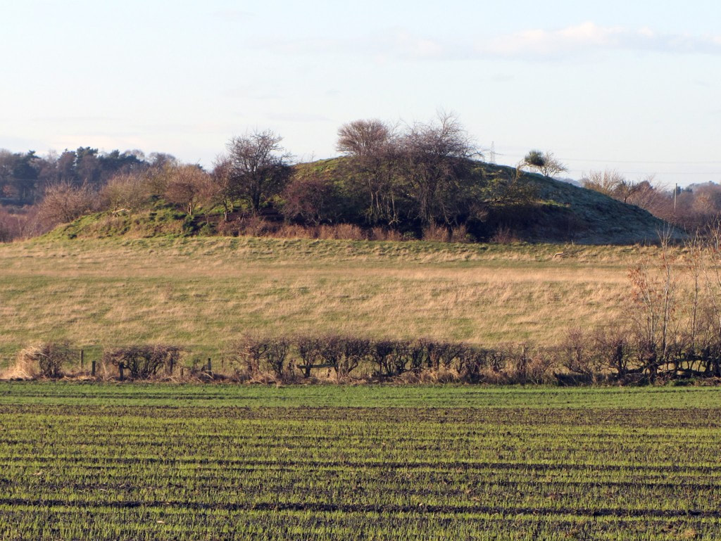
Dewley Hill. Photo A Curtis (2013)

Dewley Hill in centre of extract from LIDAR (NZ16ne_FZ_DSM_1m) © Environment Agency copyright and/or database right 2022. All rights reserved.
Although now safe from the prospects of nearby open-cast coal mining (mainly the result of a local campaign), the Dewley Hill Scheduled Monument was added to Historic England's Heritage at Risk Register (list entry: 27470) with the following assessment:
Assessment InformationAssessment
Type: Archaeology
Condition: Extensive significant problems
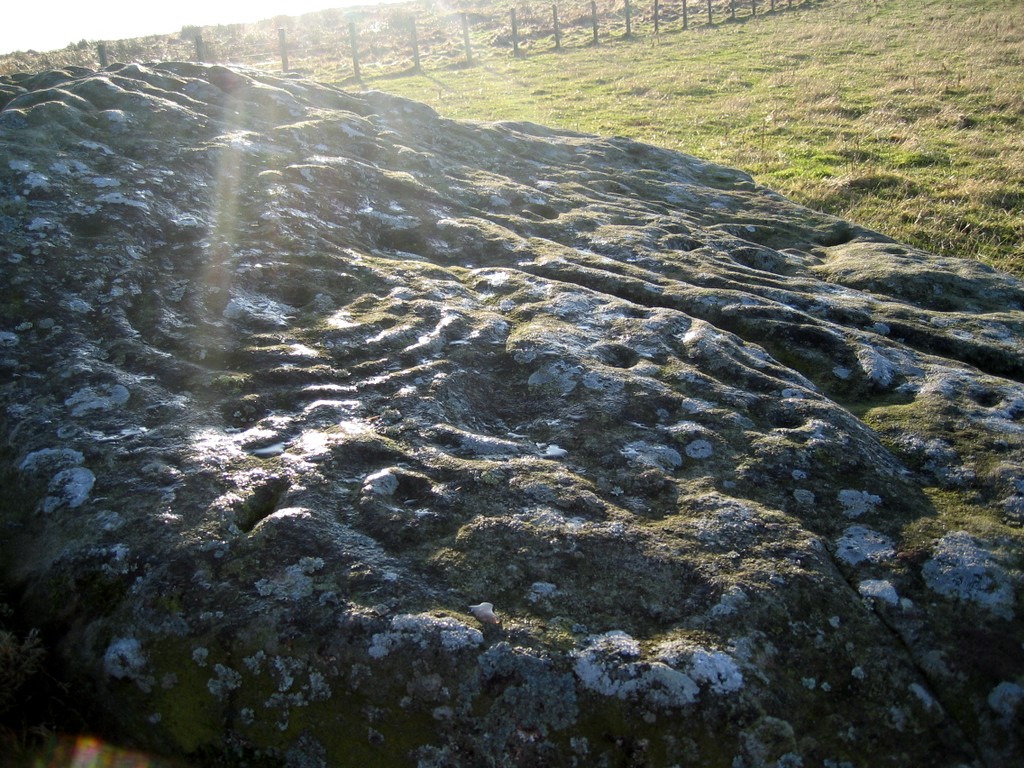
Principal Vunerability: Animal burrowing - extensive
Trend: Declining
Ownership: Private
Assessment InformationAssessment
Type: Archaeology
Condition: Extensive significant problems
Principal Vunerability: Animal burrowing - extensive
Trend: Declining
Ownership: Private
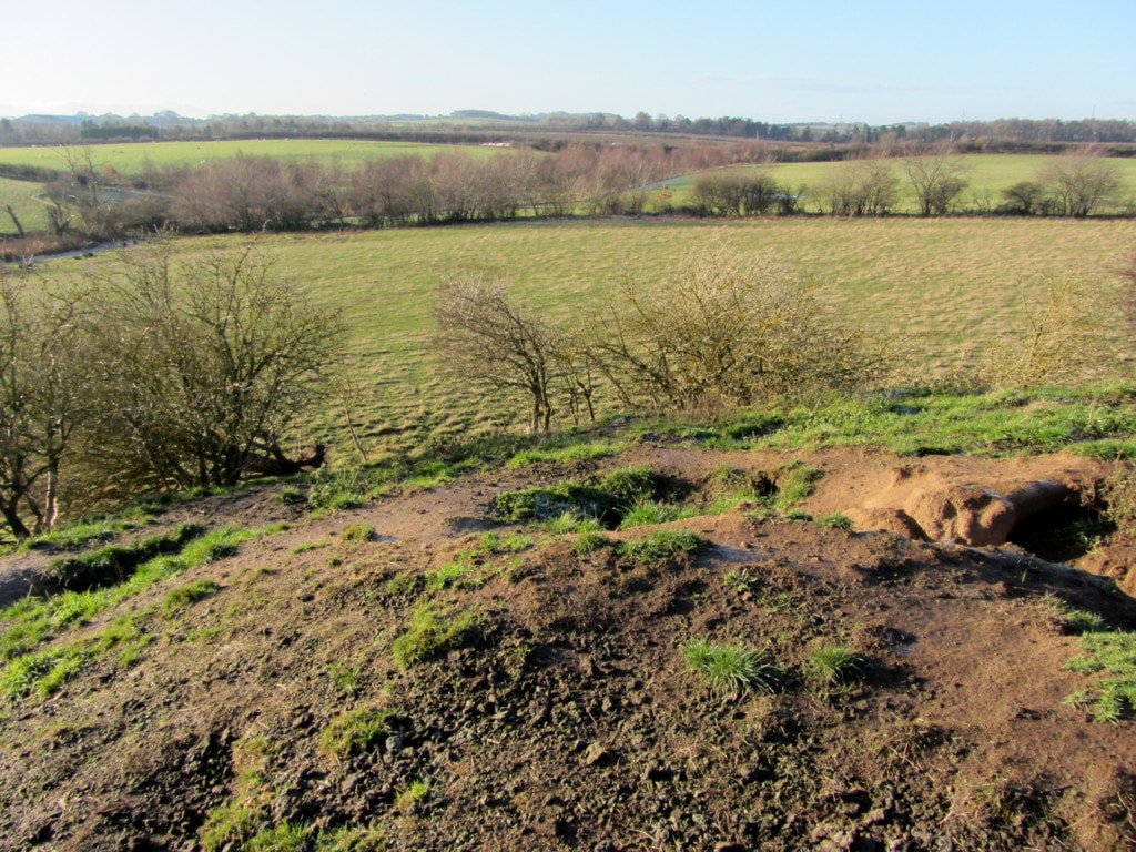
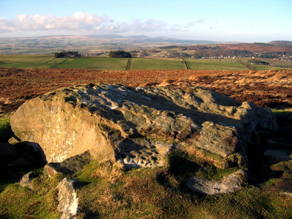
Heritage at Risk: animal burrows in the Dewley Hill mound. Photo A Curtis (2013).
 RSS Feed
