
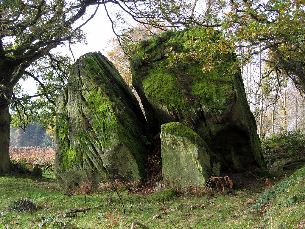
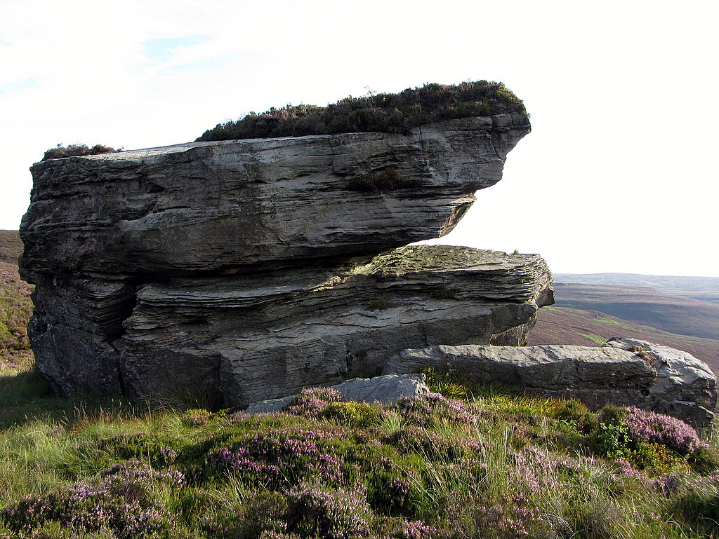
The Tailor & His Man, Shaftoe Crags. Photo A Curtis (2014).
Some things came together recently to develop further my interest in the Northumberland countryside, place-names and rocks (carved or otherwise). Firstly, on a recent walk from Alnham in the Cheviot Hills my friends introduced me to 'The Grey Yade of Coppath'.
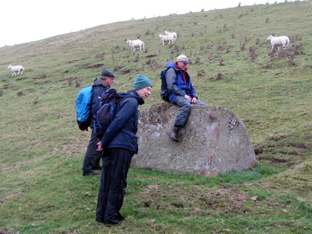
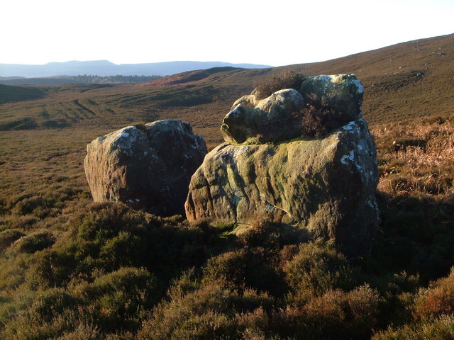
The Grey Yade of Coppath near Alnham. Photo A Curtis (2014).
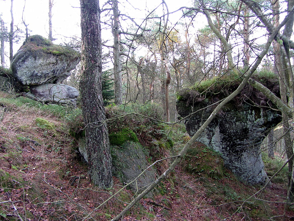
This boulder, just above the road from Alnham to the remote farm of Ewartly Shank, has the unusual name, 'Grey Yade of Coppath'. A 'yade' is a lowland Scot's word for an old mare or horse (here ridden by Dave) and is also used in parts of northern England where it has locally become part of the Geordie dialect. The road crosses the Coppath Burn just to the north accounting for the local element of the name.
"On his gray yade as he did ride
With durk and pistol by his side"
Excerpt from 'Muirland Willie' - a Scottish Ballad said by Robert Burns to describe,
"...those ruthless times 'whan thieves were rife', and the lads went a wooing in their warlike habiliments, not knowing whether they would tilt with lips or lances."
'Grey Mare' is a relatively common name for rock features in Northumberland. Here close to the Scottish Border, with its regular crossing of drovers and pedlars, it seems fitting that a Scot's word should come to be used
It is an elaborate name for a relatively small boulder. What determined that it was named at all, who named it and when? How did it get onto the Ordnance Survey map as a place-name and how has the name survived to be still used today?
The situation of the boulder in an open landscape just above the road make it a notable feature in a relatively stone-free landscape. You can imagine generations of children in times past walking by it on the way to and from school, and occasionally taking the time to have a ride on its back. Nowadays, the very few children passing are probably in a school bus, taxi, or private car.
In my research on the Grey Yade I came across the following article:
The Named Stones of Northumberland; being a list of huge stones, singly and in groups, in situ and detached, to which local names have been given in the County. By G.A. Lebour, M.A., F.G.S. etc., Professor of Geology in the University of Durham College of Physical Science, Newcastle-upon-Tyne.
History of the Berwickshire Naturalists Club, Volume 9, 1879-1881, p.531-536.
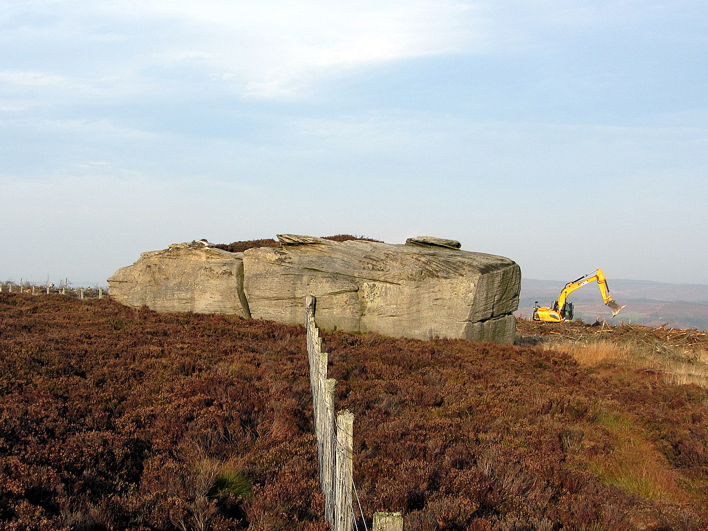
The Main Stone, Ravens Heugh, west of Simonside - marking a prominent bend in the parish boundary between Tosson and Hepple. Photo A Curtis (2014).
In this article the author lists over 100 named stones located on the 6" OS maps of his time, giving reasonably accurate latitude and longitude, and some notes. He listed over 100 stones, named on the large scale maps of his time, sensibly excluding the multitude of named crags and coastal rock features.
The three stones illustrated above are all natural rock features, unmoved (except by ice), and largely unaltered by man. However, the difficulties in drawing up such a list are considerable and his named stones cover the full range of possibilities. I have classified them into two main types which I'll call natural and artificial.
On the natural side, although crags have mainly been excluded, the distinction between crag, outcrop and boulder is blurred and can be difficult to determine. Certainly, some of his 'stones' are outcrops or small crags, as his choice of the Hanging Stone, near Cheviot and the Scottish Border, demonstrates.
On the natural side, although crags have mainly been excluded, the distinction between crag, outcrop and boulder is blurred and can be difficult to determine. Certainly, some of his 'stones' are outcrops or small crags, as his choice of the Hanging Stone, near Cheviot and the Scottish Border, demonstrates.
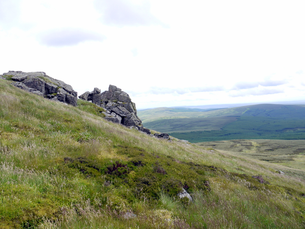
Hanging Stone below Cairn Hill, Cheviot. Photo A Curtis (2012).
The Hanging Stone does have some interesting history though. The name has been said to derive from the tale of a slumbering packman who was strangled when his heavy pack of cloth slipped over the edge, tightening the rope around his neck. The same thing is said to have happened to a robber who was carrying off a stolen sheep, both man and sheep being hanged.
Thomas Pringle (1836) refered to the 'elf-enchanted Hanging Stone'.
As James Logan Mack in The Border Line (1924) wrote, this origin is unlikely, as the name has been in use since medieval times (as Hanging Shaw or Hanging Brae). Similar names from around the country usually arise from the situation of the outcrop, in this case the central mass of fractured rock appearing to hang over the solid outcrop at the lower end. Geologically, the rock of the Hanging Stone is a hornfels, a metamorphic rock altered by the ancient intrusion of Cheviot granite.
The location was used as a boundary marker between the East and Middle Marches, divisions of the Anglo-Scottish Border, often an area of dispute and lawlessness.
The names of the Shivering Stone (south of Bloodybush Edge), Hanging Stone and Leaping Stones (north of Kielder) all carry this notion of movement.
Named parts of crags are also included. One such is the the Bridle Rock or Spindle Stone, a pillar of basalt standing out from the escarpment of the Great Whin Sill at Spindleton Heughs, west of Bamburgh, locally regarded as the rock over which Childy Wynde threw his horse's bridle when about to attack the Laidley Worm; Northumberland's own Lambton.
 Kate & Geordie. Two named rocks in the forest on the north-west slope of Simonside Hills. Photo A Curtis (2014). | 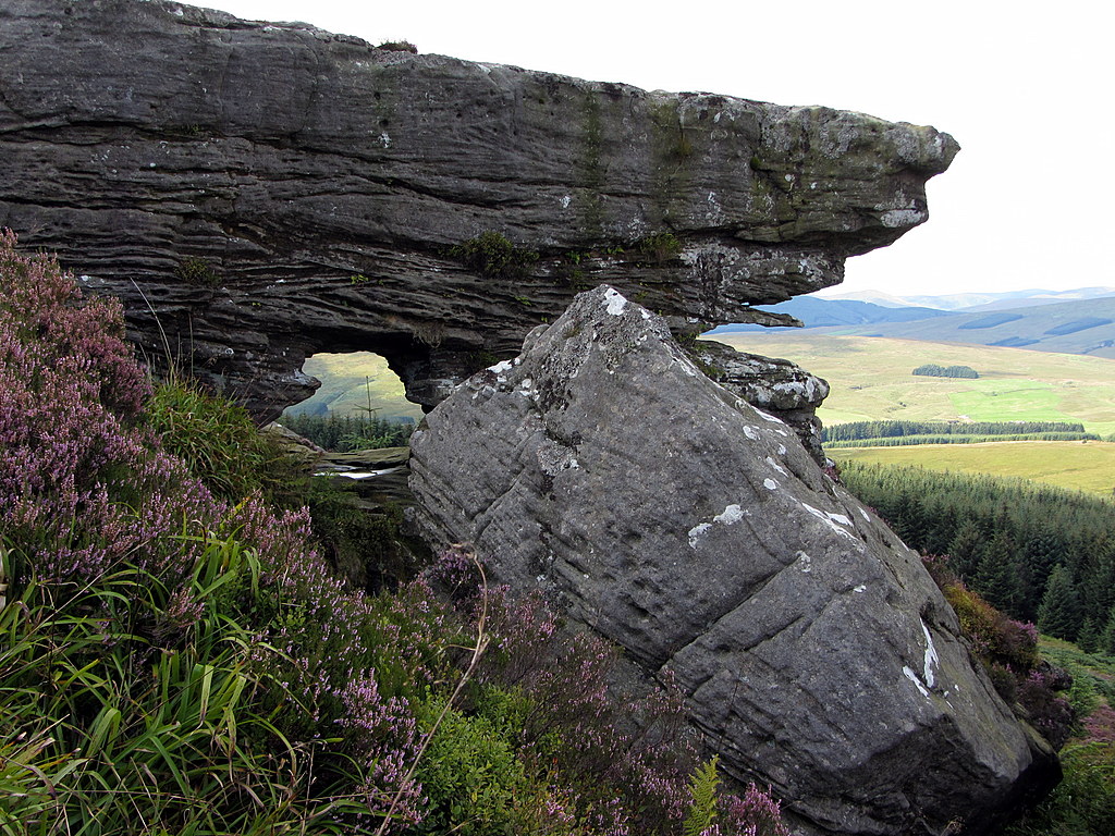 The Bore Stone on NW slope of Deadwater Fell, Kielder. Photo A Curtis (2014). |
The natural processes of erosion by wind and rain have turned certain outcrops into memorable features of the landscape, as is clearly the case with Kate & Geordie, and the Bore Stone.
Crawling through the four foot wide hole of the latter is said locally to cure pains and diseases, although it didn't have that effect on me after the not inconsiderable effort of getting there. Some think the hole was enhanced or even created by man but the process of erosion on weak strata may easily have been sufficient. Logan Mack describes how the sky can be seen through the hole from the roadway west of Deadwater Station and also, in his time, from trains on the Border Counties Railway a mile and a half away.
Crawling through the four foot wide hole of the latter is said locally to cure pains and diseases, although it didn't have that effect on me after the not inconsiderable effort of getting there. Some think the hole was enhanced or even created by man but the process of erosion on weak strata may easily have been sufficient. Logan Mack describes how the sky can be seen through the hole from the roadway west of Deadwater Station and also, in his time, from trains on the Border Counties Railway a mile and a half away.
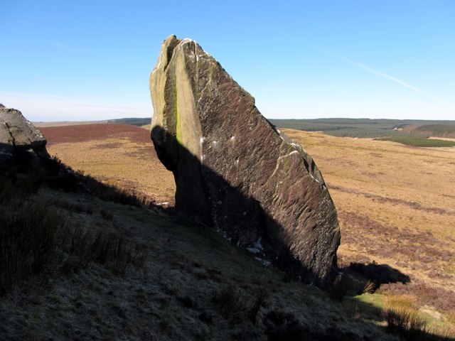
 Piper's Chair above Shaftoe Crags. Photo A Curtis (2014). |  Devil's Punchbowl above Shaftoe Crags. Photo A Curtis (2014). |
Nearer to home, man has been involved in the process of natural stones gaining a name. Above Shaftoe Crags, a boulder known as the Piper's Chair has been enhanced to make a comfortable seat with an amazing view. If you climb, gingerly onto the higher rock behind, you will find the punchbowl, among natural eroded channels and basins.
The punchbowl was probably also a natural feature, but was enlarged so that it could be filled with liquor to celebrate the wedding in 1725 of Sir William Blackett, of Wallington, to Lady Barbara Villiers, daughter of the 2nd Earl of Jersey. The capacity of the punchbowl ran to several gallons.
Contemporary newspaper reports say 'that Shaftoe Vaughan Esq., a gentleman of the neighbourhood, ordered that Shaftoe Crags be illuminated by bonfires placed upon the most eminent parts of the crag'. A large cave below the Punch Bowl rock may have played a part in the procedings as well, as old steps lead up to it from below.
A 'drink-maddened crowd' was said to have danced to the music of the pipes, and guns were fired. Presumably, the piper sat resplendent in his rock chair.
The size of the party was large as it was said that more than 1,000 pairs of kid gloves, then a traditional gift to wedding guests, were handed out.
The ‘ingenious’ Thomas Whittell, ‘licentious’ Northumbrian poet and painter, said in his youth to have ridden into Cambo on the back of an old goat (or ram) looking for work, wrote a nuptial poem to mark the occasion. It is possible that he also played a part in the carving of the punchbowl.
 The Kielder Stone. Photo A Curtis (2014). | 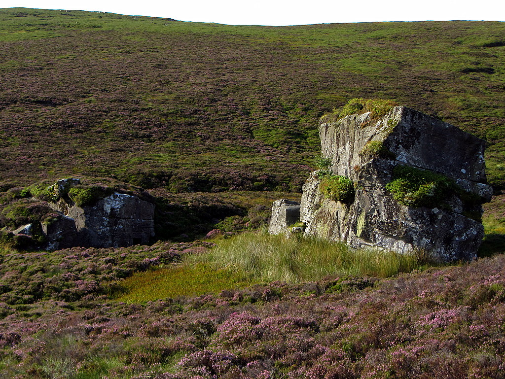 Kielder Stone from the north. Photo A Curtis (2014). |
I can't leave this section without mentioning two of the most massive of Northumberland's named stones: the Kielder Stone and the Drake Stone.
The Kielder Stone (or 'Stane' as it is called on the Scottish side) is another example of a natural feature used as a boundary marker, as the Border runs through it. It is also known as the Girdle Stone (possibly by mistake) or Rocking Stone. I safely walked around it several times, albeit clockwise, to avoid incurring the wrath of 'the little brown man of the moors'. The sandstone erratic weighs about 1600 tons and was probably moved to its present location by the action of the Cheviot glaciers.
During the times of the Border Reivers, the Wardens of the Marches of both the Scottish and English side would use the Stone as a meeting place, and a letter drop. Today the clefts of the boulder hide both a geocache and visitors' log book, retaining the tradition.
Sir Walter Scott added much to the romantic mystery of the Kielder Stone in recounting in his Poetical Works (1838), 'The Cout [Chief] of Keeldar', a Border Ballad by John Leyden, in which the chief is pursued back across the Border, past the Kielder Stone, and eventually killed by Lord Soulis' men after an ill-fated raid on his castle:
Green vervain round its base did creep,
A powerful seed that bore;
And oft, of yore, its channels deep
Were stain’d with human gore.
And still, when blood-drops, clotted thin,
Hang the gray moss upon,
The spirit murmurs from within,
And shakes the rocking stone.
There was no vervain to be seen when I visited but certainly some hanging grey moss. In fact some of the lichens that grow on the boulder are particularly rare, possible remnants of the Kielder wildwood.
The Drake Stone above Harbottle. Photo A Curtis (2009).
The Drake Stone has been polished and scratched by movements of the ice sheet during the last glaciation. Supposedly, the largest boulder in Northumberland, it is 9 metres high and weighs in excess of 2000 tons. In Murray's Northumberland (1873) it is the Draag stone of the druids, said to possess magical healing powers with the ability to cure sick children passed over it.
Tomlinson (1888) saw this in the health of the village:
"Harbottle is an exceptionally healthy place ... and mortality among children is almost unknown."
Both the Kielder and Drake Stones have tales told of tourists climbing up on top, spending an unpleasant time in their exposed predicament, and then having to be rescued. No doubt that still happens today.
Girdle Stone on Girdle Fell above Catcleugh. Photo by Pete Saunders (2009).
Differential erosion of lower sandstone layers to produce a stone with a prominent waist accounts for the name of Girdle Stone, sometimes applied to the Kielder Stone but more correctly to the large rock on Girdle Fell, further east above Catcleugh.
Animal names are fairly common. There are several Grey Mares, for example (there are seven on the list, including Grey Nag). There is a Crow Stone and a Blue Sow on the Otterburn Ranges. Named stones are prevalent in the Rothbury area where there is a Cockcrow Stone, south of Cragside. There is a Gowk (cuckoo) Stone on Glantlees Hill, shown only on the First Edition map.
Many of the stones on Lebour's list are very much smaller but have names that made it onto the Ordnance Survey maps on the basis of their location (natural or moved) onto boundaries. The Border line has a few, as do the boundaries of the County, and those between neighbouring parishes and estates. The names are often descriptive: the Grey Stone, the Split Stones, Ox Eye, Grey Mare.
A few artificial boundary stones, those in Northumberland often carved with initials to demarkate the land ownership, have also been named. Perhaps it was because of their location on a bend in an otherwise unmaked boundary. The curiously named Loughing Stone (between Ottercops and Kirkwhelpington) and the Bumping Stone on Warkworth Moor may be named from the practice of 'beating the bounds'. There is a Riding Stone in the River North Tyne by Bellingham Mill, and a Union Stone marks a junction between the parishes of Alnwick, Denwick and Edlingham.
A few artificial boundary stones, those in Northumberland often carved with initials to demarkate the land ownership, have also been named. Perhaps it was because of their location on a bend in an otherwise unmaked boundary. The curiously named Loughing Stone (between Ottercops and Kirkwhelpington) and the Bumping Stone on Warkworth Moor may be named from the practice of 'beating the bounds'. There is a Riding Stone in the River North Tyne by Bellingham Mill, and a Union Stone marks a junction between the parishes of Alnwick, Denwick and Edlingham.
 Donald's Grave near Slaley Hall. Photo A Curtis (2014). | 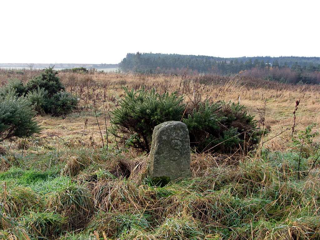 Hare Stone near Slaley Hall. Photo A Curtis (2014). |
Three boundary stones in the area south-east of Slaley Hall are named Donald's Grave, the Greyhound Stone, and the Hare Stone. I was unable to locate the Greyhound Stone in ground heavily disturbed by off-road vehicles.
Tuppie's Grave may mark an earlier course of the Scottish Border around part of Yetholm Common in the Cheviot Hills, close to Tuppie’s Sike.
Tuppie's Grave may mark an earlier course of the Scottish Border around part of Yetholm Common in the Cheviot Hills, close to Tuppie’s Sike.
Sheriff's Stone, Nookton West Fell. Photo by A Curtis (2014).
In the south of our region, of the three named stones recorded on the County boundary between Northumberland and Durham, I was unable to find the Rookhope Edge Stone, or one at Beggar's Rest. It is likely that these were both originally small Boundary Stones similar to many others that can still be found along the boundary fences nearby.
Just north of these, also on the County Boundary, there are several natural stone slabs in the region of the Sheriff's Stone. The largest of the stones here could have originally stood on one edge and formed a prominent marker. If the Sheriff's Stone wasn't also just a small boundary marker, perhaps this is it. The modern fence is now several metres further west, close to a well-built currick or shepherd's cairn.
Just north of these, also on the County Boundary, there are several natural stone slabs in the region of the Sheriff's Stone. The largest of the stones here could have originally stood on one edge and formed a prominent marker. If the Sheriff's Stone wasn't also just a small boundary marker, perhaps this is it. The modern fence is now several metres further west, close to a well-built currick or shepherd's cairn.
 Duddo Stone Circle. Photo A Curtis (2010). 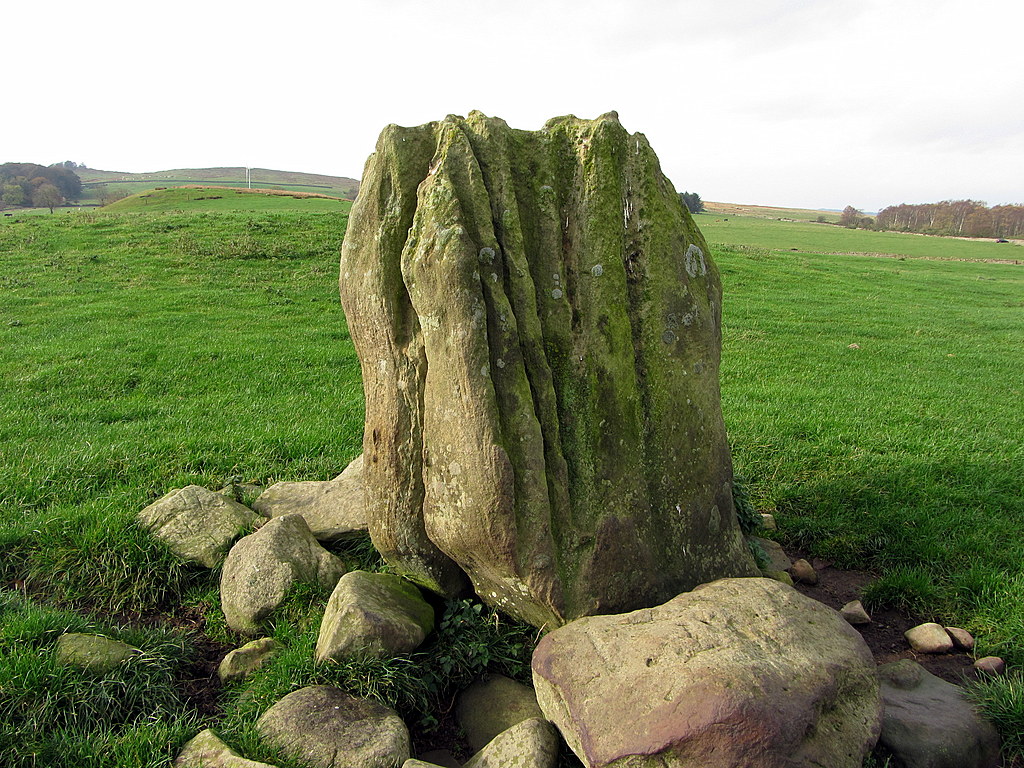 Standing Stone at The Poind & His Man. Photo A Curtis (2014). | 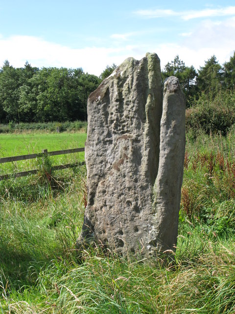 Stob Stone, Matfen. Photo by Mike Quinn (2007). |
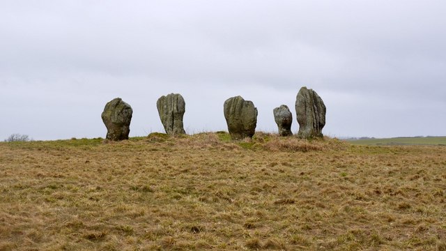
Another category of named stones are prehistoric, although we will never know their original names. There are, for example, the stone circles of Duddo and Threestoneburn, and the stone row known as the Five Kings near Holystone.
Also in this group are single standing stones such as the Stob Stone at Matfen, and the Poind & His Man close to the Devil's Causeway near Bolam West Houses. Nearby is a natural sandstone outcrop called Hunter's Stone. The Poind’s other man is now to be found in the grounds of Wallington Hall.
Also in this group are single standing stones such as the Stob Stone at Matfen, and the Poind & His Man close to the Devil's Causeway near Bolam West Houses. Nearby is a natural sandstone outcrop called Hunter's Stone. The Poind’s other man is now to be found in the grounds of Wallington Hall.
A number of the named stones were former bases of medieval wayside crosses, e.g. Kimmin's or Comyn's Cross on Haughton Common, the Golden Pots of the Otterburn ranges, the Hurl Stone of Lilburn
Percy's Cross near Wooperton on A697 was erected to commemorate Sir Ralph Percy, who fell from his horse leading the Lancastrian army at the battle of Hedgeley Moor, 23rd April 1464. Nearby are two boulders, Percy's Leap, which caused his fall.
Percy's Cross near Wooperton on A697 was erected to commemorate Sir Ralph Percy, who fell from his horse leading the Lancastrian army at the battle of Hedgeley Moor, 23rd April 1464. Nearby are two boulders, Percy's Leap, which caused his fall.
 Percy's Cross. Photo by Russel Wills (2014). |  Percy's Leap. Photo by David Clark (2009). |
There are two Battle Stones north of Wooler, both probably Bronze Age standing stones. One near Akeld on the site of the Battle of Homildon Hill (1402), and the other near Yeavering commemorating the victory of Sir Robert Umfreville over the Scots in 1415.
I feel more attracted to the natural stones. Here are two with religious connections:
 The Priest & Clerk, Cartington Hill. Photo by Derek Harper (2006). | 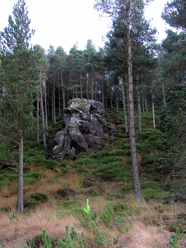 Little Church Rock (and cave), Simonside. Photo A Curtis (2014). |
I can imagine meetings of the Berwickshire Naturalists Club after Professor Lebour had published his list. It would be like the episode of Blackadder where the eponymous hero confronts Dr Johnson about his 'comprehensive' new dictionary. He would be constantly reminded about missing out someones favorite named rock, and lambasted for including some that aren't rocks at all.
Bigges Pillar - "that's a cairn (or possible medieval beacon)".
Bloody Bush Pillar - "that's a masonry pillar on the old toll road".
Standing Stone - "You can't have that, it's a description, not a name".
There are certainly a few named stones missing from Lebour's list and some that I wouldn't have included.
I can forgive him from missing off Split-the-Deil located near Russels Cairn on Windy Gyll, as it first appeared as a named feature on the map in 1899. By the 1950s the place name had moved further west on the maps, where it is shown today, and is no longer indicated as a mapped point feature.
There will of course be many locally-known names that never made it onto the OS maps. Some are alluded to by placenames: Biddlestone, Holystone, Falstone etc.
The parish of Fourstones near Hexham is said to have had four corners of its boundaries marked by stones thought to have been Roman altars, with hollows in their tops to hold holy water. One was used as a discrete letter drop in the 1700s between Lord Derwentwater and his Jacobite friends. The story is that a small boy dressed in green was employed to carry the messages, who locals thought was a fairy. The Fairy Stone as it became known was thought to have been destroyed in the nineteenth century, although The Northern Antiquarian suggests it can still be found in the village. There is some new detail about this on the blog.
Lebour's list has another Fairy Stone, just north of Housesteads Roman Fort, and probably originally a slab built into part of a native building.
I leave you with one of my favorites that surely deserves to have a name independent of the crag that it lies below.
Monolith at Queen's Crags north of Sewingshields. Photo by A Curtis (2014).
Northumberland is a big county but doesn't have a huge number of rock features, compared say with Cumbria. I certainly wouldn't like to compile a similar list there!
Below is a kml file to use with Google Earth which maps all the rocks given in the Lebour paper. I have corrected his corordinates and accurately relocated them where possible.
| northumberlands_named_stones.kml |
Two articles based on this blog were published in The Northumbrian Issue No.144 (February/March 2015) and Issue No.145 (April/May 2015).
 RSS Feed
