
My article on the Named Stones of Northumberland included a brief account of Fourstones, and the stones (described as Roman altars) which were said to have given the hamlet its name. For those that don't already know, Fourstones is a small hamlet close to the River South Tyne north-west of Hexham.
I have now had time to explore this story in more detail.
The earliest source I have found so far is 1825 by Eneas Mackenzie in An Historical, Topographical, and Descriptive View of the County of Northumberland ...
His account of the Parish of Warden includes the following on Fourstones (Vol.2, p.262):
Fourstones about 1 mile north west from Warden contains a farmhold with cottages for labourers. This place with an adjoining colliery belongs to Greenwich Hospital. This township is named from being bounded by four stones supposed to been formed to hold holy water.*
The footnote is as follows:
*A writer in the Newcastle Magazine (Feb. 1824) calls these stones Roman altars, and relates a story very current in this neighbourhood, from which one of them obtained the name of the Fairy Stone, in the rebellion of 1715.
“The Ratcliffes, Forsters, Fenwicks, and others of the Jacobite families in the neighbourhood had recourse to the following curious stratagem for the security of their correspondence. The focus of the Roman altar was cut into a square recess with a cover; a little boy, clad in green, came every evening in the twilight, to receive the letters deposited in this recess for the Earl of Derwentwater, and in retern laid down his lordship’s letters, which were spirited away in the same manner by the agents of his friends. The humour of these urchins, or the policy of their masters, probably led to those tricks, which are still related by the peasantry as characteristic ot the fairy stone."
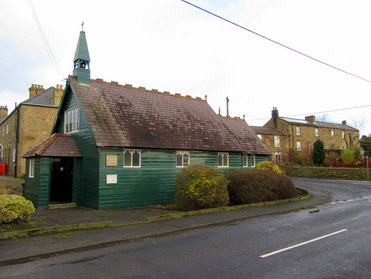
St Aidan's Mission Church, Fourstones. Photo A Curtis (2015).
John Hodgson repeats this story in A History of Northumberland (1840) but is somewhat sceptical.
The parish of Wardon [sic] is described as made up of four townships: Wardon, Walwick-Grange and High-Wardon, Fourstones and Walwick.
In Vol.3 p.411:
The parish of Wardon [sic] is described as made up of four townships: Wardon, Walwick-Grange and High-Wardon, Fourstones and Walwick.
In Vol.3 p.411:
Carel Street, i.e. Carlisle-street, had upon it, as it passed a little to the south of Fourstones, a Cross, or other pillar, set in a socket or mortise-hole, in a great square stone pediment, which, because no regular tradition remained respecting its original use, had in the middle of last century obtained the name of the Fairystone.
I presume that Carel Street is another name for Stanegate, the former Roman road that ran from Corbridge to Carlisle but reused well into medieval times. The supposed course of Stanegate, however, is just to the north of Fourstones village, not to the south as stated by Hodgson. The placename, Fourstanes, was in use as early as c.1250 (in the Testa de Nevill). Wayside crosses were commonly erected along such route-ways in medieval times.
On the next page, Fourstones is described thus:
On the next page, Fourstones is described thus:
Fourstones, a grey village, fronting the south, under the brow of a whinny hill, scarred with a long sandstone quarry, seems to sit darkling in the sun under a load of grey slate, sad and dour as an incubus, but is really a cheerful spot, and enjoys a delightful prospect over the rich and beautiful valley of the South Tyne.
He then again elaborates the story of the Fairy Stone:
The origin of Ihe name might be from the situation of the place be-fore the brow of a rocky hill that shelters it from the north, and under which there were formerly large fragments of a loose stone detached by time from their "native quarry;" or four of these stones might be remarkable enough to obtain the name of the "Four-stanes," and the village be called after them; though I am inclined to believe that "fourstanes" had formerly been fixed for some purpose here on Carel-street, from which the name originated.
Fraud and silliness, however, have each its tale on the subject. One account is, that the township "is named from being bounded by four stones supposed to have been formed to hold holy water." Another, that these stones were Roman altars, and that there is a current story in the neighbourhood, that one of them was called the Fairy-stone, because in the Rebellion in 1715, the focus of this altar was formed into a square recess with a cover to receive the correspondence of the rebel chiefs, and that a little boy clad in green came in the twilight of every evening to receive the letters left in it for lord Derwentwater, and deposit his answers which were "spirited away in the same manner by the agents of his friends" (b).
This Fairy-stone, however, certainly had existence, for a person, 80 years of age, remembers its situation to the south of the village, near the old road, and that it was squared, and had a square "cistern hewn out of its top, which was called the Fairy-trough, and traditionally said to have had a pillar fixed in it" (d).
This is an exact description of the base of an old churchyard, village, boundary, or memorial cross: but no trace of either the stone or the road remains.
(b) Placlta de Juratls etc apud Nov. Cast. 7 Edw. 1 in Dom. Cap. Westm.; III. 1., 190; and Rot. Parl. 1., 1.8.
(c) Mack. Northumb. It., 262.
(d) From the kind Information of the rev. C. Bird, vicar of Wardon, to whom I am indebted for ready answers to queries respectlng this and olber places in this parish.
Without wanting to add further to the fraudulence or silliness, I wondered if the Fairy Stone was still known today.
Although the few locals I met in the old part of Fourstones on a wet Sunday afternoon recently were unable to help my enquiries, I did find some references to the stone in parish notes in recent issues of the local magazine, The Stanegate.
Although the few locals I met in the old part of Fourstones on a wet Sunday afternoon recently were unable to help my enquiries, I did find some references to the stone in parish notes in recent issues of the local magazine, The Stanegate.
February 2014
Homer’s Lane
Clerk liaising with Cllr Straker has asked NCC NEAT inspector to investigate a possible blocked gully near the Fairy Stone.
April 2014
Homer’s Lane
The report by the Clerk and Cllr Straker concerning the possible blocked gully on C235 near the Fairy Stone has been given a Task Sheet by the NCC NEAT inspector and a dangerous sycamore tree has been identified.
The clerk of the Parish Council, Robert Macfarlane, kindly confirmed the location. Another report of the Parish Council showed that a seat had been erected by the Fairy Stone in Homer's Lane in 2014.
Homer's Lane I knew; it is a minor road running from Walwick Grange south to Warden, never close to the River North Tyne but following it on its west side. At the risk of attack by dangerous sycamores on a windy morning, I paid a visit today.
Homer's Lane I knew; it is a minor road running from Walwick Grange south to Warden, never close to the River North Tyne but following it on its west side. At the risk of attack by dangerous sycamores on a windy morning, I paid a visit today.
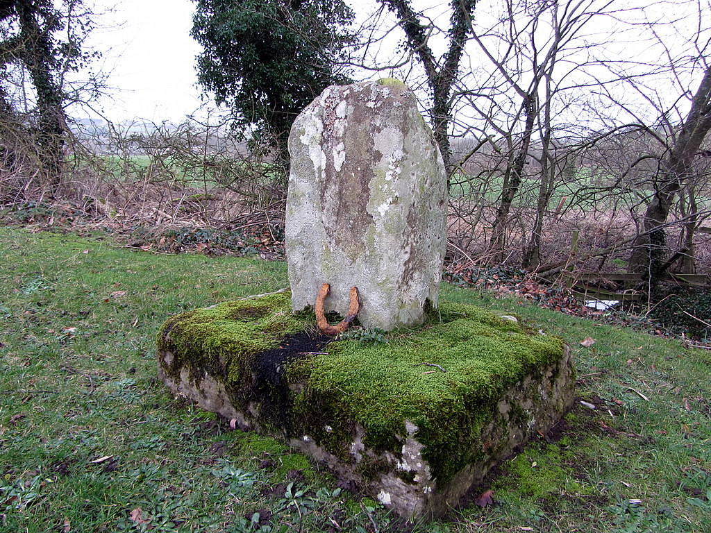 Remains of medieval cross, Homer's Lane. Photo A Curtis (2015). | 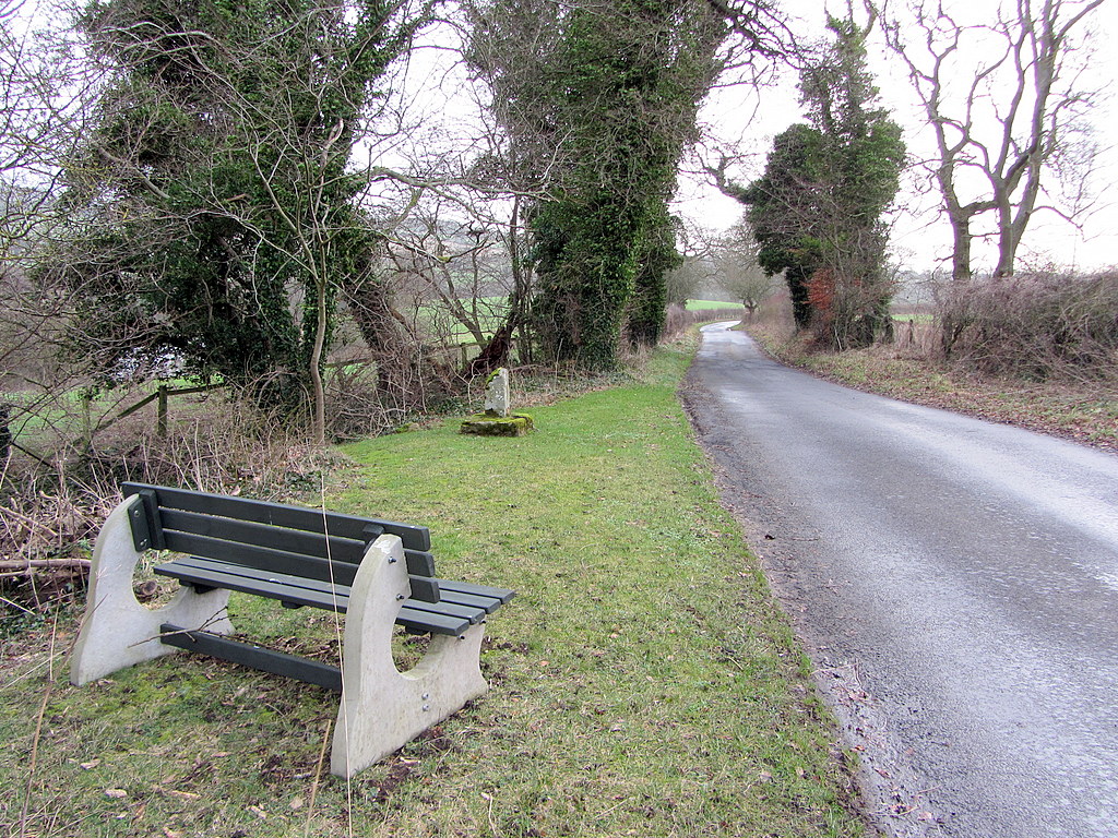 Homer's Lane near wayside cross. Photo A Curtis (2015). |
The archaeological record confirms the stone as probably a medieval wayside cross:
Pastscape
Ancient Monument Listing (No. 1008265)
The broken top of the stone has weathered and does have a very small recess. On the day of my visit, someone had placed a shiny new penny in the hollow, and a lucky horseshoe was propped up at the cross base.
Pastscape
Ancient Monument Listing (No. 1008265)
The broken top of the stone has weathered and does have a very small recess. On the day of my visit, someone had placed a shiny new penny in the hollow, and a lucky horseshoe was propped up at the cross base.
It is shown as "Cross (remains)" on large-scale OS maps but was originally located, at least before 2006, slightly further north on the same side of the lane where it is now placed. The location is very close to where Stanegate crosses Homer's Lane, heading east to its presumed ford over the river.
The 6" scale first edition map (1865) clearly indicates Stangate heading west of the lane as a definite track but I don't think it is anywhere as clear today.
The 6" scale first edition map (1865) clearly indicates Stangate heading west of the lane as a definite track but I don't think it is anywhere as clear today.
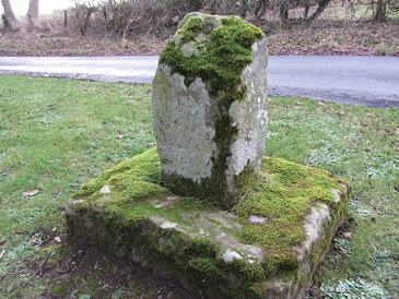
Remains of medieval cross, Homer's Lane. Photo A Curtis (2015).
Mackenzie (1825) also refers to the cross on Homer's Lane on p.261 but makes no connection to it ever being the Fairy Stone which he describes separately (given above) on his following page. This certainly doesn't help the identification of the old cross with the Fairy Stone.
At a little distance from the Grange, and adjoining the lane leading to Warden, called Homer's Lane, is the fragment of a cross, with a sheathed sword cut on it, as the token of a treaty of peace; but to what event it relates is not known.
According to the Pastscape record the cross carries an engraving on its W side; this is described as a narrow 'V' shape, 0.36m long, possibly representing the remains of
an engraved cross decoration. The first edition OS indicates it may also have had a bench mark.
an engraved cross decoration. The first edition OS indicates it may also have had a bench mark.
Homer's Lane seems also to have been a ancient north-south route, and having avoided becoming a major road in recent times, still retains the feeling that little has changed. The OS map of 1865 shows Homer's House situated a little south of the cross on the opposite side of the road.
In a place so close to Roman and other ancient remains there are other possible candidates in the area, including a 7th century cross in the churchyard of St Michael's in Warden and a Roman altar (with attached sundial) at Newbrough Lodge.
I have even seen a claim that a broken stone lying beside The Red Lion in nearby Newbrough was also one of the four boundary stones. There are sure to be others. These things get lost in the mists of time.
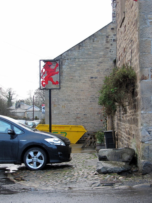 Corner of Red Lion, Newbrough. Photo A Curtis (2015). | 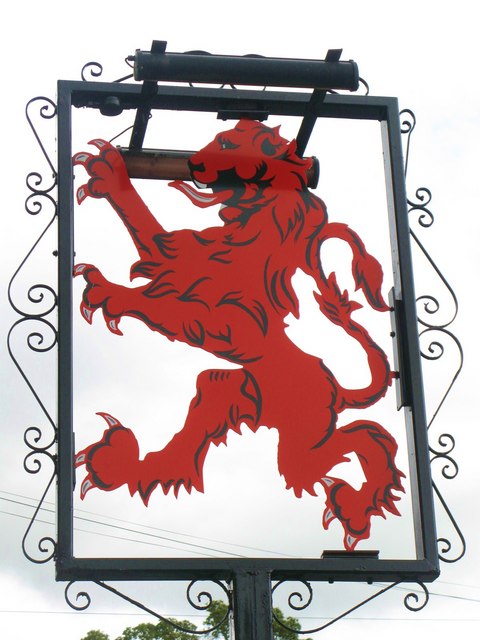 Sign for the Red Lion. Photo by Mike Quinn (2010). |
I wouldn't like to speculate on the truth or otherwise of the story or even be definite that the Fairy Stone is now located as the site of the Cross on Homer's Lane. How many of the four stones have survived, been moved or destroyed? To which of the four stones was the name applied, or has the name too moved around? Memories can often be unreliable and the evidence appears conflicting.
The old OS maps do not name a Fairy Stone at the site of the cross on Homer's Lane, or anywhere else in the vicinity.
There is a report in the Northern Antiquarian blog that when former Ley Hunter editor, Paul Screeton (1982) came looking for the stone in the late 1970s, he was fortunate in coming across an old local. The site even quotes the grid reference that he provided, NY 893 680. This is within the old part of Fourstones village, and was the basis for where I first looked. Perhaps there is still someone local who knows.
There is a report in the Northern Antiquarian blog that when former Ley Hunter editor, Paul Screeton (1982) came looking for the stone in the late 1970s, he was fortunate in coming across an old local. The site even quotes the grid reference that he provided, NY 893 680. This is within the old part of Fourstones village, and was the basis for where I first looked. Perhaps there is still someone local who knows.
Some time ago while looking for the Fairy Stone at Fourstones…I came across a farmer who pointed it out and remarked that a few years previously when the road was widened the local lengthsman made sure it was not destroyed, though it had to be moved a short distance.
Interestingly, there is another Fairy Stone shown on both old and modern maps, just north of Hadrian's Wall and Housesteads Roman fort, associated with two circular earthworks of uncertain age, standing on drier ground beside the Knag Burn. The fairies there come out from their caves below Housesteads Crags to dance on moonlit nights, spreading their fertile fairy dust on the fine green sward (Mackenzie 1825, p.310). I know because I've been there. That, though, is another story.
So you see, there are fairies in Northumberland!
So you see, there are fairies in Northumberland!
UPDATE
10/01/2015
Further information received with thanks from Robert Macfarlane:
10/01/2015
Further information received with thanks from Robert Macfarlane:
I used to refer to the stone as Homer's Lane Cross - however more recently (I'm not sure why) as Fairy Stone (possibly because of the forthcoming tercentenary commemorations).
The cross was originally in the Cross-acre field 100 yards closer to the river. It was on the boundary between Walwick Grange (Church land) and Warden.
Errington's daughters (from Beaufront) are recorded as carrying messages between the Jacobites in 1715. A key (don't know its origin) was found in the base and is at Chesters.
I tracked down the description of the movement of the cross c1800 from the field to the edge of Homer's Lane in An Account of the Roman Antiquities by J. Clayton.
UPDATE
13/01/2015
The trouble with history research (when your knowledge is limited) is that you soon find that someone else has already done it. I came to this story from my interest in stones with names, wanted to know more about the folklore that gave Fourstones its name which led to the Jacobite legends about the Fairy Stone.
Frances Dickinson, whose book Tracking a Legend: A North Country Legacy of Jacobite Times had already followed the same clues but in her case as a (proper) historian and researcher of the Jacobites. The first section of the book was first published in 1996 as The Reluctant Rebel. The second section, which included the material about her search for the Fairy Stone, was published in 2001 by Cresset Books (Newcastle upon Tyne).
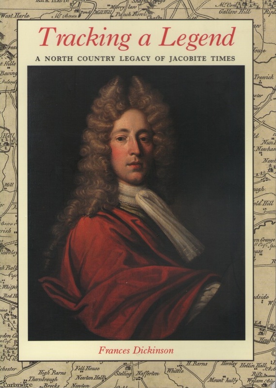 |  |
Searching for the Fairy Stone, is described on pages 114-116. Her closing sentence sums it up well:
So, the mystery of the elusive Fairy Stone remains unresolved.
It is indeed.
 RSS Feed
