
During the Jacobite uprising of 1745, the government forces based in Newcastle, under Field Marshall George Wade, were unable to cross to Carlisle in time to intercept the rebels and in fact bad weather and poor roads halted them near Hexham.
It was reported that departing Newcastle’s Town Moor on the 16th November, infantry only made it to Ovington by night. The roads were “terribly broken and full of ice” and men were sent out with lights and carts to bring them up, a process that went on till the march was continued next morning at nine. The first troops reached Hexham about four that afternoon, the rear at midnight, when, they could proceed no further because of the snow. They pitched camp on the south side of the union of the two Tynes and were provided with straw by the townsfolk who also kindled fires all over the ground as a protection against the severe cold. Wade waited three days for a thaw and, when none came, returned to Newcastle. He arrived on 22nd November, his army almost spent with fatigue and having failed dismally to halt the progress of the rebels.
One of Wade’s party, Thomas Sayer, later reported, “That he is well acquainted with the Road from Carlisle to Hexham, which is mostly through an open Country, with very few Houses, not One Part in Ten of the said Road being through inclosed Grounds: That the Country is rocky, mountainous, and boggy, and absolutely impassable, both in Summer and Winter, for heavy Carriages; and there are several Waters in the said Road, which frequently overflow and render it impassable.” The maps designated it as a ‘Summer Road’.
In 1749 a letter from the Duke of Northumberland with attached petition was referred to the Surveyor General. They asked “That Leave be given to bring in a Bill for laying out, making, and keeping in Repair, a Road proper for the Passage of Troops and Carriages between the said City of Carlisle and Town of Newcastle, in such Manner as to the House shall seem meet.”
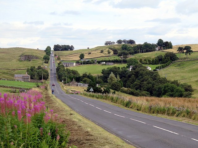
The Military Road (B6318) east of Harlow Hill. Photo A Curtis (2016).
In July to September 1749, a survey was undertaken by two military engineers, Dugal Campbell and his assistant Hugh Debbeig. Although it is often called ‘General Wade’s Military Road’, Field Marshall Wade (to give him his correct rank) in fact died in his home in Bath in 1748 and there is no evidence he had anything to do with it. It is suggested, however, that a possible instigator of the proposal, Lancelot Allgood of Nunwick, who became Sheriff of Northumberland in 1745, may have heard, first hand, the Field Marshal’s bitter remarks about the roads over which he had just struggled to Hexham, comparing them with roads that he (Wade) had made in the Highlands some years before. Allgood became a Member of Parliament in 1749 and was actively associated not only with the Military Road but also with the Corn Road from Hexham to Alnmouth.
The outcome of the survey was a map measuring about ten feet six inches long by two feet wide covering five sheets joined together to make a roll. It covered an area roughly sixty miles long (i.e. from about three miles east of Newcastle to about two miles west of Carlisle) by about six miles broad at a scale of just over two inches to the mile. There are five insets all concerned with the Roman Wall and its attendant works and the course of the proposed road is shown as a dotted line co-incidental with the Wall from Newcastle to a point nearly thirty miles west. The surveyors estimated the cost of the road as £22,450.
The outcome of the survey was a map measuring about ten feet six inches long by two feet wide covering five sheets joined together to make a roll. It covered an area roughly sixty miles long (i.e. from about three miles east of Newcastle to about two miles west of Carlisle) by about six miles broad at a scale of just over two inches to the mile. There are five insets all concerned with the Roman Wall and its attendant works and the course of the proposed road is shown as a dotted line co-incidental with the Wall from Newcastle to a point nearly thirty miles west. The surveyors estimated the cost of the road as £22,450.
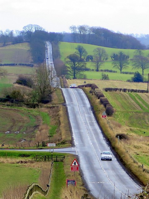
B6318 (Military Road) west of Haltwhistle Burn. Photo A Curtis (2015).
Following an Act of Parliament in 1751, construction was contracted out to civil companies, beginning that same year and finishing in 1757, with work on the new road starting at the west gate of Newcastle and in Stanwix, just north of the bridge over the Eden into Carlisle and meeting with a bridge over the Poltross Burn at the Cumberland/Northumberland county boundary.
On 4th November 1752 the Newcastle Journal reported:
“A few days ago the workmen employed in making the Military Road to Carlisle, found a great number of curious Roman coins and medals in the Ruins of the Old Wall near Heddon. They had been deposited in wood boxes which were almost decayed; yet several of the medals are as fresh and fair as if but newly struck. Some of them are made of silver; but the most part of copper and a mixture of coarser metal. They are thought to be as valuable a collection as has been discovered for some centuries past.”
Since the first 30 miles of the route coincided with the line of Hadrian’s Wall, mostly on the curtain wall itself, it became very controversial. Protests were voiced by Stukeley that not enough effort had been made to find alternative routes. Referring to the Roman Military Way, “It was the business of the surveyors of the work to trace out this road. They would have found it pretty strait, well laid out in regard to the ground, and it would have been a foundation sufficient for their new road”.
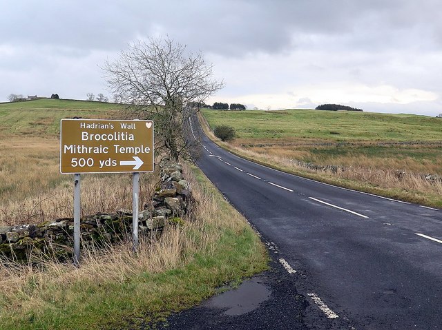
Military Road west of Brocolitia. Photo A Curtis (2015).
He railed that the overseers and workmen employed, “... demolish the Wall, and beat the stones to pieces, to make the road withal. Every carving, inscription, altar, milestone, pillar, etc., undergoes the same vile havoc, from the hands of these wretches”. Landowners, however, complained that too many stones were being used, not leaving enough to use for their farm buildings and field walls. Many preferred the line of the Wall because in many places it already acted as a boundary and meant the minimum loss of land to the new road. No doubt the decision to re-use one defunct piece of military engineering in the construction of another was hailed by many as a stroke of genius.
Total cost of road was £22,680 shared by the Cumberland and Northumberland commissioners. This included settlements for purchase of the ground (although this was waived by many of the landowners who realised the benefits of the new road), dry stone walling, and stone bridges, including those at Denton and Throckley. Some 14 toll-houses were built along its course and, in accordance with the Act, the road was measured and mile-stones erected.
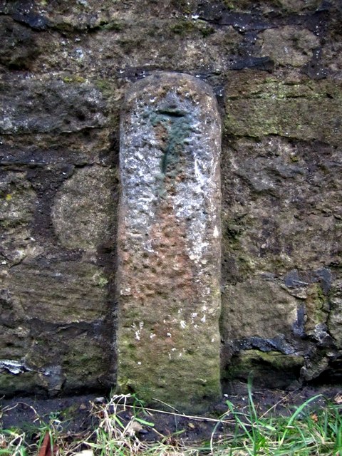
One of these milestones still exists in Heddon along the old road below the high wall that flanks Town Farm. I hope it survives subsequent development of the site. Its single numeral, 7, records the distance from Newcastle’s West Gate. It was superseded later by a metal milepost situated about ¼ mile east, still by the wood on Great Hill, showing 7 miles from Newcastle’s centre.
Based on ‘What is the Military Road?’ by Mike Bishop (2015) on the website, Per Lineam Valli, and articles in Archaelogica aeliana by W Lawson.
Total cost of road was £22,680 shared by the Cumberland and Northumberland commissioners. This included settlements for purchase of the ground (although this was waived by many of the landowners who realised the benefits of the new road), dry stone walling, and stone bridges, including those at Denton and Throckley. Some 14 toll-houses were built along its course and, in accordance with the Act, the road was measured and mile-stones erected.
One of these milestones still exists in Heddon along the old road below the high wall that flanks Town Farm. I hope it survives subsequent development of the site. Its single numeral, 7, records the distance from Newcastle’s West Gate. It was superseded later by a metal milepost situated about ¼ mile east, still by the wood on Great Hill, showing 7 miles from Newcastle’s centre.
Based on ‘What is the Military Road?’ by Mike Bishop (2015) on the website, Per Lineam Valli, and articles in Archaelogica aeliana by W Lawson.
 RSS Feed
