
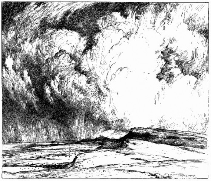
Sewingshields Crag from the West. From a pen and ink drawing by Hon. W J James in Spain (1822)
I have just had the honour to help with a field archaeology survey of land north of Hadrian's Wall at Sewingshields over four days in March. I was employed as a volunteer with the Tynedale Archaeology Group. During our recording of several stack stands (used to store winter fodder), old field boundaries and occasional settlements, I became acquainted with the Black Dyke, a long linear earthwork that tracks some distance through Northumberland, something I had only before seen on maps.
There is another, better known long earthwork, the Devil's Causeway, which can also be traced through the county. This, however, is actually a Roman road. It branches off Dere Street (the modern A68) where it crosses the Military Road at Port Gate, north of Corbridge, and runs in long straight lines north to the mouth of the River Tweed at Berwick.
The Black Dyke is one of the mysteries of Northumberland. It is a linear earthwork consisting of an embankment with a ditch on its west side, both of variable size, and completely untraceable in some areas. A definitive description was presented to the Society of Antiquaries of Newcastle-upon-Tyne by George R B Spain in November 1921, and published in their journal, Archaeologia Aeliana, Ser.3, Vol.19, p.121-168 (1922).
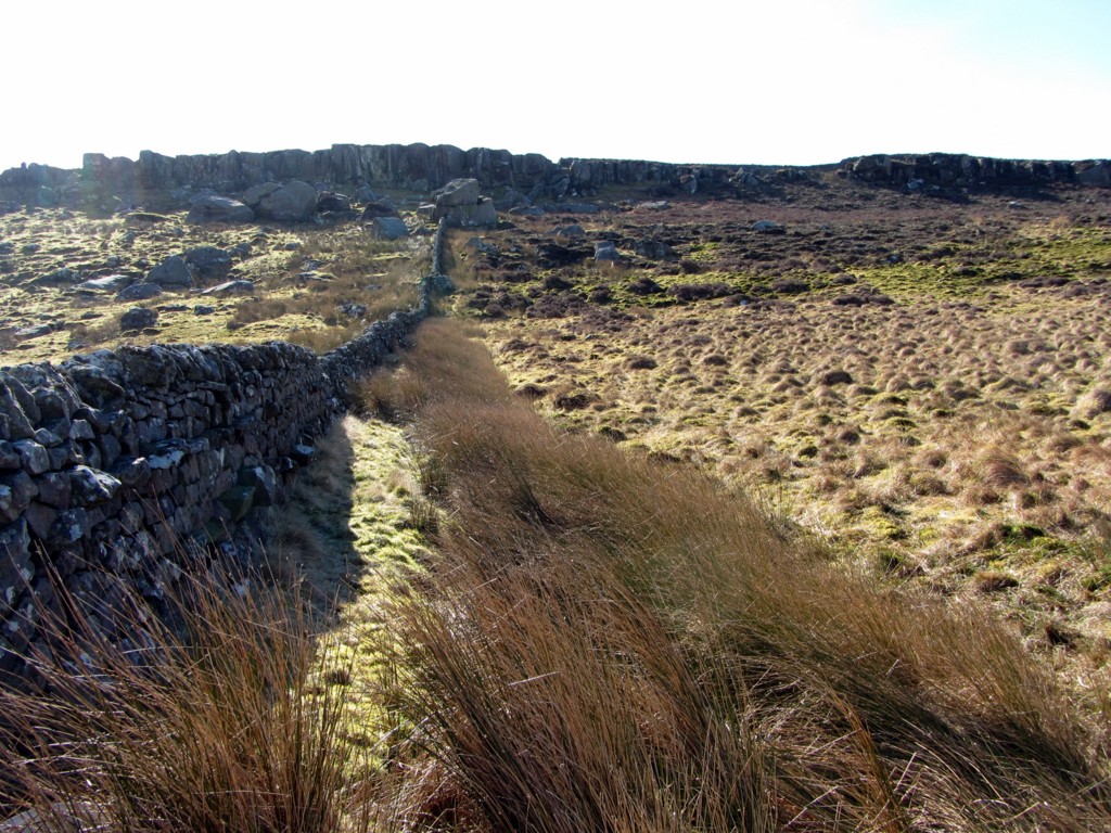
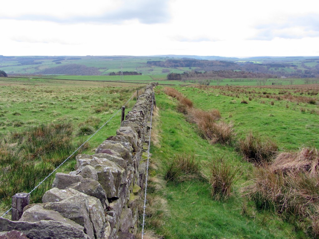
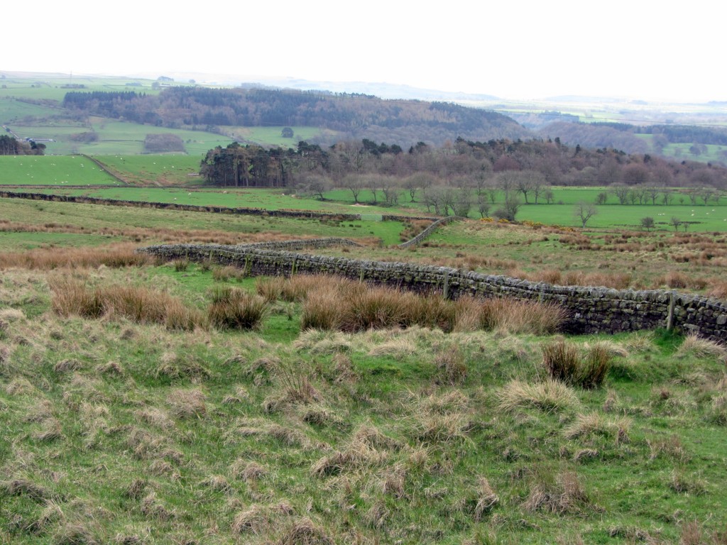
The Black Dyke followed by modern boundary wall. View south to Queen's Crags. Photo A Curtis (2014).
Since the C18th, historians and cartographers have speculated about its length and purpose.
Referring to it as the Scots Dyke, some showed it joining with the Catrail over the Scottish border and extending south to the border with County Durham south-east of Allenheads. Some even had it extending to South Yorkshire! These days, Scots' Dyke refers to a boundary earthwork constructed in the C16th to fix part of the border between Scotland and England, in the area of the West Marches.
The Black Dyke has been claimed as a fortification, a boundary, a military way, a prehistoric road, a drove for cattle, and even as a cattle grazing barrier. Similar to the Catrail, though, was it ever substantial enough to be an effective military barrier, and is more likely to have been a territorial boundary marker, possibly dating from the early Middle Ages but possibly even prehistoric.
A well-known portion of the work extends northwards from the South Tyne between Bardon Mill and Haydon Bridge, to the southern margin of Grindon Lough, and this very visible feature of the landscape attracted the early interest of the C18th antiquaries. Unfortunately, some of the best proportions of its length to the north of Hadrian's Wall are now obscured by the extensive Wark Forest plantations.
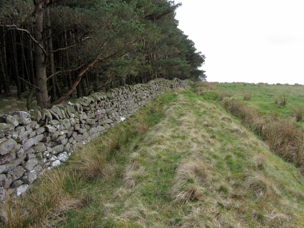
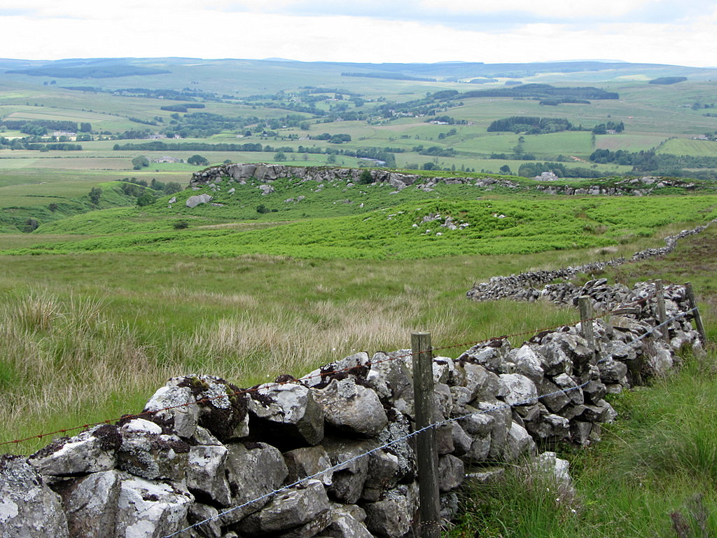
In the Middle Ages, a considerable stretch of the Black Dyke acted as part of the boundary of the Manor of Wark-on-Tyne and, as shown in the above photo, long lengths are still utilized as modern boundaries between farms, townships and parishes.
Referring to it as the Scots Dyke, some showed it joining with the Catrail over the Scottish border and extending south to the border with County Durham south-east of Allenheads. Some even had it extending to South Yorkshire! These days, Scots' Dyke refers to a boundary earthwork constructed in the C16th to fix part of the border between Scotland and England, in the area of the West Marches.
The Black Dyke has been claimed as a fortification, a boundary, a military way, a prehistoric road, a drove for cattle, and even as a cattle grazing barrier. Similar to the Catrail, though, was it ever substantial enough to be an effective military barrier, and is more likely to have been a territorial boundary marker, possibly dating from the early Middle Ages but possibly even prehistoric.
A well-known portion of the work extends northwards from the South Tyne between Bardon Mill and Haydon Bridge, to the southern margin of Grindon Lough, and this very visible feature of the landscape attracted the early interest of the C18th antiquaries. Unfortunately, some of the best proportions of its length to the north of Hadrian's Wall are now obscured by the extensive Wark Forest plantations.
In the Middle Ages, a considerable stretch of the Black Dyke acted as part of the boundary of the Manor of Wark-on-Tyne and, as shown in the above photo, long lengths are still utilized as modern boundaries between farms, townships and parishes.
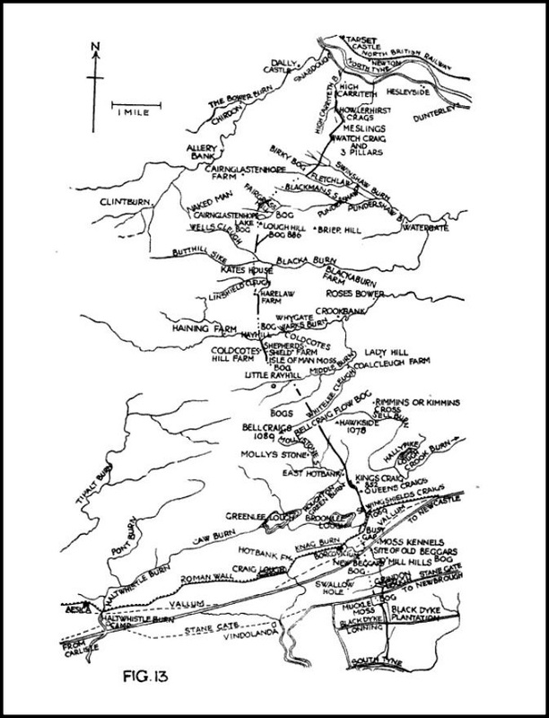
Map of course of the Black Dyke in George Spain (1922) Fig.13
George Spain's survey of the Black Dyke in 1921 showed that it probably starts on the South Tyne, just east of its junction with the River Allen, and terminates on the North Tyne, near High Carriteth, three miles west of Bellingham. Its 13 mile long course runs through country which is still remote and difficult of access; almost impenetrable moorland, bogs, flows and dense coniferous plantation. He does however admit to the possibility that it may extend further north into Redesdale.
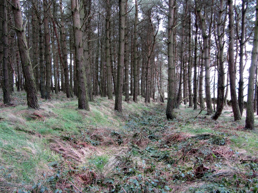
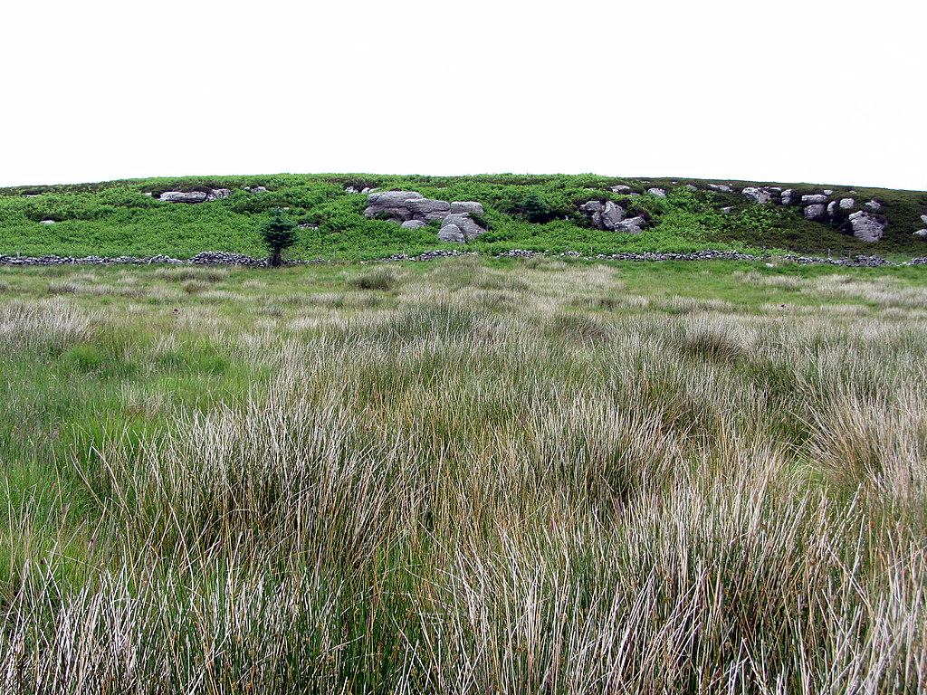
In the area just north of Hadrian's Wall, which passes along the Whin Sill outcrop of Sewingshields Crags, the place-name, Black Dyke (course of), appears to have disappeared from modern OS maps. Spain traces its line from the west side of Black Dyke Plantation south of Grindon Lough.
Its line to the north disappears in the vicinity of the Roman vallum and may here have coincided with that of Hadrian's Wall. Because its line is not clear in the region of the Wall, Spain postulated that it must predate the Roman era. It reappears just west of, and below, Sewingshields Crags where Spain records the ditch as six foot deep. From here it heads north, towards the summit of Queen's Crags. A three mile stretch of the Black Dyke forms the boundary between the farms of Hotbank and Sewingshields, and is also part of the Parish boundary between Haltwhistle and Simonburn.
Its line to the north disappears in the vicinity of the Roman vallum and may here have coincided with that of Hadrian's Wall. Because its line is not clear in the region of the Wall, Spain postulated that it must predate the Roman era. It reappears just west of, and below, Sewingshields Crags where Spain records the ditch as six foot deep. From here it heads north, towards the summit of Queen's Crags. A three mile stretch of the Black Dyke forms the boundary between the farms of Hotbank and Sewingshields, and is also part of the Parish boundary between Haltwhistle and Simonburn.
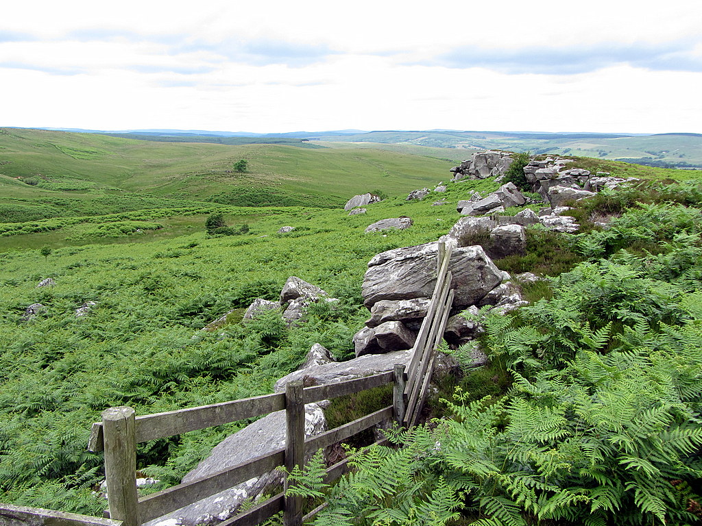
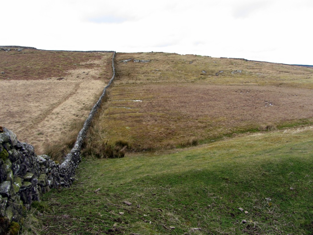 The Black Dyke approaching the summit of Queen's Crags. Photo A Curtis (2014). | 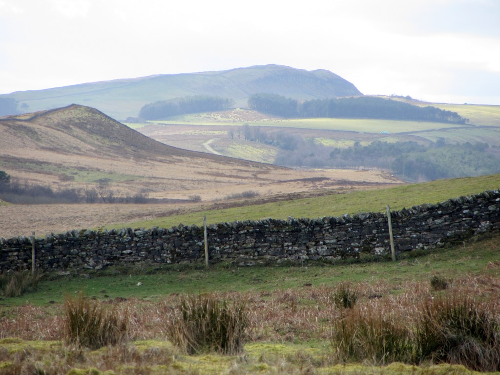 The Black Dyke south of Queen's Crags. Photo A Curtis (2014). |
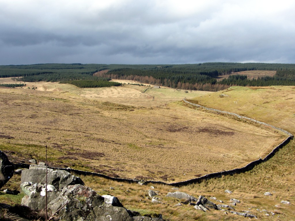 Boundary wall on Black Dyke north of Queen's Crags. Photo A Curtis (2014). | 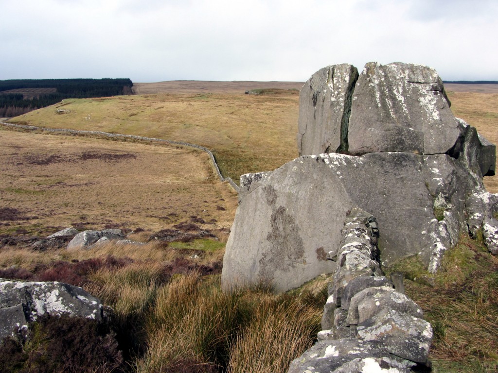 On the Black Dyke north of Queen's Crags. Photo A Curtis (2014). |
From Kingscrag Gate, a named crossing point through the boundary, the Black Dyke swings westward to flank King's Crags before maintaining its north-west line again as the eastern boundary of the forest plantation and Haughton Common. As a boundary, it is far from a straight line but curved at both the small and larger scales.
Sandstone monolith at Queen's Crags. Photo A Curtis (2014).
Both Queen's and King's Crags were well known to prehistoric man as the Bronze Age round cairn cemetery east of Kingscrag Gate and other nearby monuments show.
Queen's Crags is the site of a Roman Quarry, where wedge marks can still be found in the process of splitting one large boulder. A Roman inscription of four lines was found below an overhang here in 1960.
Queen's Crags is the site of a Roman Quarry, where wedge marks can still be found in the process of splitting one large boulder. A Roman inscription of four lines was found below an overhang here in 1960.
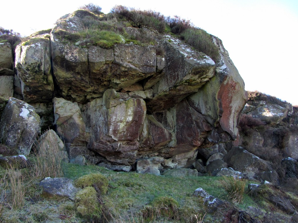 Site of Roman Quarry, Queen's Crags. Photo A Curtis (2014). | 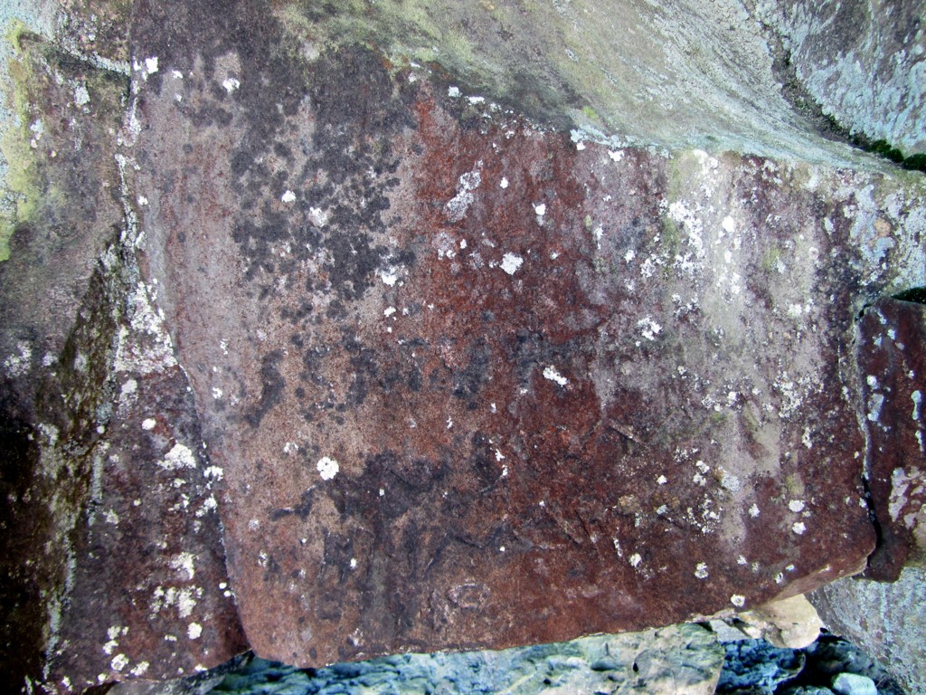 Inscription at Queen's Crags Roman Quarry. Photo A Curtis (2014). |
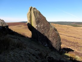
The huge pointed sandstone block at Queen's Crag forms part of an Arthurian legend, common to other parts of the country. The characters become giants in such tales capable of sub-human feats of strength. It is said that the rock was thrown in a frenzy of rage by King Arthur, from King's Crag to the north, at Guinevere, on Queen's Crag, as she was busily engaged in combing her hair and ignoring the King. Such domestic disagreements can often get out of hand; perhaps Lancelot was mentioned. As the distance is over 500 metres, the queen saw it coming, and skillfully deflected it with her comb. The marks made by the comb's teeth can of course still be observed on the upper part of the rock surface.
There is also the usual legend in these parts that King Arthur and his court rest asleep beneath the walls of Sewingshields Castle, which used to stand about a mile to the east, awaiting call by horn when they are again needed.
There is also the usual legend in these parts that King Arthur and his court rest asleep beneath the walls of Sewingshields Castle, which used to stand about a mile to the east, awaiting call by horn when they are again needed.
As George Spain summarises, the Black Dyke is an earthwork constructed with a ditch to its west between the twin rivers of the Tyne. The work is intermittent in character utilising natural features which themselves create a natural barrier, including crags (e.g. Sewingshield, Queen's Crags), bogs (e.g. Muckle Moss), a stream gorge and various lakes (e.g. Grindon Lough). The line curves west around a centre point roughly coincident with the village of Wark. Similarity with the Scottish Catrail appears striking, in this case with Hawick as its centre.
George Spain proposes a defensive line from western invaders, even possibly the Romans, for both the Black Dyke and Catrail earthworks. Modern thought would make this proposal less likely but when they were made and for what purpose still remain unknown.
Keys to the Past local history description of Wark states:
An Iron Age tribal boundary may have survived in the form of the Black Dyke. Although it is not a continuous ditch and rampart, the ditch lies on the west as if to anticipate an attack from this direction, it runs for several kilometres from the North Tyne to the South Tyne through the parish of Wark; the monument is debatable and little known.
Some observations from my recent exploration:
- The earthwork can be recognised as a bank of variable width and height with a prominent ditch on its west side. However, other ancient boundaries in parts of this landscape are today just as impressive and the Black Dyke fails to impress in many parts of its route.
- The Black Dyke is often coincident with modern boundaries between farms and parishes.
 The Black Dyke south of Haresby Road (view south). Photo A Curtis (2014). | 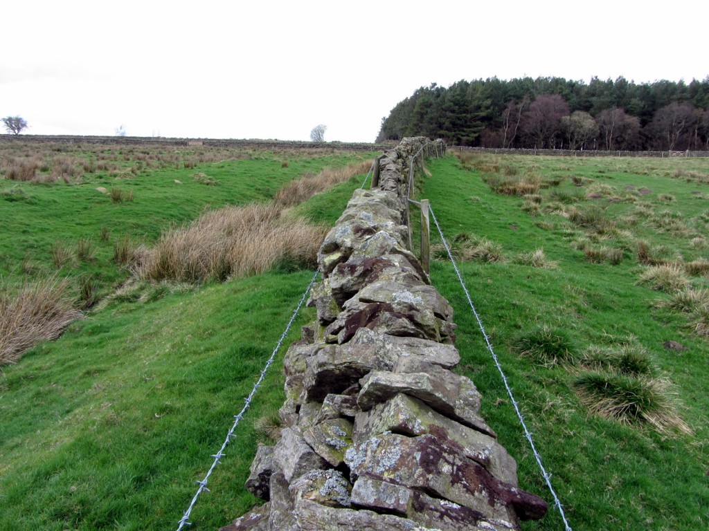 The Black Dyke south of Haresby Road (view north to Blackdyke Plantation). Photo A Curtis (2014). |
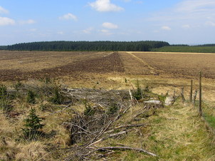
- In places though it is not followed by existing boundaries and has a course which is curved or on a different alignment. For example, from Muckle Moss heading south, the Black Dyke enters Blackdyke Plantation at a narrow angle and runs within the plantation to emerge from it again back near the boundary on the Haresby Road.
 The Black Dyke in Blackdyke Plantation (view towards Haresby Road). Photo A Curtis (2014). | 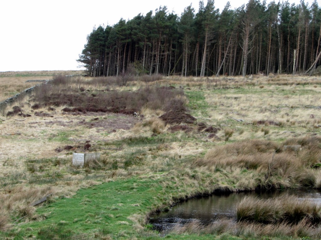 The Black Dyke in felled area of Blackdyke Plantation (view north). Photo A Curtis (2014). |
- The Black Dyke can be intermittent in having breaks at natural features (such as Muckle Moss and Grindon Lough) which themselves would be sufficient to hinder crossing and act as natural boundaries. Perhaps the continuation of the dyke was marked across the bog using other means (fence or posts).
 Black Dyke at north end of Blackdyke Plantation. Photo by A Curtis (2014). |  Muckle Moss National Nature Reserve. Photo by A Curtis (2014). |
- South of Haresby Road, heading downhill, the Black Dyke is a prominent landscape feature although its line may have been preserved by the modern boundary wall which was built on top of its bank.
- Where the wall bends sharply to the west (opposite Haresby), both the ditch and mound of the Black Dyke end completely. Spain considered that it had been ploughed out where it crossed the field but the complete loss of its line suggests to me that it didn't follow his projected course. An alternative suggestion is that the Black Dyke ditch joined the Whitechapel Burn which comes close to the wall at this point. Further down (in trees), the burn swings sharply to the west in a steep sided valley, and eventually joins the River Tyne directly opposite its confluence with the River Allen. The parish boundary still follows this prominent natural feature.
- There is a low bank running parallel to the modern wall on Spain's projected route of the Black Dyke south over Whitechapel Hill, but the lack of a ditch on the west side of this feature does not fit with the earthwork, and there is certainly no trace of it south of the hill.
 Bend in field wall away from Black Dyke near Whitechapel Burn. Photo by A Curtis (2014). | 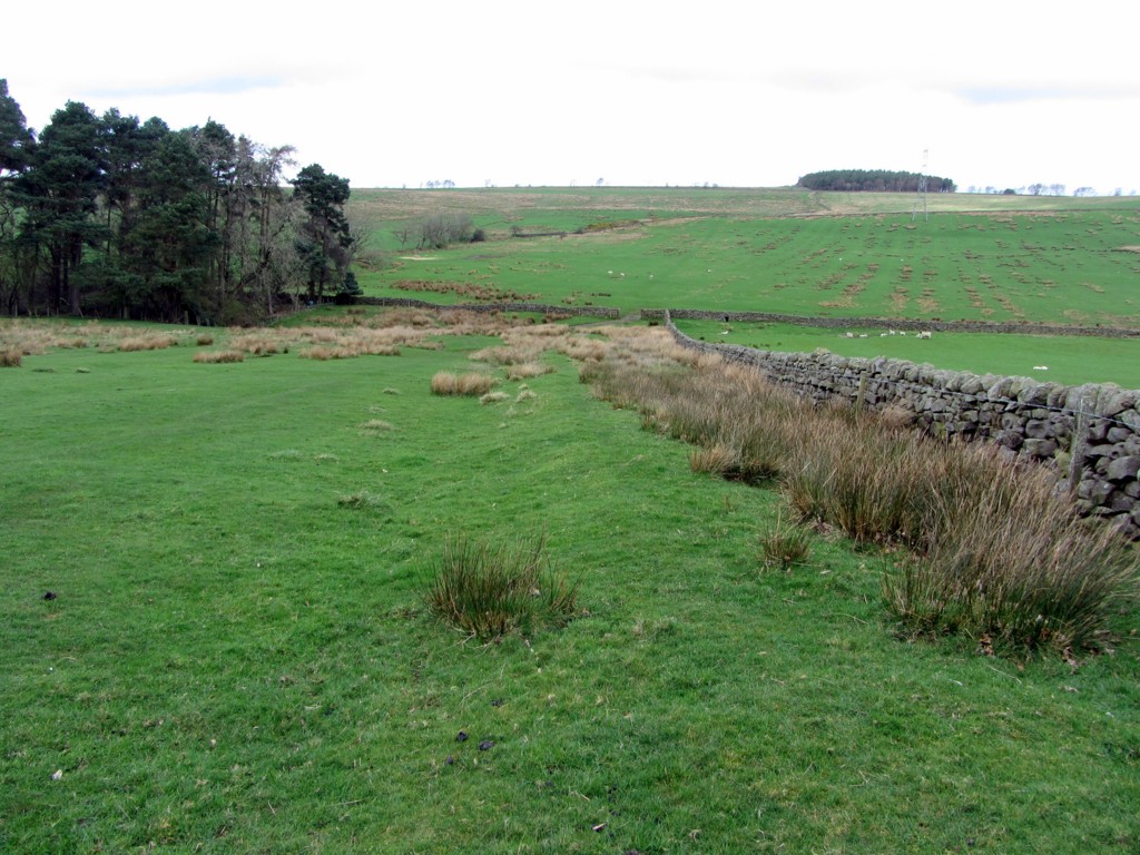 Unlikley route of Black Dyke over Whitechapel Hill. Photo by A Curtis (2014). |
- This new line I propose makes possible an extension of the boundary south of the River Tyne, as proposed by some earlier writers, using the natural line south made by the River Allen. This would explain the fact that no trace of the dyke was found by Spain on the south bank of the Tyne, east of the Allen.
- Tracing the line of the dyke north from Sewingshields Crags to Bellcraig Flow and onward, where it was possible, into the depths of the great Wark Forest west of Stonehaugh, I gradually lost enthusiasm for the Black Dyke being any kind of important boundary.
Insubstantial boundary approaching Bellcrag Flow. Photo A Curtis (2014).
I could find little archaeology to prove its line through the often dense forest plantation of Wark Forest. Perhaps I was just not in the right places. Possibly the very northern section of the Dyke's course to the North Tyne after it emerges from the forest will finally convince me of its unity as a long boundary. The aerial photos, for example, show a very prominent embankment on Carriteth Moor extending Spain's line north from Howlerhirst Crags to High Carriteth Burn. This seems to mirror my findings at the south end, where the boundary may have followed the natural water course down to the river.
The situation south of Howlerhirst Crags, around Watch Crags and Watson's Walls, doesn't look quite as clear cut though. I'll let you know when I have made the visit.
The situation south of Howlerhirst Crags, around Watch Crags and Watson's Walls, doesn't look quite as clear cut though. I'll let you know when I have made the visit.
The Black Dyke south of Watch Crags. Photo A Curtis (2014).
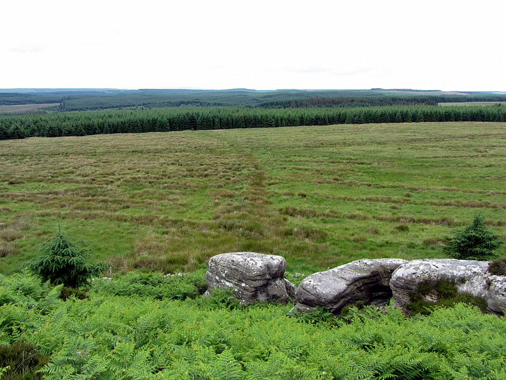
 Watch Crags from the south. Photo A Curtis (2014). | 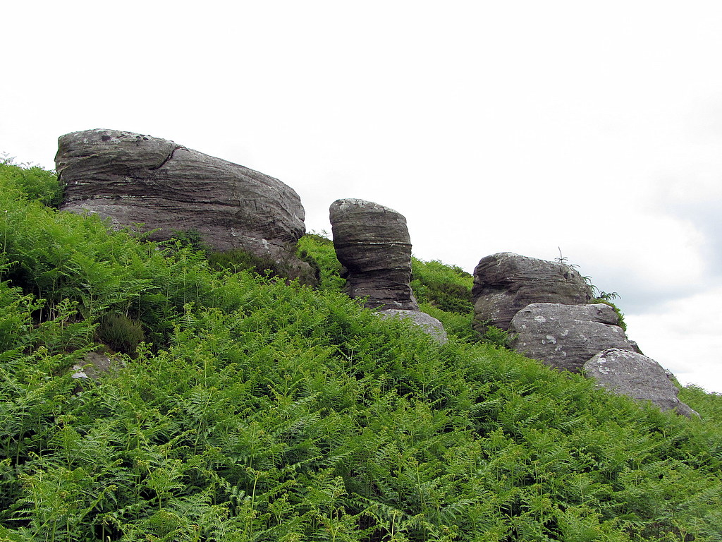 The Three Pillars at Watch Crags. Photo A Curtis (2014). |
The curved line that crosses the boggy moorland north of Wark Forest heading for the three pillars in the centre of Watch Crags is said to be a northern section of the Black Dyke. There has certainly been some form of ditch here as shown by the wide extent of reeds. The ditch was probably used in more recent times to drain an array of parallel, straight drainage ditches clearly visible from the top of Watch Crags.
George Spain in 1922 wrote the following description in his account of the Black Dyke:
George Spain in 1922 wrote the following description in his account of the Black Dyke:
The view to the south-west from the top of Watch Crag across the Pundershaw basin is a fine one. Harelaw, with its little farm perched on the hill top, is a conspicuous feature and the dark green ribbon of the ditch of the Black Dyke leaves the base of the three pillars and winds in a graceful curve for a mile across the moorland into the middle distance of the Pundershaw slopes.
Having previously tried to follow the proposed line of the Black Dyke at the south end of this huge block of Wark Forest, I didn't have the heart to try to follow it through the forest again at this northern end. The ditch itself is not a particularly prominent feature across the boggy moorland and isn't obviously accompanied by a bank (on either its west or east side) as it is in the south part of its supposed course. Spain correctly illustrates this in his relavent cross-sectional diagram.
It appears no different to the remains of a large number of old boundaries, of indeterminate age, that previously divided up these moorlands, and some are much better defined. Its curving line and approach to the centre of Watch Crags are interesting features though.
It appears no different to the remains of a large number of old boundaries, of indeterminate age, that previously divided up these moorlands, and some are much better defined. Its curving line and approach to the centre of Watch Crags are interesting features though.
Watch Crags is just a low hill, steep enough on the south side with a broken crag line. It does not constitute much of a natural boundary, but the dyke is described as passing around the bottom of the crags to its west end, presumably on the line followed by the existing (ruined) wall and fence.
After a short gap at a bog north-west of Watch Crags, Spain picks up its line again on the route of the current parish boundary between Bellingham and Falstone. He describes a stone wall, built on the Dyke's 2 to 3 foot high mound, running north for nearly half a mile, accompanied by a ditch between 10 to 12 feet wide on its west side.
After a short gap at a bog north-west of Watch Crags, Spain picks up its line again on the route of the current parish boundary between Bellingham and Falstone. He describes a stone wall, built on the Dyke's 2 to 3 foot high mound, running north for nearly half a mile, accompanied by a ditch between 10 to 12 feet wide on its west side.
Boundary wall south of Howlerhirst Crags. Photo A Curtis (2014).
The sinuous line of the modern wall and the line of the Parish boundary shown on large scale maps to follow the line of the ditch on its west side are observations in favour of a former ancient boundary. It takes a very interesting line to the east end of Howlerhirst Crags. Here the Parish boundary turns acutley back south, then east to Mesling Crags and eventually picking up the line north of the Low Carriteth Burn down to the River North Tyne.
Higher towards the west, Howlerhirst Crags form a largely uncrossable natural west to east barrier and Spain favours this line for the Black Dyke. It leads naturally towards the deep valley of the High Carriteth Burn which heads north to join the River North Tyne. The crags are still used today as a boundary (occassionally augmented by a fence) and a continuing prominent line followed by a modern fence extending from the north-west side of the hill down to the burn.
Higher towards the west, Howlerhirst Crags form a largely uncrossable natural west to east barrier and Spain favours this line for the Black Dyke. It leads naturally towards the deep valley of the High Carriteth Burn which heads north to join the River North Tyne. The crags are still used today as a boundary (occassionally augmented by a fence) and a continuing prominent line followed by a modern fence extending from the north-west side of the hill down to the burn.
 Howlerhirst Crags. Photo A Curtis (2014). | 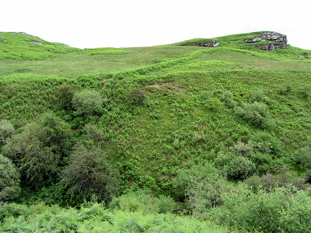 Howlerhirst Crags over High Carriteth Burn. Photo A Curtis (2014). |
Sitting for lunch above Howerhirst Crags in such a beautiful and remote spot, I am beginning to believe in the Black Dyke again. Even if the early writers made it all up, I thank them profusely for getting me out here.
UPDATE 03/04/2022
I seem to remember being fairly sceptical above of the extent of this dyke across the wider landscape which was suggested by George Spain.
Something I read recently seems to agree with my view:
Archaeology in the North. Report of the Northern Archaeological Survey By Northern Archaeological Survey, P. A. G. Clack, P. F. Gosling, Eds. (1976).
Section IX. A Survey of Wark Forest by Revd. T Hayes states (p.248):
"Whether the latter is a single continuous feature extending northwards from the Wall and cutting the corner of our area is questionable."
 RSS Feed
