
Prehistoric rock art is usually associated with north Northumberland but some fine examples have been found much closer to home.
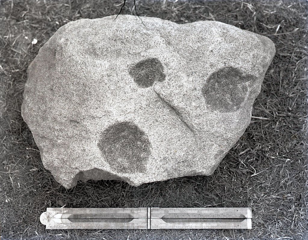
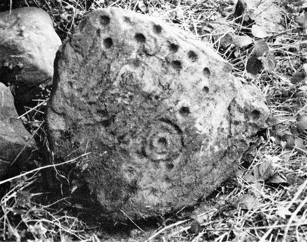
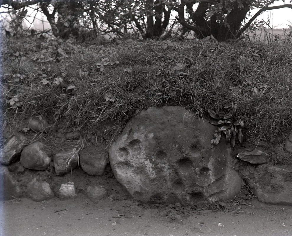 The Ryton Stone. Gateshead Libraries Local Studies Collection Ref. 09_03. | 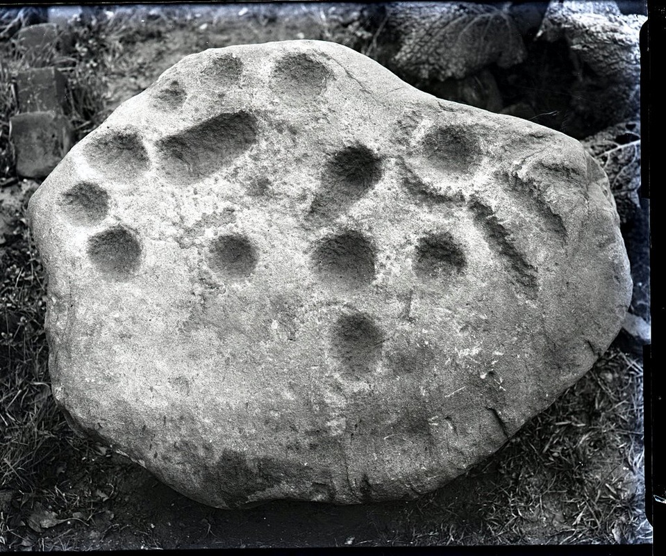 The Ryton Stone. Gateshead Libraries Local Studies Collection Ref. 09_04. |
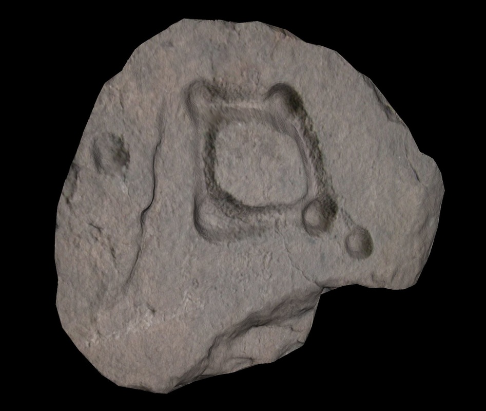
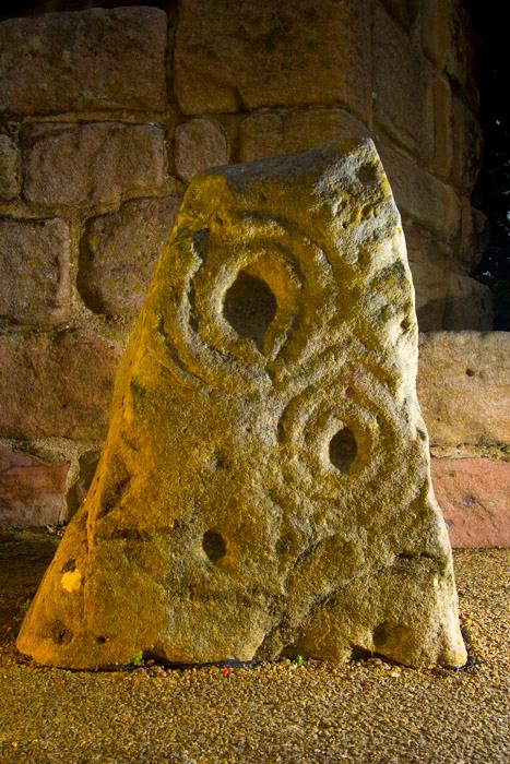
The Ryton Stone, now in the collection of the Great North Museum - Hancock (formerly Museum of Antiquities), Newcastle upon Tyne (Accession No: 1934.33) was recorded by the Northumberland & Durham Rock Art Project. Their illustration shows that another photo in the Gateshead Libraries collection (Ref. 09_05) is a reversed print of the the one shown above.
The description on England's Rock Art website - ERA-2040:
The description on England's Rock Art website - ERA-2040:
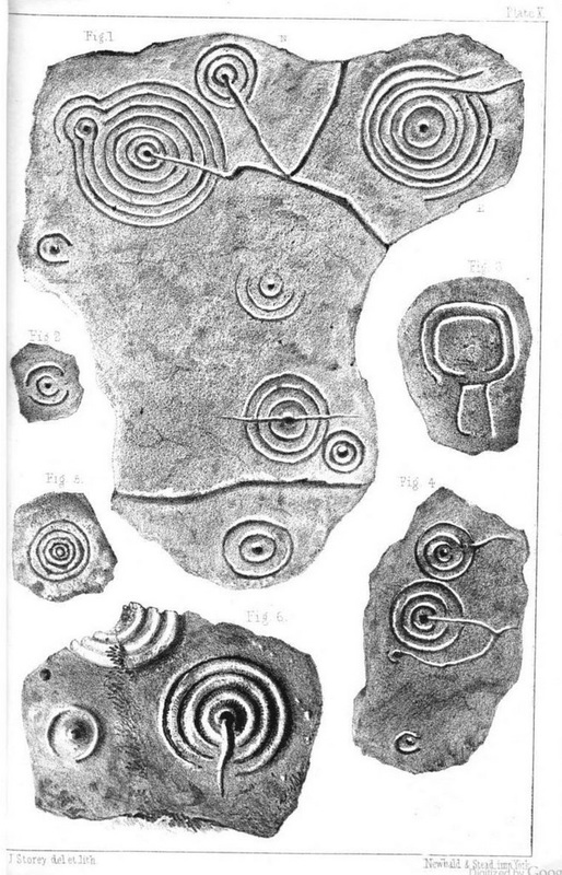
This carving comes from Woodside, Ryton and was found in the stone facing of a clay wall by W A Cocks in 1939. The motifs consists of ten cups, plus a possible small eleventh, a cup with conical groove and a cup with three short linear ducts, a curvilinear groove track one side of the latter motif giving the impression of a ring. Tooling marks are still clearly visible, suggesting the motifs haven’t been exposed to weathering.
The Gateshead Libraries caption to Cock's photo (Ref. 09_04) says that it was discovered on the site of Emma Colliery in 1953 but this location and date are in error. Emma Pit (Towneley Main Colliery) was situated just south of Bar Moor between Ryton and Crawcrook. A plaque on the south-easrt side of the B6317 road in the corner of a field next to the Ryton, Crawcrook and District Youth Centre, erected in 1989 by Andrew Golightly Ltd., shows that the pit operated between 1845 and 1968.
The Tyne & Wear HER(504) gives the find date as 1934, and the location as "Cock's Site 5 at Woodside. Ryton".
Ryton Woodside is about 1km due south of Bar Moor (and Emma Pit) on the B6315 between Ryton and Greenside. The grid reference provided, NZ 1477 6350, is located on part the old B6315 road where it was realigned just south of its junction with the new A695 bypass.
The references given are Notebooks of W.A. Cocks and W.A. Cocks (1935) The Ryton 'Cup and Ring' Marked Rock, Proceedings of the Society of Antiquaries of Newcastle, 4, VI (for 1933-34), pp. 353-4.
He gave the stone's dimensions as 737 mm x 559 mm x 381 mm, and described it thus:
The stone bears one 'cup and ring' with four radial ducts... There are also ten plain cups of circular form; one cup with a deep conical duct; and one large cup which appears to have been formed by uniting two circular cups. All shew the tool marks of manufacture.
The photos are taken from one of a number of glass plate negatives collected by William Alfred Cocks (1892-1971), a master clock maker from Ryton. He was a keen local historian, archaeologist and an inveterate collector. He not only collected and played pipes, but also made them. He helped to produce the first ever book of plans for making Northumbrian pipes and researched extensively into the history of the pipes in the region.
His collection of glass plates date from the late 1890s to the 1950s. Many of the early images were taken by J.P. Dalton, Surveyor to Ryton Urban District Council between 1898 and 1905. The plates are numbered and an annotated notebook in Cock's hand accompanies the collection from which title and date information is taken.
His collection of glass plates date from the late 1890s to the 1950s. Many of the early images were taken by J.P. Dalton, Surveyor to Ryton Urban District Council between 1898 and 1905. The plates are numbered and an annotated notebook in Cock's hand accompanies the collection from which title and date information is taken.
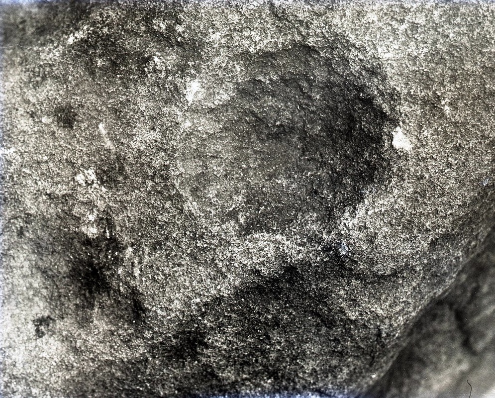
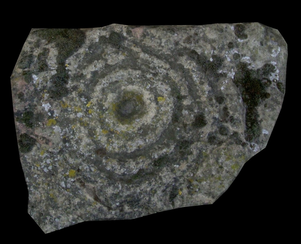
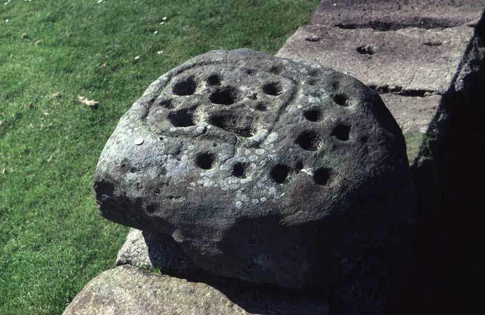
There is a display of Northumberland's prehistoric rock art in the Great North Museum. The Ryton Stone (barely recognisable below) is, like several of the other examples, poorly lit and not shown to its advantage. There is a better image on BRAC.
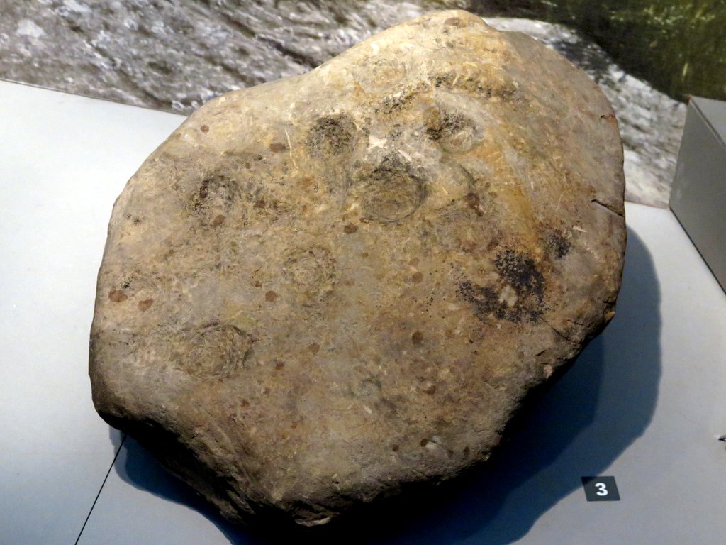 The Ryton Stone, Great North Museum (Hancock). Photo A Curtis (2015). |  'Enigma', Great North Museum. Photo A Curtis (2015). |
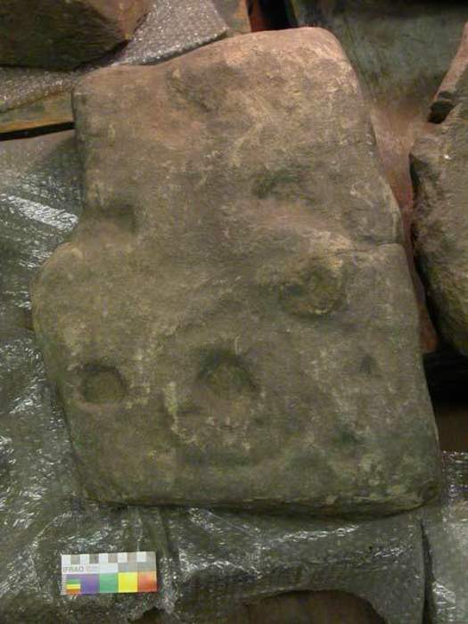
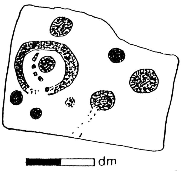
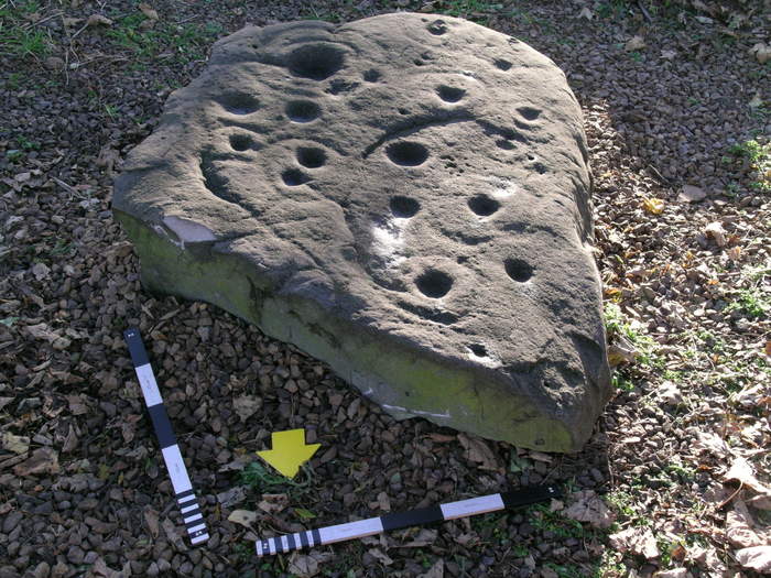
Other cup-marked stones from the same area were also recorded by Cocks.
ERA-2041 (Ryton 1) was found in 1939, with a location given as "40 yards south-west of Tweedy's Buildings, Ryton, where it had been re-used in making a land drain." Tyne and Wear HER(585) records the find-site as Cock's Site 6 and the grid reference as NZ 1480 6417. This is now within Greenfields estate, south-west of the still existing Tweedy's Buildings, between Bar Moor and Ryton.
It is described as coarse sandstone with maximum length 380 mm, and having 3 cups, which ranged in diameter from 41 - 63 mm, and in depth from 15 - 19 mm with very distinct tool pecking. W.A. Cocks, 1947, A Cup-Marked Stone at Ryton, Proceedings of the Society of Antiquaries of Newcastle, 4, X (for 1942-46), pp. 87-88.
Cup marked stone excavated at Tweedy's Buildings, Ryton. Gateshead Libraries Local History Collection Ref. 09_09
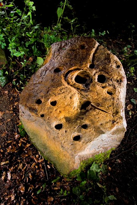
Among the other lithic material from his Site 7, again near Bar Moor, Cocks recovered a stone with one cup, measuring 150 mm x 107 metres, found in April 1944. It is recorded as Tyne and Wear HER(569) which gives the grid reference as NZ 145 635. Although not recorded, the reference number on England's Rock Art is ERA-2042 (Ryton 2).
Cup marked stone excavated at Woodside, Ryton. Gateshead Libraries Local History Collection Ref. 09_08
At his site 7, south of Bar Moor, William Cocks found during the 1940s and 1950s about 100 flints (Tyne and Wear HER 529). Amongst these he recorded 47 scrapers of various shapes and sizes, a borer, 14 cores, chips, etc., 10 assorted flint flakes 10 scrapers or strike-a-lights, 4 leaf-shaped arrowheads, 3 blades, 2 tanged and barbed arrowheads, 2 gunflints, a light grey flint point microlith interpreted as of Bronze Age type rather than Mesolithic, a brownish grey flint knife, and a 'chopper'.
ERA-2043 (Ryton 3) is also described as having one cup mark and was found by W.A Cocks in 1947, south of Clara Vale in amongst lithic material from an excavation. Tyne and Wear HER(568): provides the following detail:
In addition to the flints from Site 14A, south of Clara Vale, Cocks records the discovery, on 27th February 1948, of a cup-marked stone, "with one very deep cup which appears to have been ground out. One end fractured".
The grid reference of the location is given as NZ 142 647.
At the same site Cocks also found part of a polished axe (Tyne and Wear HER 561): light grey flint irregularly broken fragment of polished celt, retaining about 0.5" of cutting edge". He found two jet disks at the same site (Tyne and Wear HER 567).
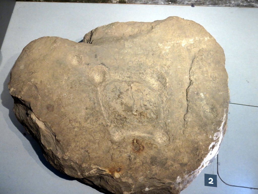 The Ouston Stone, Great North Museum. Photo A Curtis (2015). | 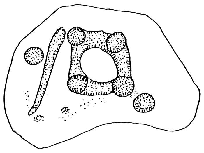 The Ouston Stone. Drawing by Stan Beckensall. |
Pike Hill, Ouston. Photo A Curtis (2012).
The Ouston Stone (ERA-1897) was probably the cover of a disturbed cist and was discovered during excavation of a tumulus on Pike Hill. BRAC has a photo of the carved panel upturned but otherwise in situ dated 1928.
Described as an irregular heart--shaped rock 24” x 21” x 5” (0.61 x 0.53 x 0.13m). The design is an irregular trapezoid with a cup at each angle, and two cup marks outside the figure. The stone is also on display at the Great North Museum. Its design and the pristine condition of the carving suggests the artwork was faced to the inside of the cist, created specially, and of an early Bronze Age date.
Described as an irregular heart--shaped rock 24” x 21” x 5” (0.61 x 0.53 x 0.13m). The design is an irregular trapezoid with a cup at each angle, and two cup marks outside the figure. The stone is also on display at the Great North Museum. Its design and the pristine condition of the carving suggests the artwork was faced to the inside of the cist, created specially, and of an early Bronze Age date.
 The Ouston Stone. VRML model downloaded from ERA displayed in Cortona3D Viewer. | 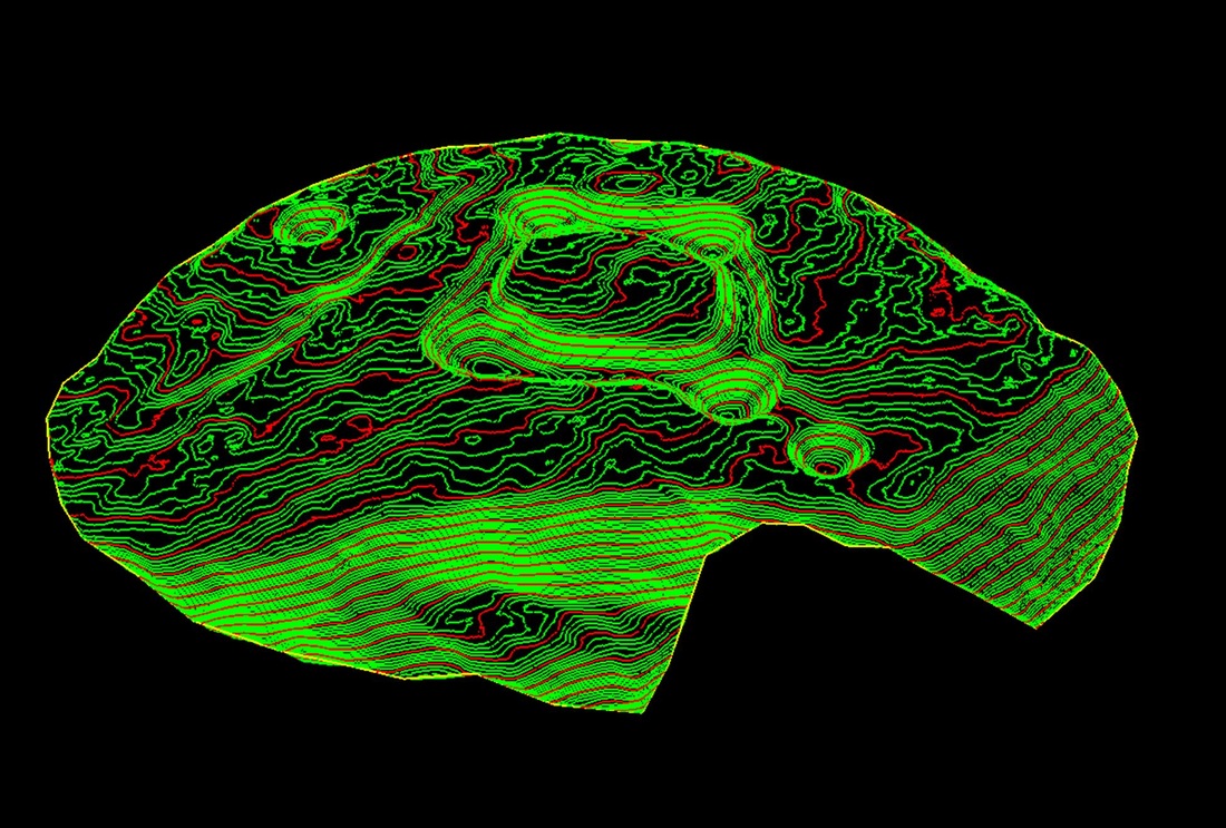 The Ouston Stone. 3D contoured model from photogrammetry data. |
The 3D models created from stereo-photo pairs by photogrammetry software allow you to zoom and rotate the image bringing the motifs to life and removing the need for raking light. Many of the panels on ERA have VRML models which can be downloaded and displayed in this way.
Several more examples have been found in the Stamfordham area. One found on top of a wall near Ingoe by the Rev John Bigge and described by Canon Greenwell as a cist-cover (ERA-720) has five incomplete concentric circles around a central cup and two grooves. It is now in Alnwick Castle Museum. It was illustrated by George Tate (1865) as Plate VII fig.4.
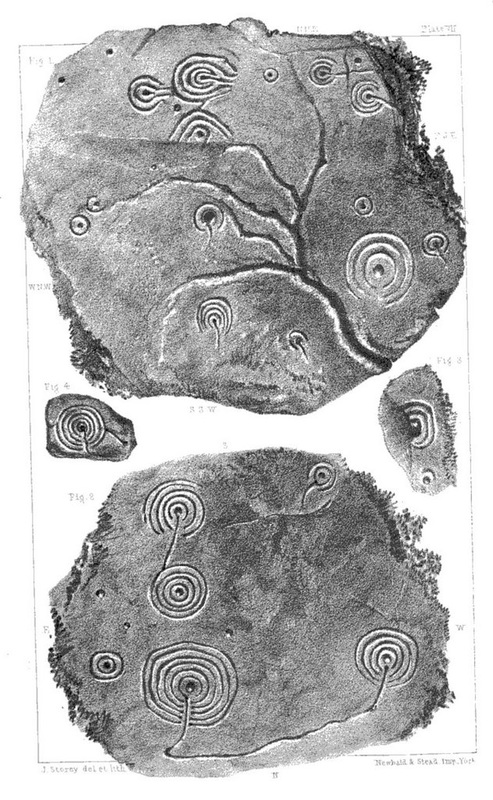 Tate (1865) Plate VII. | 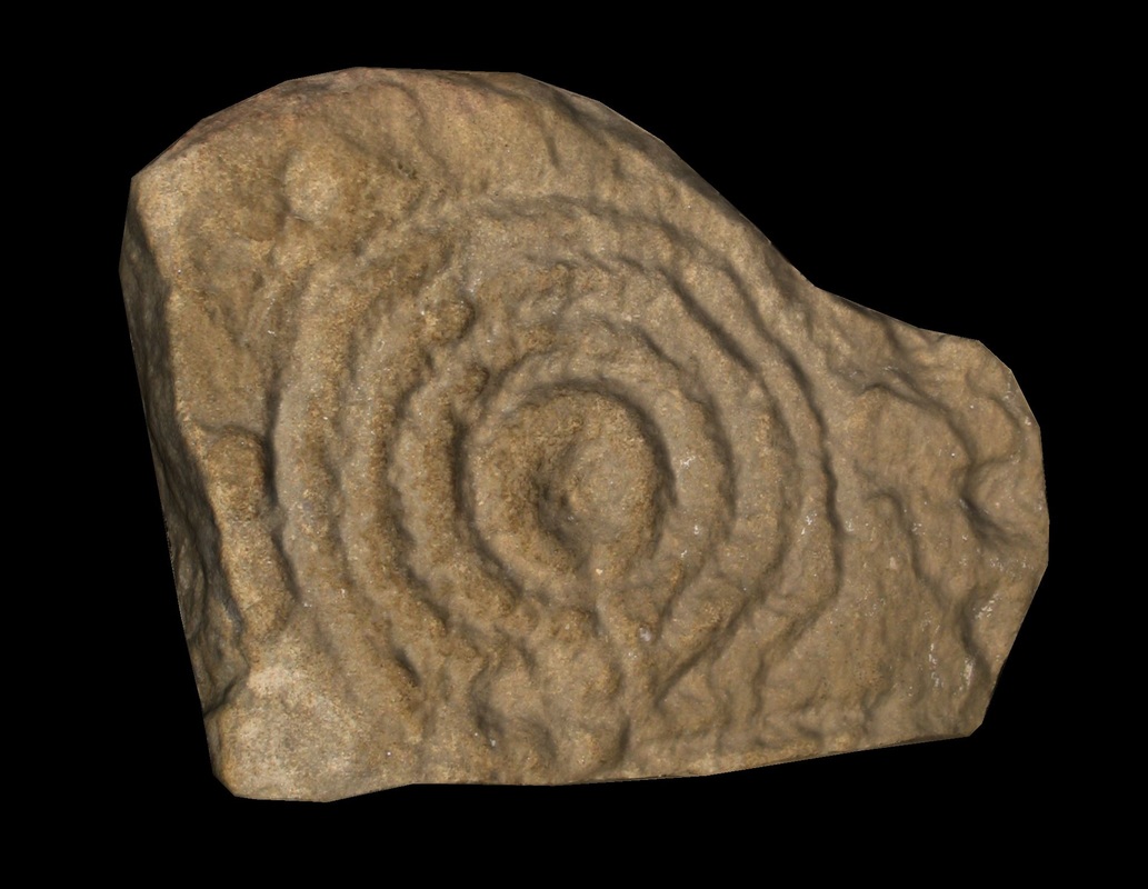 Ingoe Wall Stone. VRML model downloaded from ERA displayed in Cortona3D Viewer. |
A similar small portable stone known as Ingoe, Sandyway Heads is still in the village today. It was recorded as ERA-1480.
Ingoe Sandyway Heads. VRML model downloaded from ERA displayed in Cortona3D Viewer.
Canon Greenwell wrote: about 1820 a tumulus, formed of earth and stones, on the South Moor, near Black Heddon…was removed when three or four urns, containing burnt bones, were discovered each covered with a stone, having on the underside one of the circular markings. Only one of the stones remained, and Greenwell kept it.
In the Museum of Antiquities, University of Newcastle (now Great North Museum, Hancock), there is a stone provenanced as Stamfordham and it may be the one excavated by Greenwell. This panel is also known as the Stamfordham Cist Cover (ERA-1899). The illustrations below are from Black Heddon a in the Beckensall Archive.
In the Museum of Antiquities, University of Newcastle (now Great North Museum, Hancock), there is a stone provenanced as Stamfordham and it may be the one excavated by Greenwell. This panel is also known as the Stamfordham Cist Cover (ERA-1899). The illustrations below are from Black Heddon a in the Beckensall Archive.
 |  |
Another stone from Black Heddon with four concentric circles around a cup is illustrated by Tate (1865) as Plate X fig.5.
Tate (1865) Plate X.
The Black Heddon page on BRAC contains further images.
The Warrior Standing Stone at Ingoe is described as having a single cup mark on its east side with possibly several others heavily eroded. There are more than 26 cups at the base of the E, N and W faces of the Matfen Standing Stone (Stob Stone).
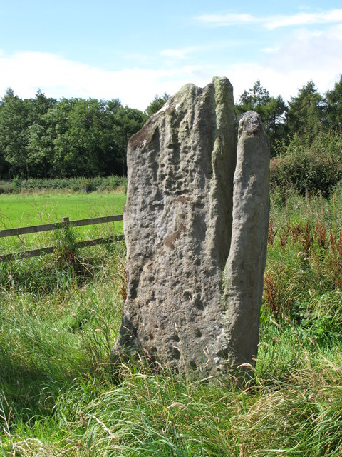 Matfen Standing Stone. Photo by Mike Quinn (2007). | 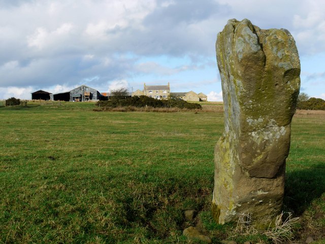 Warrior Stone, Ingoe. Photo by A Curtis (2009). |
The large carved stone found at Birney Hill near Ponteland was described in a previous blog.
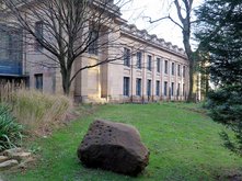 Stone from Birney Hill south of Darras Hall, Ponteland now located outside Great North Museum. Photo A Curtis (2015). | 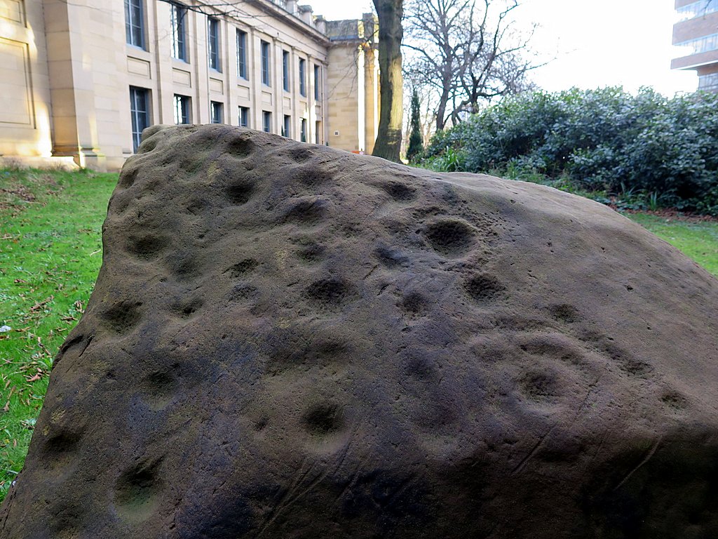 Stone from Birney Hill south of Darras Hall, Ponteland now located outside Great North Museum. Photo A Curtis (2015). |
I can think of another few local examples. There is a deeply cup-marked and grooved block of stone in the Roman Fort (Coria) at Corbridge (ERA-715). It's nice to think that the builders of the Roman Fort thought it was an interesting artefact and perhaps gave it some prominence within their building but it was actually buried in the foundations.
Two marked boulders were also found at the Chesters Roman site, but now missing and known only from illustrations. Another cup-marked cobble was found during excavation at the site of the Roman bridge on the opposite side of the River Tyne.
There is carved boulder alongside an arable field at Thornborough (ERA-1420), presumably dragged to the field headland away from the plough at some past time. It is often hard to find among tall hedgerow vegetation.
 Corbridge cup-marked stone. Photo by Stan Beckensall c.1980 from ERA-715. | 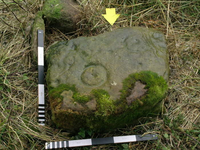 Thornborough 1. Photo from ERA-1420 (2007). |
One cup and ring marked stone still lurks in a wood near Throckley Bank (turned up by ploughing in the region of the Roman Vallum c.1985 ; ERA-1365). It has been turned over for its protection and lies alongside other large stones in a wood and too heavy for ready examination.
Cup-marked stone at Throckley Bank Top. Photo by Hob (2008) from BRAC.
There is a nice carved stone displayed in the courtyard of Prudhoe Castle (ERA-750). It was found during excavations by the Department of the Environment face upwards in the foundations of an early 14th century hall within the castle. It is likely that the stone was cut from outcrop rock and used as building material without any regard for its significance.
 Carved stone at Prudhoe Castle. Photo by Hob (2008) from BRAC. | 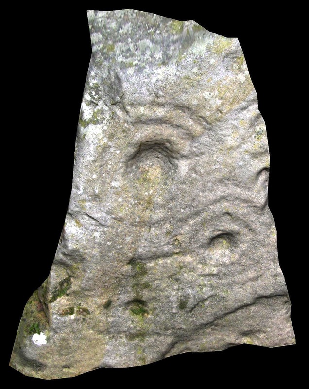 Carved stone from Prudhoe Castle. VRML model downloaded from ERA-750 displayed in Cortona3D Viewer. |
In 2007, a large carved boulder was spotted by archaeologists on an old sofa at a property in Gateshead where it has now been turned into a garden feature - Hollinside Farm (ERA-578). It was reportedly brought from an original site near Belsay.
Again, the VRML 3D model (of which the image below right is just one position) can be rotated and tilted to examine the surface moving against the light. As shown on the left, low raking sunlight can produce a better photo, but with the stone shape neessarily distorted because of the camera position.
Again, the VRML 3D model (of which the image below right is just one position) can be rotated and tilted to examine the surface moving against the light. As shown on the left, low raking sunlight can produce a better photo, but with the stone shape neessarily distorted because of the camera position.
 Hollinside carved rock. Photo ERA-578 (2007). |  Hollinside Farm. VRML model downloaded from ERA-578 displayed in Cortona3D Viewer. |
There are many examples here of the fate of lowland rock art in land under pressures of agriculture, development and industry. Some examples have been collected, by the Romans and much later archaeologists. Some have found there way into museums. Much though must have disappeared altogether. A large carved sandstone boulder, described as a likely glacial erratic, found at Hunters Hill near Ovington (ERA-701) was reported to have been broken up, soon after it was discovered, the landowner completely unaware of its significance.
 Hunters Hill, Ovington. Photo by Gary Knox (1984) from BRAC. | 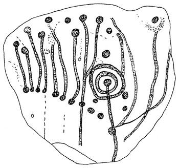 Hunters Hill, Ovington. Drawing by Stan Beckensall based on Gary Knox's photo. |
So what can we deduce from this study of our local rock art. Many of the examples are historical. Panels of carved stone have been found during excavations of Bronze Age burials (cist covers), many ending up in museums. Were they carved specially for the burials, or were they part of pre-existing carved boulders or outcrops? We can't always be sure, but the pristine nature of some of the carvings implies that they were covered shortly after their making and probably specially made. Manyl bear tool marks of stone tools.
The land in our area has been subject to intensive agriculture and other development. Existing rock outcrops here may have been much less extensive than in the upland areas. Stone has been cleared from ploughed fields and much was probably broken up, used in field walls or as building material. However, the remaining examples imply that the cup and ring rock art tradition extended south from Scotland, Northumberland, over the Tyne valley and south over an extensive area of England.
Discovery and long-term survival of many of the examples given has largely been the result of recognition of their archaeological significance. More will undoubtedly turn up in the future, and may be preserved if it is recognised.
LINKS
British Rock Art Collection
A Rock Art Gallery for The British Isles, Dedicated to Jan Brouwer, and full of happy memories.
England's Rock Art (ERA)
Northumberland Rock Art
Web access to the Beckensall Archive at University of Newcastle upon Tyne.
The Ancient British Sculptured Rocks of Northumberland and the Eastern Borders by George Tate (1865)
 RSS Feed
