
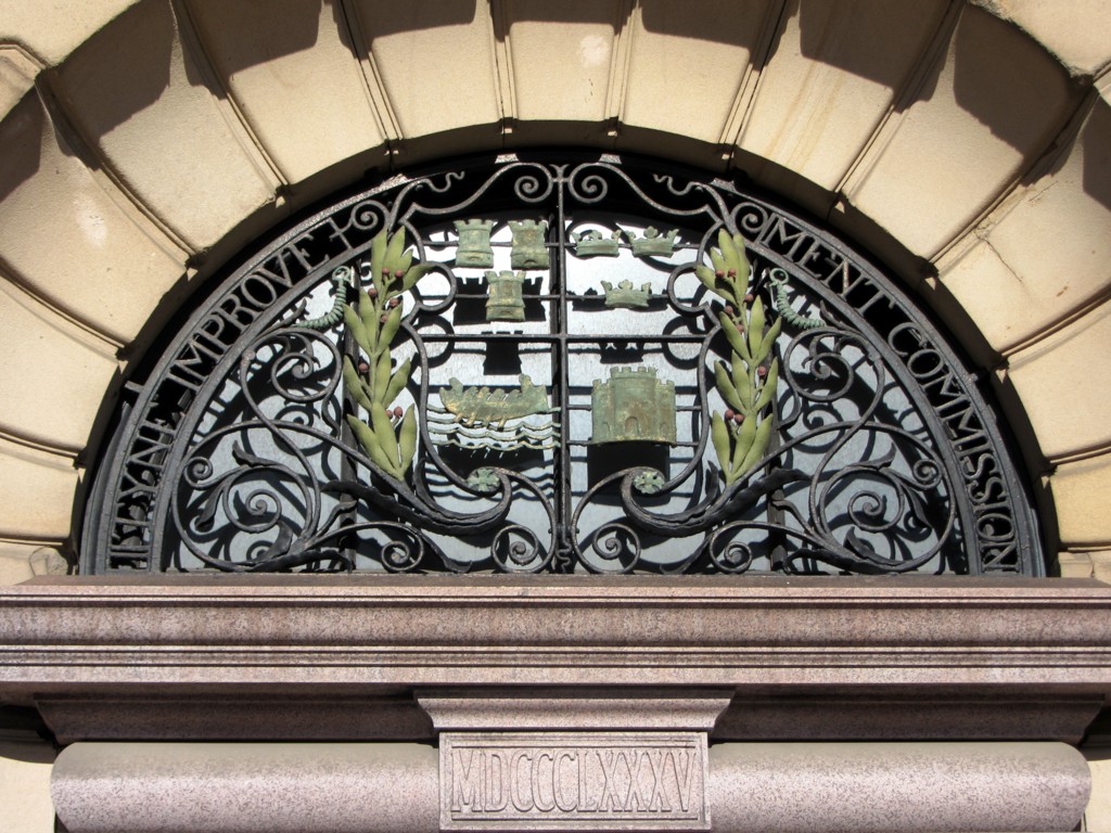
Window above doorway to Tyne Improvement Commission's Bewick House, Newcastle. Photo A Curtis (2014).
Bewick House in Bewick Street, Newcastle, close to Central Station, was built to provide offices for the Tyne Improvement Commission. It clearly was of no interest to have a location nearer to the river which probably reflects the more commercial interests of the Commission and the more general move of the city to the north in the mid C19th.
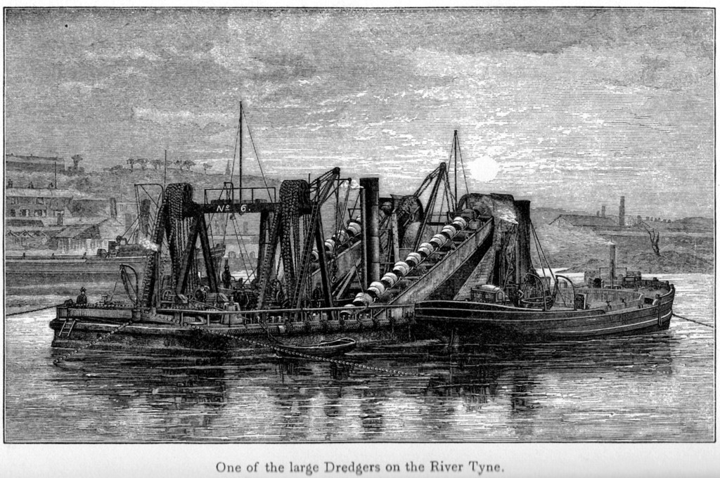
In 1854, the commissioners started a programme of development and improvement of the river that continued well into the C20th and laid the foundations for what was to become the modern-day Port of Tyne. Within 70 years, the River Tyne was deepened from 1.83 metres to 9.14 metres and over 150 million tonnes dredged from it. The North and South Piers at the river's entrance were built, together with the Northumberland, Tyne and Albert Edward Docks, and the staithes at Whitehill Point and Dunston. The results of these developments could be seen in 23 million tonnes of cargoe being handled by the Port by 1910.
On 31st July 1968 the Tyne Improvement Commission was dissolved and replaced with the Port of Tyne Authority, constituted on 28th June, and one of the UK’s largest trust ports.
The newspaper article from 1897, transcribed below, describes 'above bridge developments' of the 'great improvement scheme'.
THE MAKING OF THE TYNE
Shields Daily Gazette, Monday 27 September 1897
Shields Daily Gazette, Monday 27 September 1897
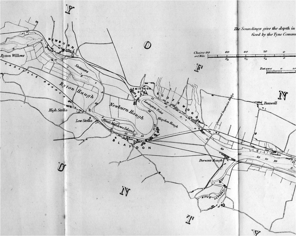
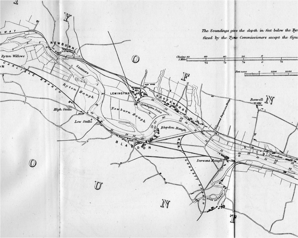
An important feature of the great scheme of improvements, designed by the late Mr Ure, and adopted by the Tyne Commissioners, was the deepening and widening of the river above Newcastle, not only to encourage the establishment of new industries, and give increased facilities for the carrying on of commerce, but also, as Mr Guthrie pointed out in his excellent book, to form "a receptacle for tidal water wherewith to scour and maintain the deepened channel below." The work already carried out under this policy is of a wonderfully extensive character. The building of warships at Elswick and of smaller vessels at Scotswood, and the loading of large vessels at the staiths which have been erected at Dunston, each signalise the triumphs which have been achieved. Higher up the river many important improvements have been effected. So long as 24 years ago, or thereabouts, a cutting was made through Blaydon Haugh, and the river diverted to avoid the circuitous bend at Lemington Point. Up to Newburn Bridge the river has been trained to a width of at least 400 feet, and the channel is now in course of being deepened.
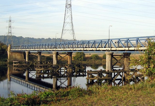
Newburn Bridge. Photo A Curtis (2003).
It is after passing Newburn Bridge that we enter the section where we find the improvement of the waterway in active progress. Here at Newburn we are on historical ground, and may pause to look round for a few moments while interesting memories are awakened. It was from these heights to the north that General Leslie's Presbyterian army descended, and attacked the king's forces, who, under General Conway's command, were ensconced on the south side of the river. The result of the engagement was the rather ignominious defeat of the English, followed by the evacuation of Newcastle. There is still in existence an old building which is pointed out as the house where General Leslie stayed prior to the battle. It is enclosed within the site on which Messrs Spencer's works are situated, and utilised by the firm as a pattern shop.
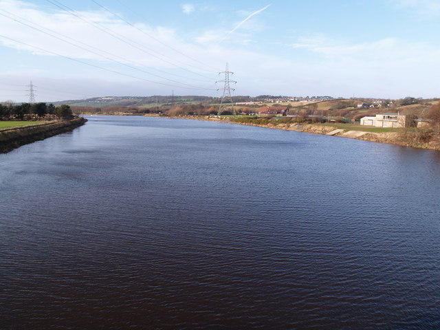
River Tyne above Newburn Bridge. Photo by Clive Nicholson (2008).
Let us return to the inspection of our river works. Above Newburn Bridge, it is little short of a transformation that is being wrought. Already the character of the landscape has been very materially altered. The river, as it flowed into the broad area of low-lying land, flanked by Ryton Willows, used to distribute itself into three irregular channels. At he time of high floods the streams were merged into one large expanse of water,measuring some 1,200 feet across. Near the middle, or a little to the northward, a piece of land higher than the rest reared its head as an island; a gravel bank also appeared above the level of the water. In order to permit of the designs in hand being carried out, the engineers have directed the waters into one channel, which wends its way by the Willows. A new channel which is designed to give a more direct flow to the river,is in active preparation. From a point near Newburn Bridge it describes a gentle curve to the boating club house at Ryton, and in width is in conformity with that of the section below the bridge, namely 400 feet.The slag protected embankments forming the training walls, are within measurable distance of completion, and the excavation of the bed is being steadily pushed forward. Before the end of another year the stream flowing by the Willows will be shut off, and the water diverted into the channel that is being created.
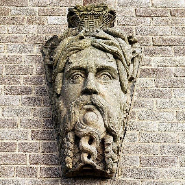
'The Tyne River God', Tyne Rowing Club, Newburn. Photo A Curtis (2013).
The work being carried on here perforce includes the reclaiming a considerable area of land. During the past forty years the stream has washed away thirty or forty acres of land about Ryton Willows. The Commissioners are now reclaiming a very considerable portion. The method which is adopted to preserve the newly-made land from the denuding action of the swift flowing stream may be noted with interest. The protection is afforded by means of groynes, which are faced with slag and stones, backed with gravel,projecting into the river, and pointing downstream. By these groynes which are placed at intervals of 150 to 200 yards, the force of the current is deflected; and the stone and gravel which are swept behind the groynes, and accumulated into heaps, form an additional protection to the banks. When the current flowing by the Willows has been diverted, and its channel filled up, the reclaimed lands will cover an extensive acreage, a very gratifying circumstance when it is remembered that the Willows are used for purposes of public recreation. On the north side of the channel, also, a large area of land is being reclaimed. A point known as the Spetchels, eastwards of Ryton Willows, is being cut away, widening the river opposite Newburn by 250 feet.

Dredging of River Tyne viewed from Holy Cross Church Spire, Ryton (detail from iSee Gateshead Ref: 03_12)
In former years, that is before the Tyne passed into the hands of its present Conservators, the tract of land through which the river flows between Ryton and Newburn was subject to flooding after extra heavy rainfalls. Finding an insufficient outlet in the narrow shallow stream, as the Tyne then was over its entire length,the waters rapidly rose and spread,until an enormous area of country stretching from the slopes of Ryton to the hills of Newburn was submerged. In the wall of the Boat House Inn at Newburn there are marks indicating the heights reached by the different memorable inundations. It seems scarcely credible - but there the fact is denoted for the edification of present and future generations - that the great flood of 1771 rose to a height of ten or eleven feet above the present quay wall. After the improvements were carried into effect in the lower parts of the river, the district became free from such devastating visitations. Through the broadening and deepening of the waterway the floods find a quick and easy escape, and after even the heaviest of rainfalls, the river never rises within about a couple of feet of the top of the quay wall at Newburn. There is reason for believing that a lake once existed in this vicinity, for the borings made by the engineer have penetrated a deposit of silt, which indicates the existence there of still waters in former ages.
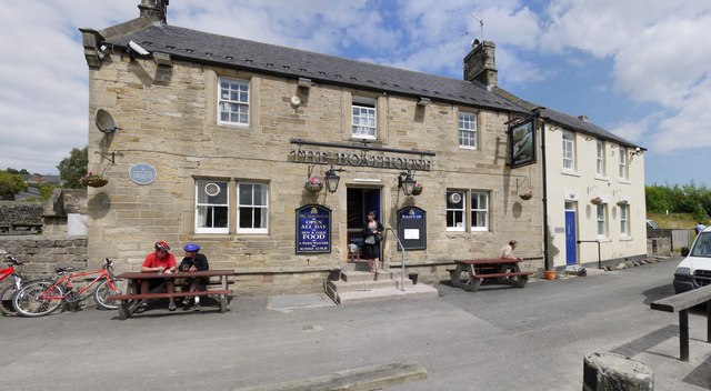 The Boathouse Inn, Water Row, Newburn. Photo A Curtis (2010). | 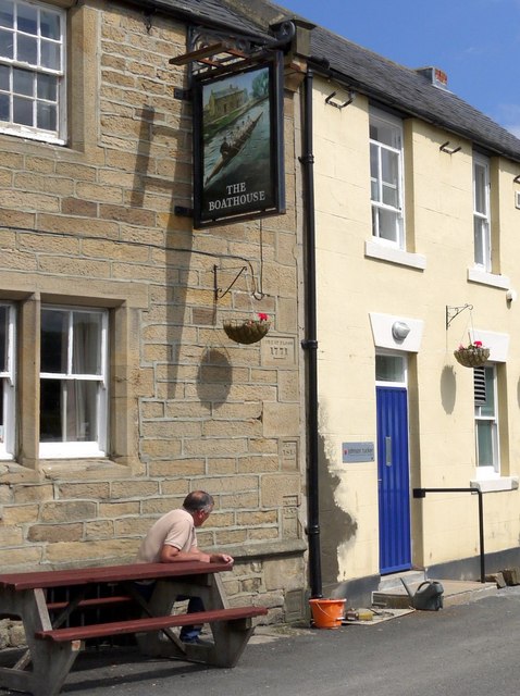 Flood markers, The Boathouse Inn, Water Row, Newburn. Photo A Curtis (2010). |
As we have already noticed, the section of the river at present under construction terminates near the Ryton boating houses. Above this point it has all its old, natural charms, running as a pure purling stream over a bed of gravel, and between banks of much beauty. But the hand of an engineer is never stayed by aesthetic or sentimental considerations; and as soon as the other section has been completed the work will be carried to the Boundary Stone at Hedwin Streams, which is nearly a mile further up the river, and marks the limit of the Commissioner's jurisdiction. In order to gain the requisite width for the channel, a long strip of land on the north side, including a pretty riverside pathway through the trees, and parts of the adjoining fields will be cut away. It is afterwards proposed to construct a weir near the boundary stone to prevent the washing down of sand and gravel from the higher reaches of the stream, into the improved waterway. If the river were deepened as high as the boundary stone it would be an inducement to coalowners, brick makers, and other manufacturers to construct staiths and wharfes, and secure economical transit by shipping their goods in the higher reaches. For large steamers the river is navigable as far as Blaydon; for lighter craft, such as wherries and tug boats, a channel exists as high as Messrs Spencer's works at Newburn. Dredging is being carried on below Newburn Bridge, and it is anticipated that a depth of twenty feet at high water spring tides will in the near future be obtained. It is very possible, therefore, that in the course of years we may see factories springing up, where green fields now exist, on the banks of this splendid waterway.
One of the large dredgers on the River Tyne from The River Tyne: its History and Resources by James Guthrie (1880).
 RSS Feed
