
This article was written with the kind help and encouragement of Ted Burt, John Gillott & David Potts of the Heddon on the Wall Local History Society. Without the assistance of these, and the authors referenced below, who know about railways, I would still be wondering.
The Wylam wagon-way was built around 1748 to a five foot gauge, and was used to transport coal from Wylam to Lemington where coal staiths stood to load shallow-bottomed keel boats for shipment down the River Tyne.
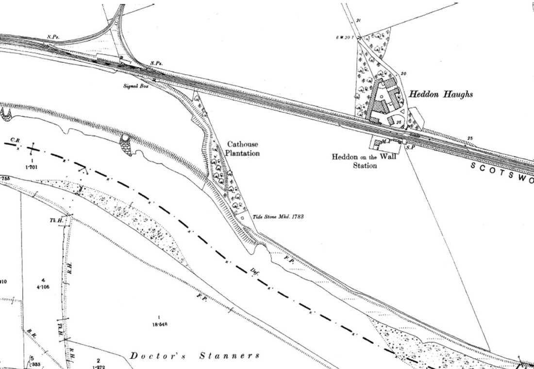
The closure of the Wylam Colliery in 1868 resulted in the wagon-way having very little use, until the Scotswood to Wylam railway line opened in 1875-76, following much of the wagon-way route. Heddon-on-the-Wall Railway Station was added 5 years later in 1881. The platforms were staggered each side of a level crossing, that to the east, on the north side of the double track, used by trains traveling east towards Newcastle.
This 'Northern' line also included a spur which ran into the yard of the Margaret Pit and Heddon Brick Works. This so-called 'triangular junction' can be seen in the map below, west of Heddon Station. Only the east side of this junction is retained today in a strip of woodland and existing field boundaries. The west side has been ploughed out within an arable field. The road that runs steeply downhill south of Heddon village is named Station Road. It ends at Heddon Haughs Farm on the line of the wagon-way. Large scale maps show that the colliery line ran parallel to the main line, passing directly behind the Newcastle platform.
Heddon-on-the-Wall Railway station, situated near Heddon Haughs Farm, was closed in 1958, and finally demolished in 1959. The current Heddon Haughs farmhouse, south of the wagon-way, incorporates the original Station-Master's house.
The 'Northern' railway line was closed in 1966 and the tracks were removed in 1972. This part of the route was then turned into a public bridleway and cycle track.
OS 1:2500 (1898)
Since I first came across it, I was puzzled by the branch line (shown below) that bends south away from the wagon-way close to the east side of the 'triangular junction', running through Cathouse Plantation. It is clearly a disused railway line or wagon-way, built-up on colliery waste. In one place, the farmer has cut through the bank to provide access between the neighboring fields. The line appears to have terminated on the bank of the River Tyne, just west of the Tide Stone.
None of the old OS maps shows the existence of a track along this route, making it likely to have been in only temporary use. I wondered at first if it had provided a way of disposing of pit waste form Heddon Colliery, perhaps by dumping it in the river.
None of the old OS maps shows the existence of a track along this route, making it likely to have been in only temporary use. I wondered at first if it had provided a way of disposing of pit waste form Heddon Colliery, perhaps by dumping it in the river.
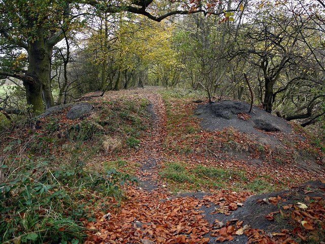
The 'Hedwin Streams Railway' (disused). Photo A Curtis (2011).
The Tide Stone bears the ‘Three Castles' emblem of the Corporation of Newcastle upon Tyne and the date 1783. It marked the limit upstream of the Port of Tyne Authority, located at the upper point at which the river was tidal, a place marked in the river by a shallow rapid known as the Hedwin Streams. Following dredging of the river and its embankment by the River Tyne Improvement Commission, it is now tidal as far as Wylam Bridge. There is an account of the 1818 annual Ascension Day ceremony at the Tide Stone involving the occupant of the former Cat House on the same linked page.
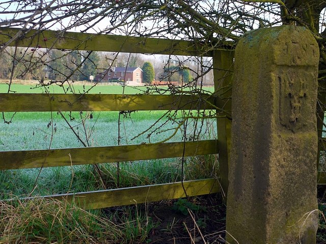 River Tyne Tide Stone & Heddon Haugh Farm. Photo A Curtis (2012). | 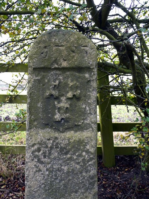 River Tyne Tide Stone. Photo A Curtis (2011). |
My first theory about this strange branch-line which now ends on the bank, high above the river bed, was discussed here. A written history of the village recorded that the stone from Killiebrigs Quarry located in Slacks Plantation just below Heddon village used to be carried in wagons down the incline from the quarry to the corner of the Close House cricket ground. From there it was described as running eastwards by the Low Wood (presumably Clayton's Wood) drawn by the Heddon Colliery engine through the pit yard, and on to the jetty for transporting down the river in wherries to the coal staithes in Newcastle.
The 1897 OS map shows its line east of Close House annotated at that time as 'Mineral Railway (disused)'. Its line merges with the Wylam Wagon-way some distance west of the 'triangular junction' making the statement regarding the pit yard unlikely. The prior edition maps (c1865) do not show the mineral line at all and later maps show no evidence that it took the more northerly route described above.
I wondered if the stone from the quarry was actually transported onward by train (at least as far as the Lemington staiths) or could it possibly have been loaded onto boats at a temporary jetty close to the Tide Stone. I had also seen a photo purporting to show a tunnel entrance on the river bank 'at point where the railway ended'. However, I am now unable to find this tunnel entrance, and its exact location and purpose remains uncertain. Old maps don't offer any help. The river bed is often exposed in this area, although tidal, but could even shallow vessels reliably transport stone from this far up-river.
The following account is also on the River Tyne page of this website.
The river was eventually dredged by Joseph Cowen in 1873. A railway track laid across the shallow bed of the river was used to transport iron slag from Spencers Iron Works in Newburn which was used to reinforce the river banks. Before it was deepened, the river could be crossed at several places by ford often where the river bed was stony in places called by the geordie dialect name, 'stanners'. There were several such fords in the vicinity of Newburn and one in particular across the river below Close House leading to Clara Vale, known as Stanner Ford.
Colleagues from the Local History Society then pointed me to figure 50 in the book:
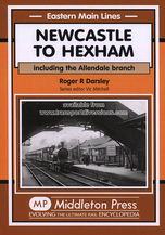
Newcastle to Hexham: Including the Allendale Branch by Roger R Darsley, Middleton Press (2005).
The caption to the photo reads:
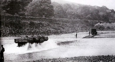
Between 1898 and 1912, the Tyne Improvement Commissioners (TIC) realigned and strengthened the river banks from Ryton Willows to Newburn Sands. A branch railway was built on the north bank of the river from the NER triangular junction west of Heddon station to Tidal Stone (The tidal limit). Sidings were laid as required on both sides of the river and across the river! Here a set of four side-tipping wagons are hauled to the Ryton side where a locomotive, probably
a Manning Wardle, is waiting on 30th May 1911. (D.G.Charlton collection).
Further information is provided in a later section of the book which deals with Heddon Station (figure 100). Here the author tells us that the curved embankment going south to the river's edge is the route of the Tyne Improvement Commission Railway from 1898 to 1912. This crossed the River Tyne towards Ryton Willows by means of a 'railway ford'. He also says that the sidings on the river bank were moved around as the work progressed.
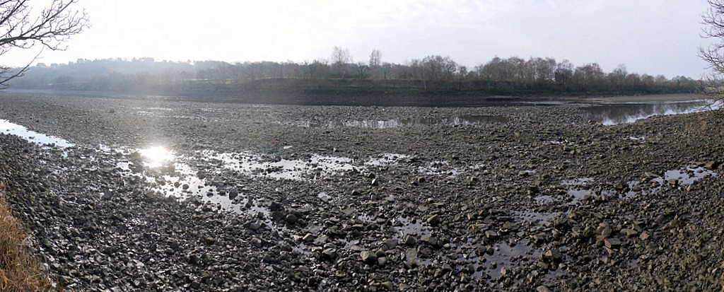
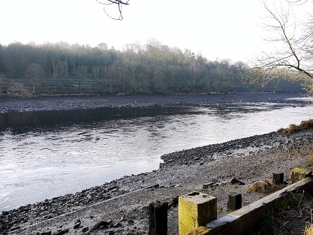
'Stanners' on bed of River Tyne near the Tide Stone at low tide. Photo A Curtis (2012).
The exact location of the part of the river shown in the photo from the book is hard to determine as the trees may appear very different after 100 years. There is a path just above the river bank with a small figure visible on the left. Above the path, a wall may indicate the line of the railway (still extant) on the south bank. This appears to place the location of the railway across the river shown in the 1911 photo to just west of Ryton Ferry House. This would also fit with the line of the hill in the background.
Interestingly, a wooden marker post still stands in this location in the river bed as shown in the right hand of the two photos below. They might however have been positioned all along the bank at one time.
Presumably the track of the 'Hedwin Streams Railway' would have curved round eastwards past the Tide Stone and then taken a gradual descent to the river bed. There may have been a similar junction with the railway line on the south side.
 Ferry House, River Lane, Ryton. Photo A Curtis (2011). | 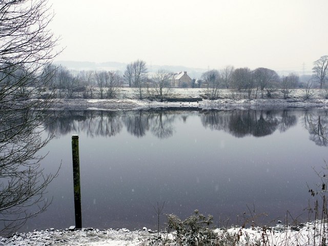 River Tyne, west of Ferry House. View towards Moore Court on the north bank. Photo A Curtis (2011). |
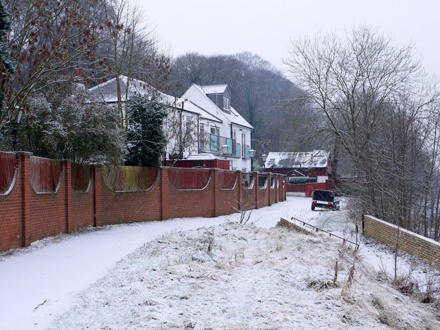
Improvements to the north bank of the river can still be seen in this location in the recent photos below. Metal-bearing rocks, some very dense, still line the bank.
 River Tyne west of Ryton Ferry House from north side. Photo A Curtis (2013). | 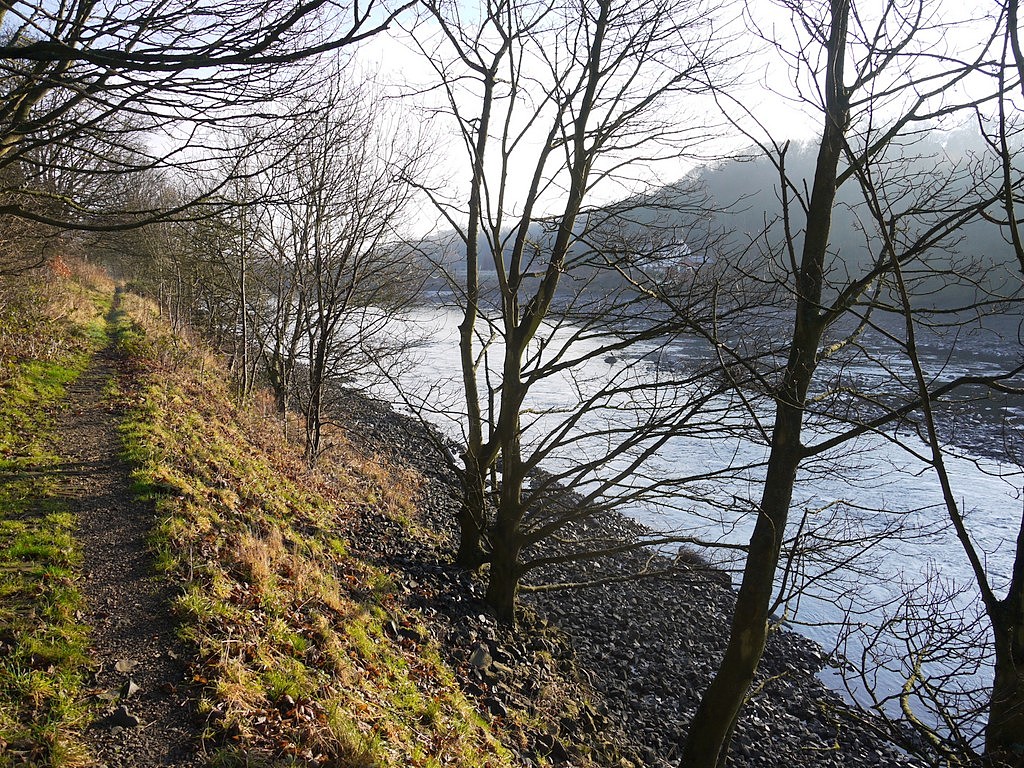 Path on north bank of River Tyne, west of Ryton Ferry House. Photo A Curtis (2013). |
There is a splendid photograph taken from the spire of Holy Cross Church in Ryton on the iSee Gateshead website (Reference Number: 03_12). It is one of many glass plate negatives collected by W.A. Cocks of Ryton. It provides a wide vista north across the river showing Throckley Colliery and Blayney Row. Although undated, it shows neat, treeless and clearly strengthened banks on the north side and also dredging underway in the river. Evidence indeed, that quite large vessels could progress this far up river at flood tide. Perhaps the quarry did indeed load stone here too but the improvements to the river (and the Hedwin Streams Railway too) probably came sometime after the mineral line from Killiebrigs stone quarry was closed.
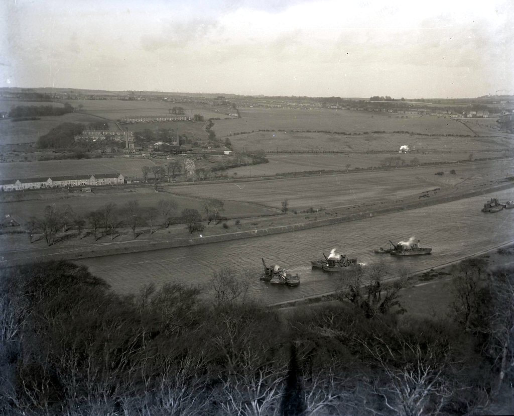
River Tyne from Holy Cross Church Spire, Ryton. Gateshead Ref. 03_12.
 RSS Feed
