Heddon-on-the-Wall Local History Society
  • Home
  • Calendar
  • Introduction
  • Where are we?
  • History Map
  • Timeline
    • Prehistoric
    • AD43 to 1599
    • 1600 to 1799
    • 1800 to 1899
    • 1900 to 1999
    • 2000 to 2099
  • Heddon's History
    • Prehistory
    • Hadrian's Wall >
      • Vallum excavation (1893)
      • Hadrian's Wall excavation 1926
      • Wall ditch, Bays Leap (1958)
      • Hadrian’s Wall: Archaeological research by English Heritage 1976-2000
      • Throckley & Heddon entanglements
      • WallWatch
      • English Heritage (2020)
      • Wardell-Armstrong Archaeolgy Reports
      • Historic England Archives
    • Six townships >
      • 1 Heddon township >
        • Heddon in the Middle Ages
        • Common Land
        • Middle Marches
        • Tithe Award
        • St Andrew's Church >
          • Stained Glass Windows
          • Churchyard
          • Monuments of church & churchyard (1991)
          • Monuments Page 2
          • Vicars of Heddon
        • Village property
        • Heddon Hall >
          • Sale of Heddon Hall 2012
        • Heddon Banks Farm
        • Frenchman's Row
        • Methodist Church >
          • Heddon Methodist Church Centenary 1877-1977
        • Men's Institute
        • Women's Institute
        • Welfare Field
        • Knott Memorial Hall
        • Memorial Park
        • Schools
        • River Tyne
        • Coal Mining
        • Quarrying
        • Water Supplies
        • Transport
        • Waggonway & Railway
        • Occupations from 1800
        • Miscellaneous
      • 2 West Heddon township
      • 3 East Heddon township
      • 4 Houghton & Close House township >
        • Close House
      • 5 Eachwick township
      • 6 Whitchester township
    • Rudchester
  • People
    • Sir James Knott
    • Cadwallader J. Bates
    • Richard Burdon
    • Hugh Sinclair (Tim) Swann
    • George Clark
  • Old Photos
    • Postcards
    • Old photos 1
    • Old photos 2
    • Old photos 3
    • Old photos 4
    • Old photos 5
    • Old photos 6
    • Old Photos 7
  • Old News
    • Community News
    • Letter from the Emigrant Clergy of Frenchman's Row (1802)
    • Alleged Brutal Murder at Heddon-on-the-Wall (1876)
    • Sad boat accident at Ryton (1877)
    • Coronation tree (1902)
    • 65 Years on a Ferry Boat (1929)
    • Come claim your kiss at Heddon (1953)
    • The Swan (1972)
    • Heddon WI (1987)
    • Church House (1966)
    • Happy return (1993)
    • Hexham Courant (1997)
    • Butterfly Garden (1999)
    • Foot & Mouth (2001)
    • Remembrance Day (1996)
    • Remembrance Day (2016)
    • RAF at Ouston (2007)
    • Close House Golf Course (2009)
    • Heddon pupils celebrate British heritage (2011)
    • Roman Wall Forge (2011)
    • Diamond Jubilee (2012)
    • Auction of Bronze Statue, Close House (2012)
    • Heddon WI (2012)
    • Puffing Billy Festival (2013)
    • Heddon Village Show (2014)
    • View of the North (2014)
    • The Wall at Heddon (2014)
    • Heddon Village Show (2015)
    • War veterans singing send-off (September 2015)
    • Anglo-Saxon history (2014)
    • Heddon WI at 100 (2017)
    • Hadrian's Wall discovery (2019)
    • Tulip Mews (2020)
    • Mike Furlonger
    • Hadrian's Wall 1900 Festival
  • Memories
    • Olive White
    • Betty Cockburn
    • Betty Cockburn - miscellaneous information
    • Isabel Snowdon
    • William & Winnie Watson
    • Edith Ward
    • Mark Parker
    • Jack Lawson
    • Winnie Spoor
    • P Reay
    • Mr and Mrs Hall
    • Peter Chapman
    • Elizabeth Elenora Eames
    • Harry Murray
  • Other documents
    • Mackenzie (1825)
    • Bates (1886) >
      • Early & Roman
      • Townships
      • Heddon Church
      • Heddon & Houghton
      • Whitchester
      • Eachwick
      • West & East Heddon
      • Records
      • Addenda
      • Appendix A
    • History, Topography & Directory of Northumberland (Bulmer's) - 1886
    • History of Northumberland (1930)
    • Collingwood Bruce (1853)
    • Whellan (1855)
    • Post Office Directory (1879)
    • Prominent people in Heddon
    • Place names
    • Ad Murum
    • Archived documents
    • Thomas Bewick's History of British Birds (1826)
    • Census data 1801-1991
    • Historical Records 1888-1890
    • Knott Sale of Village Property (1924)
    • Extracts from Parish Council Records
    • Local colliery records
    • Blackburn (1938)
    • Clark (c.1963)
    • History of Church (1968)
    • Boundary Commission Report 1984
    • Village Atlas 2022
  • Walks
    • Walks 2
  • Blog
  • Contact us
  • Links
  • What's new
  • Site search
  • Past & Present
  • Photo of the Month
  • Place Name Studies
    • Meas & Meres
    • OS Name Books: Elsdon
    • OS Name Books: Allendale
    • OS Name Books: Cheviot Hills

Steam Drifter 2

6/8/2019

0 Comments

 
Picture
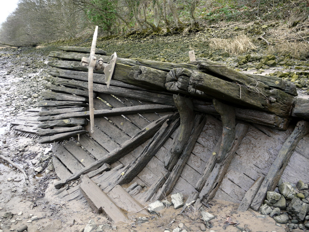
Remains of steam drifter on River Tyne at Ryton. Photo A Curtis (2013)
In 2013 I wrote an article on this blog about the wreck of a wooden-hulled steam drifter (fishing boat) on the bed of the River Tyne close to the Ryton shore.

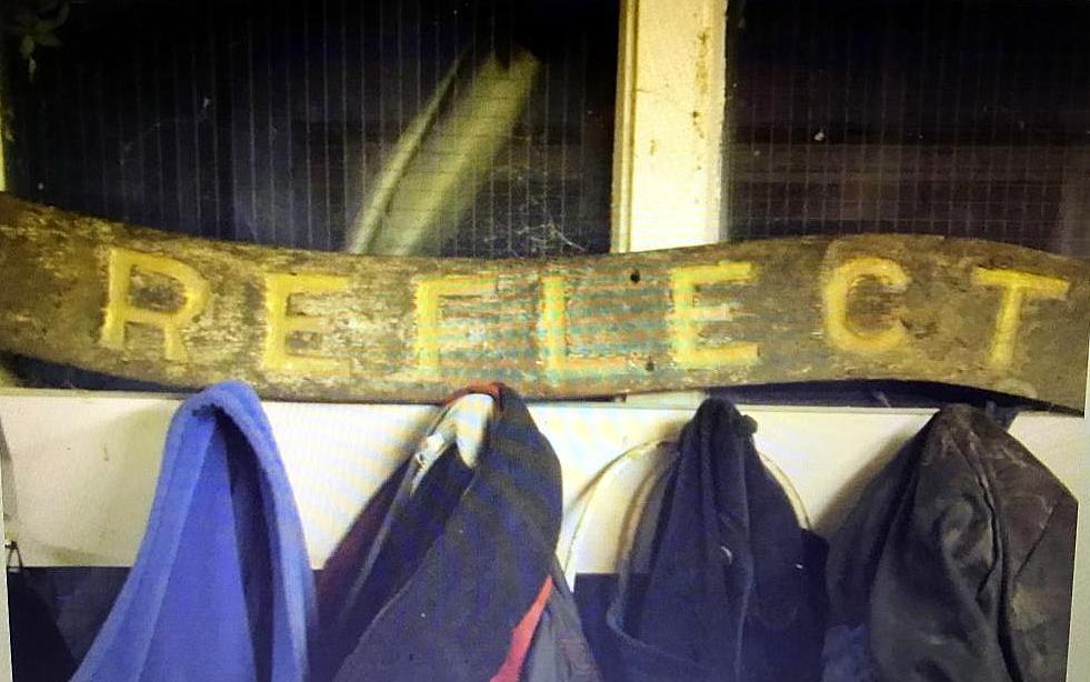
Together with an archaeologist who had examined the wreck a few years earlier, we had tried to find out more details. The best information we had was that from a correspondent who told us the vessel had been called Reflect. The vessel had been purchased from Clayton & Davis, ship breakers at Dunston, in the early 1950's. It was to have been a house boat at Ryton for the Sea Scouts but sank before it was converted.
In June of this year, completely out of the blue, another correspondent, ex deep-sea fisherman and researcher of fishing boats, Andrew Hall, sent us a full history of the vessel.
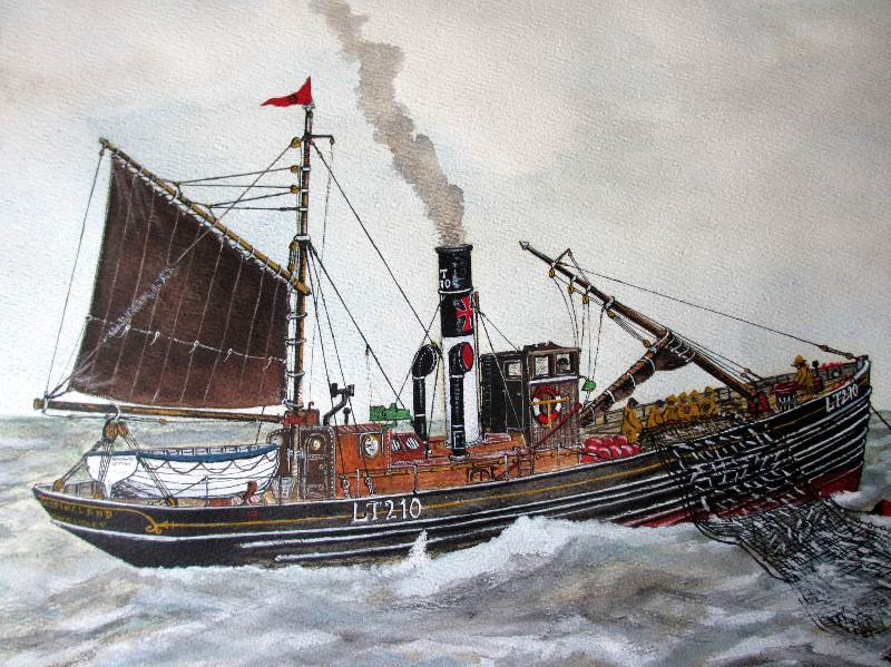
She had started life in 1902, launched by S. Richards & Co. Ltd, of Lowestoft for Robert S. Gouldby, Kessingland, Suffolk as 'Kessingland'. Completed in 1908 and registered at Lowestoft as LT 210.
Picture
Steam Drifter "Kessingland" LT210 Lowestoft, watercolour on paper by Perry Broad 30-08-1982.
In 1915, the Kessingland was requisitioned as a Net Laying Vessel (Ad No.1056) based at Dover, being returned to her owners in 1919. In 1920 she was in Scarborough, registered as SH 210, with several different owners up to 1926.

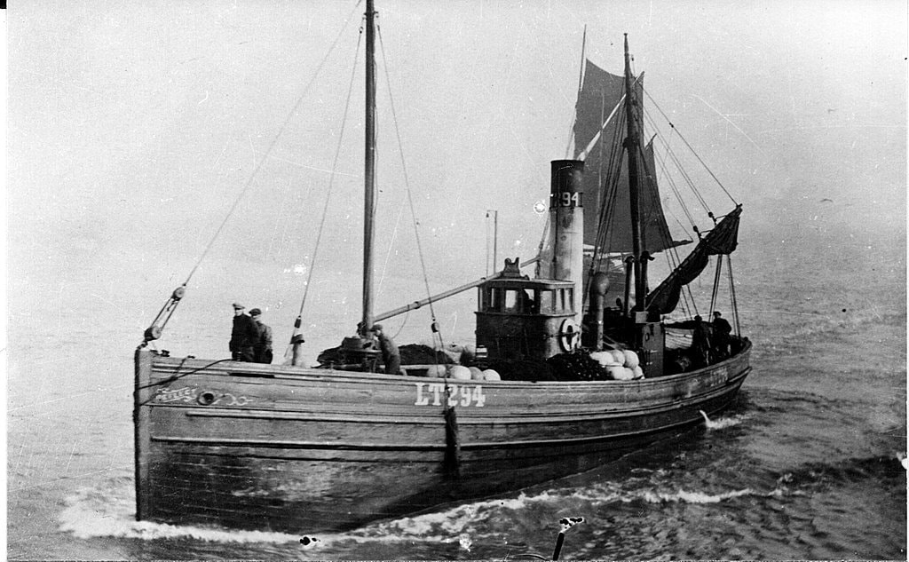
In this year she was back in Lowestoft, registered as LT 294 and renamed 'Reflect'.

Picture
Steam drifter LT294 'Reflect'. Photo courtesy of the Port of Lowestoft Research Society.
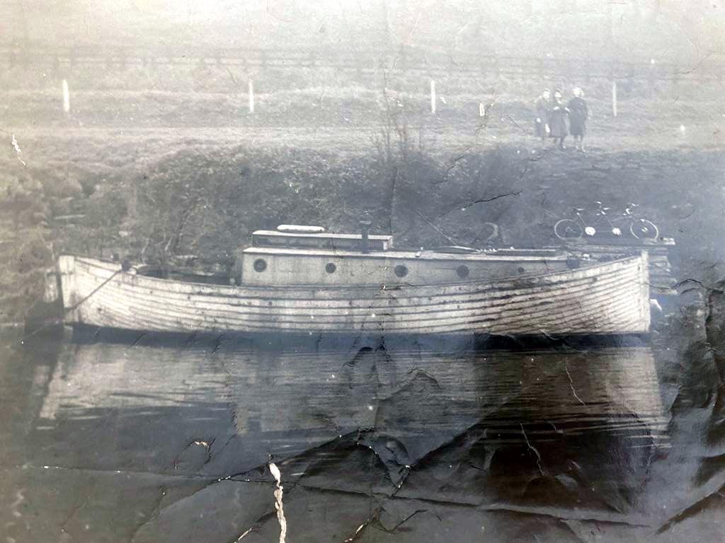
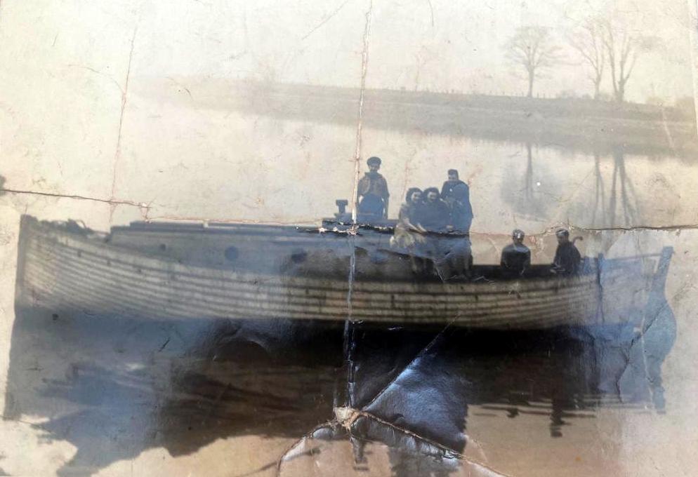
In the Second World War, Reflect was requisitioned as an Examination Vessel, returned to her owners in 1945. Two years later she was sold as scrap to Clayton & Davies of Dunston on Tyne. Here she was purchased by the 1st Tyne Sea Scouts, sailed to Ryton, but sank before refitting as a houseboat.

UPDATE - 13/08/2022

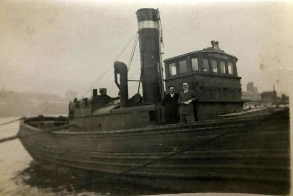
Photos and information below provided recently by Arthur Newton.

He tells me that the loss of the boat was caused by vandalism when rocks loaded to keep the vessel upright at low tide were moved onto her downslope side.
Picture
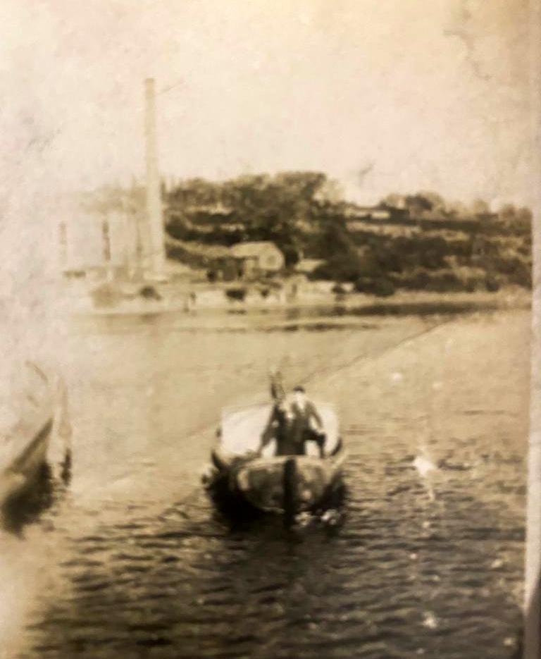
Reflect - en route from Clayton & Davies yard in Dunston to Ryton showing Arthur Newton's father & brother in law (c.1950), Photo courtesy A Newton (2022).
Picture
Name plate from Reflect. Photo courtesy A Newton (2022).
Picture
Name plate & anchors from Reflect. Photo courtesy A Newton (2022).
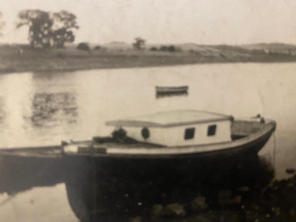
Other boats on the River Tyne and houseboats at Ryton Willows.

Talk on YouTube: Passage of Tyne
by Andy Curtis (3rd May 2021).

0 Comments

A View of Wylam Bridge

10/6/2018

0 Comments

 
Picture
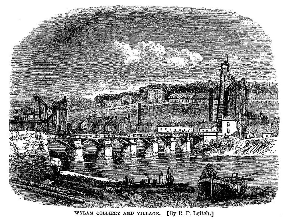
The illustration above of Wylam Bridge by R P Leitch was made for the 3rd edition of Samuel Smiles’ book, The Life of George Stephenson, published in 1868. It shows an industrial village with a coal mine and iron works along the northern riverbank and few buildings higher up in the village, including the colliery school built in 1854. Between the colliery pumping engine and the blast furnace stand the buildings of Wylam Mill, with another tall chimney.
 
Smiles described the village at he saw it.
“The colliery village of Wylam is situated on the north bank of the Tyne, about eight miles west of Newcastle. The Newcastle and Carlisle Railway runs along the opposite bank; and the traveller by that line sees the usual signs of a colliery in the unsightly pumping-engines surrounded by heaps of ashes, coal-dust, and slag, while a neighbouring iron-furnace in full blast throws out dense smoke and loud jets of steam by day and lurid flames at night. These works form the nucleus of the village, which is almost entirely occupied by coal-miners and iron-furnace-men. The place is remarkable for its large population, but not for its cleanness or neatness as a village; the houses, as in most colliery villages, being the property of the owners or lessees, who employ them in temporarily accommodating the work-people, against whose earnings there is a weekly set-off for house and coals.”
 
“There is nothing to interest one in the village itself.”
 
An article in The Newcastle Courant of 17 January 1874 entitled 'Our Colliery Villages' still described the village as “...  the very worst colliery village that we have yet beheld …'
 
The late 18th century had been a period of prosperity for Wylam – the colliery was thriving and an iron works, a lead-shot manufactory and a brewery were all established in the village. In the mid 1750s, Blackett, the colliery owner had had the Wylam Waggonway constructed to transport coal from the Haugh Pit to Lemington, originally using horse-drawn wagons, but in the early 1800s using some of the earliest steam locomotives including Puffing Billy and Wylam Dilly.
 
Benjamin Thompson established the Wylam Iron Works in 1835; one of its blast furnaces can be seen on the right, close to the location in Falcon Terrace where the school was built in 1909-10 (now the library and railway museum). Few remains of this industry can still be found, although many of the garden walls in Wylam’s Main Road are built of slag.
 
In 1825, he became a director of the Newcastle and Carlisle Railway and surveyed the route for the line, supervising the later stages of its construction between 1833 and 1835. At the iron works, locomotives were built for several years and in 1836 he was responsible for the erection of Wylam Bridge to link the village (and his works) to the new railway. It was originally a combined road and railway bridge with a timber deck supported on stone piers. It was funded by public subscription and tolls. This replaced a small ferry boat and earlier, often hazardous ford.
 
In 1864 the iron works closed. Four years later the colliery was closed, Haugh Pit below the river flooded for the last time. The brewery ceased to operate sometime in the 1870s. In 1876 Wylam Mill was modernised and converted into a steam mill. In 1931, most of its buildings including its chimney were destroyed by fire although the former Mill Stables is now the new Co-op store.
 
In 1876 the Scotswood, Newburn and Wylam Railway was completed with its arch-rib designed bridge at Hagg Bank, too late for much of Wylam’s industry. The track of this railway, serving a new station at North Wylam, was built along much of the course of the old waggonway.

The timber decking of Wylam Bridge was replaced with steel in 1897 when the bridge was no longer in use by rail traffic. It was again replaced in 1946. In 1960 the bridge still had an old tollhouse at the south end where the station car park entrance is today, although the company had erected a new one at the north end in 1899. The house sports a Puffing Billy weather vane on its dormer window.

Pedestrians were charged one penny to cross but an agreement between the landowner and the bridge company allowed free passage to some of the well-off residents. Opposition to the tolls led eventually to its acquisition by Northumberland County Council and it was freed from toll in 1936.

In 1942 strengthening and widening was carried out by the Ministry Of Transport so that it could be used by tanks. Flood damage and erosion forced replacement of two piers in the 1950s and the bridge was widened in 1959 to 24 feet, including a 6 foot wide path. A weight restriction of 9 tons was imposed in 1960, later raised to 10 tons. Following concerns over the safety of the railings following impact by cars, the bridge was closed for several weeks in 2007 for safety improvements.

The decline of industry in the 19th century led to a substantial change in the character of the village. By the 20th century Wylam was almost entirely a residential settlement, its transport well served by two railway stations.
Picture
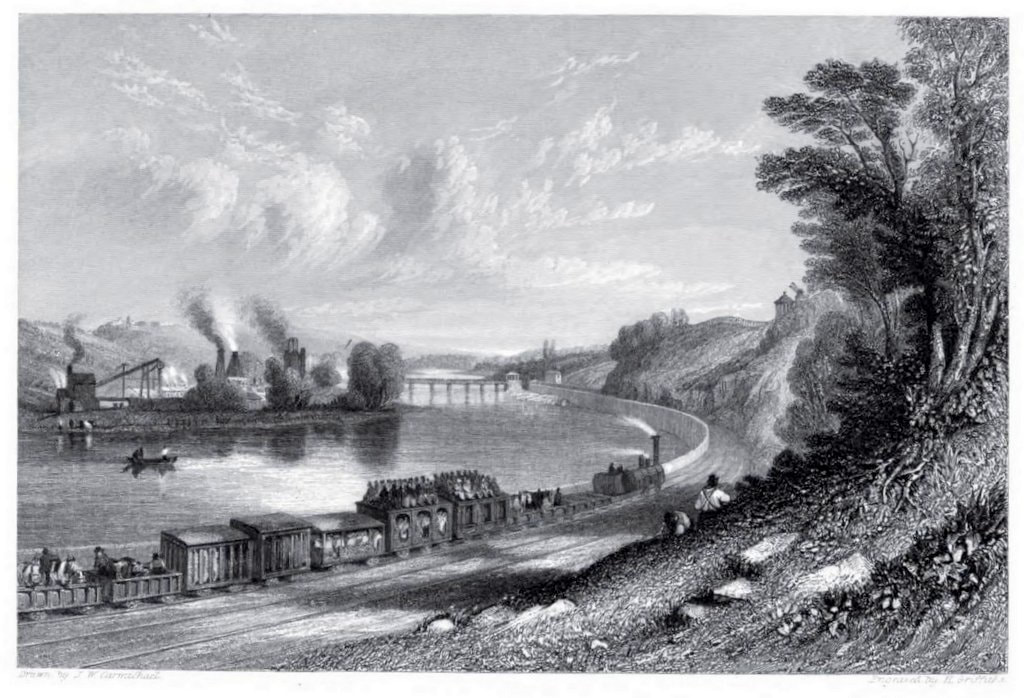
The length of river bank east of Hagg Bank is known as Wylam Scars and it was here that work on the Newcastle-Carlisle railway began in 1831. The scene was delightfully illustrated by J.W. Carmichael in one of his famous views of this railway. This was the first cross-country line to be built and the first section, between Blaydon and Hexham, opened on March 9th 1835.

LINKS

Wylam History Walk on ViewRanger, free navigation app for mobile phone.
Wylam Globe Supplement to Issue 41 (June 1988)
wylamglobe41supplement.pdf
File Size: 6475 kb
File Type: pdf
Download File

0 Comments

Acomb Little Man

12/4/2018

0 Comments

 
Picture
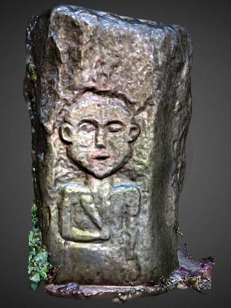
3D model of 'Acomb Little Man' by A Curtis (2018). Click photo for link to model on Sketchfab.
I was re-reading the leaflets from last year's Tales of the Frontier which reminded me of another 'Little Man' located in the Tyne valley, potentially much older than 'Heddon Man', the subject of my, tongue in cheek, April 1st post.
The sandstone sculture was found in 1970 at Waters Meet, where the North and South Tyne Rivers converge, and is something of a mystery.

Believed to be of Romano-British origin, the stone represents a rare, previously unrecorded style. The figure, possibly ‘Hercules’, carries a club in right hand. The carving was kept in Acomb House for 30 years, then spent 5 years in a barn. It now stands just off the bridleway at the edge of the village.
Picture
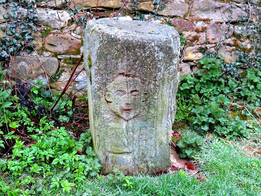
The Little Man of Acomb. Photo A Curtis (2018).
The carved sandstone block about 86cm high bearing the figure of 'Acomb Man' was installed in 2011 where the bridle path joins The Green in the village of Acomb, Northumberland.

It was found in 1970 at Water's Meet (Howford), where the Rivers North & South Tyne join west of Hexham and remained at Acomb House for 30 years until the house was sold.

Stan Beckensall compiled a report on the carving and sent it to English Heritage. He said experts at the Museum of Antiquities and the Vindolanda and Arbeia Forts on Hadrian’s Wall had confirmed the carving was probably made during the Roman occupation in the 2nd or 3rd century.

"Paul Bidwell, an expert at Arbeia Fort in Wallsend, says it’s in a native style and therefore very unusual and very rare – perhaps unique,” said Stan.

“The carving is obviously meant to be Hercules; he’s holding a club across his chest in one hand and a round object in the other that might be a purse or a dish."
Dr Sharpe remembers being intrigued by the ‘Little Man’ of Acomb, which appears in leaflet ‘No. 7 The Tyne Valley: Old Stones and New Faith’.

“It’s a carved figure of a man with a very sweet smile on his face. There is still some debate as to whether it’s actually Roman,” she says. “It was found at the Tyne Waters Meet in 1970 and was kept in a barn for many years before it reappeared. The villagers wouldn’t let it go to the museum – it’s now on a concrete plinth at the edge of the village."

Tales of the Frontier: The Life of Hadrian's Wall

Hexham Courant, 21st March 2011

The Journal, 10th March 2011


0 Comments

Ryton Ferry

27/12/2015

0 Comments

 
Picture
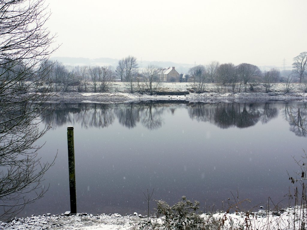
View across the River Tyne, west of Ferry House. Photo A Curtis (2011).
From History of the Parish of Ryton by William Bourn of Whickham (1896).
Turning to the right, a short walk through the Dene brings you to Ryton Ferry, which is one of the fairest spots around the old village. The place is remarkable for its stillness, which is only broken by the shriek of the whistle of a passing train, or the chiming of the hour by the church clock. The scenery is exceptionally picturesque.

On the south side of the river are the banks of Ryton, richly wooded, and teeming with bird life ; on the north side is the old-fashioned house of the boatman, protected from the north winds by a belt of trees running east and west along thebank of the stream. Rising gracefully from the low lying ground, the southern hills, with their hamlets and woods, and pretty cottages, form a splendid background. Half a mile westward the river makes a graceful bend to the north, and eastward in the same direction till it reaches Newburn. Altogether the Ryton Ferry is one of the most delightful pieces of scenery on the Tyne.

Read More
0 Comments

Beyond the Blaydon Races

26/11/2014

0 Comments

 
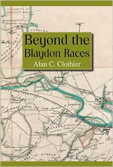
A new book on the collieries, waggonways and railways of Wylam, Heddon, Throckley, Newburn, Walbottle, Hollywell, Lemington and Callerton by Alan Clothier.
The area covered by this book is mainly that of the five waggonways delivering coal to their staiths on the River Tyne at Lemington from collieries at Wylam, Heddon, Throckley, Walbottle, Hollywell and Black Callerton. The main objective has been to place the early wooden waggonways fully in the context of their purpose and usage within the mining industry and continues with their development and the coming of railways up to the demise of the coal industry in that district. There is a more detailed insight into the multifarious activities of Colliery Viewers whose work it is felt has not always received the attention which it deserves. For much of this feature, the author is indebted to the wonderfully detailed work diaries of William Oliver held by the North of England Institute of Mining and Mechanical Engineers. The opening date for the Wylam Waggonway has long escaped the notice of historians and many well-known writers have had it wrong; the author is pleased that his researches have at least narrowed it down to the year in which this event occurred. A Glossary of Terms used in the mining industry is also included as well as numerous plans and a Chronological Listing of Events.
Picture
Beyond the Blaydon Races by Alan Clothier (2014)
0 Comments

Newcastle Swing Bridge

20/3/2014

0 Comments

 
Picture
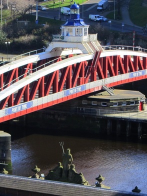
Neptune and Swing Bridge, Newcastle. Photo A Curtis (2014).
Newcastle's Swing Bridge, thought to have been the fourth bridge that crossed the River Tyne at low level on the site, was designed by Lord Armstrong and the Tyne Improvement Commission. It was built at Armstrong's Elswick works between 1868-76 at a cost of £222,000. At the time of its opening it was the largest such bridge in the world. It was a necessary development to allow for upriver navigation by sea-going vessels but required the removal of the current nine-arched stone bridge built in 1781.

The bridge mechanism is still driven by the original Armstrong hydraulic engines, although the steam pumps were replaced by small electric pumps in 1959. The pumps force water into the chambers of hydraulic accumulators, sunk down into the bed of the river. When the motors cut out, 60-ton weights above the chambers force water out under pressure which run the machinery to turn the bridge. The bridge now opens only very rarely and is controlled from the cupola above the superstructure.
Picture
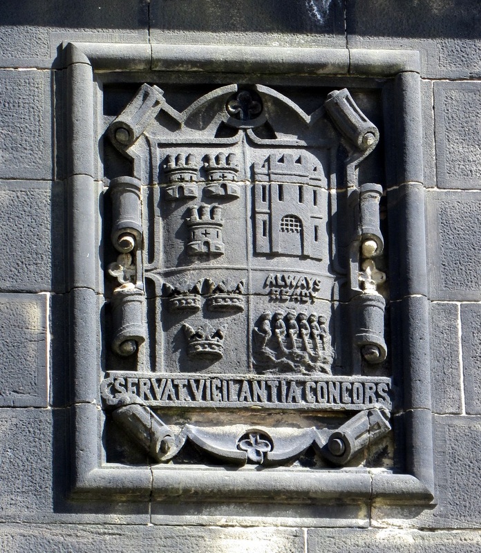
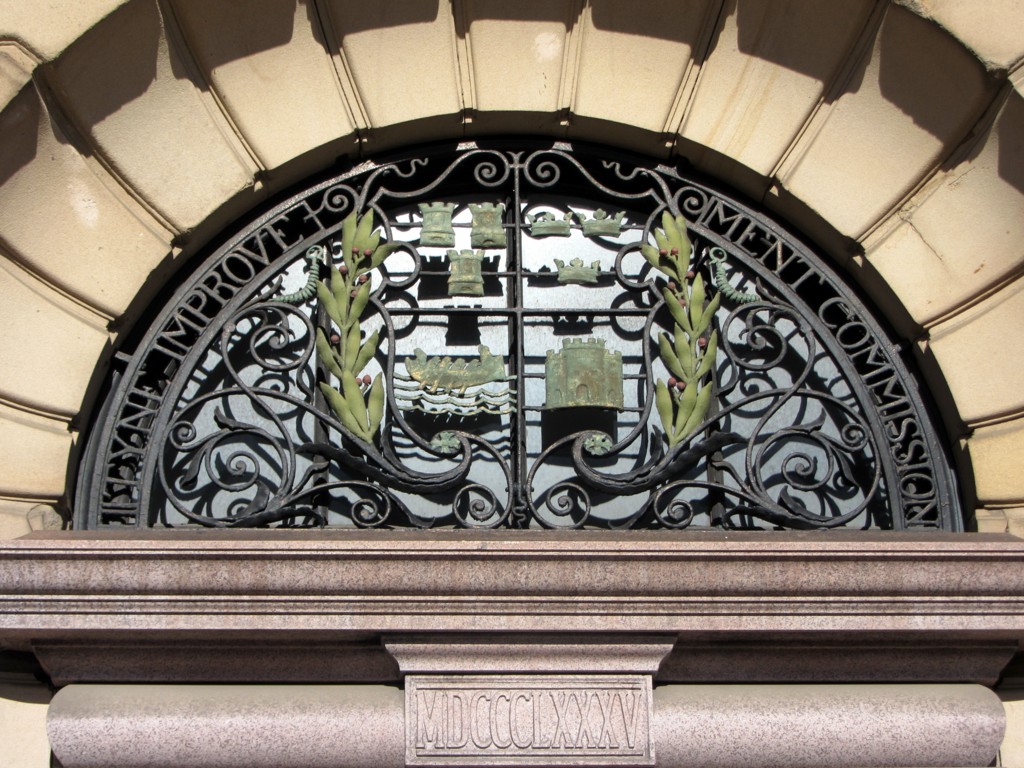
Tyne Improvement Commission coat of arms, Swing Bridge Newcastle abutment. Photo A Curtis (2013).

Read More
0 Comments

Improving the Tyne

11/3/2014

0 Comments

 
Picture
Window above doorway to Tyne Improvement Commission's Bewick House, Newcastle. Photo A Curtis (2014).
Bewick House in Bewick Street, Newcastle, close to Central Station, was built to provide offices for the Tyne Improvement Commission. It clearly was of no interest to have a location nearer to the river which probably reflects the more commercial interests of the Commission and the more general move of the city to the north in the mid C19th.

In 1854, the commissioners started a programme of development and improvement of the river that continued well into the C20th and laid the foundations for what was to become the modern-day Port of Tyne. Within 70 years, the River Tyne was deepened from 1.83 metres to 9.14 metres and over 150 million tonnes dredged from it. The North and South Piers at the river's entrance were built, together with the Northumberland, Tyne and Albert Edward Docks, and the staithes at Whitehill Point and Dunston. The results of these developments could be seen in 23 million tonnes of cargoe being handled by the Port by 1910.

On 31st July 1968 the Tyne Improvement Commission was dissolved and replaced with the Port of Tyne Authority, constituted on 28th June, and one of the UK’s largest trust ports.

The newspaper article from 1897, transcribed below, describes 'above bridge developments' of the 'great improvement scheme'.

Read More
0 Comments

1914 - 2014 Remembering The Great War

4/1/2014

0 Comments

 
Picture
2014 marks 100 years since the outbreak of the First World War.

One hundred years on, we are all connected to the First World War, either through our own family history, the heritage of our local communities or because of its long-term impact on society and the world we live in today.

From 2014 to 2018, across the world, nations, communities and individuals of all ages will come together to mark, commemorate and remember the lives of those who lived, fought and died in the First World War.

IWM (Imperial War Museums) is leading the First World War Centenary Partnership, a network of local, regional, national and international cultural and educational organisations.

Through the First World War Centenary Programme, a vibrant global programme of cultural events and activities, and online resources, the aims are to connect current and future generations with the lives, stories and impact of the First World War.
Here in Heddon on the Wall we would also like to put together some memories of this time and of those men from the village who gave their lives and that we remember to this day. The first of our articles appears below. It is intended to illustrate the calm before the storm, setting the tranquil scene in the locality of our village in the spring of 1914 using text from a local newspaper article.
Picture
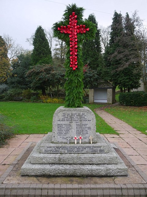
Heddon War Memorial - Armistice Day. Photo A Curtis (2011).
The North East War Memorials Project records for that for the Heddon on the Wall district, including Heddon Colliery, over 200 men served in the Great War, 16 were killed.

Read More
0 Comments

Excavation of waggonway in Newcastle

27/7/2013

1 Comment

 
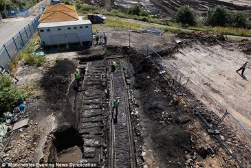
Archaeologists looking for Roman remains have stumbled across an even more historic find - a wooden railway which was instrumental in the development of the Industrial Revolution.

An excavation on the banks of the Tyne unearthed a stretch of waggonway which is more than 200 years old, making it the earliest surviving example of the standard-gauge railway.

The discovery was originally part of a network which linked the ports of the North East with collieries in Tyneside and Northumberland in the late 18th century.

Picture
Photo from The Daily Mail, 26 July 2013.
The waggonway is made up of a heavy duty 'main way' with two sets of rails laid on top of each other to preserve their longevity, with a loop from the main line descending into a dip.

That depression would have been filled with water where coal wagons' wooden wheels were rested to stop them drying out and cracking. In the middle of the loop is a stone elevation where the horse pulling the waggon would have stood. It is the first time such a 'Watering Pond' has been recorded, although previously known from maps.

Read More
1 Comment

Wylam Waggonway

9/6/2013

1 Comment

 
To focus my mind on the Wylam Waggonway for the Puffing Billy Festival I decided to create a map of the waggonway so that I could discuss some things that interest me along its route. As always I am particularly interested in finding clues to the past which can still be seen today.

This will be an ongoing blog and I will add to it as I feel inspired.

View Wylam Waggonway in a larger map
Key to map above:
Red: North Wylam, Newburn & Scotswood Railway where it diverges from the route of the former Waggonway.
Blue: approximate route of Wylam Waggonway (1859 Map)
Green: Mineral line (single track) closely parallel to railway line (double track) - possibly on the original waggonway line.
Purple: Early Throckley Waggonway (1859 map)
Pink: Later Throckley Waggonway (1897 map)
Yellow: Throckley Isabella Mineral Railway (1897 map)
Light Blue: North Walbottle Waggonway (1859 Map)
Yellow Pin: Named feature

Read More
1 Comment
<<Previous

    RSS Feed

    Author

    Andy Curtis

    Archives

    February 2023
    November 2022
    September 2022
    August 2022
    June 2022
    May 2022
    January 2022
    December 2021
    November 2021
    September 2021
    August 2021
    June 2021
    May 2021
    October 2020
    June 2020
    May 2020
    March 2020
    November 2019
    August 2019
    July 2019
    March 2019
    January 2019
    November 2018
    October 2018
    August 2018
    July 2018
    June 2018
    April 2018
    March 2018
    January 2018
    October 2017
    September 2017
    July 2017
    June 2017
    May 2017
    April 2017
    March 2017
    February 2017
    January 2017
    December 2016
    November 2016
    September 2016
    August 2016
    July 2016
    June 2016
    May 2016
    April 2016
    February 2016
    January 2016
    December 2015
    October 2015
    September 2015
    August 2015
    July 2015
    June 2015
    May 2015
    April 2015
    March 2015
    February 2015
    January 2015
    December 2014
    November 2014
    September 2014
    August 2014
    July 2014
    June 2014
    May 2014
    April 2014
    March 2014
    February 2014
    January 2014
    December 2013
    October 2013
    September 2013
    August 2013
    July 2013
    June 2013
    May 2013
    April 2013
    March 2013
    February 2013
    January 2013
    December 2012
    November 2012
    October 2012
    September 2012
    August 2012
    July 2012
    June 2012
    May 2012
    April 2012
    March 2012
    December 2011
    November 2011
    October 2011
    September 2011
    August 2011
    June 2011
    May 2011
    April 2011
    March 2011
    February 2011


    Categories

    All
    Agricultural Engineering
    Archaeology
    Barrow
    Bays Leap
    Beamish Museum
    Beer
    Beer-mat
    Bewcastle
    Books
    Border Line
    Brewery
    Brown
    Cabinetmaker
    Charlton
    Cheviots
    Churches
    Civil War
    Clennell Street
    Close House
    Coal Mining
    Cullercoats
    Cumbria
    Eachwick
    Earl Grey
    Elswick
    Family History
    Fishing
    Fishwives
    Folkestone Warren
    Forth Banks
    Furniture
    Gardens
    General
    George Clark
    Gibson
    Goods Station
    Hadrian's Wall
    Harbours
    Heddon
    Heddon Hall
    Hexham
    Hidden Chains
    Houghton
    Howick Hall
    Hunting
    Iron Sign
    Isaac Jackson
    John Grundy
    John Smith
    Knott
    Landslide
    Lead Works
    Lemington
    Lindisfarne
    Maritime
    Meetings
    Military Road
    Mill
    Monument
    Newburn
    Newcastle
    Newcastle Assizes
    News
    North Lodge
    North Shields
    Northumberland
    Northumberland Records Office
    Old Middleton
    Oral History
    Ouseburn
    Outings
    Photography
    Place Names
    Place-names
    Ponteland
    Ports
    Prehistory
    Pubs
    Quarries
    Railways
    Redesdale
    River Tyne
    Rock Art
    Roman
    Sadler
    Sanderson
    Schools
    Seaton Delaval
    Ships
    Shot Tower
    Slave Trade
    Songs/Poems
    Spearman
    Stagecoach
    Stained Glass
    St. Andrews
    Stephenson
    Swann
    Tea Robbery
    Throckley
    Town Farm
    Transportation
    Trinity House
    Victorian Panorama
    Walbottle
    Walk
    Water Supply
    William Brown
    Williamson
    Woodhorn
    Ww1
    Ww2
    Wylam
    Yetholm

Powered by Create your own unique website with customizable templates.