
Walbottle Moor Waggonway is known to have been in operation from 1769. This Waggonway ran from old pits north of Hexham Road past the location of Duke Pit in Walbottle down to coal staiths on the River Tyne at Lemington. The network is one of the last surviving examples of an 18th century waggonway to survive in Newcastle.
The system was still in use in 1860, using horses and employing 50 keelmen at the riverside staiths for transport down river.
This now disused network provides the village of Walbottle with picturesque paths allowing easy access to the surrounding countryside. These waggonways also have historic importance due to their connection with railway pioneer George Stephenson, who as a boy worked on them as a fireman and horse driver.
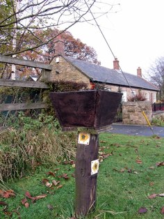
'Waggonways Walk' marker, Black Callerton. Photo A Curtis (2013).
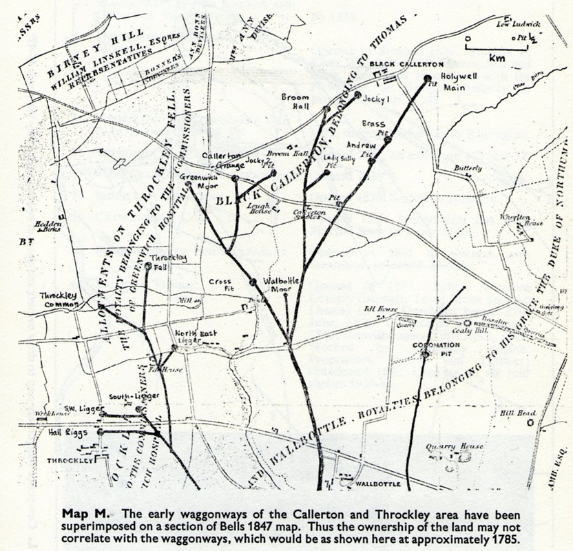 Enlarged route map M from C.R. Warn, Waggonways and Early Railways of Northumberland. Frank Graham (1976). |  Plan of the collieries on the rivers Tyne and Wear by John Gibson (1788). |
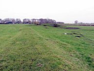
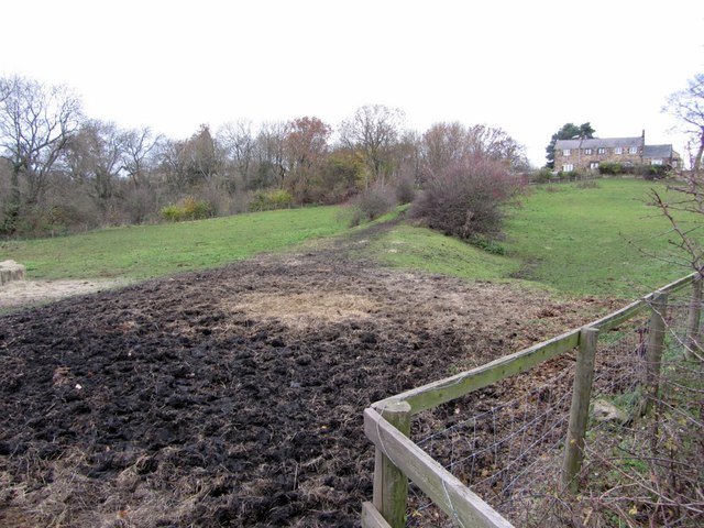 Embankment of former Walbottle Waggonway (Duke Branch). Photo A Curtis (2013).  Planters off The Paddock, Walbottle. Photo A Curtis (2013). 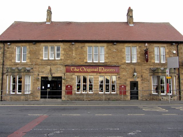 'The Original Masons', Hexham Road, Walbottle. Photo A Curtis (2013). 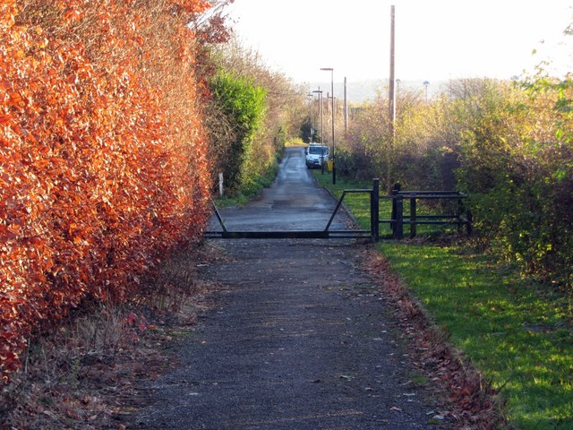 Bridle path east of Walbottle Campus (view south). Photo A Curtis (2013). 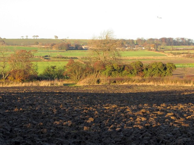 Farmland north of A69 near Cutend. Photo A Curtis (2013). | Waggonway embankment leads from the straight section of Walbottle Road opposite Dene Terrace up to the site of the former Duke Pit of Walbottle Colliery. Duke Pit was situated close to here. The open space is on the line of the former waggonway that served Duke Pit in 1850s and before that other coal pits to the north. 'The Original Masons' has been the site of a public house for a long time. In 1859 it was named 'The Engine Inn' and reputed to be the site of a stationary winding engine for the local pit. A straight narrow lane starting on the Hexham Road just west of the Original Masons traces the line of the waggonway north to the A69. The line of the former waggonway can be traced through this recently ploughed field north of the A69 by the dark residue of its small coals. Cutend is named after a waggonway cutting. |
At Cutend the waggonway crosses a west-east track that runs from Throckley (south of Dewley Farm) to Fell House Farm near North Walbottle. Although there is nothing there today, the 1859 map shows buildings on both sides of the track, the remains on the north side (possibly a small farmhouse) now hidden in trees.
Just north of the track, the waggonway branched, the western route heading north for Callerton Lane End and serving the coal pits of Greenwich Moor, and Callerton Grange. The eastern branch serving pits on the way to, and near, Black Callerton. Walbottle Moor Pit near the junction (just to the right in the photo below) is now only visible as a slight depression in the field.
Just north of the track, the waggonway branched, the western route heading north for Callerton Lane End and serving the coal pits of Greenwich Moor, and Callerton Grange. The eastern branch serving pits on the way to, and near, Black Callerton. Walbottle Moor Pit near the junction (just to the right in the photo below) is now only visible as a slight depression in the field.
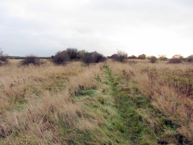
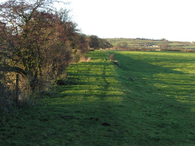 Embankment of former waggonway south-east of Dewley Farm. Photo A Curtis (2013). 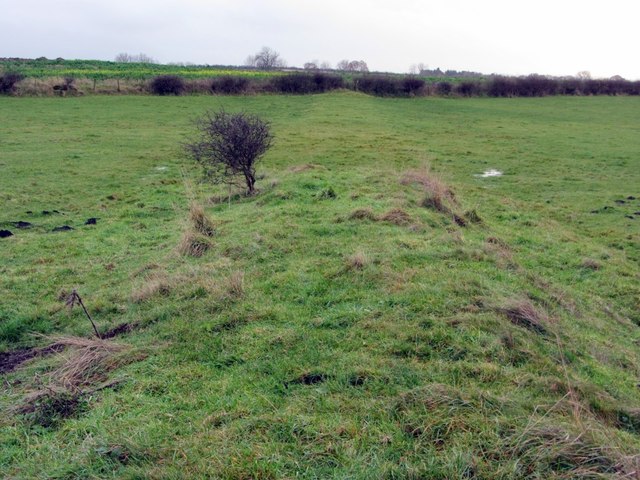 Embankment of former Walbottle Waggonway (eastern branch). View south. Photo A Curtis (2013). 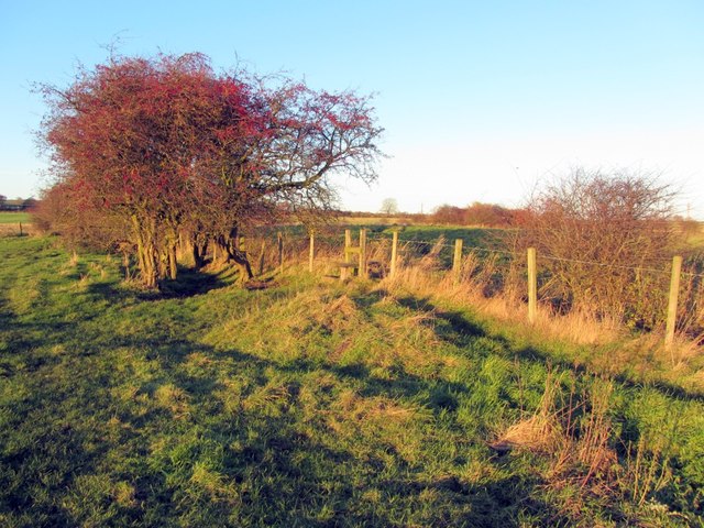 Public footpath on line of former waggonway (eastern branch). View north. Photo A Curtis (2013). 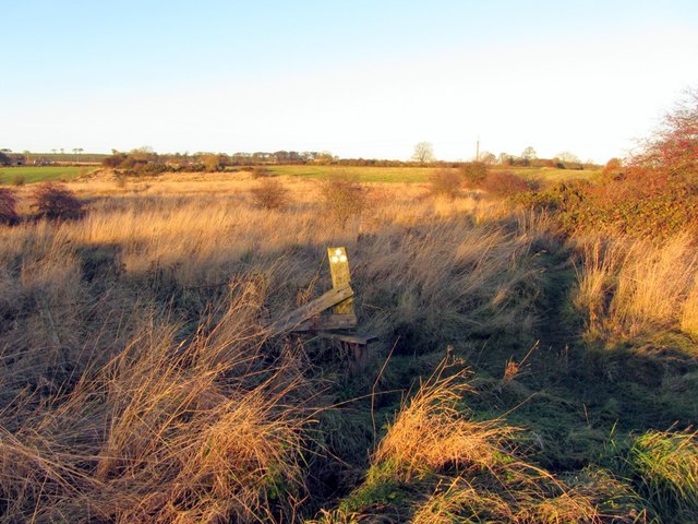 Rough pasture south of Lough House. Photo A Curtis (2013). | The western branch of the waggonway served a number of coal pits east of Dewley Farm up to Callerton Lane End. A public footpath now follows much of the route but crosses several arable fields. The track of the waggonway runs south into the adjacent field at the location shown by the rise in the hedgerow. Just beyond this stile the former waggonway branched again in rough and boggy ground. The junction of footpaths here shows the location of another branch in the former waggonway. |
A branch heading north served a former coal pit just north of the boggy area shown above, crossed the Stamfordham Road east of Lough Houses and terminated at a former pit near Broomhall Farm south of the Callerton Road.
 Waggonway embankment south of Broomhall Farm. View north. Photo A Curtis (2013). 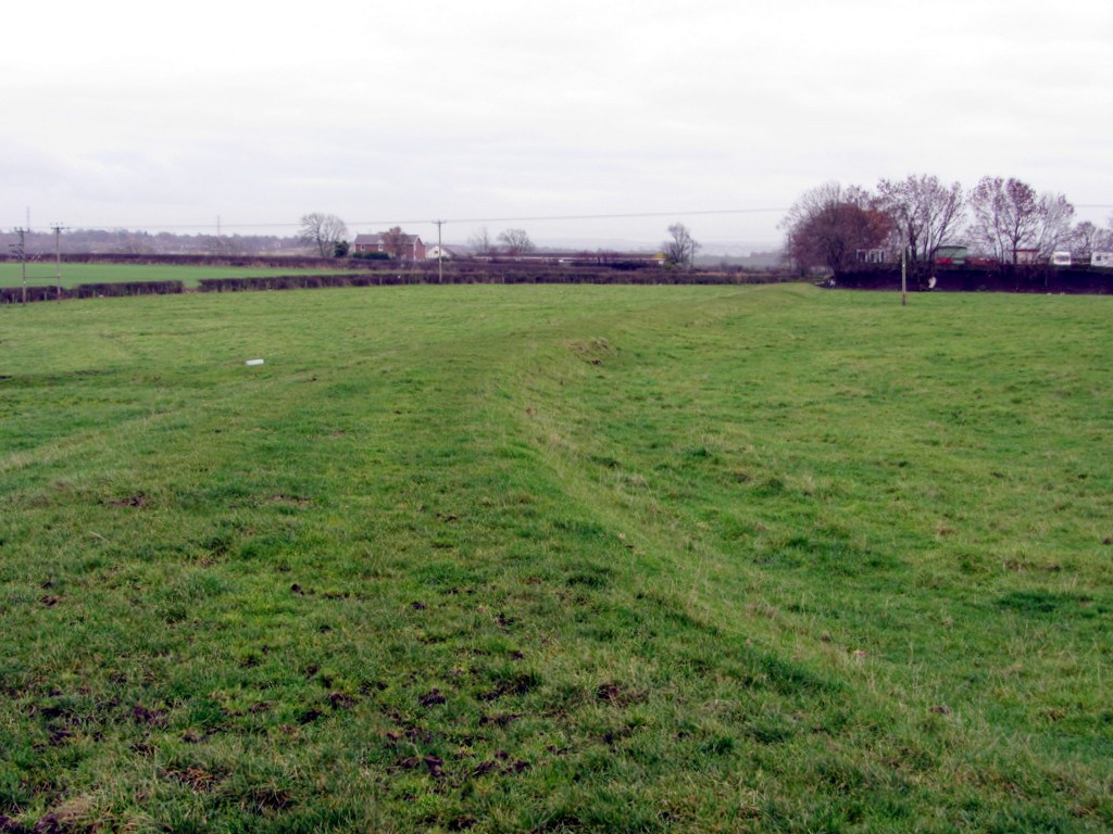 Waggonway embankment south of Broomhall Farm. View south. Photo A Curtis (2013). | View north along waggonway embankment towards Broomhall Farm with the site of Lady Pit on the right. Part of Callerton Garden Centre, just east of Lough House on the Stamfordham Road, is visible on the right. Its site was part of the much more recent Callerton Colliery. |
The branch heading north-east crossed Stamfordham Road between Lough House and Callerton, continuing in the same direction to former pits close to Black Callerton. Its line is followed by another public footpath.
 Eastern arm of former Walbottle Moors Waggonway. Photo A Curtis (2013). 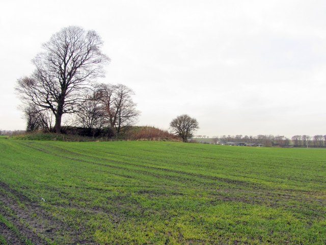 Remains of Engine Pit No. 2 near Stamfordham Road. Photo A Curtis (2013). 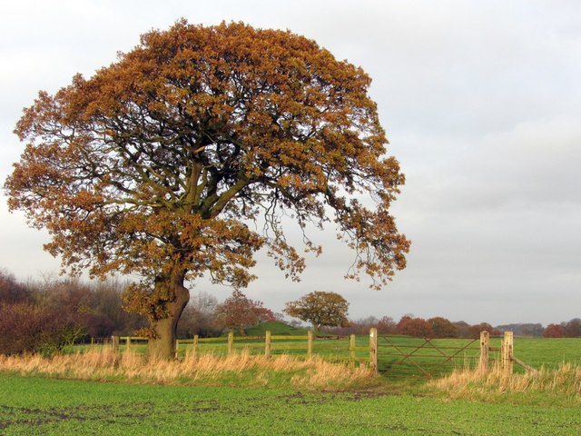 Oak tree and field gate near Andrew Plantation. Photo A Curtis (2013). 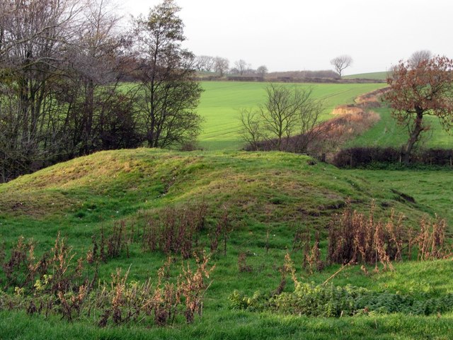 Remains of Andrew Pit. Photo A Curtis (2013). 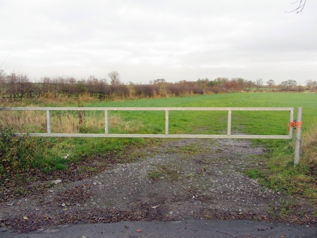 Hedgerow east of Black Callerton. Photo A Curtis (2013). | The former waggonway runs in a straight line north-east as a slight embankment following a field boundary. Just north of the Stamfordham Road the line of the waggonway follows a field boundary close to the location of Engine Pit No. 2. The footpath crosses arable fields and any remains of the waggonway have been ploughed out. Andrew Plantation is named after Andrew Pit. Grassy spoil heaps show the location of Andrew Pit along the line of the north-eastern branch of the waggonway. Brass Pit, concealed by trees, is further north-east. The small patch of woodland at the end of the hedge-line is the site of another old coal pit, perhaps Dolly Pit of Holywell Main Colliery, and marks the terminus of the waggonway. |
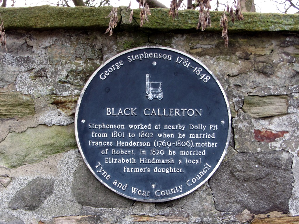 Plaque on wall at Black Callerton. Photo A Curtis (2013). | George Stephenson worked at Dolly Pit from 1801-1802 as a 'brakesman', controlling the winding gear of the pit. |
Strangely, I have been unable to determine the exact location of a Dolly Pit in the Black Callerton area.
While working at the Dolly pit, George Stephenson lodged at a neighbouring farm where he met Frances Henderson (1769–1806), a farm servant and the daughter of a small farmer at Capheaton. They married on 28 November 1802 at Newburn church, and on 16 October of the following year, their only son, Robert Stephenson, was born. In 1804 the Stephenson family moved to Killingworth following George's appointment as brakesman to the West Moor colliery engine. Frances died in 1806 and he later married Elizabeth Hindmarsh, a farmer's daughter from Black Callerton in 1820.
While working at the Dolly pit, George Stephenson lodged at a neighbouring farm where he met Frances Henderson (1769–1806), a farm servant and the daughter of a small farmer at Capheaton. They married on 28 November 1802 at Newburn church, and on 16 October of the following year, their only son, Robert Stephenson, was born. In 1804 the Stephenson family moved to Killingworth following George's appointment as brakesman to the West Moor colliery engine. Frances died in 1806 and he later married Elizabeth Hindmarsh, a farmer's daughter from Black Callerton in 1820.
Links
Walbottle Moors Waggonway - photos on Geograph
Stephenson, George - Oxford Dictionary of National Biography
Stephenson, George - Oxford Dictionary of National Biography
| wylam__walbottle_waggonways.pdf |
UPDATE 13th July 2020
An earthwork survey of the surviving remains of the waggonway system in this area prepared by Headland Archaeology for Banks Mining Ltd. in October 2018 is attached below. It is a draft report prepared as part of a pre-planning application for the poposed development of Dewley Hill Surface Mine for open cast extraction of coal and fire-clay. The Proposed Development Area avoids the Dewley Hill mound prehistoric Scheduled Monument and the buildings of the farms of Dewley Hill and Crescent.
An earthwork survey of the surviving remains of the waggonway system in this area prepared by Headland Archaeology for Banks Mining Ltd. in October 2018 is attached below. It is a draft report prepared as part of a pre-planning application for the poposed development of Dewley Hill Surface Mine for open cast extraction of coal and fire-clay. The Proposed Development Area avoids the Dewley Hill mound prehistoric Scheduled Monument and the buildings of the farms of Dewley Hill and Crescent.
 RSS Feed
