
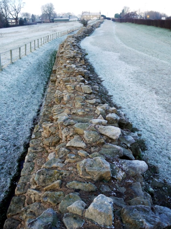
Hadrian's Wall, Heddon on the Wall. Photo A Curtis (2011)
Hadrian's Wall shows signs that it was planned in straight lines, at least in the relatively flat sections at its west and east ends. This is very similar to Roman roads that take long straight line routes across country often regardless of the intervening topography.
The 200m conserved section of Hadrian's Wall at Heddon on the Wall shows a prominent bend in the broad wall situated just west of the Great Hill on the east side of the village. What does this tell us? According to a book published in 2010, quite a lot.
The 200m conserved section of Hadrian's Wall at Heddon on the Wall shows a prominent bend in the broad wall situated just west of the Great Hill on the east side of the village. What does this tell us? According to a book published in 2010, quite a lot.
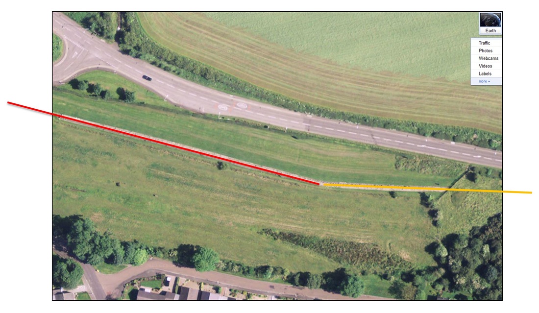
A long stretch of Hadrian's Wall between Newcastle and Chollerford had been destroyed by the building of 'General Wade's Military Road' (now the B6318) in the 1750s. I have speculated that the section of the broad wall at Heddon on the Wall survived this historical vandalism because its line through the village was already blocked by existing buildings (as it is today) or that the steepness of the Great Hill was mitigated (for the road) by a slight detour to the north where it could utilise the Wall ditch. The road regains the line of the Wall, to the north of the village, in the vicinity of Heddon Service Station and the Three Tuns Inn.
Hadrian's Wall east of Heddon on the Wall. Photo A Curtis (2011).
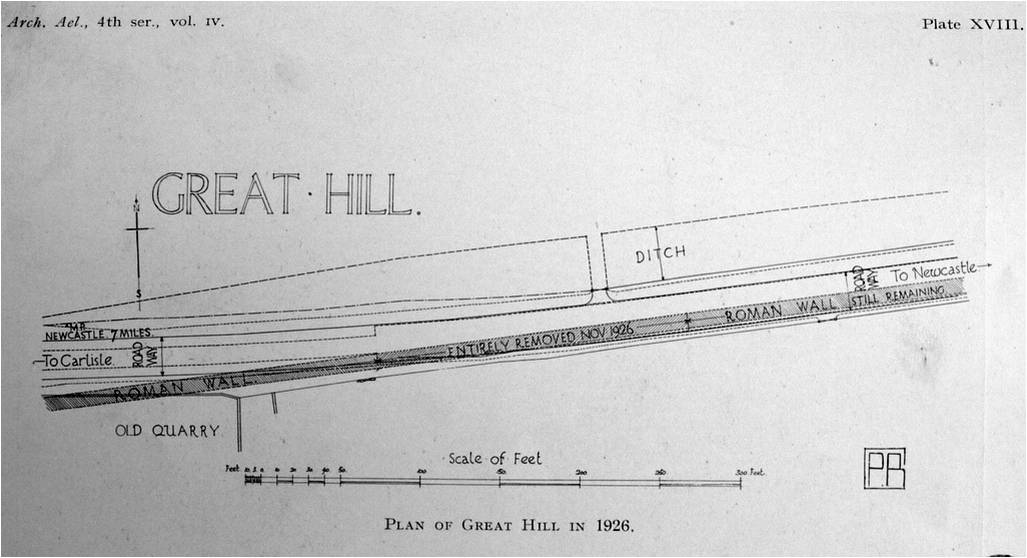
In 1926, Northumberland County Council improved the Military or turnpike road east of Heddon by lowering the level of the road surface at the crossing of the crown of Great Hill.
'At this point the road deviates a few degrees to the north, leaving the line of the Wall, which descended the hill, then gradually curved to the north, joining up with the fragment, now the property of this Society’
A length of more than sixty yards of the Wall embedded in the south lane of the road was removed.
 | The Planning of Roman Roads and Walls in Northern Britain by John Poulter Amberley (2010). |
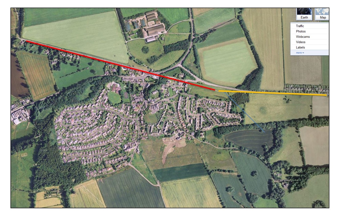
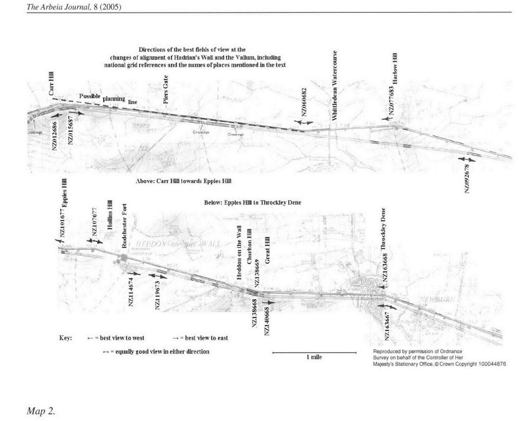
To John Poulter, the bend in the Roman Wall at Heddon is part of the evidence for the planning of Hadrian's Wall in this area in terms of long distance sighting lines laid out from east to west. One planning line runs from Benwell to Throckley Dene with the Wall diverging slightly north of its line to cross Sugley Dene. A second line runs from Throckley Dene to the Great Hill, and a third line from the Great Hill to the hill on which Rudchester Fort was eventually built.
It seems in no way obvious however, why there should have been a diversion north to cross Sugley Dene rather than one to avoid the much greater obstacle of Throckley (Walbottle) Dene. John Poulter thinks the crossing of the later may have been chosen to retain views to the south along the ridge west to Heddon. Views to the north would be available from the highest parts of the turrets and milecastles.
He proposes that the Wall planners could have set out this third line from the summit of Great Hill, therefore working from east to west, although the actual bend in the line of the Wall, towards Rudchester, was actually made slightly west, in low lying land between Great Hill and Heddon on the Wall.
The line continues just past Rudchester to Hollins Hill and takes up a new long distance alignment further west. John Poulter describes deviations of the line of the Wall from this alignment made to maintain views both to the north and the south (e.g. at Harlow Hill). Observation to the north and signalling to the rear may have been a major part of the Wall's plan.
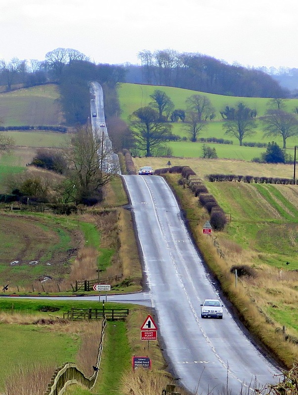
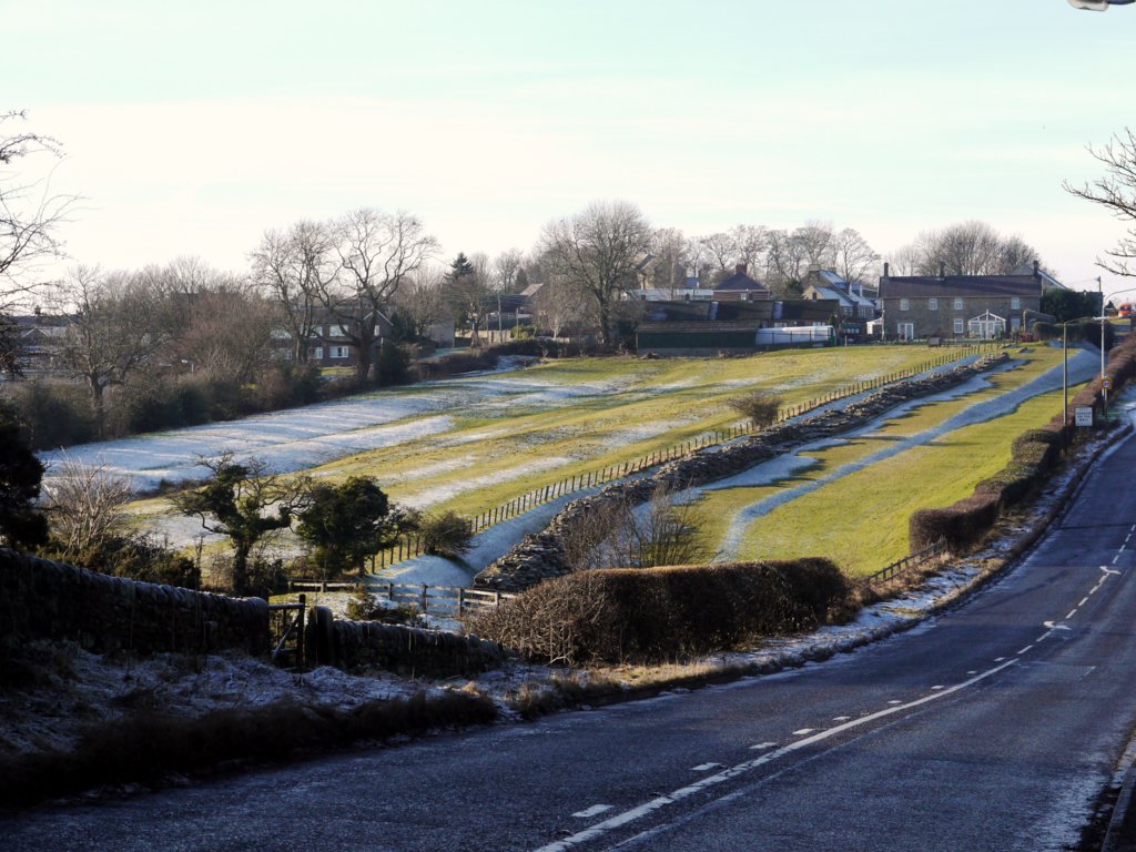
The Military Road (B6318) east of Harlow Hill. Photo A Curtis (2016).
From Benwell, the Vallum runs straight to Throckley Dene without the deviation to the north taken by the Wall at Sugley Dene. From Throckley Dene it runs due west, south of Hadrian's Wall, to Great Hill where there is what John Poulter describes as a rather clumsy double turn before accompanying the Wall on a slightly divergent course towards Rudchester Fort. He thinks that the section of Vallum from Benwell to Throckley Dene and Heddon were set out from east to west and the stretch to Rudchester planned from west to east. The rather clumsy turn on Great Hill is interpreted as a junction between the two directions of planning.
The Vallum was constructed behind the Wall from end to end some years after the Wall was finished and apparently its course may have been set out from the positions chosen for the forts. The Vallum is more or less a symmetrical structure, apparently built to block traffic crossing from both north and south. Two models are commonly proposed for its purpose, either to form a military cordon behind the Wall, or constructed as a temporary measure because of delays in the building of Hadrian's Wall either because of renewed warfare or construction of the forts.
Reference:
J Poulter (2005). The direction of planning of the eastern sector of Hadrian's Wall and the Vallum, from the River North Tyne to Ben well, west of Newcastle upon Tyne. The Arbeia Journal, Volume 8, Pages 87-100.
J Poulter (2005). The direction of planning of the eastern sector of Hadrian's Wall and the Vallum, from the River North Tyne to Ben well, west of Newcastle upon Tyne. The Arbeia Journal, Volume 8, Pages 87-100.
 RSS Feed
