
Tyne & Wear Historic Environment Record (HER) - Sitelines - lists two cinemas in Throckley, both buildings now demolished.
Tyne and Wear HER (7963): The Picture and Variety Palace, Bank Field Terrace.
Tyne and Wear HER (7963): The Picture and Variety Palace, Bank Field Terrace.
Shown on third edition Ordnance Survey 25 inch to 1 mile of 1920. The planning application for the picture theatre was made in 1912. The building was to be single storey, 70 feet long by 45 feet wide, and constucted of timber with a corrugated iron roof. The picture theatre was demolished by 1952 and the site was turned into a car park in the 1970s.
Cinema Treasures website provides further information.
The Picture & Variety Palace:
1 screen, 600 seats.
Located on Bank Field Terrace, off the main Newcastle to Hexham Road, in the village of Throckley to the west of Newcastle upon Tyne. The building was constructed out of corrugated iron on its side walls and roof. It was the former Picturedrome of Newburn (October 1910-1911) which was designed by architect E. Tweddle of West Hartlepool. It was dismantled and and transported to Throckley by operator Towyn Thomas in October 1912. An additional 12ft was added to its length. It was granted a Cinematograph Licence on 12th November 1912.
In July 1922 it was taken over by Charles Nichol and was re-named Imperial Cinema. On 12th December 1922 it was destroyed by fire. A car park now occupies the site
The village of Throckley was without a cinema until the Lyric Cinema was opened in 1935 (it has its own page on Cinema Treasures).
Tyne and Wear HER (12844): Lyric Cinema, Newburn Road.
The Hinge circuit built the Lyric to designs by Percy L. Browne. It had a 850 seat auditorium with a dance hall and 7 shops. The Lyric opened on 15 May 1935 and the proceeds were donated to the Newburn and District Nursing Association, Newburn Cottage Homes and other local charities. The cinema had ruched curtains which changed colour from orange to green to red before the show started. The Lyric closed in October 1966 and became a bingo hall. It closed in the mid 1970s when permission was refused to convert it into an amusement arcade.
Cinema Treasures website provides further information.
Lyric Cinema, Throckley
1 screen, 858 seats.
Located in the village of Throckley, which today is a district to the outer west of Newcastle upon Tyne. The Lyric Cinema was built by the E.J. Hinge Circuit and opened on 15th May 1935 with William Powell in “The Thin Man”. Designed by architect Percy Lindsay Browne in an Art Deco style, seating was provided in stalls and circle levels. There was also a cafe & darts club in the building, which also had a row of shops attached. It was equipped with a British Talking Pictures (BTP) sound system.
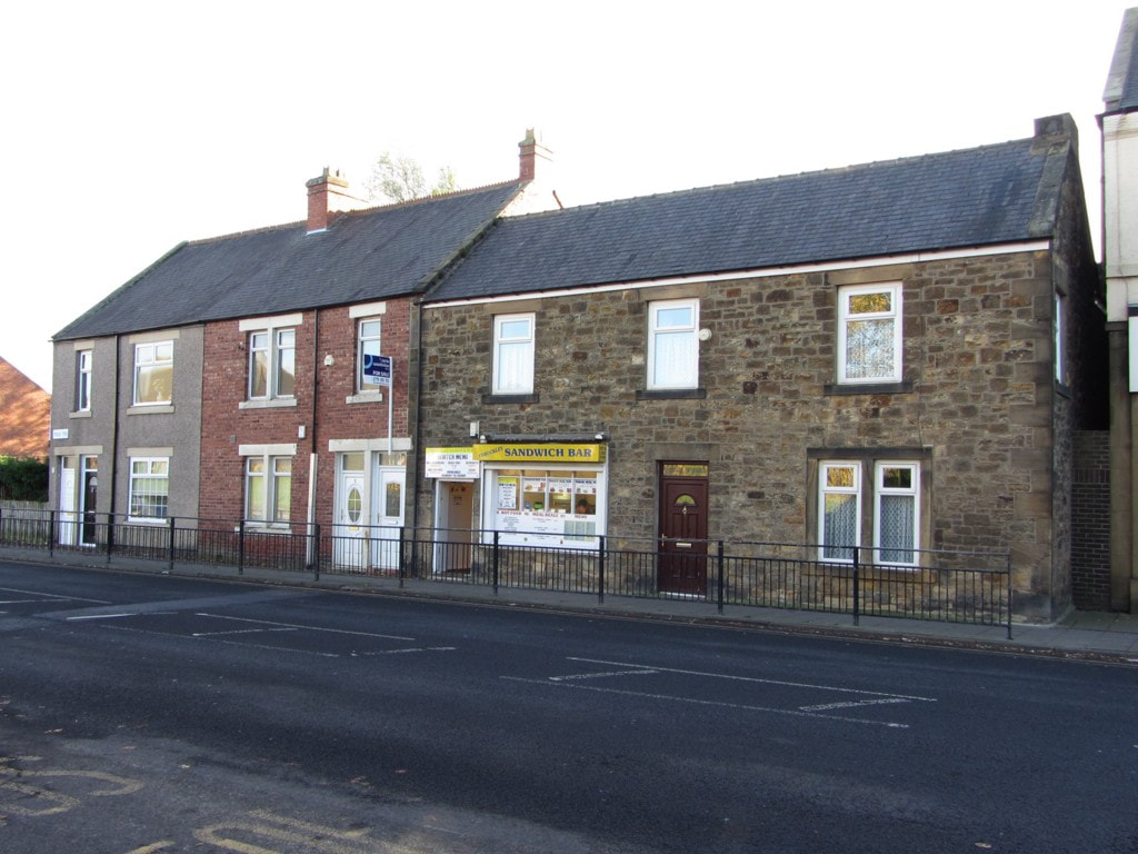
The Lyric Cinema was closed in October 1966 and became a bingo club. It was closed in 1976 and the building became derelict and vandalised. It has since been demolished and the site is now a car park for Sainsbury’s Supermarket. The end shop unit still stands and is in use as Lyric Wines.
Lyric Cinema, Throckley
1 screen, 858 seats.
Located in the village of Throckley, which today is a district to the outer west of Newcastle upon Tyne. The Lyric Cinema was built by the E.J. Hinge Circuit and opened on 15th May 1935 with William Powell in “The Thin Man”. Designed by architect Percy Lindsay Browne in an Art Deco style, seating was provided in stalls and circle levels. There was also a cafe & darts club in the building, which also had a row of shops attached. It was equipped with a British Talking Pictures (BTP) sound system.
The Lyric Cinema was closed in October 1966 and became a bingo club. It was closed in 1976 and the building became derelict and vandalised. It has since been demolished and the site is now a car park for Sainsbury’s Supermarket. The end shop unit still stands and is in use as Lyric Wines.
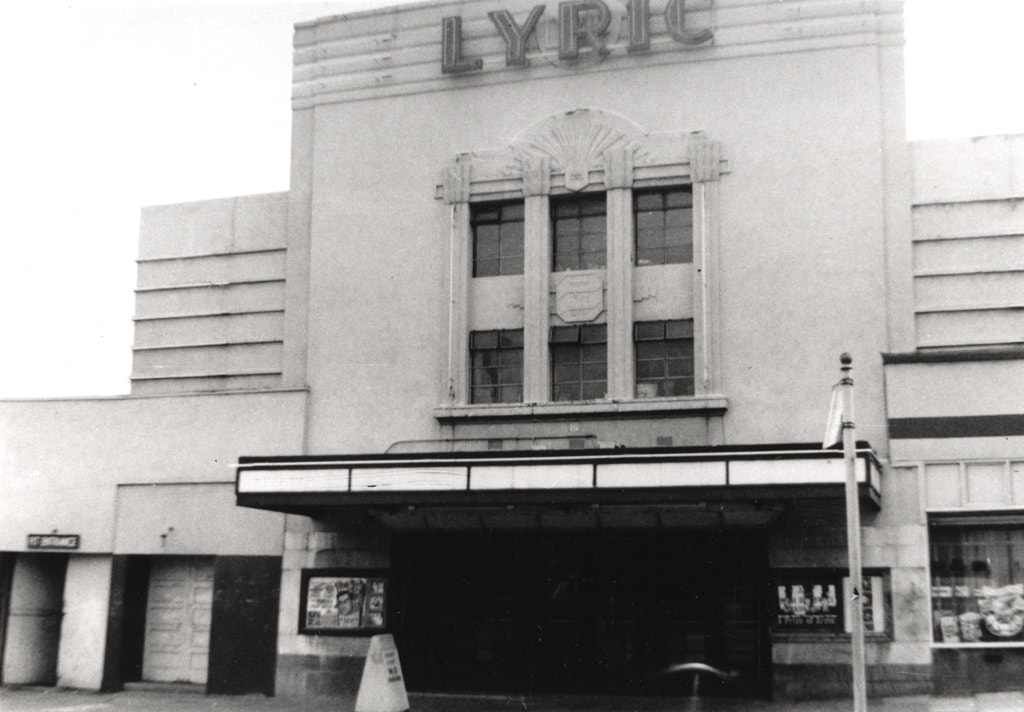
Lyric Cinema, Throckley (1963). Newcastle Libraries ref. 068682
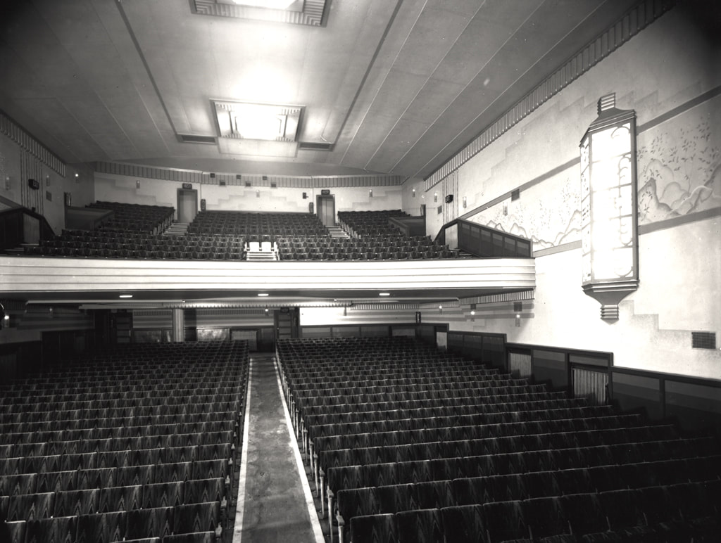
Lyric Cinema, Throckley (1938). Newcastle Libraries ref. 068806. Photograph of the auditorium of the Lyric cinema Newburn Road, Throckley. The photograph has been taken from the proscenium looking towards the back of the cinema and up to the circle.
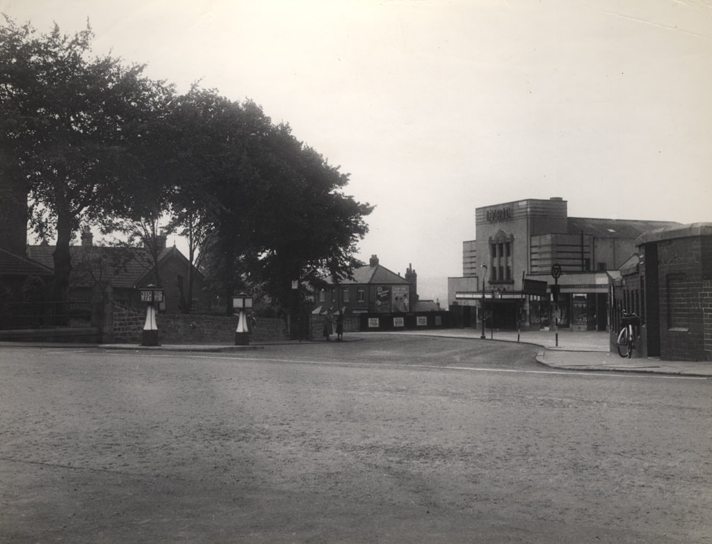
Newcastle Libraries (ref. 056515): decribed as Hexham Road/Coach Road, Throckley (but actually top of Newburn Road), Francis Frith c.1956.
"Blast from the past, Lyric Cinema at Throckley, Tyne & Wear. We demolished this building in the early 1990s (Synergy Demolition Group).
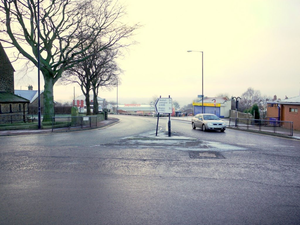
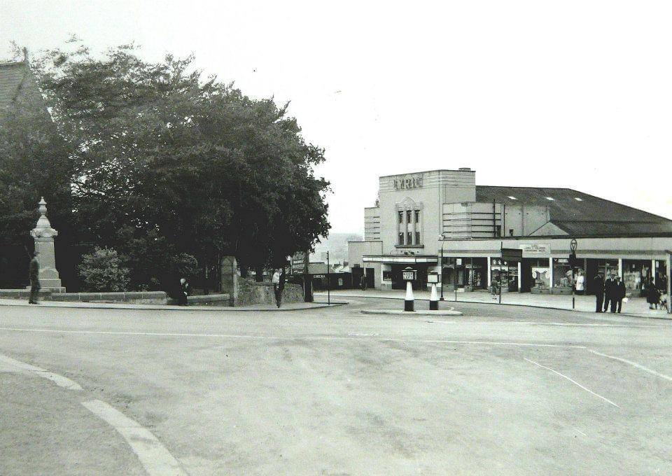
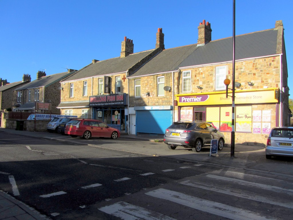
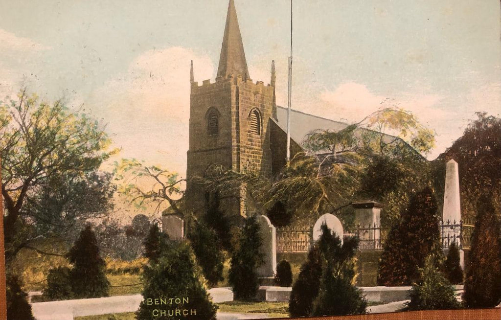
Junction of Newburn Road & Hexham Road, Throckley. Photo A Curtis (2011). Taken from the roundabout at the junction with Hexham Road. St Mary's Church is on the left NZ1566 : St Mary the Virgin Church, Throckley. The small building behind the car is the only reminder of the Lyric Cinema which used to be at this junction. The store is called, 'Lyric Wines'. The Lyric Cinema opened in 1935 and closed in 1966.


 RSS Feed
